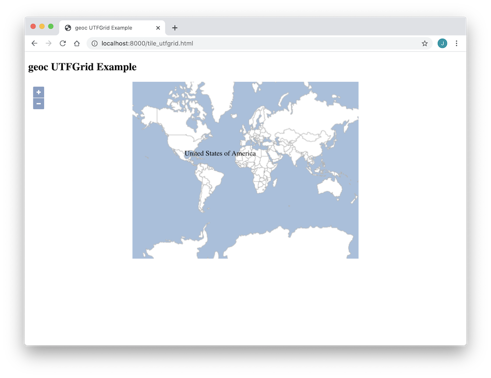
<!doctype html>
<html lang="en">
<head>
<link rel="stylesheet" href="https://cdn.rawgit.com/openlayers/openlayers.github.io/master/en/v5.3.0/css/ol.css" type="text/css">
<style>
.map {
height: 400px;
width: 100%;
}
</style>
<script src="https://cdn.rawgit.com/openlayers/openlayers.github.io/master/en/v5.3.0/build/ol.js" type="text/javascript"></script>
<title>geoc UTFGrid Example</title>
</head>
<body>
<h2>geoc UTFGrid Example</h2>
<div id="map" class="map"></div>
<div style="display: none;">
<!-- Overlay with the country info -->
<div id="country-info">
<div id="country-name"> </div>
</div>
</div>
<script type="text/javascript">
var tms = new ol.layer.Tile({
source: new ol.source.XYZ({
url: 'http://localhost:8000/tms/{z}/{x}/{-y}.jpeg',
wrapX: false,
noWrap: true
})
});
var gridSource = new ol.source.UTFGrid({
tileJSON: {
tilejson: "2.2.0",
grids: [ 'http://localhost:8000/utf/{z}/{x}/{y}.grid.json' ]
}
});
var utfGrid = new ol.layer.Tile({
source: gridSource
});
var view = new ol.View({
center: [0, 0],
zoom: 1
});
var mapElement = document.getElementById('map');
var map = new ol.Map({
target: mapElement,
layers: [
tms,
utfGrid
],
view: view
});
var infoElement = document.getElementById('country-info');
var nameElement = document.getElementById('country-name');
var infoOverlay = new ol.Overlay({
element: infoElement,
offset: [15, 15],
stopEvent: false
});
map.addOverlay(infoOverlay);
var displayCountryInfo = function(coordinate) {
var viewResolution = view.getResolution();
gridSource.forDataAtCoordinateAndResolution(coordinate, viewResolution, function(data) {
mapElement.style.cursor = data ? 'pointer' : '';
if (data) {
nameElement.innerHTML = data['NAME'];
}
infoOverlay.setPosition(data ? coordinate : undefined);
});
};
map.on('pointermove', function(evt) {
if (evt.dragging) {
return;
}
var coordinate = map.getEventCoordinate(evt.originalEvent);
displayCountryInfo(coordinate);
});
map.on('click', function(evt) {
displayCountryInfo(evt.coordinate);
});
</script>
</body>
</html>
