Introduction
Geo Shell is an interactive shell for geospatial analysis.
Modules
Geo Shell has modules for dealing with vectors, rasters, tiles, maps, and styles.
For vector layers, you can use workspace commands access layers of spatial data in datasets like shapefiles, geopackages, or postgis databases. With layer commands you can perform geoprocessing functions like calculating centroids or buffer features.
For raster layers, you can use format commands access individual rasters from geotifs or world images. With raster commands you can perform mosaic, raster algebra, or crop functions.
The tile commands let you create tile layers, get tiles, and get rasters from tiles.
The style commands let you create styles for vector layers and raster.
The map commands allow you to visualize vector, raster, and tile layers.
Workspace
Workspaces hold vector layers. A Workspace can be a GeoPackage database, a directory of Shapefiles, or a PostGIS database.
Basics
You can open, close, and list Workspaces. The eariest Workspace to open is an in memory Workspace.
Open
Open a Workspace.
Name |
Description |
Mandatory |
Specified Default |
Unspecified Default |
name |
The Workspace name |
true |
||
params |
The connection parameters |
true |
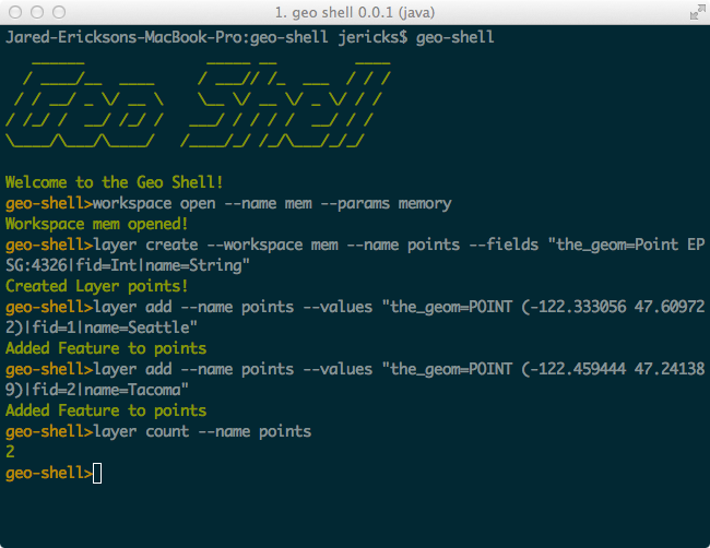
geo-shell> workspace open --name mem --params memory
Workspace mem opened!
You can open a Workspace with --params or connection parameters. You can give it a name with --name flag.
Layers
List the Layer in a Workspaces.
Name |
Description |
Mandatory |
Specified Default |
Unspecified Default |
name |
The Workspace name |
true |
In this example, we will open a GeoPackage database filled with data from Natural Earth.
geo-shell> workspace open --name naturalearth --params src/test/resources/naturalearth.gpkg
Workspace naturalearth opened!
geo-shell> workspace layers --name naturalearth
countries
ocean
places
states
geo-shell> workspace close --name naturalearth
Workspace naturalearth closed!
Layer
Basics
Open
Open a Layer.
geo-shell> layer open --workspace naturalearth --layer countries --name countries
Name |
Description |
Mandatory |
Specified Default |
Unspecified Default |
workspace |
The Workspace name |
true |
||
layer |
The Layer name |
true |
||
name |
The name |
false |
geo-shell> workspace open --name naturalearth --params src/test/resources/naturalearth.gpkg
Workspace naturalearth opened!
geo-shell> layer open --workspace naturalearth --layer countries --name countries
Opened Workspace naturalearth Layer countries as countries
geo-shell> workspace close --name naturalearth
Workspace naturalearth closed!
Close
Close a Layer.
geo-shell> layer close --name countries
Name |
Description |
Mandatory |
Specified Default |
Unspecified Default |
name |
The Layer name |
true |
geo-shell> workspace open --name naturalearth --params src/test/resources/naturalearth.gpkg
Workspace naturalearth opened!
geo-shell> layer open --workspace naturalearth --layer countries --name countries
Opened Workspace naturalearth Layer countries as countries
geo-shell> layer close --name countries
Layer countries closed!
geo-shell> workspace close --name naturalearth
Workspace naturalearth closed!
List
List open Layers.
geo-shell> layer list
| No parameters |
geo-shell> workspace open --name naturalearth --params src/test/resources/naturalearth.gpkg
Workspace naturalearth opened!
geo-shell> layer open --workspace naturalearth --layer countries --name countries
Opened Workspace naturalearth Layer countries as countries
geo-shell> layer open --workspace naturalearth --layer ocean --name ocean
Opened Workspace naturalearth Layer ocean as ocean
geo-shell> layer open --workspace naturalearth --layer states --name states
Opened Workspace naturalearth Layer states as states
geo-shell> layer list
countries = GeoPackage
ocean = GeoPackage
states = GeoPackage
geo-shell> workspace close --name naturalearth
Workspace naturalearth closed!
Schema
Inspect a Layer’s Schema.
geo-shell> layer schema --name countries
Name |
Description |
Mandatory |
Specified Default |
Unspecified Default |
name |
The Layer name |
true |
geo-shell> workspace open --name naturalearth --params src/test/resources/naturalearth.gpkg
Workspace naturalearth opened!
geo-shell> layer open --workspace naturalearth --layer countries --name countries
Opened Workspace naturalearth Layer countries as countries
geo-shell> layer schema --name countries
Name Type
-------------------- --------------------
the_geom MultiPolygon
ScaleRank Long
FeatureCla String
SOVEREIGNT String
SOVISO String
SOV_A3 String
LEVEL Double
TYPE String
NAME String
SORTNAME String
ADM0_A3 String
NAME_SM String
NAME_LNG String
TERR_ String
PARENTHETI String
NAME_ALT String
LOCAL_LNG String
LOCAL_SM String
FORMER String
ABBREV_ String
MAP_COLOR Double
PEOPLE Double
GDP_USDM Double
FIPS_10 String
ISO_A2 String
ISO_A3 String
ISO_N3 Double
ITU String
IOC String
FIFA String
DS String
WMO String
GAUL Double
MARC String
STANAG1059 String
GW_ID Double
DIAL Double
INTERNET_ String
COG String
ACTUAL String
CAPAY String
CRPAY String
ANI String
LIBENR String
ANCNOM String
PAYS_R_GIO String
COMMENT String
geo-shell> workspace close --name naturalearth
Workspace naturalearth closed!
Count
Count the Feature in a Layer.
geo-shell> layer count --name countries
Name |
Description |
Mandatory |
Specified Default |
Unspecified Default |
name |
The Layer name |
true |
geo-shell> workspace open --name naturalearth --params src/test/resources/naturalearth.gpkg
Workspace naturalearth opened!
geo-shell> layer open --workspace naturalearth --layer countries --name countries
Opened Workspace naturalearth Layer countries as countries
geo-shell> layer count --name countries
177
geo-shell> workspace close --name naturalearth
Workspace naturalearth closed!
Projection
Get the Projection of a Layer.
geo-shell> layer projection --name countries
Name |
Description |
Mandatory |
Specified Default |
Unspecified Default |
name |
The Layer name |
true |
geo-shell> workspace open --name naturalearth --params src/test/resources/naturalearth.gpkg
Workspace naturalearth opened!
geo-shell> layer open --workspace naturalearth --layer countries --name countries
Opened Workspace naturalearth Layer countries as countries
geo-shell> layer projection --name countries
EPSG:4326
geo-shell> workspace close --name naturalearth
Workspace naturalearth closed!
Features
Display the Features of a Layer.
geo-shell> layer features --name states --filter "NAME_1='North Dakota'"
Name |
Description |
Mandatory |
Specified Default |
Unspecified Default |
name |
The Layer name |
true |
||
filter |
The CQL Filter |
false |
||
sort |
A Sort parameter (fld dir) |
false |
||
start |
The start index |
false |
-1 |
|
max |
The maximum number of records |
false |
-1 |
|
field |
A subfield to include |
false |
geo-shell> workspace open --name naturalearth --params src/test/resources/naturalearth.gpkg
Workspace naturalearth opened!
geo-shell> layer open --workspace naturalearth --layer states --name states
Opened Workspace naturalearth Layer states as states
geo-shell> layer features --name states --filter "NAME_1='North Dakota'"
Feature (states.3)
------------------
the_geom = MULTIPOLYGON
FID_1 = 31
ScaleRank = 2
FeatureCla = 1st Order Admin Polys
OBJECTID = 22
VertexCou = 223.0
ISO = USA
NAME_0 = United States
NAME_1 = North Dakota
VARNAME_1 = ND|N.D.
NL_NAME_1 =
HASC_1 = US.ND
TYPE_1 = State
ENGTYPE_1 = State
VALIDFR_1 = 18891102
VALIDTO_1 = Present
REMARKS_1 =
Region =
RegionVar =
ProvNumber = 23
NEV_Countr = United States
FIRST_FIPS =
FIRST_HASC =
FIPS_1 = US38
gadm_level = 1.0
CheckMe = 0
Region_Cod =
Region_C_1 =
ScaleRan_1 = 1
Region_C_2 =
Region_C_3 =
Country_Pr =
geo-shell> workspace close --name naturalearth
Workspace naturalearth closed!
Get Style
Get the Layer’s style.
geo-shell> layer style get --name states --style target/states.sld
Name |
Description |
Mandatory |
Specified Default |
Unspecified Default |
name |
The Layer name |
true |
||
style |
The SLD File |
false |
geo-shell> workspace open --name naturalearth --params src/test/resources/naturalearth.gpkg
Workspace naturalearth opened!
geo-shell> layer open --workspace naturalearth --layer states --name states
Opened Workspace naturalearth Layer states as states
geo-shell> style vector default --layer states --color #1E90FF --file examples/states_simple.sld
Default Vector Style for states written to /home/runner/work/geo-shell/geo-shell/examples/states_simple.sld!
geo-shell> layer style get --name states --style target/states.sld
states style written to /home/runner/work/geo-shell/geo-shell/target/states.sld
geo-shell> workspace close --name naturalearth
Workspace naturalearth closed!
<?xml version="1.0" encoding="UTF-8"?><sld:StyledLayerDescriptor xmlns:sld="http://www.opengis.net/sld" xmlns="http://www.opengis.net/sld" xmlns:gml="http://www.opengis.net/gml" xmlns:ogc="http://www.opengis.net/ogc" version="1.0.0">
  <sld:UserLayer>
    <sld:LayerFeatureConstraints>
      <sld:FeatureTypeConstraint/>
    </sld:LayerFeatureConstraints>
    <sld:UserStyle>
      <sld:Name>Default Styler</sld:Name>
      <sld:FeatureTypeStyle>
        <sld:Name>name</sld:Name>
        <sld:Rule>
          <sld:PolygonSymbolizer>
            <sld:Fill>
              <sld:CssParameter name="fill">#f2f2f2</sld:CssParameter>
            </sld:Fill>
          </sld:PolygonSymbolizer>
          <sld:LineSymbolizer>
            <sld:Stroke>
              <sld:CssParameter name="stroke">#a9a9a9</sld:CssParameter>
              <sld:CssParameter name="stroke-width">0.5</sld:CssParameter>
            </sld:Stroke>
          </sld:LineSymbolizer>
        </sld:Rule>
      </sld:FeatureTypeStyle>
    </sld:UserStyle>
  </sld:UserLayer>
</sld:StyledLayerDescriptor>
Set Style
Set a Layer’s style
geo-shell> layer style get --name states --style target/states_simple.sld
Name |
Description |
Mandatory |
Specified Default |
Unspecified Default |
name |
The Layer name |
true |
||
style |
The SLD or CSS File |
true |
geo-shell> workspace open --name naturalearth --params src/test/resources/naturalearth.gpkg
Workspace naturalearth opened!
geo-shell> layer open --workspace naturalearth --layer states --name states
Opened Workspace naturalearth Layer states as states
geo-shell> style vector default --layer states --color #1E90FF --file examples/states_simple.sld
Default Vector Style for states written to /home/runner/work/geo-shell/geo-shell/examples/states_simple.sld!
geo-shell> layer style get --name states --style target/states_simple.sld
states style written to /home/runner/work/geo-shell/geo-shell/target/states_simple.sld
geo-shell> map open --name map
Map map opened!
geo-shell> map add layer --name map --layer states
Added states layer to map map
geo-shell> map draw --name map --file examples/layer_set_style.png
Done drawing /home/runner/work/geo-shell/geo-shell/examples/layer_set_style.png!
geo-shell> map close --name map
Map map closed!
geo-shell> workspace close --name naturalearth
Workspace naturalearth closed!
Copy
Copy one Layer to another Workspace.
geo-shell> layer copy --input-name states_gpkg --output-workspace shapefiles --output-name states
Name |
Description |
Mandatory |
Specified Default |
Unspecified Default |
input-name |
The Layer name |
true |
||
output-workspace |
The output Layer Workspace |
true |
||
output-name |
The output Layer name |
true |
||
filter |
The CQL Filter |
false |
||
sort |
A Sort parameter (fld dir) |
false |
||
start |
The start index |
false |
-1 |
|
max |
The maximum number of records |
false |
-1 |
|
field |
A subfield to include |
false |
geo-shell> workspace open --name naturalearth --params src/test/resources/naturalearth.gpkg
Workspace naturalearth opened!
geo-shell> layer open --workspace naturalearth --layer states --name states_gpkg
Opened Workspace naturalearth Layer states as states_gpkg
geo-shell> workspace open --name shapefiles --params target/
Workspace shapefiles opened!
geo-shell> layer copy --input-name states_gpkg --output-workspace shapefiles --output-name states
Done!
geo-shell> layer count --name states
52
geo-shell> workspace close --name shapefiles
Workspace shapefiles closed!
geo-shell> workspace close --name naturalearth
Workspace naturalearth closed!
Create
Create a new Layer.
geo-shell> layer create --workspace mem --name points --fields "the_geom=Point EPSG:4326|fid=Int|name=String"
Name |
Description |
Mandatory |
Specified Default |
Unspecified Default |
workspace |
The Workspace name |
true |
||
name |
The new Layer name |
true |
||
fields |
The pipe delimited list of fields (name=type) |
true |
geo-shell> workspace open --name mem --params memory
Workspace mem opened!
geo-shell> layer create --workspace mem --name points --fields "the_geom=Point EPSG:4326|fid=Int|name=String"
Created Layer points!
geo-shell> layer schema --name points
Name Type
-------------------- --------------------
the_geom Point
fid Integer
name String
Add
Add a new Feature to a Layer.
geo-shell> layer add --name points --values "the_geom=POINT (-122.333056 47.609722)|fid=1|name=Seattle"
Name |
Description |
Mandatory |
Specified Default |
Unspecified Default |
name |
The Layer name |
true |
||
values |
The pipe delimited list of values (field=value) |
true |
geo-shell> workspace open --name mem --params memory
Workspace mem opened!
geo-shell> layer create --workspace mem --name points --fields "the_geom=Point EPSG:4326|fid=Int|name=String"
Created Layer points!
geo-shell> layer add --name points --values "the_geom=POINT (-122.333056 47.609722)|fid=1|name=Seattle"
Added Feature to points
geo-shell> layer add --name points --values "the_geom=POINT (-122.459444 47.241389)|fid=2|name=Tacoma"
Added Feature to points
geo-shell> layer count --name points
2
Delete
Delete features from the Layer
geo-shell> layer delete --name points --filter "fid=2"
Name |
Description |
Mandatory |
Specified Default |
Unspecified Default |
name |
The Layer name |
true |
||
filter |
The CQL Filter |
true |
geo-shell> workspace open --name mem --params memory
Workspace mem opened!
geo-shell> layer create --workspace mem --name points --fields "the_geom=Point EPSG:4326|fid=Int|name=String"
Created Layer points!
geo-shell> layer add --name points --values "the_geom=POINT (-122.333056 47.609722)|fid=1|name=Seattle"
Added Feature to points
geo-shell> layer add --name points --values "the_geom=POINT (-122.459444 47.241389)|fid=2|name=Tacoma"
Added Feature to points
geo-shell> layer count --name points
2
geo-shell> layer delete --name points --filter "fid=2"
Deleted fid=2 Features from points
geo-shell> layer count --name points
1
Remove
Remove a Layer from a Workspace.
geo-shell> layer remove --layer polygons --workspace mem
Name |
Description |
Mandatory |
Specified Default |
Unspecified Default |
workspace |
The Workspace name |
true |
||
layer |
The Layer name |
true |
geo-shell> workspace open --name mem --params memory
Workspace mem opened!
geo-shell> layer create --workspace mem --name points --fields "the_geom=Point EPSG:4326|fid=Int|name=String"
Created Layer points!
geo-shell> layer create --workspace mem --name lines --fields "the_geom=LineString EPSG:4326|fid=Int|name=String"
Created Layer lines!
geo-shell> layer create --workspace mem --name polygons --fields "the_geom=Polygon EPSG:4326|fid=Int|name=String"
Created Layer polygons!
geo-shell> workspace layers --name mem
lines
points
polygons
geo-shell> layer remove --layer polygons --workspace mem
Layer polygons removed from Workspace mem
geo-shell> workspace layers --name mem
lines
points
Write
Write a Layer to GeoJSON, CSV, or KML.
geo-shell> layer write --name points --format geojson --file src/main/docs/output/points.json
Name |
Description |
Mandatory |
Specified Default |
Unspecified Default |
name |
The Layer name |
true |
||
format |
The format |
true |
||
file |
The output file |
false |
geo-shell> workspace open --name mem --params memory
Workspace mem opened!
geo-shell> layer create --workspace mem --name points --fields "the_geom=Point EPSG:4326|fid=Int|name=String"
Created Layer points!
geo-shell> layer add --name points --values "the_geom=POINT (-122.333056 47.609722)|fid=1|name=Seattle"
Added Feature to points
geo-shell> layer add --name points --values "the_geom=POINT (-122.459444 47.241389)|fid=2|name=Tacoma"
Added Feature to points
geo-shell> layer write --name points --format geojson --file src/main/docs/output/points.json
Layer points written to /home/runner/work/geo-shell/geo-shell/src/main/docs/output/points.json as geojson
Read
Read a Layer from a GeoJSON, KML, or YAML file.
geo-shell> layer read --workspace mem --name points --file src/test/resources/points.json
Name |
Description |
Mandatory |
Specified Default |
Unspecified Default |
workspace |
The Workspace name |
true |
||
name |
The name |
true |
||
file |
The output file |
true |
geo-shell> workspace open --name mem --params memory
Workspace mem opened!
geo-shell> layer read --workspace mem --name points --file src/test/resources/points.json
Created Layer points in Workspace mem for /home/runner/work/geo-shell/geo-shell/src/test/resources/points.json!
geo-shell> layer features --name points
Feature (fid-31cf07e6_18ba1860a40_-7561)
----------------------------------------
geometry = POINT (1 1)
id = 1
name = Home
Feature (fid-31cf07e6_18ba1860a40_-7560)
----------------------------------------
geometry = POINT (2 2)
id = 2
name = Work
Update Field
Update the values of a field
geo-shell> layer updatefield --name points --field state --value WA
Name |
Description |
Mandatory |
Specified Default |
Unspecified Default |
name |
The Layer name |
true |
||
field |
The field name |
true |
||
value |
The value |
true |
||
filter |
The CQL Filter |
false |
INCLUDE |
INCLUDE |
script |
Whether the value is a script or not |
false |
false |
false |
geo-shell> workspace open --name mem --params memory
Workspace mem opened!
geo-shell> layer create --workspace mem --name points --fields "the_geom=Point EPSG:4326|fid=Int|name=String|state=String"
Created Layer points!
geo-shell> layer add --name points --values "the_geom=POINT (-122.333056 47.609722)|fid=1|name=Seattle"
Added Feature to points
geo-shell> layer add --name points --values "the_geom=POINT (-122.459444 47.241389)|fid=2|name=Tacoma"
Added Feature to points
geo-shell> layer updatefield --name points --field state --value WA
Done updating state with WA!
geo-shell> layer features --name points
Feature (fid-31cf07e6_18ba1860a40_-75b6)
----------------------------------------
the_geom = POINT (-122.333056 47.609722)
fid = 1
name = Seattle
state = WA
Feature (fid-31cf07e6_18ba1860a40_-75b4)
----------------------------------------
the_geom = POINT (-122.459444 47.241389)
fid = 2
name = Tacoma
state = WA
Add Fields
Add Fields to the input Layer and save the result to the output Layer
geo-shell> layer addfields --input-name points --output-workspace mem --output-name points2 --fields "name=String,state=String"
Name |
Description |
Mandatory |
Specified Default |
Unspecified Default |
input-name |
The Layer name |
true |
||
output-workspace |
The output Layer Workspace |
true |
||
output-name |
The output Layer name |
true |
||
fields |
The Fields (name=type proj) |
true |
geo-shell> workspace open --name mem --params memory
Workspace mem opened!
geo-shell> layer create --workspace mem --name points --fields "the_geom=Point EPSG:4326"
Created Layer points!
geo-shell> layer addfields --input-name points --output-workspace mem --output-name points2 --fields "name=String,state=String"
Done!
geo-shell> layer schema --name points2
Name Type
-------------------- --------------------
the_geom Point
name String
state String
Add Area Field
Add area Field to the input Layer and save the result to the output Layer
geo-shell> layer addareafield --input-name states --output-workspace mem --output-name states_area --area-fieldname AREA
Name |
Description |
Mandatory |
Specified Default |
Unspecified Default |
input-name |
The Layer name |
true |
||
output-workspace |
The output Layer Workspace |
true |
||
output-name |
The output Layer name |
true |
||
area-fieldname |
The area field name |
true |
area |
area |
geo-shell> workspace open --name mem --params memory
Workspace mem opened!
geo-shell> workspace open --name naturalearth --params examples/naturalearth.gpkg
Workspace naturalearth opened!
geo-shell> layer open --workspace naturalearth --layer states --name states
Opened Workspace naturalearth Layer states as states
geo-shell> layer addareafield --input-name states --output-workspace mem --output-name states_area --area-fieldname AREA
Done!
geo-shell> layer schema --name states_area
Name Type
-------------------- --------------------
the_geom MultiPolygon
FID_1 Long
ScaleRank Long
FeatureCla String
OBJECTID Long
VertexCou Double
ISO String
NAME_0 String
NAME_1 String
VARNAME_1 String
NL_NAME_1 String
HASC_1 String
TYPE_1 String
ENGTYPE_1 String
VALIDFR_1 String
VALIDTO_1 String
REMARKS_1 String
Region String
RegionVar String
ProvNumber Long
NEV_Countr String
FIRST_FIPS String
FIRST_HASC String
FIPS_1 String
gadm_level Double
CheckMe Long
Region_Cod String
Region_C_1 String
ScaleRan_1 Long
Region_C_2 String
Region_C_3 String
Country_Pr String
AREA Double
geo-shell> layer features --name states_area --filter "NAME_1='North Dakota'" --field "NAME_0,AREA"
Feature (fid-31cf07e6_18ba1860a40_-75af)
----------------------------------------
NAME_0 = United States
AREA = 21.804544852979944
Add ID Field
Add area ID to the input Layer and save the result to the output Layer
geo-shell> layer addidfield --input-name places --output-workspace mem --output-name places_id --id-fieldname ID --start-value 1
Name |
Description |
Mandatory |
Specified Default |
Unspecified Default |
input-name |
The Layer name |
true |
||
output-workspace |
The output Layer Workspace |
true |
||
output-name |
The output Layer name |
true |
||
id-fieldname |
The id field name |
true |
id |
id |
start-value |
The value to start at |
true |
1 |
1 |
geo-shell> workspace open --name mem --params memory
Workspace mem opened!
geo-shell> workspace open --name naturalearth --params examples/naturalearth.gpkg
Workspace naturalearth opened!
geo-shell> layer open --workspace naturalearth --layer places --name places
Opened Workspace naturalearth Layer places as places
geo-shell> layer addidfield --input-name places --output-workspace mem --output-name places_id --id-fieldname ID --start-value 1
Done!
geo-shell> layer schema --name places_id
Name Type
-------------------- --------------------
the_geom Point
SCALERANK Long
NATSCALE Long
LABELRANK Long
FEATURECLA String
NAME String
NAMEPAR String
NAMEALT String
DIFFASCII Long
NAMEASCII String
ADM0CAP Double
CAPALT Double
CAPIN String
WORLDCITY Double
MEGACITY Long
SOV0NAME String
SOV_A3 String
ADM0NAME String
ADM0_A3 String
ADM1NAME String
ISO_A2 String
NOTE String
LATITUDE Double
LONGITUDE Double
CHANGED Double
NAMEDIFF Long
DIFFNOTE String
POP_MAX Long
POP_MIN Long
POP_OTHER Long
GEONAMEID Double
MEGANAME String
LS_NAME String
LS_MATCH Long
CHECKME Long
MAX_POP10 Long
MAX_POP20 Long
MAX_POP50 Long
MAX_POP300 Long
MAX_POP310 Long
MAX_NATSCA Long
MIN_AREAKM Long
MAX_AREAKM Double
MIN_AREAMI Double
MAX_AREAMI Double
MIN_PERKM Double
MAX_PERKM Double
MIN_PERMI Double
MAX_PERMI Double
MIN_BBXMIN Double
MAX_BBXMIN Double
MIN_BBXMAX Double
MAX_BBXMAX Double
MIN_BBYMIN Double
MAX_BBYMIN Double
MIN_BBYMAX Double
MAX_BBYMAX Double
MEAN_BBXC Double
MEAN_BBYC Double
COMPARE Long
GN_ASCII String
FEATURE_CL String
FEATURE_CO String
ADMIN1_COD Double
GN_POP Long
ELEVATION Double
GTOPO30 Double
TIMEZONE String
GEONAMESNO String
UN_FID Long
UN_ADM0 String
UN_LAT Double
UN_LONG Double
POP1950 Double
POP1955 Double
POP1960 Double
POP1965 Double
POP1970 Double
POP1975 Double
POP1980 Double
POP1985 Double
POP1990 Double
POP1995 Double
POP2000 Double
POP2005 Double
POP2010 Double
POP2015 Double
POP2020 Double
POP2025 Double
POP2050 Double
CITYALT String
popDiff Long
popPerc Double
ls_gross Long
ID Integer
geo-shell> layer features --name places_id --filter "NAME='Seattle'" --field "NAME,ID"
Feature (fid-31cf07e6_18ba1860a40_-76f4)
----------------------------------------
NAME = Seattle
ID = 10
Add XY Fields
Add x and y coordinate Fields to the input Layer and save the result to the output Layer
geo-shell> layer addxyfields --input-name places --output-workspace mem --output-name places_xy --x-fieldname X --y-fieldname Y
Name |
Description |
Mandatory |
Specified Default |
Unspecified Default |
input-name |
The Layer name |
true |
||
output-workspace |
The output Layer Workspace |
true |
||
output-name |
The output Layer name |
true |
||
x-fieldname |
The x field name |
true |
x |
x |
y-fieldname |
The y field name |
true |
y |
y |
geo-shell> workspace open --name mem --params memory
Workspace mem opened!
geo-shell> workspace open --name naturalearth --params examples/naturalearth.gpkg
Workspace naturalearth opened!
geo-shell> layer open --workspace naturalearth --layer places --name places
Opened Workspace naturalearth Layer places as places
geo-shell> layer addxyfields --input-name places --output-workspace mem --output-name places_xy --x-fieldname X --y-fieldname Y
Done!
geo-shell> layer schema --name places_xy
Name Type
-------------------- --------------------
the_geom Point
SCALERANK Long
NATSCALE Long
LABELRANK Long
FEATURECLA String
NAME String
NAMEPAR String
NAMEALT String
DIFFASCII Long
NAMEASCII String
ADM0CAP Double
CAPALT Double
CAPIN String
WORLDCITY Double
MEGACITY Long
SOV0NAME String
SOV_A3 String
ADM0NAME String
ADM0_A3 String
ADM1NAME String
ISO_A2 String
NOTE String
LATITUDE Double
LONGITUDE Double
CHANGED Double
NAMEDIFF Long
DIFFNOTE String
POP_MAX Long
POP_MIN Long
POP_OTHER Long
GEONAMEID Double
MEGANAME String
LS_NAME String
LS_MATCH Long
CHECKME Long
MAX_POP10 Long
MAX_POP20 Long
MAX_POP50 Long
MAX_POP300 Long
MAX_POP310 Long
MAX_NATSCA Long
MIN_AREAKM Long
MAX_AREAKM Double
MIN_AREAMI Double
MAX_AREAMI Double
MIN_PERKM Double
MAX_PERKM Double
MIN_PERMI Double
MAX_PERMI Double
MIN_BBXMIN Double
MAX_BBXMIN Double
MIN_BBXMAX Double
MAX_BBXMAX Double
MIN_BBYMIN Double
MAX_BBYMIN Double
MIN_BBYMAX Double
MAX_BBYMAX Double
MEAN_BBXC Double
MEAN_BBYC Double
COMPARE Long
GN_ASCII String
FEATURE_CL String
FEATURE_CO String
ADMIN1_COD Double
GN_POP Long
ELEVATION Double
GTOPO30 Double
TIMEZONE String
GEONAMESNO String
UN_FID Long
UN_ADM0 String
UN_LAT Double
UN_LONG Double
POP1950 Double
POP1955 Double
POP1960 Double
POP1965 Double
POP1970 Double
POP1975 Double
POP1980 Double
POP1985 Double
POP1990 Double
POP1995 Double
POP2000 Double
POP2005 Double
POP2010 Double
POP2015 Double
POP2020 Double
POP2025 Double
POP2050 Double
CITYALT String
popDiff Long
popPerc Double
ls_gross Long
X Double
Y Double
geo-shell> layer features --name places_xy --filter "NAME='Seattle'" --field "NAME,X,Y"
Feature (fid-31cf07e6_18ba1860a40_-5d9a)
----------------------------------------
NAME = Seattle
X = -122.34193084586849
Y = 47.57194791253073
Validity
Check for invalid geometries in the Layer.
geo-shell> layer validity --name areas
Name |
Description |
Mandatory |
Specified Default |
Unspecified Default |
name |
The Layer name |
true |
||
fields |
A comma delimited list of Fields to include |
false |
geo-shell> workspace open --name areas --params src/test/resources/invalid.properties
Workspace areas opened!
geo-shell> layer open --workspace areas --layer invalid --name areas
Opened Workspace areas Layer invalid as areas
geo-shell> layer validity --name areas
Values Reason
--------------------- --------------------
invalid.1360815594529 Self-intersection
Fix
Fix the geometries of the features of the input Layer and save them to the output Layer
geo-shell> layer fix --input-name lines --output-workspace mem --output-name lines_fixed
Name |
Description |
Mandatory |
Specified Default |
Unspecified Default |
input-name |
The Layer name |
true |
||
output-workspace |
The output Layer Workspace |
true |
||
output-name |
The output Layer name |
true |
geo-shell> workspace open --name mem --params memory
Workspace mem opened!
geo-shell> layer create --workspace mem --name lines --fields "the_geom=LineString EPSG:4326|fid=Int|name=String"
Created Layer lines!
geo-shell> layer add --name lines --values "the_geom=LINESTRING (0 0, 0 0, 0 0, 1 1)|fid=1|name=Location 1"
Added Feature to lines
geo-shell> layer add --name lines --values "the_geom=LINESTRING (1 1, 2 2, 2 2, 2 2, 3 3)|fid=2|name=Location 2"
Added Feature to lines
geo-shell> layer fix --input-name lines --output-workspace mem --output-name lines_fixed
Done!
geo-shell> layer features --name lines_fixed
Feature (fid-31cf07e6_18ba1860a40_-756b)
----------------------------------------
the_geom = LINESTRING (0 0, 1 1)
fid = 1
name = Location 1
Feature (fid-31cf07e6_18ba1860a40_-756a)
----------------------------------------
the_geom = LINESTRING (1 1, 2 2, 3 3)
fid = 2
name = Location 2
Geoprocessing
Clip
Clip the input Layer by the other Layer to produce the output Layer
geo-shell> layer clip --input-name a --clip-name b --output-workspace results --output-name results
Name |
Description |
Mandatory |
Specified Default |
Unspecified Default |
input-name |
The Layer name |
true |
||
clip-name |
The clip Layer name |
true |
||
output-workspace |
The output Layer Workspace |
true |
||
output-name |
The output Layer name |
true |
geo-shell> workspace open --name layers --params src/test/resources/layeralgebra.gpkg
Workspace layers opened!
geo-shell> workspace open --name results --params memory
Workspace results opened!
geo-shell> layer open --workspace layers --layer a --name a
Opened Workspace layers Layer a as a
geo-shell> layer open --workspace layers --layer b --name b
Opened Workspace layers Layer b as b
geo-shell> layer clip --input-name a --clip-name b --output-workspace results --output-name results
Done clipping a to b to create results!
geo-shell> style vector default --layer a --color red --opacity 0.75 --file examples/red.sld
Default Vector Style for a written to /home/runner/work/geo-shell/geo-shell/examples/red.sld!
geo-shell> style vector default --layer b --color green --opacity 0.75 --file examples/green.sld
Default Vector Style for b written to /home/runner/work/geo-shell/geo-shell/examples/green.sld!
geo-shell> style vector default --layer results --color blue --opacity 0.75 --file examples/blue.sld
Default Vector Style for results written to /home/runner/work/geo-shell/geo-shell/examples/blue.sld!
geo-shell> layer style set --name a --style examples/red.sld
Style /home/runner/work/geo-shell/geo-shell/examples/red.sld set on a
geo-shell> layer style set --name b --style examples/green.sld
Style /home/runner/work/geo-shell/geo-shell/examples/green.sld set on b
geo-shell> layer style set --name results --style examples/blue.sld
Style /home/runner/work/geo-shell/geo-shell/examples/blue.sld set on results
geo-shell> map open --name map
Map map opened!
geo-shell> map add layer --name map --layer a
Added a layer to map map
geo-shell> map add layer --name map --layer b
Added b layer to map map
geo-shell> map add layer --name map --layer results
Added results layer to map map
geo-shell> map draw --name map --file examples/layer_clip.png
Done drawing /home/runner/work/geo-shell/geo-shell/examples/layer_clip.png!
geo-shell> map close --name map
Map map closed!

Convex Hull
Calculate the convexhull of the input Layer and save it to the output Layer.
geo-shell> layer convexhull --input-name countries --output-workspace layers --output-name convexhull
Name |
Description |
Mandatory |
Specified Default |
Unspecified Default |
input-name |
The Layer name |
true |
||
output-workspace |
The output Layer Workspace |
true |
||
output-name |
The output Layer name |
true |
||
geometry-field |
The geometry field name |
false |
the_geom |
the_geom |
geo-shell> workspace open --name layers --params memory
Workspace layers opened!
geo-shell> workspace open --name naturalearth --params examples/naturalearth.gpkg
Workspace naturalearth opened!
geo-shell> layer open --workspace naturalearth --layer countries --name countries
Opened Workspace naturalearth Layer countries as countries
geo-shell> layer style set --name countries --style examples/countries.sld
Style /home/runner/work/geo-shell/geo-shell/examples/countries.sld set on countries
geo-shell> layer open --workspace naturalearth --layer ocean --name ocean
Opened Workspace naturalearth Layer ocean as ocean
geo-shell> layer style set --name ocean --style examples/ocean.sld
Style /home/runner/work/geo-shell/geo-shell/examples/ocean.sld set on ocean
geo-shell> layer convexhull --input-name countries --output-workspace layers --output-name convexhull
Done!
geo-shell> style vector default --layer convexhull --color #1E90FF --opacity 0.25 --file examples/convexhull.sld
Default Vector Style for convexhull written to /home/runner/work/geo-shell/geo-shell/examples/convexhull.sld!
geo-shell> layer style set --name convexhull --style examples/convexhull.sld
Style /home/runner/work/geo-shell/geo-shell/examples/convexhull.sld set on convexhull
geo-shell> map open --name map
Map map opened!
geo-shell> map add layer --name map --layer ocean
Added ocean layer to map map
geo-shell> map add layer --name map --layer countries
Added countries layer to map map
geo-shell> map add layer --name map --layer convexhull
Added convexhull layer to map map
geo-shell> map draw --name map --file examples/layer_convexhull.png
Done drawing /home/runner/work/geo-shell/geo-shell/examples/layer_convexhull.png!
geo-shell> map close --name map
Map map closed!

Convex Hulls
Calculate the convexhull of each Feature in the input Layer and save them to the output Layer.
geo-shell> layer convexhulls --input-name countries --output-workspace layers --output-name convexhulls
Name |
Description |
Mandatory |
Specified Default |
Unspecified Default |
input-name |
The Layer name |
true |
||
output-workspace |
The output Layer Workspace |
true |
||
output-name |
The output Layer name |
true |
geo-shell> workspace open --name layers --params memory
Workspace layers opened!
geo-shell> workspace open --name naturalearth --params examples/naturalearth.gpkg
Workspace naturalearth opened!
geo-shell> layer open --workspace naturalearth --layer countries --name countries
Opened Workspace naturalearth Layer countries as countries
geo-shell> layer style set --name countries --style examples/countries.sld
Style /home/runner/work/geo-shell/geo-shell/examples/countries.sld set on countries
geo-shell> layer open --workspace naturalearth --layer ocean --name ocean
Opened Workspace naturalearth Layer ocean as ocean
geo-shell> layer style set --name ocean --style examples/ocean.sld
Style /home/runner/work/geo-shell/geo-shell/examples/ocean.sld set on ocean
geo-shell> layer convexhulls --input-name countries --output-workspace layers --output-name convexhulls
Done!
geo-shell> style vector default --layer convexhulls --color #1E90FF --opacity 0.25 --file examples/convexhulls.sld
Default Vector Style for convexhulls written to /home/runner/work/geo-shell/geo-shell/examples/convexhulls.sld!
geo-shell> layer style set --name convexhulls --style examples/convexhulls.sld
Style /home/runner/work/geo-shell/geo-shell/examples/convexhulls.sld set on convexhulls
geo-shell> map open --name map
Map map opened!
geo-shell> map add layer --name map --layer ocean
Added ocean layer to map map
geo-shell> map add layer --name map --layer countries
Added countries layer to map map
geo-shell> map add layer --name map --layer convexhulls
Added convexhulls layer to map map
geo-shell> map draw --name map --file examples/layer_convexhulls.png
Done drawing /home/runner/work/geo-shell/geo-shell/examples/layer_convexhulls.png!
geo-shell> map close --name map
Map map closed!
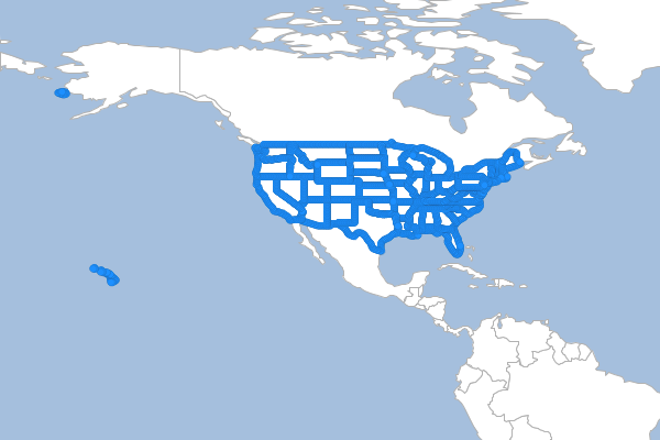
Coordinates
Extract the coordinates each Feature in the input Layer and save them to the output Layer.
geo-shell> layer coordinates --input-name states --output-workspace layers --output-name coordinates
Name |
Description |
Mandatory |
Specified Default |
Unspecified Default |
input-name |
The Layer name |
true |
||
output-workspace |
The output Layer Workspace |
true |
||
output-name |
The output Layer name |
true |
geo-shell> workspace open --name layers --params memory
Workspace layers opened!
geo-shell> workspace open --name naturalearth --params examples/naturalearth.gpkg
Workspace naturalearth opened!
geo-shell> layer open --workspace naturalearth --layer states --name states
Opened Workspace naturalearth Layer states as states
geo-shell> layer coordinates --input-name states --output-workspace layers --output-name coordinates
Done!
geo-shell> style vector default --layer coordinates --color #1E90FF --opacity 0.75 --file examples/coordinates.sld
Default Vector Style for coordinates written to /home/runner/work/geo-shell/geo-shell/examples/coordinates.sld!
geo-shell> layer style set --name coordinates --style examples/coordinates.sld
Style /home/runner/work/geo-shell/geo-shell/examples/coordinates.sld set on coordinates
geo-shell> layer open --workspace naturalearth --layer countries --name countries
Opened Workspace naturalearth Layer countries as countries
geo-shell> layer style set --name countries --style examples/countries.sld
Style /home/runner/work/geo-shell/geo-shell/examples/countries.sld set on countries
geo-shell> layer open --workspace naturalearth --layer ocean --name ocean
Opened Workspace naturalearth Layer ocean as ocean
geo-shell> layer style set --name ocean --style examples/ocean.sld
Style /home/runner/work/geo-shell/geo-shell/examples/ocean.sld set on ocean
geo-shell> map open --name map
Map map opened!
geo-shell> map add layer --name map --layer ocean
Added ocean layer to map map
geo-shell> map add layer --name map --layer countries
Added countries layer to map map
geo-shell> map add layer --name map --layer coordinates
Added coordinates layer to map map
geo-shell> map draw --name map --file examples/layer_coordinates.png --bounds "-180,-8.233,-36.738,73.378"
Done drawing /home/runner/work/geo-shell/geo-shell/examples/layer_coordinates.png!
geo-shell> map close --name map
Map map closed!
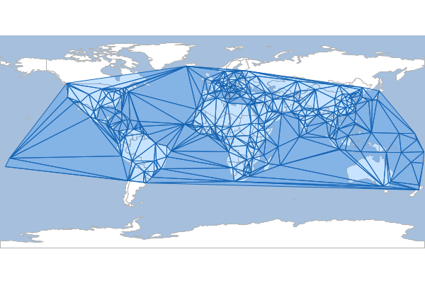
Delaunay
Calculate a delaunay diagram of the input Layer and save it to the output Layer.
geo-shell> layer delaunay --input-name places --output-workspace layers --output-name delaunay
Name |
Description |
Mandatory |
Specified Default |
Unspecified Default |
input-name |
The Layer name |
true |
||
output-workspace |
The output Layer Workspace |
true |
||
output-name |
The output Layer name |
true |
||
geometry-field |
The geometry field name |
false |
the_geom |
the_geom |
geo-shell> workspace open --name layers --params memory
Workspace layers opened!
geo-shell> workspace open --name naturalearth --params examples/naturalearth.gpkg
Workspace naturalearth opened!
geo-shell> layer open --workspace naturalearth --layer places --name places
Opened Workspace naturalearth Layer places as places
geo-shell> layer delaunay --input-name places --output-workspace layers --output-name delaunay
Done!
geo-shell> style vector default --layer delaunay --color #1E90FF --opacity 0.25 --file examples/delaunay.sld
Default Vector Style for delaunay written to /home/runner/work/geo-shell/geo-shell/examples/delaunay.sld!
geo-shell> layer style set --name delaunay --style examples/delaunay.sld
Style /home/runner/work/geo-shell/geo-shell/examples/delaunay.sld set on delaunay
geo-shell> layer open --workspace naturalearth --layer countries --name countries
Opened Workspace naturalearth Layer countries as countries
geo-shell> layer style set --name countries --style examples/countries.sld
Style /home/runner/work/geo-shell/geo-shell/examples/countries.sld set on countries
geo-shell> layer open --workspace naturalearth --layer ocean --name ocean
Opened Workspace naturalearth Layer ocean as ocean
geo-shell> layer style set --name ocean --style examples/ocean.sld
Style /home/runner/work/geo-shell/geo-shell/examples/ocean.sld set on ocean
geo-shell> map open --name map
Map map opened!
geo-shell> map add layer --name map --layer ocean
Added ocean layer to map map
geo-shell> map add layer --name map --layer countries
Added countries layer to map map
geo-shell> map add layer --name map --layer delaunay
Added delaunay layer to map map
Done drawing /home/runner/work/geo-shell/geo-shell/examples/layer_delaunay.png!
geo-shell> map draw --name map --file examples/layer_delaunay.png
Map map closed!
geo-shell> map close --name map
Densify
Densify the features of the input Layer and save them to the output Layer
geo-shell> layer densify --input-name states --output-workspace layers --output-name states_densified --distance 0.1
Name |
Description |
Mandatory |
Specified Default |
Unspecified Default |
input-name |
The Layer name |
true |
||
output-workspace |
The output Layer Workspace |
true |
||
output-name |
The output Layer name |
true |
||
distance |
The distance tolerance |
true |
geo-shell> workspace open --name layers --params memory
Workspace layers opened!
geo-shell> workspace open --name naturalearth --params examples/naturalearth.gpkg
Workspace naturalearth opened!
geo-shell> layer open --workspace naturalearth --layer states --name states
Opened Workspace naturalearth Layer states as states
geo-shell> layer densify --input-name states --output-workspace layers --output-name states_densified --distance 0.1
Done!
geo-shell> layer coordinates --input-name states_densified --output-workspace layers --output-name coordinates
Done!
geo-shell> style vector default --layer coordinates --color #1E90FF --opacity 0.75 --file examples/coordinates.sld
Default Vector Style for coordinates written to /home/runner/work/geo-shell/geo-shell/examples/coordinates.sld!
geo-shell> layer style set --name coordinates --style examples/coordinates.sld
Style /home/runner/work/geo-shell/geo-shell/examples/coordinates.sld set on coordinates
geo-shell> layer open --workspace naturalearth --layer countries --name countries
Opened Workspace naturalearth Layer countries as countries
geo-shell> layer style set --name countries --style examples/countries.sld
Style /home/runner/work/geo-shell/geo-shell/examples/countries.sld set on countries
geo-shell> layer open --workspace naturalearth --layer ocean --name ocean
Opened Workspace naturalearth Layer ocean as ocean
geo-shell> layer style set --name ocean --style examples/ocean.sld
Style /home/runner/work/geo-shell/geo-shell/examples/ocean.sld set on ocean
geo-shell> map open --name map
Map map opened!
geo-shell> map add layer --name map --layer ocean
Added ocean layer to map map
geo-shell> map add layer --name map --layer countries
Added countries layer to map map
Added coordinates layer to map map
geo-shell> map add layer --name map --layer coordinates
Done drawing /home/runner/work/geo-shell/geo-shell/examples/layer_densify.png!
geo-shell> map draw --name map --file examples/layer_densify.png --bounds "-180,-8.233,-36.738,73.378"
Map map closed!
geo-shell> map close --name map
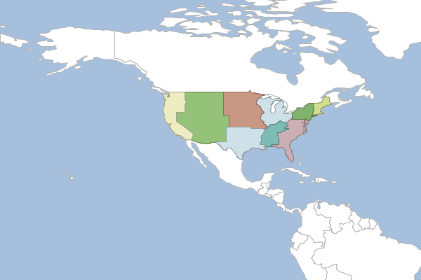
Dissolve
Dissolve the Features of a Layer by a Field.
geo-shell> layer dissolve --input-name states --output-workspace layers --output-name regions --field SUB_REGION
Name |
Description |
Mandatory |
Specified Default |
Unspecified Default |
input-name |
The Layer name |
true |
||
output-workspace |
The output Layer Workspace |
true |
||
output-name |
The output Layer name |
true |
||
field |
The field to use to dissolve features |
true |
||
idField |
The name of the id field |
false |
id |
id |
countField |
The name of the count field |
false |
count |
count |
geo-shell> workspace open --name layers --params memory
Workspace layers opened!
geo-shell> workspace open --name shapefiles --params examples/states/states.shp
Workspace shapefiles opened!
geo-shell> layer open --workspace shapefiles --layer states --name states
Opened Workspace shapefiles Layer states as states
geo-shell> layer dissolve --input-name states --output-workspace layers --output-name regions --field SUB_REGION
Done dissolving states to regions by SUB_REGION!
geo-shell> style vector uniquevalues --layer regions --field SUB_REGION --colors MutedTerrain --file [silver] examples/regions.sld
Unique Values Vector Style for regions’s SUB_REGION Field written to /home/runner/work/geo-shell/geo-shell/examples/regions.sld!
geo-shell> layer style set --name regions --style examples/regions.sld
Style /home/runner/work/geo-shell/geo-shell/examples/regions.sld set on regions
geo-shell> workspace open --name naturalearth --params examples/naturalearth.gpkg
Workspace naturalearth opened!
geo-shell> layer open --workspace naturalearth --layer countries --name countries
Opened Workspace naturalearth Layer countries as countries
geo-shell> layer style set --name countries --style examples/countries.sld
Style /home/runner/work/geo-shell/geo-shell/examples/countries.sld set on countries
geo-shell> layer open --workspace naturalearth --layer ocean --name ocean
Opened Workspace naturalearth Layer ocean as ocean
geo-shell> layer style set --name ocean --style examples/ocean.sld
Style /home/runner/work/geo-shell/geo-shell/examples/ocean.sld set on ocean
geo-shell> map open --name map
Map map opened!
geo-shell> map add layer --name map --layer ocean
Added ocean layer to map map
geo-shell> map add layer --name map --layer countries
Added countries layer to map map
Added regions layer to map map
geo-shell> map add layer --name map --layer regions
Done drawing /home/runner/work/geo-shell/geo-shell/examples/layer_dissolve.png!
geo-shell> map draw --name map --file examples/layer_dissolve.png --bounds "-180,-8.233,-36.738,73.378"
Map map closed!
geo-shell> map close --name map
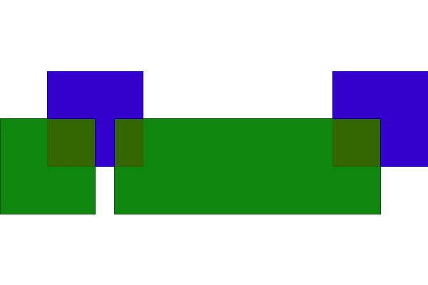
Erase
Erase one Layer from another Layer
geo-shell> layer erase --input-name a --other-name b --output-workspace results --output-name results
Name |
Description |
Mandatory |
Specified Default |
Unspecified Default |
input-name |
The Layer name |
true |
||
other-name |
The other Layer name |
true |
||
output-workspace |
The output Layer Workspace |
true |
||
output-name |
The output Layer name |
true |
geo-shell> workspace open --name layers --params src/test/resources/layeralgebra.gpkg
Workspace layers opened!
geo-shell> workspace open --name results --params memory
Workspace results opened!
geo-shell> layer open --workspace layers --layer a --name a
Opened Workspace layers Layer a as a
geo-shell> layer open --workspace layers --layer b --name b
Opened Workspace layers Layer b as b
geo-shell> layer erase --input-name a --other-name b --output-workspace results --output-name results
Done erasing a from b to create results!
geo-shell> style vector default --layer a --color red --opacity 0.75 --file examples/red.sld
Default Vector Style for a written to /home/runner/work/geo-shell/geo-shell/examples/red.sld!
geo-shell> style vector default --layer b --color green --opacity 0.75 --file examples/green.sld
Default Vector Style for b written to /home/runner/work/geo-shell/geo-shell/examples/green.sld!
geo-shell> style vector default --layer results --color blue --opacity 0.75 --file examples/blue.sld
Default Vector Style for results written to /home/runner/work/geo-shell/geo-shell/examples/blue.sld!
geo-shell> layer style set --name a --style examples/red.sld
Style /home/runner/work/geo-shell/geo-shell/examples/red.sld set on a
geo-shell> layer style set --name b --style examples/green.sld
Style /home/runner/work/geo-shell/geo-shell/examples/green.sld set on b
geo-shell> layer style set --name results --style examples/blue.sld
Style /home/runner/work/geo-shell/geo-shell/examples/blue.sld set on results
geo-shell> map open --name map
Map map opened!
geo-shell> map add layer --name map --layer a
Added a layer to map map
geo-shell> map add layer --name map --layer b
Added b layer to map map
geo-shell> map add layer --name map --layer results
Added results layer to map map
geo-shell> map draw --name map --file examples/layer_erase.png
Done drawing /home/runner/work/geo-shell/geo-shell/examples/layer_erase.png!
geo-shell> map close --name map
Map map closed!
Grid Row / Column
Create a grid Layer with rows and columns
geo-shell> layer grid rowcol --output-workspace layers --output-name rowcol --geometry -180,-90,180,90 --rows 10 --columns 8
Name |
Description |
Mandatory |
Specified Default |
Unspecified Default |
output-workspace |
The output Layer Workspace |
true |
||
output-name |
The output Layer name |
true |
||
rows |
The number of rows |
true |
||
columns |
The number of columns |
true |
||
geometry |
The constraining geometry |
true |
||
type |
The geometry type (point or polygon |
false |
polygon |
polygon |
projection |
The projection |
false |
EPSG:4326 |
EPSG:4326 |
geometry-field |
The geometry field name |
false |
the_geom |
the_geom |
geo-shell> workspace open --name layers --params memory
Workspace layers opened!
geo-shell> layer grid rowcol --output-workspace layers --output-name rowcol --geometry -180,-90,180,90 --rows 10 --columns 8
Done!
geo-shell> style vector default --layer rowcol --color #1E90FF --opacity 0.30 --file examples/rowcol.sld
Default Vector Style for rowcol written to /home/runner/work/geo-shell/geo-shell/examples/rowcol.sld!
geo-shell> layer style set --name rowcol --style examples/rowcol.sld
Style /home/runner/work/geo-shell/geo-shell/examples/rowcol.sld set on rowcol
geo-shell> workspace open --name naturalearth --params examples/naturalearth.gpkg
Workspace naturalearth opened!
geo-shell> layer open --workspace naturalearth --layer countries --name countries
Opened Workspace naturalearth Layer countries as countries
geo-shell> layer style set --name countries --style examples/countries.sld
Style /home/runner/work/geo-shell/geo-shell/examples/countries.sld set on countries
geo-shell> layer open --workspace naturalearth --layer ocean --name ocean
Opened Workspace naturalearth Layer ocean as ocean
geo-shell> layer style set --name ocean --style examples/ocean.sld
Style /home/runner/work/geo-shell/geo-shell/examples/ocean.sld set on ocean
geo-shell> map open --name map
Map map opened!
geo-shell> map add layer --name map --layer ocean
Added ocean layer to map map
geo-shell> map add layer --name map --layer countries
Added countries layer to map map
geo-shell> map add layer --name map --layer rowcol
Added rowcol layer to map map
geo-shell> map draw --name map --file examples/layer_grid_rowcol.png
Done drawing /home/runner/work/geo-shell/geo-shell/examples/layer_grid_rowcol.png!
geo-shell> map close --name map
Map map closed!

Grid Width / Height
Create a grid Layer with cell width and height
geo-shell> layer grid widthheight --output-workspace layers --output-name widthheight --geometry -180,-90,180,90 --cell-width 8 --cell-height 7
Name |
Description |
Mandatory |
Specified Default |
Unspecified Default |
output-workspace |
The output Layer Workspace |
true |
||
output-name |
The output Layer name |
true |
||
cell-width |
The width of each cell |
true |
||
cell-height |
The height of each cell |
true |
||
geometry |
The constraining geometry |
true |
||
type |
The geometry type (point or polygon |
false |
polygon |
polygon |
projection |
The projection |
false |
EPSG:4326 |
EPSG:4326 |
geometry-field |
The geometry field name |
false |
the_geom |
the_geom |
geo-shell> workspace open --name layers --params memory
Workspace layers opened!
geo-shell> layer grid widthheight --output-workspace layers --output-name widthheight --geometry -180,-90,180,90 --cell-width 8 --cell-height 7
Done!
geo-shell> style vector default --layer widthheight --color #1E90FF --opacity 0.30 --file examples/widthheight.sld
Default Vector Style for widthheight written to /home/runner/work/geo-shell/geo-shell/examples/widthheight.sld!
geo-shell> layer style set --name widthheight --style examples/widthheight.sld
Style /home/runner/work/geo-shell/geo-shell/examples/widthheight.sld set on widthheight
geo-shell> workspace open --name naturalearth --params examples/naturalearth.gpkg
Workspace naturalearth opened!
geo-shell> layer open --workspace naturalearth --layer countries --name countries
Opened Workspace naturalearth Layer countries as countries
geo-shell> layer style set --name countries --style examples/countries.sld
Style /home/runner/work/geo-shell/geo-shell/examples/countries.sld set on countries
geo-shell> layer open --workspace naturalearth --layer ocean --name ocean
Opened Workspace naturalearth Layer ocean as ocean
geo-shell> layer style set --name ocean --style examples/ocean.sld
Style /home/runner/work/geo-shell/geo-shell/examples/ocean.sld set on ocean
geo-shell> map open --name map
Map map opened!
geo-shell> map add layer --name map --layer ocean
Added ocean layer to map map
geo-shell> map add layer --name map --layer countries
Added countries layer to map map
geo-shell> map add layer --name map --layer widthheight
Added widthheight layer to map map
geo-shell> map draw --name map --file examples/layer_grid_widthheight.png
Done drawing /home/runner/work/geo-shell/geo-shell/examples/layer_grid_widthheight.png!
geo-shell> map close --name map
Map map closed!

Identity
Calculate the intersection between a Layer with another Layer
geo-shell> layer identity --input-name a --other-name b --output-workspace results --output-name results
Name |
Description |
Mandatory |
Specified Default |
Unspecified Default |
input-name |
The Layer name |
true |
||
other-name |
The other Layer name |
true |
||
output-workspace |
The output Layer Workspace |
true |
||
output-name |
The output Layer name |
true |
||
postfix-all |
Whether to postfix all field names when combining schemas |
false |
false |
false |
include-duplicates |
Whether to include duplicate field names |
false |
true |
true |
geo-shell> workspace open --name layers --params src/test/resources/layeralgebra.gpkg
Workspace layers opened!
geo-shell> workspace open --name results --params memory
Workspace results opened!
geo-shell> layer open --workspace layers --layer a --name a
Opened Workspace layers Layer a as a
geo-shell> layer open --workspace layers --layer b --name b
Opened Workspace layers Layer b as b
geo-shell> layer identity --input-name a --other-name b --output-workspace results --output-name results
Done calculating the identity between a and b to create results!
geo-shell> style vector default --layer a --color red --opacity 0.75 --file examples/red.sld
Default Vector Style for a written to /home/runner/work/geo-shell/geo-shell/examples/red.sld!
geo-shell> style vector default --layer b --color green --opacity 0.75 --file examples/green.sld
Default Vector Style for b written to /home/runner/work/geo-shell/geo-shell/examples/green.sld!
geo-shell> style vector default --layer results --color blue --opacity 0.75 --file examples/blue.sld
Default Vector Style for results written to /home/runner/work/geo-shell/geo-shell/examples/blue.sld!
geo-shell> layer style set --name a --style examples/red.sld
Style /home/runner/work/geo-shell/geo-shell/examples/red.sld set on a
geo-shell> layer style set --name b --style examples/green.sld
Style /home/runner/work/geo-shell/geo-shell/examples/green.sld set on b
geo-shell> layer style set --name results --style examples/blue.sld
Style /home/runner/work/geo-shell/geo-shell/examples/blue.sld set on results
geo-shell> map open --name map
Map map opened!
geo-shell> map add layer --name map --layer a
Added a layer to map map
geo-shell> map add layer --name map --layer b
Added b layer to map map
geo-shell> map add layer --name map --layer results
Added results layer to map map
geo-shell> map draw --name map --file examples/layer_identity.png
Done drawing /home/runner/work/geo-shell/geo-shell/examples/layer_identity.png!
geo-shell> map close --name map
Map map closed!
Intersection
Calculate the intersection between a Layer with another Layer
geo-shell> layer intersection --input-name a --other-name b --output-workspace results --output-name results
Name |
Description |
Mandatory |
Specified Default |
Unspecified Default |
input-name |
The Layer name |
true |
||
other-name |
The other Layer name |
true |
||
output-workspace |
The output Layer Workspace |
true |
||
output-name |
The output Layer name |
true |
||
postfix-all |
Whether to postfix all field names when combining schemas |
false |
false |
false |
include-duplicates |
Whether to include duplicate field names |
false |
true |
true |
geo-shell> workspace open --name layers --params src/test/resources/layeralgebra.gpkg
Workspace layers opened!
geo-shell> workspace open --name results --params memory
Workspace results opened!
geo-shell> layer open --workspace layers --layer a --name a
Opened Workspace layers Layer a as a
geo-shell> layer open --workspace layers --layer b --name b
Opened Workspace layers Layer b as b
geo-shell> layer intersection --input-name a --other-name b --output-workspace results --output-name results
Done calculating the intersection between a and b to create results!
geo-shell> style vector default --layer a --color red --opacity 0.75 --file examples/red.sld
Default Vector Style for a written to /home/runner/work/geo-shell/geo-shell/examples/red.sld!
geo-shell> style vector default --layer b --color green --opacity 0.75 --file examples/green.sld
Default Vector Style for b written to /home/runner/work/geo-shell/geo-shell/examples/green.sld!
geo-shell> style vector default --layer results --color blue --opacity 0.75 --file examples/blue.sld
Default Vector Style for results written to /home/runner/work/geo-shell/geo-shell/examples/blue.sld!
geo-shell> layer style set --name a --style examples/red.sld
Style /home/runner/work/geo-shell/geo-shell/examples/red.sld set on a
geo-shell> layer style set --name b --style examples/green.sld
Style /home/runner/work/geo-shell/geo-shell/examples/green.sld set on b
geo-shell> layer style set --name results --style examples/blue.sld
Style /home/runner/work/geo-shell/geo-shell/examples/blue.sld set on results
geo-shell> map open --name map
Map map opened!
geo-shell> map add layer --name map --layer a
Added a layer to map map
geo-shell> map add layer --name map --layer b
Added b layer to map map
geo-shell> map add layer --name map --layer results
Added results layer to map map
geo-shell> map draw --name map --file examples/layer_intersection.png
Done drawing /home/runner/work/geo-shell/geo-shell/examples/layer_intersection.png!
geo-shell> map close --name map
Map map closed!
Minimum Circle
Calculate the mininmum bounding circle of the input Layer and save it to the output Layer.
geo-shell> layer mincircle --input-name countries --output-workspace layers --output-name mincircle
Name |
Description |
Mandatory |
Specified Default |
Unspecified Default |
input-name |
The Layer name |
true |
||
output-workspace |
The output Layer Workspace |
true |
||
output-name |
The output Layer name |
true |
||
geometry-field |
The geometry field name |
false |
the_geom |
the_geom |
geo-shell> workspace open --name layers --params memory
Workspace layers opened!
geo-shell> workspace open --name naturalearth --params examples/naturalearth.gpkg
Workspace naturalearth opened!
geo-shell> layer open --workspace naturalearth --layer countries --name countries
Opened Workspace naturalearth Layer countries as countries
geo-shell> layer style set --name countries --style examples/countries.sld
Style /home/runner/work/geo-shell/geo-shell/examples/countries.sld set on countries
geo-shell> layer open --workspace naturalearth --layer ocean --name ocean
Opened Workspace naturalearth Layer ocean as ocean
geo-shell> layer style set --name ocean --style examples/ocean.sld
Style /home/runner/work/geo-shell/geo-shell/examples/ocean.sld set on ocean
geo-shell> layer mincircle --input-name countries --output-workspace layers --output-name mincircle
Done!
geo-shell> style vector default --layer mincircle --color #1E90FF --opacity 0.25 --file examples/mincircle.sld
Default Vector Style for mincircle written to /home/runner/work/geo-shell/geo-shell/examples/mincircle.sld!
geo-shell> layer style set --name mincircle --style examples/mincircle.sld
Style /home/runner/work/geo-shell/geo-shell/examples/mincircle.sld set on mincircle
geo-shell> map open --name map
Map map opened!
geo-shell> map add layer --name map --layer ocean
Added ocean layer to map map
geo-shell> map add layer --name map --layer countries
Added countries layer to map map
geo-shell> map add layer --name map --layer mincircle
Added mincircle layer to map map
geo-shell> map draw --name map --file examples/layer_mincircle.png
Done drawing /home/runner/work/geo-shell/geo-shell/examples/layer_mincircle.png!
geo-shell> map close --name map
Map map closed!
Minimum Circles
Calculate the minimum bounding circle of each Feature in the input Layer and save them to the output Layer.
geo-shell> layer mincircles --input-name countries --output-workspace layers --output-name mincircles
Name |
Description |
Mandatory |
Specified Default |
Unspecified Default |
input-name |
The Layer name |
true |
||
output-workspace |
The output Layer Workspace |
true |
||
output-name |
The output Layer name |
true |
geo-shell> workspace open --name layers --params memory
Workspace layers opened!
geo-shell> workspace open --name naturalearth --params examples/naturalearth.gpkg
Workspace naturalearth opened!
geo-shell> layer open --workspace naturalearth --layer countries --name countries
Opened Workspace naturalearth Layer countries as countries
geo-shell> layer style set --name countries --style examples/countries.sld
Style /home/runner/work/geo-shell/geo-shell/examples/countries.sld set on countries
geo-shell> layer open --workspace naturalearth --layer ocean --name ocean
Opened Workspace naturalearth Layer ocean as ocean
geo-shell> layer style set --name ocean --style examples/ocean.sld
Style /home/runner/work/geo-shell/geo-shell/examples/ocean.sld set on ocean
geo-shell> layer mincircles --input-name countries --output-workspace layers --output-name mincircles
Done!
geo-shell> style vector default --layer mincircles --color #1E90FF --opacity 0.25 --file examples/mincircles.sld
Default Vector Style for mincircles written to /home/runner/work/geo-shell/geo-shell/examples/mincircles.sld!
geo-shell> layer style set --name mincircles --style examples/mincircles.sld
Style /home/runner/work/geo-shell/geo-shell/examples/mincircles.sld set on mincircles
geo-shell> map open --name map
Map map opened!
geo-shell> map add layer --name map --layer ocean
Added ocean layer to map map
geo-shell> map add layer --name map --layer countries
Added countries layer to map map
geo-shell> map add layer --name map --layer mincircles
Added mincircles layer to map map
geo-shell> map draw --name map --file examples/layer_mincircles.png
Done drawing /home/runner/work/geo-shell/geo-shell/examples/layer_mincircles.png!
geo-shell> map close --name map
Map map closed!
Minimum Rectangle
Calculate the mininmum rectangle of the input Layer and save it to the output Layer.
geo-shell> layer minrect --input-name countries --output-workspace layers --output-name minrect
Name |
Description |
Mandatory |
Specified Default |
Unspecified Default |
input-name |
The Layer name |
true |
||
output-workspace |
The output Layer Workspace |
true |
||
output-name |
The output Layer name |
true |
||
geometry-field |
The geometry field name |
false |
the_geom |
the_geom |
geo-shell> workspace open --name layers --params memory
Workspace layers opened!
geo-shell> workspace open --name naturalearth --params examples/naturalearth.gpkg
Workspace naturalearth opened!
geo-shell> layer open --workspace naturalearth --layer countries --name countries
Opened Workspace naturalearth Layer countries as countries
geo-shell> layer style set --name countries --style examples/countries.sld
Style /home/runner/work/geo-shell/geo-shell/examples/countries.sld set on countries
geo-shell> layer open --workspace naturalearth --layer ocean --name ocean
Opened Workspace naturalearth Layer ocean as ocean
geo-shell> layer style set --name ocean --style examples/ocean.sld
Style /home/runner/work/geo-shell/geo-shell/examples/ocean.sld set on ocean
geo-shell> layer minrect --input-name countries --output-workspace layers --output-name minrect
Done!
geo-shell> style vector default --layer minrect --color #1E90FF --opacity 0.25 --file examples/minrect.sld
Default Vector Style for minrect written to /home/runner/work/geo-shell/geo-shell/examples/minrect.sld!
geo-shell> layer style set --name minrect --style examples/minrect.sld
Style /home/runner/work/geo-shell/geo-shell/examples/minrect.sld set on minrect
geo-shell> map open --name map
Map map opened!
geo-shell> map add layer --name map --layer ocean
Added ocean layer to map map
geo-shell> map add layer --name map --layer countries
Added countries layer to map map
geo-shell> map add layer --name map --layer minrect
Added minrect layer to map map
geo-shell> map draw --name map --file examples/layer_minrect.png
Done drawing /home/runner/work/geo-shell/geo-shell/examples/layer_minrect.png!
geo-shell> map close --name map
Map map closed!
Minimum Rectangles
Calculate the minimum rectangle of each Feature in the input Layer and save them to the output Layer.
geo-shell> layer minrects --input-name countries --output-workspace layers --output-name minrects
Name |
Description |
Mandatory |
Specified Default |
Unspecified Default |
input-name |
The Layer name |
true |
||
output-workspace |
The output Layer Workspace |
true |
||
output-name |
The output Layer name |
true |
geo-shell> workspace open --name layers --params memory
Workspace layers opened!
geo-shell> workspace open --name naturalearth --params examples/naturalearth.gpkg
Workspace naturalearth opened!
geo-shell> layer open --workspace naturalearth --layer countries --name countries
Opened Workspace naturalearth Layer countries as countries
geo-shell> layer style set --name countries --style examples/countries.sld
Style /home/runner/work/geo-shell/geo-shell/examples/countries.sld set on countries
geo-shell> layer open --workspace naturalearth --layer ocean --name ocean
Opened Workspace naturalearth Layer ocean as ocean
geo-shell> layer style set --name ocean --style examples/ocean.sld
Style /home/runner/work/geo-shell/geo-shell/examples/ocean.sld set on ocean
geo-shell> layer minrects --input-name countries --output-workspace layers --output-name minrects
Done!
geo-shell> style vector default --layer minrects --color #1E90FF --opacity 0.25 --file examples/minrects.sld
Default Vector Style for minrects written to /home/runner/work/geo-shell/geo-shell/examples/minrects.sld!
geo-shell> layer style set --name minrects --style examples/minrects.sld
Style /home/runner/work/geo-shell/geo-shell/examples/minrects.sld set on minrects
geo-shell> map open --name map
Map map opened!
geo-shell> map add layer --name map --layer ocean
Added ocean layer to map map
geo-shell> map add layer --name map --layer countries
Added countries layer to map map
geo-shell> map add layer --name map --layer minrects
Added minrects layer to map map
geo-shell> map draw --name map --file examples/layer_minrects.png
Done drawing /home/runner/work/geo-shell/geo-shell/examples/layer_minrects.png!
geo-shell> map close --name map
Map map closed!
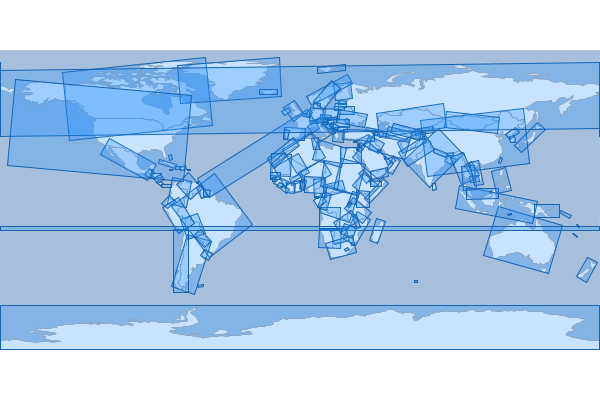
Octangle Envelope
Calculate the octagonal envelope of the input Layer and save it to the output Layer.
geo-shell> layer octagonalenvelope --input-name countries --output-workspace layers --output-name octagonalenvelope
Name |
Description |
Mandatory |
Specified Default |
Unspecified Default |
input-name |
The Layer name |
true |
||
output-workspace |
The output Layer Workspace |
true |
||
output-name |
The output Layer name |
true |
||
geometry-field |
The geometry field name |
false |
the_geom |
the_geom |
geo-shell> workspace open --name layers --params memory
Workspace layers opened!
geo-shell> workspace open --name naturalearth --params examples/naturalearth.gpkg
Workspace naturalearth opened!
geo-shell> layer open --workspace naturalearth --layer countries --name countries
Opened Workspace naturalearth Layer countries as countries
geo-shell> layer style set --name countries --style examples/countries.sld
Style /home/runner/work/geo-shell/geo-shell/examples/countries.sld set on countries
geo-shell> layer open --workspace naturalearth --layer ocean --name ocean
Opened Workspace naturalearth Layer ocean as ocean
geo-shell> layer style set --name ocean --style examples/ocean.sld
Style /home/runner/work/geo-shell/geo-shell/examples/ocean.sld set on ocean
geo-shell> layer octagonalenvelope --input-name countries --output-workspace layers --output-name octagonalenvelope
Done!
geo-shell> style vector default --layer octagonalenvelope --color #1E90FF --opacity 0.25 --file examples/octagonalenvelope.sld
Default Vector Style for octagonalenvelope written to /home/runner/work/geo-shell/geo-shell/examples/octagonalenvelope.sld!
geo-shell> layer style set --name octagonalenvelope --style examples/octagonalenvelope.sld
Style /home/runner/work/geo-shell/geo-shell/examples/octagonalenvelope.sld set on octagonalenvelope
geo-shell> map open --name map
Map map opened!
geo-shell> map add layer --name map --layer ocean
Added ocean layer to map map
geo-shell> map add layer --name map --layer countries
Added countries layer to map map
geo-shell> map add layer --name map --layer octagonalenvelope
Added octagonalenvelope layer to map map
geo-shell> map draw --name map --file examples/layer_octagonalenvelope.png
Done drawing /home/runner/work/geo-shell/geo-shell/examples/layer_octagonalenvelope.png!
geo-shell> map close --name map
Map map closed!
Octangle Envelopes
Calculate the octagonal envelope of each Feature in the input Layer and save them to the output Layer.
geo-shell> layer octagonalenvelopes --input-name countries --output-workspace layers --output-name octagonalenvelopes
Name |
Description |
Mandatory |
Specified Default |
Unspecified Default |
input-name |
The Layer name |
true |
||
output-workspace |
The output Layer Workspace |
true |
||
output-name |
The output Layer name |
true |
geo-shell> workspace open --name layers --params memory
Workspace layers opened!
geo-shell> workspace open --name naturalearth --params examples/naturalearth.gpkg
Workspace naturalearth opened!
geo-shell> layer open --workspace naturalearth --layer countries --name countries
Opened Workspace naturalearth Layer countries as countries
geo-shell> layer style set --name countries --style examples/countries.sld
Style /home/runner/work/geo-shell/geo-shell/examples/countries.sld set on countries
geo-shell> layer open --workspace naturalearth --layer ocean --name ocean
Opened Workspace naturalearth Layer ocean as ocean
geo-shell> layer style set --name ocean --style examples/ocean.sld
Style /home/runner/work/geo-shell/geo-shell/examples/ocean.sld set on ocean
geo-shell> layer octagonalenvelopes --input-name countries --output-workspace layers --output-name octagonalenvelopes
Done!
geo-shell> style vector default --layer octagonalenvelopes --color #1E90FF --opacity 0.25 --file examples/octagonalenvelopes.sld
Default Vector Style for octagonalenvelopes written to /home/runner/work/geo-shell/geo-shell/examples/octagonalenvelopes.sld!
geo-shell> layer style set --name octagonalenvelopes --style examples/octagonalenvelopes.sld
Style /home/runner/work/geo-shell/geo-shell/examples/octagonalenvelopes.sld set on octagonalenvelopes
geo-shell> map open --name map
Map map opened!
geo-shell> map add layer --name map --layer ocean
Added ocean layer to map map
geo-shell> map add layer --name map --layer countries
Added countries layer to map map
geo-shell> map add layer --name map --layer octagonalenvelopes
Added octagonalenvelopes layer to map map
geo-shell> map draw --name map --file examples/layer_octagonalenvelopes.png
Done drawing /home/runner/work/geo-shell/geo-shell/examples/layer_octagonalenvelopes.png!
geo-shell> map close --name map
Map map closed!
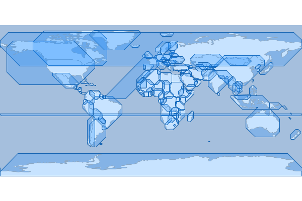
Points Along Lines
Create points along lines
geo-shell> layer points along lines --input-name mississippi --output-workspace layers --output-name points --distance 2.0
Name |
Description |
Mandatory |
Specified Default |
Unspecified Default |
input-name |
The Layer name |
true |
||
output-workspace |
The output Layer Workspace |
true |
||
output-name |
The output Layer name |
true |
||
distance |
The distance between points |
true |
geo-shell> workspace open --name layers --params memory
Workspace layers opened!
geo-shell> workspace open --name rivers --params src/test/resources/rivers/ne_110m_rivers_lake_centerlines.shp
Workspace rivers opened!
geo-shell> layer open --workspace rivers --layer ne_110m_rivers_lake_centerlines --name rivers
Opened Workspace rivers Layer ne_110m_rivers_lake_centerlines as rivers
geo-shell> layer copy --input-name rivers --output-workspace layers --output-name mississippi # [gray]--filter# "name='Mississippi'"
Done!
geo-shell> style vector default --layer mississippi --color blue --file examples/river.sld
Default Vector Style for mississippi written to /home/runner/work/geo-shell/geo-shell/examples/river.sld!
geo-shell> layer style set --name mississippi --style examples/river.sld
Style /home/runner/work/geo-shell/geo-shell/examples/river.sld set on mississippi
geo-shell> layer points along lines --input-name mississippi --output-workspace layers --output-name points --distance 2.0
Done placing points along mississippi every 2.0 to create points!
geo-shell> style vector default --layer points --color green --file examples/points.sld
Default Vector Style for points written to /home/runner/work/geo-shell/geo-shell/examples/points.sld!
geo-shell> layer style set --name points --style examples/points.sld
Style /home/runner/work/geo-shell/geo-shell/examples/points.sld set on points
geo-shell> workspace open --name naturalearth --params examples/naturalearth.gpkg
Workspace naturalearth opened!
geo-shell> layer open --workspace naturalearth --layer countries --name countries
Opened Workspace naturalearth Layer countries as countries
geo-shell> layer style set --name countries --style examples/countries.sld
Style /home/runner/work/geo-shell/geo-shell/examples/countries.sld set on countries
geo-shell> layer open --workspace naturalearth --layer ocean --name ocean
Opened Workspace naturalearth Layer ocean as ocean
geo-shell> layer style set --name ocean --style examples/ocean.sld
Style /home/runner/work/geo-shell/geo-shell/examples/ocean.sld set on ocean
geo-shell> map open --name map
Map map opened!
geo-shell> map add layer --name map --layer ocean
Added ocean layer to map map
geo-shell> map add layer --name map --layer countries
Added countries layer to map map
geo-shell> map add layer --name map --layer mississippi
Added mississippi layer to map map
geo-shell> map add layer --name map --layer points
Added points layer to map map
geo-shell> map draw --name map --file examples/layer_points_along_lines.png --bounds "-180,-8.233,-36.738,73.378"
Done drawing /home/runner/work/geo-shell/geo-shell/examples/layer_points_along_lines.png!

Simplify
Simplify the features of the input Layer and save them to the output Layer
geo-shell> layer simplify --input-name mississippi --output-workspace layers --output-name simplified --distance 1.0
Name |
Description |
Mandatory |
Specified Default |
Unspecified Default |
input-name |
The Layer name |
true |
||
output-workspace |
The output Layer Workspace |
true |
||
output-name |
The output Layer name |
true |
||
algorithm |
The simplify algorithm (DouglasPeucker - dp or TopologyPreserving - tp) |
false |
tp |
tp |
distance |
The distance tolerance |
true |
geo-shell> workspace open --name layers --params memory
Workspace layers opened!
geo-shell> workspace open --name rivers --params src/test/resources/rivers/ne_110m_rivers_lake_centerlines.shp
Workspace rivers opened!
geo-shell> layer open --workspace rivers --layer ne_110m_rivers_lake_centerlines --name rivers
Opened Workspace rivers Layer ne_110m_rivers_lake_centerlines as rivers
geo-shell> layer copy --input-name rivers --output-workspace layers --output-name mississippi # [gray]--filter# "name='Mississippi'"
Done!
geo-shell> layer simplify --input-name mississippi --output-workspace layers --output-name simplified --distance 1.0
Done!
geo-shell> style vector default --layer simplified --color blue --file examples/river.sld
Default Vector Style for simplified written to /home/runner/work/geo-shell/geo-shell/examples/river.sld!
geo-shell> layer style set --name simplified --style examples/river.sld
Style /home/runner/work/geo-shell/geo-shell/examples/river.sld set on simplified
geo-shell> layer coordinates --input-name simplified --output-workspace layers --output-name points
Done!
geo-shell> style vector default --layer points --color green --file examples/points.sld
Default Vector Style for points written to /home/runner/work/geo-shell/geo-shell/examples/points.sld!
geo-shell> layer style set --name points --style examples/points.sld
Style /home/runner/work/geo-shell/geo-shell/examples/points.sld set on points
geo-shell> workspace open --name naturalearth --params examples/naturalearth.gpkg
Workspace naturalearth opened!
geo-shell> layer open --workspace naturalearth --layer countries --name countries
Opened Workspace naturalearth Layer countries as countries
geo-shell> layer style set --name countries --style examples/countries.sld
Style /home/runner/work/geo-shell/geo-shell/examples/countries.sld set on countries
geo-shell> layer open --workspace naturalearth --layer ocean --name ocean
Opened Workspace naturalearth Layer ocean as ocean
geo-shell> layer style set --name ocean --style examples/ocean.sld
Style /home/runner/work/geo-shell/geo-shell/examples/ocean.sld set on ocean
geo-shell> map open --name map
Map map opened!
geo-shell> map add layer --name map --layer ocean
Added ocean layer to map map
geo-shell> map add layer --name map --layer countries
Added countries layer to map map
geo-shell> map add layer --name map --layer simplified
Added simplified layer to map map
geo-shell> map add layer --name map --layer points
Added points layer to map map
geo-shell> map draw --name map --file examples/layer_simplify.png --bounds "-180,-8.233,-36.738,73.378"
Done drawing /home/runner/work/geo-shell/geo-shell/examples/layer_simplify.png!
geo-shell> map close --name map
Map map closed!
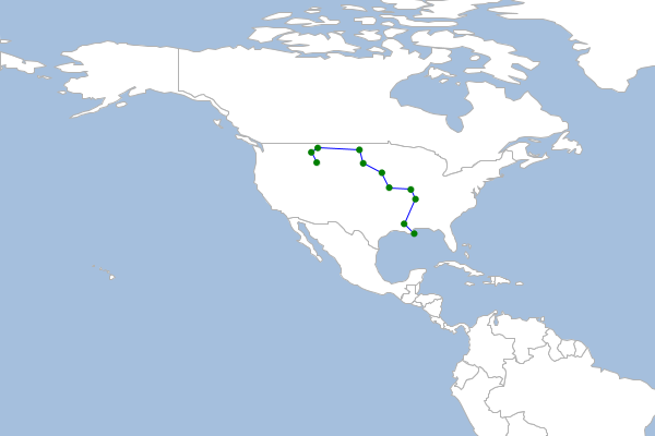
Symmetric Difference
Calculate the symmetric difference between a Layer and another Layer.
geo-shell> layer symdifference --input-name a --other-name b --output-workspace results --output-name results
Name |
Description |
Mandatory |
Specified Default |
Unspecified Default |
input-name |
The Layer name |
true |
||
other-name |
The other Layer name |
true |
||
output-workspace |
The output Layer Workspace |
true |
||
output-name |
The output Layer name |
true |
||
postfix-all |
Whether to postfix all field names when combining schemas |
false |
false |
false |
include-duplicates |
Whether to include duplicate field names |
false |
true |
true |
geo-shell> workspace open --name layers --params src/test/resources/layeralgebra.gpkg
Workspace layers opened!
geo-shell> workspace open --name results --params memory
Workspace results opened!
geo-shell> layer open --workspace layers --layer a --name a
Opened Workspace layers Layer a as a
geo-shell> layer open --workspace layers --layer b --name b
Opened Workspace layers Layer b as b
geo-shell> layer symdifference --input-name a --other-name b --output-workspace results --output-name results
Done calculating the symmetric difference between a and b to create results!
geo-shell> style vector default --layer a --color red --opacity 0.75 --file examples/red.sld
Default Vector Style for a written to /home/runner/work/geo-shell/geo-shell/examples/red.sld!
geo-shell> style vector default --layer b --color green --opacity 0.75 --file examples/green.sld
Default Vector Style for b written to /home/runner/work/geo-shell/geo-shell/examples/green.sld!
geo-shell> style vector default --layer results --color blue --opacity 0.75 --file examples/blue.sld
Default Vector Style for results written to /home/runner/work/geo-shell/geo-shell/examples/blue.sld!
geo-shell> layer style set --name a --style examples/red.sld
Style /home/runner/work/geo-shell/geo-shell/examples/red.sld set on a
geo-shell> layer style set --name b --style examples/green.sld
Style /home/runner/work/geo-shell/geo-shell/examples/green.sld set on b
geo-shell> layer style set --name results --style examples/blue.sld
Style /home/runner/work/geo-shell/geo-shell/examples/blue.sld set on results
geo-shell> map open --name map
Map map opened!
geo-shell> map add layer --name map --layer a
Added a layer to map map
geo-shell> map add layer --name map --layer b
Added b layer to map map
geo-shell> map add layer --name map --layer results
Added results layer to map map
geo-shell> map draw --name map --file examples/layer_symdifference.png
Done drawing /home/runner/work/geo-shell/geo-shell/examples/layer_symdifference.png!
geo-shell> map close --name map
Map map closed!
Transform
Transform the features of the input Layer and save them to the output Layer
geo-shell> layer transform --input-name points --output-workspace layers --output-name polys --transforms "the_geom=buffer(the_geom, 5)|id=id*10"
Name |
Description |
Mandatory |
Specified Default |
Unspecified Default |
input-name |
The Layer name |
true |
||
output-workspace |
The output Layer Workspace |
true |
||
output-name |
The output Layer name |
true |
||
transforms |
The pipe delimited list of transforms (field=expression or function) |
true |
geo-shell> workspace open --name layers --params memory
Workspace layers opened!
geo-shell> layer random --output-workspace layers --output-name points --geometry -180,-90,180,90 --number 100 --projection EPSG:4326
Done!
geo-shell> style vector default --layer points --color #1E90FF --file examples/points.sld
Default Vector Style for points written to /home/runner/work/geo-shell/geo-shell/examples/points.sld!
geo-shell> layer style set --name points --style examples/points.sld
Style /home/runner/work/geo-shell/geo-shell/examples/points.sld set on points
geo-shell> layer transform --input-name points --output-workspace layers --output-name polys --transforms "the_geom=buffer(the_geom, 5)|id=id*10"
Done transforming points to polys with the_geom=buffer(the_geom, 5)|id=id*10!
geo-shell> style vector default --layer polys --color blue --opacity 0.25 --file examples/polys.sld
Default Vector Style for polys written to /home/runner/work/geo-shell/geo-shell/examples/polys.sld!
geo-shell> layer style set --name polys --style examples/polys.sld
Style /home/runner/work/geo-shell/geo-shell/examples/polys.sld set on polys
geo-shell> workspace open --name naturalearth --params examples/naturalearth.gpkg
Workspace naturalearth opened!
geo-shell> layer open --workspace naturalearth --layer countries --name countries
Opened Workspace naturalearth Layer countries as countries
geo-shell> layer style set --name countries --style examples/countries.sld
Style /home/runner/work/geo-shell/geo-shell/examples/countries.sld set on countries
geo-shell> layer open --workspace naturalearth --layer ocean --name ocean
Opened Workspace naturalearth Layer ocean as ocean
geo-shell> layer style set --name ocean --style examples/ocean.sld
Style /home/runner/work/geo-shell/geo-shell/examples/ocean.sld set on ocean
geo-shell> map open --name map
Map map opened!
geo-shell> map add layer --name map --layer ocean
Added ocean layer to map map
geo-shell> map add layer --name map --layer countries
Added countries layer to map map
geo-shell> map add layer --name map --layer polys
Added polys layer to map map
geo-shell> map add layer --name map --layer points
Added points layer to map map
geo-shell> map draw --name map --file examples/layer_transform.png
Done drawing /home/runner/work/geo-shell/geo-shell/examples/layer_transform.png!
geo-shell> map close --name map
Map map closed!
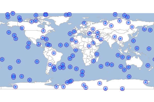
Union
Union a Layer with another Layer
geo-shell> layer union --input-name a --other-name b --output-workspace results --output-name results
Name |
Description |
Mandatory |
Specified Default |
Unspecified Default |
input-name |
The Layer name |
true |
||
other-name |
The other Layer name |
true |
||
output-workspace |
The output Layer Workspace |
true |
||
output-name |
The output Layer name |
true |
||
postfix-all |
Whether to postfix all field names when combining schemas |
false |
false |
false |
include-duplicates |
Whether to include duplicate field names |
false |
true |
true |
geo-shell> workspace open --name layers --params src/test/resources/layeralgebra.gpkg
Workspace layers opened!
geo-shell> workspace open --name results --params memory
Workspace results opened!
geo-shell> layer open --workspace layers --layer a --name a
Opened Workspace layers Layer a as a
geo-shell> layer open --workspace layers --layer b --name b
Opened Workspace layers Layer b as b
geo-shell> layer union --input-name a --other-name b --output-workspace results --output-name results
Done unioning a and b to create results!
geo-shell> style vector default --layer a --color red --opacity 0.75 --file examples/red.sld
Default Vector Style for a written to /home/runner/work/geo-shell/geo-shell/examples/red.sld!
geo-shell> style vector default --layer b --color green --opacity 0.75 --file examples/green.sld
Default Vector Style for b written to /home/runner/work/geo-shell/geo-shell/examples/green.sld!
geo-shell> style vector default --layer results --color blue --opacity 0.75 --file examples/blue.sld
Default Vector Style for results written to /home/runner/work/geo-shell/geo-shell/examples/blue.sld!
geo-shell> layer style set --name a --style examples/red.sld
Style /home/runner/work/geo-shell/geo-shell/examples/red.sld set on a
geo-shell> layer style set --name b --style examples/green.sld
Style /home/runner/work/geo-shell/geo-shell/examples/green.sld set on b
geo-shell> layer style set --name results --style examples/blue.sld
Style /home/runner/work/geo-shell/geo-shell/examples/blue.sld set on results
geo-shell> map open --name map
Map map opened!
geo-shell> map add layer --name map --layer a
Added a layer to map map
geo-shell> map add layer --name map --layer b
Added b layer to map map
geo-shell> map add layer --name map --layer results
Added results layer to map map
geo-shell> map draw --name map --file examples/layer_union.png
Done drawing /home/runner/work/geo-shell/geo-shell/examples/layer_union.png!
geo-shell> map close --name map
Map map closed!

Update
Calculate the update between a Layer with another Layer
geo-shell> layer update --input-name a --other-name b --output-workspace results --output-name results
Name |
Description |
Mandatory |
Specified Default |
Unspecified Default |
input-name |
The Layer name |
true |
||
other-name |
The other Layer name |
true |
||
output-workspace |
The output Layer Workspace |
true |
||
output-name |
The output Layer name |
true |
geo-shell> workspace open --name layers --params src/test/resources/layeralgebra.gpkg
Workspace layers opened!
geo-shell> workspace open --name results --params memory
Workspace results opened!
geo-shell> layer open --workspace layers --layer a --name a
Opened Workspace layers Layer a as a
geo-shell> layer open --workspace layers --layer b --name b
Opened Workspace layers Layer b as b
geo-shell> layer update --input-name a --other-name b --output-workspace results --output-name results
Done calculating the update between a and b to create results!
geo-shell> style vector default --layer a --color red --opacity 0.75 --file examples/red.sld
Default Vector Style for a written to /home/runner/work/geo-shell/geo-shell/examples/red.sld!
geo-shell> style vector default --layer b --color green --opacity 0.75 --file examples/green.sld
Default Vector Style for b written to /home/runner/work/geo-shell/geo-shell/examples/green.sld!
geo-shell> style vector default --layer results --color blue --opacity 0.75 --file examples/blue.sld
Default Vector Style for results written to /home/runner/work/geo-shell/geo-shell/examples/blue.sld!
geo-shell> layer style set --name a --style examples/red.sld
Style /home/runner/work/geo-shell/geo-shell/examples/red.sld set on a
geo-shell> layer style set --name b --style examples/green.sld
Style /home/runner/work/geo-shell/geo-shell/examples/green.sld set on b
geo-shell> layer style set --name results --style examples/blue.sld
Style /home/runner/work/geo-shell/geo-shell/examples/blue.sld set on results
geo-shell> map open --name map
Map map opened!
geo-shell> map add layer --name map --layer a
Added a layer to map map
geo-shell> map add layer --name map --layer b
Added b layer to map map
geo-shell> map add layer --name map --layer results
Added results layer to map map
geo-shell> map draw --name map --file examples/layer_update.png
Done drawing /home/runner/work/geo-shell/geo-shell/examples/layer_update.png!
geo-shell> map close --name map
Map map closed!
Voronoi
Calculate a voronoi diagram of the input Layer and save it to the output Layer.
geo-shell> layer voronoi --input-name places --output-workspace layers --output-name voronoi
Name |
Description |
Mandatory |
Specified Default |
Unspecified Default |
input-name |
The Layer name |
true |
||
output-workspace |
The output Layer Workspace |
true |
||
output-name |
The output Layer name |
true |
||
geometry-field |
The geometry field name |
false |
the_geom |
the_geom |
geo-shell> workspace open --name layers --params memory
Workspace layers opened!
geo-shell> workspace open --name naturalearth --params examples/naturalearth.gpkg
Workspace naturalearth opened!
geo-shell> layer open --workspace naturalearth --layer places --name places
Opened Workspace naturalearth Layer places as places
geo-shell> layer voronoi --input-name places --output-workspace layers --output-name voronoi
Done!
geo-shell> style vector default --layer voronoi --color #1E90FF --opacity 0.25 --file examples/voronoi.sld
Default Vector Style for voronoi written to /home/runner/work/geo-shell/geo-shell/examples/voronoi.sld!
geo-shell> layer style set --name voronoi --style examples/voronoi.sld
Style /home/runner/work/geo-shell/geo-shell/examples/voronoi.sld set on voronoi
geo-shell> layer open --workspace naturalearth --layer countries --name countries
Opened Workspace naturalearth Layer countries as countries
geo-shell> layer style set --name countries --style examples/countries.sld
Style /home/runner/work/geo-shell/geo-shell/examples/countries.sld set on countries
geo-shell> layer open --workspace naturalearth --layer ocean --name ocean
Opened Workspace naturalearth Layer ocean as ocean
geo-shell> layer style set --name ocean --style examples/ocean.sld
Style /home/runner/work/geo-shell/geo-shell/examples/ocean.sld set on ocean
geo-shell> map open --name map
Map map opened!
geo-shell> map add layer --name map --layer ocean
Added ocean layer to map map
geo-shell> map add layer --name map --layer countries
Added countries layer to map map
geo-shell> map add layer --name map --layer voronoi
Added voronoi layer to map map
Done drawing /home/runner/work/geo-shell/geo-shell/examples/layer_voronoi.png!
geo-shell> map draw --name map --file examples/layer_voronoi.png --bounds -180,-90,180,90
Map map closed!
geo-shell> map close --name map
Random Points
Create a Layer with a number of randomly located points
geo-shell> layer random --output-workspace layers --output-name points --geometry -180,-90,180,90 --number 100 --projection EPSG:4326
Name |
Description |
Mandatory |
Specified Default |
Unspecified Default |
output-workspace |
The output Layer Workspace |
true |
||
output-name |
The output Layer name |
true |
||
number |
The number of points |
true |
||
geometry |
The geometry or bounds in which to create the points |
true |
||
projection |
The projection |
true |
||
id-field |
The id field name |
false |
id |
id |
geometry-field |
The geometry field name |
false |
the_geom |
the_geom |
grid |
Whether to create points in a grid |
false |
false |
false |
constrained-to-circle |
Whether points should be constrained to a circle |
false |
false |
false |
gutter-fraction |
The size of gutter between cells |
false |
0 |
0 |
geo-shell> workspace open --name layers --params memory
Workspace layers opened!
geo-shell> layer random --output-workspace layers --output-name points --geometry -180,-90,180,90 --number 100 --projection EPSG:4326
Done!
geo-shell> style vector default --layer points --color #1E90FF --file examples/points.sld
Default Vector Style for points written to /home/runner/work/geo-shell/geo-shell/examples/points.sld!
geo-shell> layer style set --name points --style examples/points.sld
Style /home/runner/work/geo-shell/geo-shell/examples/points.sld set on points
geo-shell> workspace open --name naturalearth --params examples/naturalearth.gpkg
Workspace naturalearth opened!
geo-shell> layer open --workspace naturalearth --layer countries --name countries
Opened Workspace naturalearth Layer countries as countries
geo-shell> layer style set --name countries --style examples/countries.sld
Style /home/runner/work/geo-shell/geo-shell/examples/countries.sld set on countries
geo-shell> layer open --workspace naturalearth --layer ocean --name ocean
Opened Workspace naturalearth Layer ocean as ocean
geo-shell> layer style set --name ocean --style examples/ocean.sld
Style /home/runner/work/geo-shell/geo-shell/examples/ocean.sld set on ocean
geo-shell> map open --name randomMap
Map randomMap opened!
geo-shell> map add layer --name randomMap --layer ocean
Added ocean layer to map randomMap
geo-shell> map add layer --name randomMap --layer countries
Added countries layer to map randomMap
geo-shell> map add layer --name randomMap --layer points
Added points layer to map randomMap
geo-shell> map draw --name randomMap --file examples/random_points.png
Done drawing /home/runner/work/geo-shell/geo-shell/examples/random_points.png!
geo-shell> map close --name randomMap
Map randomMap closed!
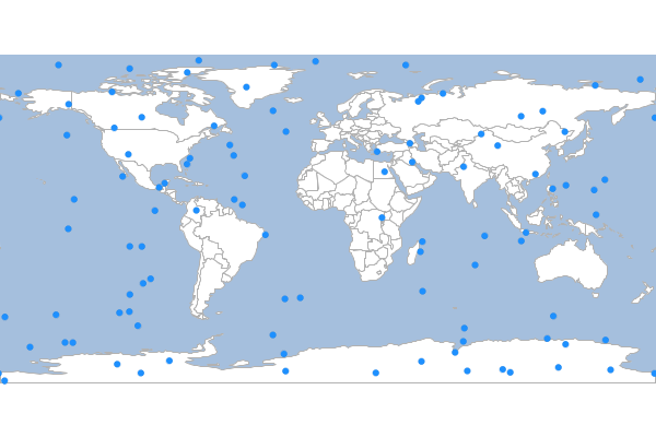
Buffer
Buffer the input Layer to the output Layer.
geo-shell> layer buffer --input-name points --output-workspace layers --output-name buffers --distance 10
Name |
Description |
Mandatory |
Specified Default |
Unspecified Default |
input-name |
The Layer name |
true |
||
output-workspace |
The output Layer Workspace |
true |
||
output-name |
The output Layer name |
true |
||
distance |
The buffer distance |
true |
geo-shell> workspace open --name layers --params memory
Workspace layers opened!
geo-shell> layer random --output-workspace layers --output-name points --geometry -180,-90,180,90 --number 100 --projection EPSG:4326
Done!
geo-shell> layer buffer --input-name points --output-workspace layers --output-name buffers --distance 10
Done!
geo-shell> style vector default --layer points --color #1E90FF --file examples/points.sld
Default Vector Style for points written to /home/runner/work/geo-shell/geo-shell/examples/points.sld!
geo-shell> style vector default --layer buffers --color #1E90FF --opacity 0.25 --file examples/buffers.sld
Default Vector Style for buffers written to /home/runner/work/geo-shell/geo-shell/examples/buffers.sld!
geo-shell> layer style set --name points --style examples/points.sld
Style /home/runner/work/geo-shell/geo-shell/examples/points.sld set on points
geo-shell> layer style set --name buffers --style examples/buffers.sld
Style /home/runner/work/geo-shell/geo-shell/examples/buffers.sld set on buffers
geo-shell> workspace open --name naturalearth --params examples/naturalearth.gpkg
Workspace naturalearth opened!
geo-shell> layer open --workspace naturalearth --layer countries --name countries
Opened Workspace naturalearth Layer countries as countries
geo-shell> layer style set --name countries --style examples/countries.sld
Style /home/runner/work/geo-shell/geo-shell/examples/countries.sld set on countries
geo-shell> layer open --workspace naturalearth --layer ocean --name ocean
Opened Workspace naturalearth Layer ocean as ocean
geo-shell> layer style set --name ocean --style examples/ocean.sld
Style /home/runner/work/geo-shell/geo-shell/examples/ocean.sld set on ocean
geo-shell> map open --name map
Map map opened!
geo-shell> map add layer --name map --layer ocean
Added ocean layer to map map
geo-shell> map add layer --name map --layer countries
Added countries layer to map map
geo-shell> map add layer --name map --layer buffers
Added buffers layer to map map
geo-shell> map add layer --name map --layer points
Added points layer to map map
geo-shell> map draw --name map --file examples/layer_buffer.png
Done drawing /home/runner/work/geo-shell/geo-shell/examples/layer_buffer.png!
geo-shell> map close --name map
Map map closed!
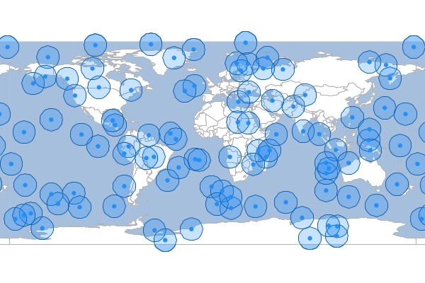
Centroid
Calculate the centroids of the input Layer to the output Layer.
geo-shell> layer centroid --input-name countries --output-name centroids --output-workspace layers
Name |
Description |
Mandatory |
Specified Default |
Unspecified Default |
input-name |
The Layer name |
true |
||
output-workspace |
The output Layer Workspace |
true |
||
output-name |
The output Layer name |
true |
geo-shell> workspace open --name layers --params memory
Workspace layers opened!
geo-shell> workspace open --name naturalearth --params examples/naturalearth.gpkg
Workspace naturalearth opened!
geo-shell> layer open --workspace naturalearth --layer countries --name countries
Opened Workspace naturalearth Layer countries as countries
geo-shell> layer style set --name countries --style examples/countries.sld
Style /home/runner/work/geo-shell/geo-shell/examples/countries.sld set on countries
geo-shell> layer centroid --input-name countries --output-name centroids --output-workspace layers
Done!
geo-shell> style vector default --layer centroids --color #1E90FF --file examples/centroids.sld
Default Vector Style for centroids written to /home/runner/work/geo-shell/geo-shell/examples/centroids.sld!
geo-shell> layer style set --name centroids --style examples/centroids.sld
Style /home/runner/work/geo-shell/geo-shell/examples/centroids.sld set on centroids
geo-shell> layer open --workspace naturalearth --layer ocean --name ocean
Opened Workspace naturalearth Layer ocean as ocean
geo-shell> layer style set --name ocean --style examples/ocean.sld
Style /home/runner/work/geo-shell/geo-shell/examples/ocean.sld set on ocean
geo-shell> map open --name map
Map map opened!
geo-shell> map add layer --name map --layer ocean
Added ocean layer to map map
geo-shell> map add layer --name map --layer countries
Added countries layer to map map
geo-shell> map add layer --name map --layer centroids
Added centroids layer to map map
geo-shell> map draw --name map --file examples/layer_centroid.png
Done drawing /home/runner/work/geo-shell/geo-shell/examples/layer_centroid.png!
geo-shell> map close --name map
Map map closed!
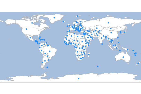
Interior Point
Calculate the interior points of the input Layer to the output Layer.
geo-shell> layer interiorpoint --input-name countries --output-name interiorpoints --output-workspace layers
Name |
Description |
Mandatory |
Specified Default |
Unspecified Default |
input-name |
The Layer name |
true |
||
output-workspace |
The output Layer Workspace |
true |
||
output-name |
The output Layer name |
true |
geo-shell> workspace open --name layers --params memory
Workspace layers opened!
geo-shell> workspace open --name naturalearth --params examples/naturalearth.gpkg
Workspace naturalearth opened!
geo-shell> layer open --workspace naturalearth --layer countries --name countries
Opened Workspace naturalearth Layer countries as countries
geo-shell> layer style set --name countries --style examples/countries.sld
Style /home/runner/work/geo-shell/geo-shell/examples/countries.sld set on countries
geo-shell> layer interiorpoint --input-name countries --output-name interiorpoints --output-workspace layers
Done!
geo-shell> style vector default --layer interiorpoints --color #1E90FF --file examples/interiorpoints.sld
Default Vector Style for interiorpoints written to /home/runner/work/geo-shell/geo-shell/examples/interiorpoints.sld!
geo-shell> layer style set --name interiorpoints --style examples/interiorpoints.sld
Style /home/runner/work/geo-shell/geo-shell/examples/interiorpoints.sld set on interiorpoints
geo-shell> layer open --workspace naturalearth --layer ocean --name ocean
Opened Workspace naturalearth Layer ocean as ocean
geo-shell> layer style set --name ocean --style examples/ocean.sld
Style /home/runner/work/geo-shell/geo-shell/examples/ocean.sld set on ocean
geo-shell> map open --name map
Map map opened!
geo-shell> map add layer --name map --layer ocean
Added ocean layer to map map
geo-shell> map add layer --name map --layer countries
Added countries layer to map map
geo-shell> map add layer --name map --layer interiorpoints
Added interiorpoints layer to map map
geo-shell> map draw --name map --file examples/layer_interiorpoint.png
Done drawing /home/runner/work/geo-shell/geo-shell/examples/layer_interiorpoint.png!
geo-shell> map close --name map
Map map closed!
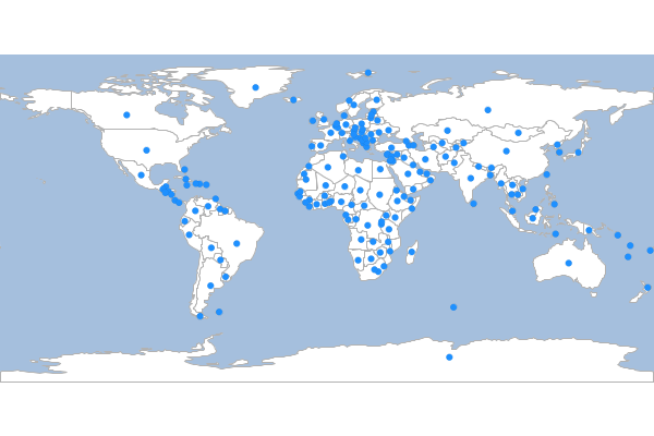
Extent
Calculate the extent of the input Layer and save it to the output Layer.
geo-shell> layer extent --input-name states --output-workspace layers --output-name usa
Name |
Description |
Mandatory |
Specified Default |
Unspecified Default |
input-name |
The Layer name |
true |
||
output-workspace |
The output Layer Workspace |
true |
||
output-name |
The output Layer name |
true |
||
geometry-field |
The geometry field name |
false |
the_geom |
the_geom |
geo-shell> workspace open --name layers --params memory
Workspace layers opened!
geo-shell> workspace open --name naturalearth --params examples/naturalearth.gpkg
Workspace naturalearth opened!
geo-shell> layer style set --name states --style examples/states.sld
Unable to find Layer states
geo-shell> layer open --workspace naturalearth --layer states --name states
Opened Workspace naturalearth Layer states as states
geo-shell> layer extent --input-name states --output-workspace layers --output-name usa
Done!
geo-shell> style vector default --layer usa --color #1E90FF --opacity 0.25 --file examples/extent.sld
Default Vector Style for usa written to /home/runner/work/geo-shell/geo-shell/examples/extent.sld!
geo-shell> layer style set --name usa --style examples/extent.sld
Style /home/runner/work/geo-shell/geo-shell/examples/extent.sld set on usa
geo-shell> layer open --workspace naturalearth --layer countries --name countries
Opened Workspace naturalearth Layer countries as countries
geo-shell> layer style set --name countries --style examples/countries.sld
Style /home/runner/work/geo-shell/geo-shell/examples/countries.sld set on countries
geo-shell> layer open --workspace naturalearth --layer ocean --name ocean
Opened Workspace naturalearth Layer ocean as ocean
geo-shell> layer style set --name ocean --style examples/ocean.sld
Style /home/runner/work/geo-shell/geo-shell/examples/ocean.sld set on ocean
geo-shell> map open --name map
Map map opened!
geo-shell> map add layer --name map --layer ocean
Added ocean layer to map map
geo-shell> map add layer --name map --layer countries
Added countries layer to map map
geo-shell> map add layer --name map --layer states
Added states layer to map map
geo-shell> map add layer --name map --layer usa
Added usa layer to map map
geo-shell> map draw --name map --file examples/layer_extent.png
Done drawing /home/runner/work/geo-shell/geo-shell/examples/layer_extent.png!
geo-shell> map close --name map
Map map closed!
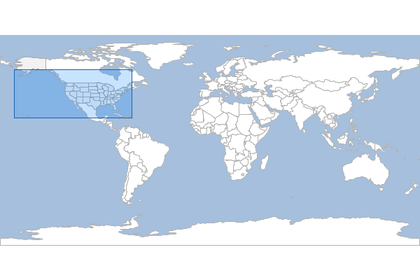
Extents
Calculate the extents of each Feature in the input Layer and save them to the output Layer.
geo-shell> layer extents --input-name states --output-workspace layers --output-name state_extents
Name |
Description |
Mandatory |
Specified Default |
Unspecified Default |
input-name |
The Layer name |
true |
||
output-workspace |
The output Layer Workspace |
true |
||
output-name |
The output Layer name |
true |
geo-shell> workspace open --name layers --params memory
Workspace layers opened!
geo-shell> workspace open --name naturalearth --params examples/naturalearth.gpkg
Workspace naturalearth opened!
geo-shell> layer style set --name states --style examples/states.sld
Unable to find Layer states
geo-shell> layer open --workspace naturalearth --layer states --name states
Opened Workspace naturalearth Layer states as states
geo-shell> layer extents --input-name states --output-workspace layers --output-name state_extents
Done!
geo-shell> style vector default --layer state_extents --color #1E90FF --opacity 0.25 --file examples/extent.sld
Default Vector Style for state_extents written to /home/runner/work/geo-shell/geo-shell/examples/extent.sld!
geo-shell> layer style set --name state_extents --style examples/extent.sld
Style /home/runner/work/geo-shell/geo-shell/examples/extent.sld set on state_extents
geo-shell> layer open --workspace naturalearth --layer countries --name countries
Opened Workspace naturalearth Layer countries as countries
geo-shell> layer style set --name countries --style examples/countries.sld
Style /home/runner/work/geo-shell/geo-shell/examples/countries.sld set on countries
geo-shell> layer open --workspace naturalearth --layer ocean --name ocean
Opened Workspace naturalearth Layer ocean as ocean
geo-shell> layer style set --name ocean --style examples/ocean.sld
Style /home/runner/work/geo-shell/geo-shell/examples/ocean.sld set on ocean
geo-shell> map open --name map
Map map opened!
geo-shell> map add layer --name map --layer ocean
Added ocean layer to map map
geo-shell> map add layer --name map --layer countries
Added countries layer to map map
geo-shell> map add layer --name map --layer states
Added states layer to map map
geo-shell> map add layer --name map --layer state_extents
Added state_extents layer to map map
geo-shell> map draw --name map --file examples/layer_extents.png
Done drawing /home/runner/work/geo-shell/geo-shell/examples/layer_extents.png!
geo-shell> map close --name map
Map map closed!
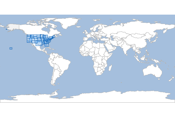
Graticule
Square
Create a square graticule.
geo-shell> layer graticule square --workspace layers --name squares --bounds -180,-90,180,90 --length 20
Name |
Description |
Mandatory |
Specified Default |
Unspecified Default |
workspace |
The Workspace name |
true |
||
name |
The new Layer name |
true |
||
bounds |
The bounds |
true |
||
length |
The length |
true |
||
spacing |
The spacing |
false |
-1 |
-1 |
geo-shell> workspace open --name layers --params memory
Workspace layers opened!
geo-shell> layer graticule square --workspace layers --name squares --bounds -180,-90,180,90 --length 20
Created Square Graticule Layer squares!
geo-shell> style vector default --layer squares --color #1E90FF --opacity 0.30 --file examples/squares.sld
Default Vector Style for squares written to /home/runner/work/geo-shell/geo-shell/examples/squares.sld!
geo-shell> layer style set --name squares --style examples/squares.sld
Style /home/runner/work/geo-shell/geo-shell/examples/squares.sld set on squares
geo-shell> workspace open --name naturalearth --params examples/naturalearth.gpkg
Workspace naturalearth opened!
geo-shell> layer open --workspace naturalearth --layer countries --name countries
Opened Workspace naturalearth Layer countries as countries
geo-shell> layer style set --name countries --style examples/countries.sld
Style /home/runner/work/geo-shell/geo-shell/examples/countries.sld set on countries
geo-shell> layer open --workspace naturalearth --layer ocean --name ocean
Opened Workspace naturalearth Layer ocean as ocean
geo-shell> layer style set --name ocean --style examples/ocean.sld
Style /home/runner/work/geo-shell/geo-shell/examples/ocean.sld set on ocean
geo-shell> map open --name graticule
Map graticule opened!
geo-shell> map add layer --name graticule --layer ocean
Added ocean layer to map graticule
geo-shell> map add layer --name graticule --layer countries
Added countries layer to map graticule
geo-shell> map add layer --name graticule --layer squares
Added squares layer to map graticule
geo-shell> map draw --name graticule --file examples/square_graticules.png
Done drawing /home/runner/work/geo-shell/geo-shell/examples/square_graticules.png!
geo-shell> map close --name graticule
Map graticule closed!
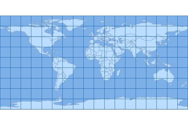
Rectangle
Create a rectangle graticule.
geo-shell> layer graticule rectangle --workspace layers --name rectangles --bounds -180,-90,180,90 --width 20 --height 10
Name |
Description |
Mandatory |
Specified Default |
Unspecified Default |
workspace |
The Workspace name |
true |
||
name |
The new Layer name |
true |
||
bounds |
The bounds |
true |
||
width |
The width |
true |
||
height |
The height |
true |
||
spacing |
The spacing |
false |
-1 |
-1 |
geo-shell> workspace open --name layers --params memory
Workspace layers opened!
geo-shell> layer graticule rectangle --workspace layers --name rectangles --bounds -180,-90,180,90 --width 20 --height 10
Created Rectangle Graticule Layer rectangles!
geo-shell> style vector default --layer rectangles --color #1E90FF --opacity 0.30 --file examples/rectangles.sld
Default Vector Style for rectangles written to /home/runner/work/geo-shell/geo-shell/examples/rectangles.sld!
geo-shell> layer style set --name rectangles --style examples/rectangles.sld
Style /home/runner/work/geo-shell/geo-shell/examples/rectangles.sld set on rectangles
geo-shell> workspace open --name naturalearth --params examples/naturalearth.gpkg
Workspace naturalearth opened!
geo-shell> layer open --workspace naturalearth --layer countries --name countries
Opened Workspace naturalearth Layer countries as countries
geo-shell> layer style set --name countries --style examples/countries.sld
Style /home/runner/work/geo-shell/geo-shell/examples/countries.sld set on countries
geo-shell> layer open --workspace naturalearth --layer ocean --name ocean
Opened Workspace naturalearth Layer ocean as ocean
geo-shell> layer style set --name ocean --style examples/ocean.sld
Style /home/runner/work/geo-shell/geo-shell/examples/ocean.sld set on ocean
geo-shell> map open --name graticule
Map graticule opened!
geo-shell> map add layer --name graticule --layer ocean
Added ocean layer to map graticule
geo-shell> map add layer --name graticule --layer countries
Added countries layer to map graticule
geo-shell> map add layer --name graticule --layer rectangles
Added rectangles layer to map graticule
geo-shell> map draw --name graticule --file examples/rectangle_graticules.png
Done drawing /home/runner/work/geo-shell/geo-shell/examples/rectangle_graticules.png!
geo-shell> map close --name graticule
Map graticule closed!
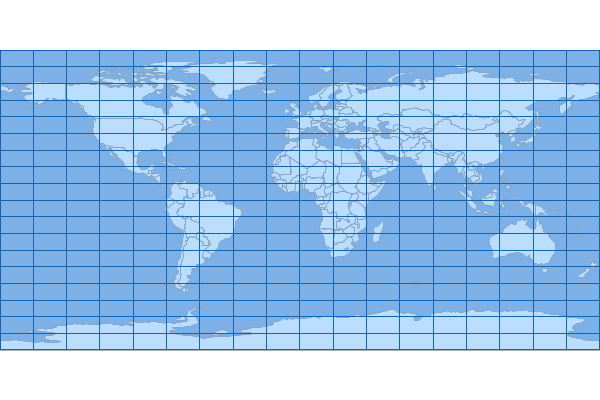
Oval
Create a oval graticule.
geo-shell> layer graticule oval --workspace layers --name ovals --bounds -180,-90,180,90 --size 20
Name |
Description |
Mandatory |
Specified Default |
Unspecified Default |
workspace |
The Workspace name |
true |
||
name |
The new Layer name |
true |
||
bounds |
The bounds |
true |
||
size |
The size |
true |
geo-shell> workspace open --name layers --params memory
Workspace layers opened!
geo-shell> layer graticule oval --workspace layers --name ovals --bounds -180,-90,180,90 --size 20
Created Oval Graticule Layer ovals!
geo-shell> style vector default --layer ovals --color #1E90FF --opacity 0.30 --file examples/ovals.sld
Default Vector Style for ovals written to /home/runner/work/geo-shell/geo-shell/examples/ovals.sld!
geo-shell> layer style set --name ovals --style examples/ovals.sld
Style /home/runner/work/geo-shell/geo-shell/examples/ovals.sld set on ovals
geo-shell> workspace open --name naturalearth --params examples/naturalearth.gpkg
Workspace naturalearth opened!
geo-shell> layer open --workspace naturalearth --layer countries --name countries
Opened Workspace naturalearth Layer countries as countries
geo-shell> layer style set --name countries --style examples/countries.sld
Style /home/runner/work/geo-shell/geo-shell/examples/countries.sld set on countries
geo-shell> layer open --workspace naturalearth --layer ocean --name ocean
Opened Workspace naturalearth Layer ocean as ocean
geo-shell> layer style set --name ocean --style examples/ocean.sld
Style /home/runner/work/geo-shell/geo-shell/examples/ocean.sld set on ocean
geo-shell> map open --name graticule
Map graticule opened!
geo-shell> map add layer --name graticule --layer ocean
Added ocean layer to map graticule
geo-shell> map add layer --name graticule --layer countries
Added countries layer to map graticule
geo-shell> map add layer --name graticule --layer ovals
Added ovals layer to map graticule
geo-shell> map draw --name graticule --file examples/oval_graticules.png
Done drawing /home/runner/work/geo-shell/geo-shell/examples/oval_graticules.png!
geo-shell> map close --name graticule
Map graticule closed!
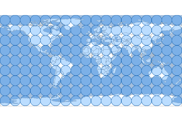
Hexagon
Create a hexagon graticule.
geo-shell> layer graticule hexagon --workspace layers --name hexagons --bounds -180,-90,180,90 --length 10
Name |
Description |
Mandatory |
Specified Default |
Unspecified Default |
workspace |
The Workspace name |
true |
||
name |
The new Layer name |
true |
||
bounds |
The bounds |
true |
||
length |
The length |
true |
||
spacing |
The spacing |
false |
5 |
5 |
orientation |
The orientation (flat or angled) |
false |
flat |
flat |
geo-shell> workspace open --name layers --params memory
Workspace layers opened!
geo-shell> layer graticule hexagon --workspace layers --name hexagons --bounds -180,-90,180,90 --length 10
Created Hexagon Graticule Layer hexagons!
geo-shell> style vector default --layer hexagons --color #1E90FF --opacity 0.30 --file examples/hexagons.sld
Default Vector Style for hexagons written to /home/runner/work/geo-shell/geo-shell/examples/hexagons.sld!
geo-shell> layer style set --name hexagons --style examples/hexagons.sld
Style /home/runner/work/geo-shell/geo-shell/examples/hexagons.sld set on hexagons
geo-shell> workspace open --name naturalearth --params examples/naturalearth.gpkg
Workspace naturalearth opened!
geo-shell> layer open --workspace naturalearth --layer countries --name countries
Opened Workspace naturalearth Layer countries as countries
geo-shell> layer style set --name countries --style examples/countries.sld
Style /home/runner/work/geo-shell/geo-shell/examples/countries.sld set on countries
geo-shell> layer open --workspace naturalearth --layer ocean --name ocean
Opened Workspace naturalearth Layer ocean as ocean
geo-shell> layer style set --name ocean --style examples/ocean.sld
Style /home/runner/work/geo-shell/geo-shell/examples/ocean.sld set on ocean
geo-shell> map open --name graticule
Map graticule opened!
geo-shell> map add layer --name graticule --layer ocean
Added ocean layer to map graticule
geo-shell> map add layer --name graticule --layer countries
Added countries layer to map graticule
geo-shell> map add layer --name graticule --layer hexagons
Added hexagons layer to map graticule
geo-shell> map draw --name graticule --file examples/hexagon_graticules.png
Done drawing /home/runner/work/geo-shell/geo-shell/examples/hexagon_graticules.png!
geo-shell> map close --name graticule
Map graticule closed!
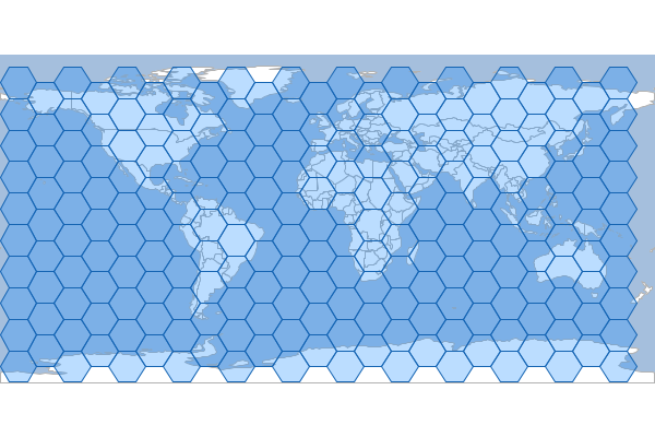
Format
Open
Open a Raster Format.
geo-shell> format open --name earth --input src/test/resources/earth.tif
Name |
Description |
Mandatory |
Specified Default |
Unspecified Default |
name |
The Format name |
false |
||
input |
The input string |
true |
geo-shell> format open --name earth --input src/test/resources/earth.tif
Format earth opened!
geo-shell> format close --name earth
Format earth closed!
List
List open Raster Formats.
geo-shell> format list
| No parameters |
geo-shell> format open --name earth --input src/test/resources/earth.tif
Format earth opened!
geo-shell> format open --name raster --input src/test/resources/raster.tif
Format raster opened!
geo-shell> format list
earth = GeoTIFF
raster = GeoTIFF
geo-shell> format close --name earth
Format earth closed!
geo-shell> format close --name raster
Format raster closed!
Close
Close a Raster Format.
geo-shell> format close --name earth
Name |
Description |
Mandatory |
Specified Default |
Unspecified Default |
name |
The Format name |
true |
geo-shell> format open --name earth --input src/test/resources/earth.tif
Format earth opened!
geo-shell> format close --name earth
Format earth closed!
Rasters
List the Rasters in a Format.
geo-shell> format rasters --name earth
Name |
Description |
Mandatory |
Specified Default |
Unspecified Default |
name |
The Format name |
true |
geo-shell> format open --name earth --input src/test/resources/earth.tif
Format earth opened!
geo-shell> format rasters --name earth
earth
geo-shell> format close --name earth
Format earth closed!
Raster
Open
Open a Raster.
geo-shell> raster open --format earth --raster earth --name earth
Name |
Description |
Mandatory |
Specified Default |
Unspecified Default |
format |
The Format name |
true |
||
raster |
The Raster name |
true |
||
name |
The name |
false |
geo-shell> format open --name earth --input src/test/resources/earth.tif
Format earth opened!
geo-shell> raster open --format earth --raster earth --name earth
Opened Format earth Raster earth as earth
geo-shell> raster close --name earth
Raster earth closed!
geo-shell> format close --name earth
Format earth closed!
Close
Close a Raster.
geo-shell> raster close --name earth
Name |
Description |
Mandatory |
Specified Default |
Unspecified Default |
name |
The Raster name |
true |
geo-shell> format open --name earth --input src/test/resources/earth.tif
Format earth opened!
geo-shell> raster open --format earth --raster earth --name earth
Opened Format earth Raster earth as earth
geo-shell> raster close --name earth
Raster earth closed!
geo-shell> format close --name earth
Format earth closed!
List
List open Rasters.
geo-shell> raster list
| No parameters |
geo-shell> format open --name earth --input src/test/resources/earth.tif
Format earth opened!
geo-shell> raster open --format earth --raster earth --name earth
Opened Format earth Raster earth as earth
geo-shell> raster list
earth = GeoTIFF
geo-shell> raster close --name earth
Raster earth closed!
geo-shell> format close --name earth
Format earth closed!
Info
Get information about a Raster.
geo-shell> raster info --name earth
Name |
Description |
Mandatory |
Specified Default |
Unspecified Default |
name |
The Raster name |
true |
geo-shell> format open --name earth --input src/test/resources/earth.tif
Format earth opened!
geo-shell> raster open --format earth --raster earth --name earth
Opened Format earth Raster earth as earth
geo-shell> raster info --name earth
Format: GeoTIFF
Size: 800, 400
Projection ID: EPSG:4326
Projection WKT: GEOGCS["WGS 84",
DATUM["World Geodetic System 1984",
SPHEROID["WGS 84", 6378137.0, 298.257223563, AUTHORITY["EPSG","7030"]],
AUTHORITY["EPSG","6326"]],
PRIMEM["Greenwich", 0.0, AUTHORITY["EPSG","8901"]],
UNIT["degree", 0.017453292519943295],
AXIS["Geodetic longitude", EAST],
AXIS["Geodetic latitude", NORTH],
AUTHORITY["EPSG","4326"]]
Extent: -179.99999999999997, -89.99999999998205, 179.99999999996405, 90.0
Pixel Size: 0.44999999999995505, 0.4499999999999551
Block Size: 800, 8
Bands:
RED_BAND
Min Value: 56.0 Max Value: 255.0
GREEN_BAND
Min Value: 84.0 Max Value: 255.0
BLUE_BAND
Min Value: 91.0 Max Value: 255.0
geo-shell> raster close --name earth
Raster earth closed!
geo-shell> format close --name earth
Format earth closed!
Value
Get a value from the Raster.
geo-shell> raster value --name earth --x 60 --y 45
geo-shell> raster value --name earth --x 10 --y 15 --type pixel
Name |
Description |
Mandatory |
Specified Default |
Unspecified Default |
name |
The Raster name |
true |
||
band |
The x coordinate |
false |
0 |
0 |
x |
The x coordinate |
true |
||
y |
The y coordinate |
true |
||
type |
The y coordinate |
false |
geometry |
geometry |
geo-shell> format open --name earth --input src/test/resources/earth.tif
Format earth opened!
geo-shell> raster open --format earth --raster earth --name earth
Opened Format earth Raster earth as earth
geo-shell> raster value --name earth --x 60 --y 45
235.0
geo-shell> raster value --name earth --x 10 --y 15 --type pixel
109.0
geo-shell> raster close --name earth
Raster earth closed!
geo-shell> format close --name earth
Format earth closed!
Envelope
Create a Vector Layer from the envelope of a Raster.
geo-shell> raster envelope --name earth --output-workspace layers --output-name outline
Name |
Description |
Mandatory |
Specified Default |
Unspecified Default |
name |
The Raster name |
true |
||
output-workspace |
The output Layer Workspace |
true |
||
output-name |
The output Layer name |
true |
geo-shell> format open --name earth --input src/test/resources/earth.tif
Format earth opened!
geo-shell> raster open --format earth --raster earth --name earth
Opened Format earth Raster earth as earth
geo-shell> workspace open --name layers --params memory
Workspace layers opened!
geo-shell> raster envelope --name earth --output-workspace layers --output-name outline
Done creating envelope in outline from earth!
geo-shell> style create --params "stroke=black stroke-width=3" --file examples/outline.sld
Style stroke=black stroke-width=3 written to /home/runner/work/geo-shell/geo-shell/examples/outline.sld!
geo-shell> layer style set --name outline --style examples/outline.sld
Style /home/runner/work/geo-shell/geo-shell/examples/outline.sld set on outline
geo-shell> map open --name map
Map map opened!
geo-shell> map add raster --name map --raster earth
Added earth layer to map map
geo-shell> map add layer --name map --layer outline
Added outline layer to map map
geo-shell> map draw --name map --file examples/raster_envelope.png
Done drawing /home/runner/work/geo-shell/geo-shell/examples/raster_envelope.png!
geo-shell> map close --name map
Map map closed!
Get Style
Get the Raster’s style.
geo-shell> raster style get --name pc --style examples/pc_style.sld
Name |
Description |
Mandatory |
Specified Default |
Unspecified Default |
name |
The Raster name |
true |
||
style |
The SLD File |
false |
geo-shell> format open --name pierce_county --input src/test/resources/pc.tif
Format pierce_county opened!
geo-shell> raster open --format pierce_county --raster pc --name pc
Opened Format pierce_county Raster pc as pc
geo-shell> style raster colormap --raster pc --values "25=#9fd182,470=#3e7f3c,920=#133912,1370=#08306b,1820=#fffff5" --file examples/style_raster_colormap.sld
Colormap Raster Style for pc written to /home/runner/work/geo-shell/geo-shell/examples/style_raster_colormap.sld!
geo-shell> raster style set --name pc --style examples/style_raster_colormap.sld
Style /home/runner/work/geo-shell/geo-shell/examples/style_raster_colormap.sld set on pc
geo-shell> map open --name map
Map map opened!
geo-shell> map add raster --name map --raster pc
Added pc layer to map map
geo-shell> map draw --name map --file examples/raster_style_get.png
Done drawing /home/runner/work/geo-shell/geo-shell/examples/raster_style_get.png!
geo-shell> map close --name map
Map map closed!
geo-shell> raster style get --name pc --style examples/pc_style.sld
pc style written to /home/runner/work/geo-shell/geo-shell/examples/pc_style.sld

Set Style
Set a Raster’s style
geo-shell> raster style set --name pc --style examples/style_raster_colormap.sld
Name |
Description |
Mandatory |
Specified Default |
Unspecified Default |
name |
The Raster name |
true |
||
style |
The SLD or CSS File |
true |
geo-shell> format open --name pierce_county --input src/test/resources/pc.tif
Format pierce_county opened!
geo-shell> raster open --format pierce_county --raster pc --name pc
Opened Format pierce_county Raster pc as pc
geo-shell> style raster colormap --raster pc --values "25=#9fd182,470=#3e7f3c,920=#133912,1370=#08306b,1820=#fffff5" --file examples/style_raster_colormap.sld
Colormap Raster Style for pc written to /home/runner/work/geo-shell/geo-shell/examples/style_raster_colormap.sld!
geo-shell> raster style set --name pc --style examples/style_raster_colormap.sld
Style /home/runner/work/geo-shell/geo-shell/examples/style_raster_colormap.sld set on pc
geo-shell> map open --name map
Map map opened!
geo-shell> map add raster --name map --raster pc
Added pc layer to map map
geo-shell> map draw --name map --file examples/raster_style_set.png
Done drawing /home/runner/work/geo-shell/geo-shell/examples/raster_style_set.png!
geo-shell> map close --name map
Map map closed!
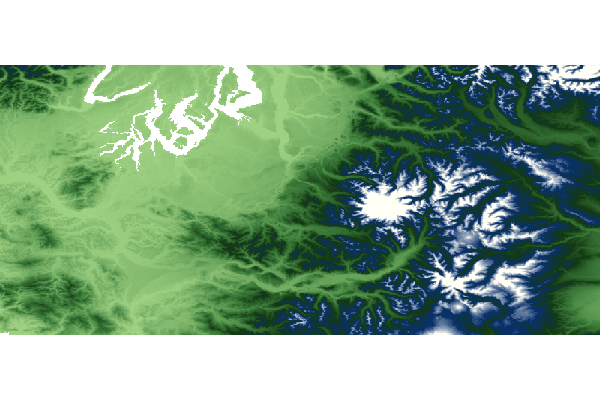
Add Raster
Add two Rasters together
geo-shell> raster add raster --name1 high --name2 low --output-format add --output-name add
Name |
Description |
Mandatory |
Specified Default |
Unspecified Default |
name1 |
The Raster name |
true |
||
name2 |
The Raster name |
true |
||
output-format |
The output Format Workspace |
true |
||
output-name |
The output Raster name |
false |
geo-shell> format open --name high --input src/test/resources/high.tif
Format high opened!
geo-shell> raster open --format high --raster high --name high
Opened Format high Raster high as high
geo-shell> workspace open --name layers --params memory
Workspace layers opened!
geo-shell> style create --params "stroke=black stroke-width=2 label=value label-size=12" --file examples/grid.sld
Style stroke=black stroke-width=2 label=value label-size=12 written to /home/runner/work/geo-shell/geo-shell/examples/grid.sld!
geo-shell> raster polygon --name high --output-workspace layers --output-name high_polygons
Done converting Raster high to a Polygon Layer high_polygons!
geo-shell> style raster palette colormap --min 1 --max 50 --palette MutedTerrain --number 20 --file examples/high.sld
Colormap Palette Raster Style written to /home/runner/work/geo-shell/geo-shell/examples/high.sld!
geo-shell> raster style set --name high --style examples/high.sld
Style /home/runner/work/geo-shell/geo-shell/examples/high.sld set on high
geo-shell> layer style set --name high_polygons --style examples/grid.sld
Style /home/runner/work/geo-shell/geo-shell/examples/grid.sld set on high_polygons
geo-shell> map open --name mapHigh
Map mapHigh opened!
geo-shell> map add raster --name mapHigh --raster high
Added high layer to map mapHigh
geo-shell> map add layer --name mapHigh --layer high_polygons
Added high_polygons layer to map mapHigh
geo-shell> map draw --name mapHigh --file examples/raster_add_raster_high.png --bounds "-180,-90,180,90,EPSG:4326"
Done drawing /home/runner/work/geo-shell/geo-shell/examples/raster_add_raster_high.png!
geo-shell> map close --name mapHigh
Map mapHigh closed!

geo-shell> format open --name low --input src/test/resources/low.tif
Format low opened!
geo-shell> raster open --format low --raster low --name low
Opened Format low Raster low as low
geo-shell> raster polygon --name low --output-workspace layers --output-name low_polygons
Done converting Raster low to a Polygon Layer low_polygons!
geo-shell> style raster palette colormap --min 1 --max 50 --palette MutedTerrain --number 20 --file examples/low.sld
Colormap Palette Raster Style written to /home/runner/work/geo-shell/geo-shell/examples/low.sld!
geo-shell> raster style set --name low --style examples/low.sld
Style /home/runner/work/geo-shell/geo-shell/examples/low.sld set on low
geo-shell> layer style set --name low_polygons --style examples/grid.sld
Style /home/runner/work/geo-shell/geo-shell/examples/grid.sld set on low_polygons
geo-shell> map open --name mapLow
Map mapLow opened!
geo-shell> map add raster --name mapLow --raster low
Added low layer to map mapLow
geo-shell> map add layer --name mapLow --layer low_polygons
Added low_polygons layer to map mapLow
geo-shell> map draw --name mapLow --file examples/raster_add_raster_low.png --bounds "-180,-90,180,90,EPSG:4326"
Done drawing /home/runner/work/geo-shell/geo-shell/examples/raster_add_raster_low.png!
geo-shell> map close --name mapLow
Map mapLow closed!

geo-shell> format open --name add --input examples/add.tif
Format add opened!
geo-shell> raster add raster --name1 high --name2 low --output-format add --output-name add
Added high to low to create add!
geo-shell> raster polygon --name add --output-workspace layers --output-name add_polygons
Done converting Raster add to a Polygon Layer add_polygons!
geo-shell> style raster palette colormap --min 1 --max 50 --palette MutedTerrain --number 20 --file examples/add.sld
Colormap Palette Raster Style written to /home/runner/work/geo-shell/geo-shell/examples/add.sld!
geo-shell> raster style set --name add --style examples/add.sld
Style /home/runner/work/geo-shell/geo-shell/examples/add.sld set on add
geo-shell> layer style set --name add_polygons --style examples/grid.sld
Style /home/runner/work/geo-shell/geo-shell/examples/grid.sld set on add_polygons
geo-shell> map open --name mapAdd
Map mapAdd opened!
geo-shell> map add raster --name mapAdd --raster add
Added add layer to map mapAdd
geo-shell> map add layer --name mapAdd --layer add_polygons
Added add_polygons layer to map mapAdd
geo-shell> map draw --name mapAdd --file examples/raster_add_raster_add.png --bounds "-180,-90,180,90,EPSG:4326"
Done drawing /home/runner/work/geo-shell/geo-shell/examples/raster_add_raster_add.png!
geo-shell> map close --name mapAdd
Map mapAdd closed!
Add Constant
Add constant values to a Raster
geo-shell> raster add constant --name pc --output-format pcAdd100 --output-name pcAdd100 --values 100
Name |
Description |
Mandatory |
Specified Default |
Unspecified Default |
name |
The Raster name |
true |
||
output-format |
The output Format Workspace |
true |
||
output-name |
The output Raster name |
false |
||
values |
The values |
true |
geo-shell> format open --name pierce_county --input src/test/resources/pc.tif
Format pierce_county opened!
geo-shell> raster open --format pierce_county --raster pc --name pc
Opened Format pierce_county Raster pc as pc
geo-shell> raster value --name pc --x -121.799927 --y 46.867703
3069.0
geo-shell> format open --name pcAdd100 --input examples/pcAdd100.tif
Format pcAdd100 opened!
geo-shell> raster add constant --name pc --output-format pcAdd100 --output-name pcAdd100 --values 100
Added 100 to pc to create pcAdd100!
geo-shell> raster value --name pcAdd100 --x -121.799927 --y 46.867703
3169.0
geo-shell> style raster colormap --raster pcAdd100 --values "25=#9fd182,470=#3e7f3c,920=#133912,1370=#08306b,1820=#fffff5" --file examples/style_raster_colormap.sld
Colormap Raster Style for pcAdd100 written to /home/runner/work/geo-shell/geo-shell/examples/style_raster_colormap.sld!
geo-shell> raster style set --name pcAdd100 --style examples/style_raster_colormap.sld
Style /home/runner/work/geo-shell/geo-shell/examples/style_raster_colormap.sld set on pcAdd100
geo-shell> map open --name map
Map map opened!
geo-shell> map add raster --name map --raster pcAdd100
Added pcAdd100 layer to map map
geo-shell> map draw --name map --file examples/raster_add_constant.png
Done drawing /home/runner/work/geo-shell/geo-shell/examples/raster_add_constant.png!
geo-shell> map close --name map
Map map closed!
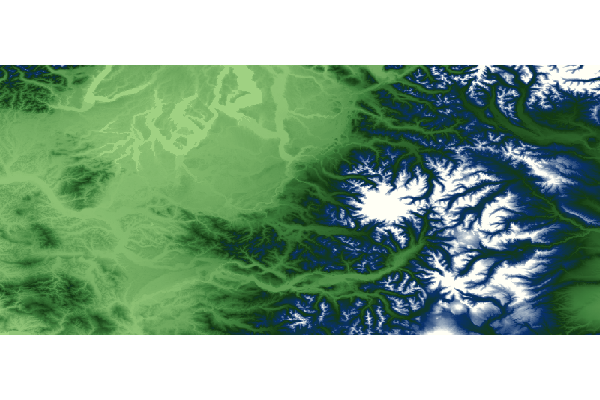
Subtract Raster
Subtract one Raster from another
geo-shell> raster subtract raster --name1 high --name2 low --output-format subtract --output-name subtract
Name |
Description |
Mandatory |
Specified Default |
Unspecified Default |
name1 |
The Raster name |
true |
||
name2 |
The Raster name |
true |
||
output-format |
The output Format Workspace |
true |
||
output-name |
The output Raster name |
false |
geo-shell> format open --name high --input src/test/resources/high.tif
Format high opened!
geo-shell> raster open --format high --raster high --name high
Opened Format high Raster high as high
geo-shell> workspace open --name layers --params memory
Workspace layers opened!
geo-shell> style create --params "stroke=black stroke-width=2 label=value label-size=12" --file examples/grid.sld
Style stroke=black stroke-width=2 label=value label-size=12 written to /home/runner/work/geo-shell/geo-shell/examples/grid.sld!
geo-shell> raster polygon --name high --output-workspace layers --output-name high_polygons
Done converting Raster high to a Polygon Layer high_polygons!
geo-shell> style raster palette colormap --min 1 --max 50 --palette MutedTerrain --number 20 --file examples/high.sld
Colormap Palette Raster Style written to /home/runner/work/geo-shell/geo-shell/examples/high.sld!
geo-shell> raster style set --name high --style examples/high.sld
Style /home/runner/work/geo-shell/geo-shell/examples/high.sld set on high
geo-shell> layer style set --name high_polygons --style examples/grid.sld
Style /home/runner/work/geo-shell/geo-shell/examples/grid.sld set on high_polygons
geo-shell> map open --name mapHigh
Map mapHigh opened!
geo-shell> map add raster --name mapHigh --raster high
Added high layer to map mapHigh
geo-shell> map add layer --name mapHigh --layer high_polygons
Added high_polygons layer to map mapHigh
geo-shell> map draw --name mapHigh --file examples/raster_subtract_raster_high.png --bounds "-180,-90,180,90,EPSG:4326"
Done drawing /home/runner/work/geo-shell/geo-shell/examples/raster_subtract_raster_high.png!
geo-shell> map close --name mapHigh
Map mapHigh closed!

geo-shell> format open --name low --input src/test/resources/low.tif
Format low opened!
geo-shell> raster open --format low --raster low --name low
Opened Format low Raster low as low
geo-shell> raster polygon --name low --output-workspace layers --output-name low_polygons
Done converting Raster low to a Polygon Layer low_polygons!
geo-shell> style raster palette colormap --min 1 --max 50 --palette MutedTerrain --number 20 --file examples/low.sld
Colormap Palette Raster Style written to /home/runner/work/geo-shell/geo-shell/examples/low.sld!
geo-shell> raster style set --name low --style examples/low.sld
Style /home/runner/work/geo-shell/geo-shell/examples/low.sld set on low
geo-shell> layer style set --name low_polygons --style examples/grid.sld
Style /home/runner/work/geo-shell/geo-shell/examples/grid.sld set on low_polygons
geo-shell> map open --name mapLow
Map mapLow opened!
geo-shell> map add raster --name mapLow --raster low
Added low layer to map mapLow
geo-shell> map add layer --name mapLow --layer low_polygons
Added low_polygons layer to map mapLow
geo-shell> map draw --name mapLow --file examples/raster_subtract_raster_low.png --bounds "-180,-90,180,90,EPSG:4326"
Done drawing /home/runner/work/geo-shell/geo-shell/examples/raster_subtract_raster_low.png!
geo-shell> map close --name mapLow
Map mapLow closed!

geo-shell> format open --name subtract --input examples/subtract.tif
Format subtract opened!
geo-shell> raster subtract raster --name1 high --name2 low --output-format subtract --output-name subtract
Subtracted high from low to create subtract!
geo-shell> raster polygon --name subtract --output-workspace layers --output-name subtract_polygons
Done converting Raster subtract to a Polygon Layer subtract_polygons!
geo-shell> style raster palette colormap --min 1 --max 50 --palette MutedTerrain --number 20 --file examples/subtract.sld
Colormap Palette Raster Style written to /home/runner/work/geo-shell/geo-shell/examples/subtract.sld!
geo-shell> raster style set --name subtract --style examples/subtract.sld
Style /home/runner/work/geo-shell/geo-shell/examples/subtract.sld set on subtract
geo-shell> layer style set --name subtract_polygons --style examples/grid.sld
Style /home/runner/work/geo-shell/geo-shell/examples/grid.sld set on subtract_polygons
geo-shell> map open --name mapSubtract
Map mapSubtract opened!
geo-shell> map add raster --name mapSubtract --raster subtract
Added subtract layer to map mapSubtract
geo-shell> map add layer --name mapSubtract --layer subtract_polygons
Added subtract_polygons layer to map mapSubtract
geo-shell> map draw --name mapSubtract --file examples/raster_subtract_raster_subtract.png --bounds "-180,-90,180,90,EPSG:4326"
Done drawing /home/runner/work/geo-shell/geo-shell/examples/raster_subtract_raster_subtract.png!
geo-shell> map close --name mapSubtract
Map mapSubtract closed!
Subtract Constant
Subtract constant values from a Raster
geo-shell> raster subtract constant --name pc --output-format pcMinus100 --output-name pcMinus100 --values 100
Name |
Description |
Mandatory |
Specified Default |
Unspecified Default |
name |
The Raster name |
true |
||
output-format |
The output Format Workspace |
true |
||
output-name |
The output Raster name |
false |
||
values |
The values |
true |
||
from |
Whether to subtract the Raster from the constant or vice verse |
false |
false |
false |
geo-shell> format open --name pierce_county --input src/test/resources/pc.tif
Format pierce_county opened!
geo-shell> raster open --format pierce_county --raster pc --name pc
Opened Format pierce_county Raster pc as pc
geo-shell> raster value --name pc --x -121.799927 --y 46.867703
3069.0
geo-shell> format open --name pcMinus100 --input examples/pcMinus100.tif
Format pcMinus100 opened!
geo-shell> raster subtract constant --name pc --output-format pcMinus100 --output-name pcMinus100 --values 100
Subtracted 100 from pc to create pcMinus100!
geo-shell> raster value --name pcMinus100 --x -121.799927 --y 46.867703
2969.0
geo-shell> style raster colormap --raster pcMinus100 --values "25=#9fd182,470=#3e7f3c,920=#133912,1370=#08306b,1820=#fffff5" --file examples/style_raster_colormap.sld
Colormap Raster Style for pcMinus100 written to /home/runner/work/geo-shell/geo-shell/examples/style_raster_colormap.sld!
geo-shell> raster style set --name pcMinus100 --style examples/style_raster_colormap.sld
Style /home/runner/work/geo-shell/geo-shell/examples/style_raster_colormap.sld set on pcMinus100
geo-shell> map open --name map
Map map opened!
geo-shell> map add raster --name map --raster pcMinus100
Added pcMinus100 layer to map map
geo-shell> map draw --name map --file examples/raster_subtract_constant.png
Done drawing /home/runner/work/geo-shell/geo-shell/examples/raster_subtract_constant.png!
geo-shell> map close --name map
Map map closed!
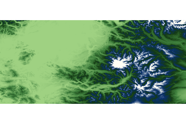
Multiply Raster
Multiply two Raster together
geo-shell> raster multiply raster --name1 high --name2 low --output-format multiply --output-name multiply
Name |
Description |
Mandatory |
Specified Default |
Unspecified Default |
name1 |
The Raster name |
true |
||
name2 |
The Raster name |
true |
||
output-format |
The output Format Workspace |
true |
||
output-name |
The output Raster name |
false |
geo-shell> format open --name high --input src/test/resources/high.tif
Format high opened!
geo-shell> raster open --format high --raster high --name high
Opened Format high Raster high as high
geo-shell> workspace open --name layers --params memory
Workspace layers opened!
geo-shell> style create --params "stroke=black stroke-width=2 label=value label-size=12" --file examples/grid.sld
Style stroke=black stroke-width=2 label=value label-size=12 written to /home/runner/work/geo-shell/geo-shell/examples/grid.sld!
geo-shell> raster polygon --name high --output-workspace layers --output-name high_polygons
Done converting Raster high to a Polygon Layer high_polygons!
geo-shell> style raster palette colormap --min 1 --max 50 --palette MutedTerrain --number 20 --file examples/high.sld
Colormap Palette Raster Style written to /home/runner/work/geo-shell/geo-shell/examples/high.sld!
geo-shell> raster style set --name high --style examples/high.sld
Style /home/runner/work/geo-shell/geo-shell/examples/high.sld set on high
geo-shell> layer style set --name high_polygons --style examples/grid.sld
Style /home/runner/work/geo-shell/geo-shell/examples/grid.sld set on high_polygons
geo-shell> map open --name mapHigh
Map mapHigh opened!
geo-shell> map add raster --name mapHigh --raster high
Added high layer to map mapHigh
geo-shell> map add layer --name mapHigh --layer high_polygons
Added high_polygons layer to map mapHigh
geo-shell> map draw --name mapHigh --file examples/raster_multiply_raster_high.png --bounds "-180,-90,180,90,EPSG:4326"
Done drawing /home/runner/work/geo-shell/geo-shell/examples/raster_multiply_raster_high.png!
geo-shell> map close --name mapHigh
Map mapHigh closed!

geo-shell> format open --name low --input src/test/resources/low.tif
Format low opened!
geo-shell> raster open --format low --raster low --name low
Opened Format low Raster low as low
geo-shell> raster polygon --name low --output-workspace layers --output-name low_polygons
Done converting Raster low to a Polygon Layer low_polygons!
geo-shell> style raster palette colormap --min 1 --max 50 --palette MutedTerrain --number 20 --file examples/low.sld
Colormap Palette Raster Style written to /home/runner/work/geo-shell/geo-shell/examples/low.sld!
geo-shell> raster style set --name low --style examples/low.sld
Style /home/runner/work/geo-shell/geo-shell/examples/low.sld set on low
geo-shell> layer style set --name low_polygons --style examples/grid.sld
Style /home/runner/work/geo-shell/geo-shell/examples/grid.sld set on low_polygons
geo-shell> map open --name mapLow
Map mapLow opened!
geo-shell> map add raster --name mapLow --raster low
Added low layer to map mapLow
geo-shell> map add layer --name mapLow --layer low_polygons
Added low_polygons layer to map mapLow
geo-shell> map draw --name mapLow --file examples/raster_multiply_raster_low.png --bounds "-180,-90,180,90,EPSG:4326"
Done drawing /home/runner/work/geo-shell/geo-shell/examples/raster_multiply_raster_low.png!
geo-shell> map close --name mapLow
Map mapLow closed!

geo-shell> format open --name multiply --input examples/multiply.tif
Format multiply opened!
geo-shell> raster multiply raster --name1 high --name2 low --output-format multiply --output-name multiply
Multiplied high and low to create multiply!
geo-shell> raster polygon --name multiply --output-workspace layers --output-name multiply_polygons
Done converting Raster multiply to a Polygon Layer multiply_polygons!
geo-shell> style raster palette colormap --min 1 --max 50 --palette MutedTerrain --number 20 --file examples/multiply.sld
Colormap Palette Raster Style written to /home/runner/work/geo-shell/geo-shell/examples/multiply.sld!
geo-shell> raster style set --name multiply --style examples/multiply.sld
Style /home/runner/work/geo-shell/geo-shell/examples/multiply.sld set on multiply
geo-shell> layer style set --name multiply_polygons --style examples/grid.sld
Style /home/runner/work/geo-shell/geo-shell/examples/grid.sld set on multiply_polygons
geo-shell> map open --name mapSubtract
Map mapSubtract opened!
geo-shell> map add raster --name mapSubtract --raster multiply
Added multiply layer to map mapSubtract
geo-shell> map add layer --name mapSubtract --layer multiply_polygons
Added multiply_polygons layer to map mapSubtract
geo-shell> map draw --name mapSubtract --file examples/raster_multiply_raster_multiply.png --bounds "-180,-90,180,90,EPSG:4326"
Done drawing /home/runner/work/geo-shell/geo-shell/examples/raster_multiply_raster_multiply.png!
geo-shell> map close --name mapSubtract
Map mapSubtract closed!
Multiply Constant
Multiply constant values to a Raster
geo-shell> raster multiply constant --name pc --output-format pcTimes2 --output-name pcTimes2 --values 2
Name |
Description |
Mandatory |
Specified Default |
Unspecified Default |
name |
The Raster name |
true |
||
output-format |
The output Format Workspace |
true |
||
output-name |
The output Raster name |
false |
||
values |
The values |
true |
geo-shell> format open --name pierce_county --input src/test/resources/pc.tif
Format pierce_county opened!
geo-shell> raster open --format pierce_county --raster pc --name pc
Opened Format pierce_county Raster pc as pc
geo-shell> raster value --name pc --x -121.799927 --y 46.867703
3069.0
geo-shell> format open --name pcTimes2 --input examples/pcTimes2.tif
Format pcTimes2 opened!
geo-shell> raster multiply constant --name pc --output-format pcTimes2 --output-name pcTimes2 --values 2
Multiplied pc by 2 to create pcTimes2!
geo-shell> raster value --name pcTimes2 --x -121.799927 --y 46.867703
6138.0
geo-shell> style raster colormap --raster pcTimes2 --values "25=#9fd182,470=#3e7f3c,920=#133912,1370=#08306b,1820=#fffff5" --file examples/style_raster_colormap.sld
Colormap Raster Style for pcTimes2 written to /home/runner/work/geo-shell/geo-shell/examples/style_raster_colormap.sld!
geo-shell> raster style set --name pcTimes2 --style examples/style_raster_colormap.sld
Style /home/runner/work/geo-shell/geo-shell/examples/style_raster_colormap.sld set on pcTimes2
geo-shell> map open --name map
Map map opened!
geo-shell> map add raster --name map --raster pcTimes2
Added pcTimes2 layer to map map
geo-shell> map draw --name map --file examples/raster_multiply_constant.png
Done drawing /home/runner/work/geo-shell/geo-shell/examples/raster_multiply_constant.png!
geo-shell> map close --name map
Map map closed!
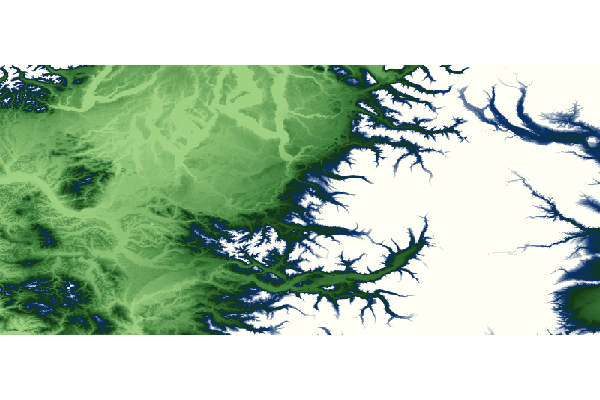
Divide Raster
Divide one Raster by another Raster
geo-shell> raster divide raster --name1 high --name2 low --output-format divide --output-name divide
Name |
Description |
Mandatory |
Specified Default |
Unspecified Default |
name1 |
The Raster name |
true |
||
name2 |
The Raster name |
true |
||
output-format |
The output Format Workspace |
true |
||
output-name |
The output Raster name |
false |
geo-shell> format open --name high --input src/test/resources/high.tif
Format high opened!
geo-shell> raster open --format high --raster high --name high
Opened Format high Raster high as high
geo-shell> workspace open --name layers --params memory
Workspace layers opened!
geo-shell> style create --params "stroke=black stroke-width=2 label=value label-size=12" --file examples/grid.sld
Style stroke=black stroke-width=2 label=value label-size=12 written to /home/runner/work/geo-shell/geo-shell/examples/grid.sld!
geo-shell> raster polygon --name high --output-workspace layers --output-name high_polygons
Done converting Raster high to a Polygon Layer high_polygons!
geo-shell> style raster palette colormap --min 1 --max 50 --palette MutedTerrain --number 20 --file examples/high.sld
Colormap Palette Raster Style written to /home/runner/work/geo-shell/geo-shell/examples/high.sld!
geo-shell> raster style set --name high --style examples/high.sld
Style /home/runner/work/geo-shell/geo-shell/examples/high.sld set on high
geo-shell> layer style set --name high_polygons --style examples/grid.sld
Style /home/runner/work/geo-shell/geo-shell/examples/grid.sld set on high_polygons
geo-shell> map open --name mapHigh
Map mapHigh opened!
geo-shell> map add raster --name mapHigh --raster high
Added high layer to map mapHigh
geo-shell> map add layer --name mapHigh --layer high_polygons
Added high_polygons layer to map mapHigh
geo-shell> map draw --name mapHigh --file examples/raster_divide_raster_high.png --bounds "-180,-90,180,90,EPSG:4326"
Done drawing /home/runner/work/geo-shell/geo-shell/examples/raster_divide_raster_high.png!
geo-shell> map close --name mapHigh
Map mapHigh closed!
geo-shell> format open --name low --input src/test/resources/low.tif
Format low opened!
geo-shell> raster open --format low --raster low --name low
Opened Format low Raster low as low
geo-shell> raster polygon --name low --output-workspace layers --output-name low_polygons
Done converting Raster low to a Polygon Layer low_polygons!
geo-shell> style raster palette colormap --min 1 --max 50 --palette MutedTerrain --number 20 --file examples/low.sld
Colormap Palette Raster Style written to /home/runner/work/geo-shell/geo-shell/examples/low.sld!
geo-shell> raster style set --name low --style examples/low.sld
Style /home/runner/work/geo-shell/geo-shell/examples/low.sld set on low
geo-shell> layer style set --name low_polygons --style examples/grid.sld
Style /home/runner/work/geo-shell/geo-shell/examples/grid.sld set on low_polygons
geo-shell> map open --name mapLow
Map mapLow opened!
geo-shell> map add raster --name mapLow --raster low
Added low layer to map mapLow
geo-shell> map add layer --name mapLow --layer low_polygons
Added low_polygons layer to map mapLow
geo-shell> map draw --name mapLow --file examples/raster_divide_raster_low.png --bounds "-180,-90,180,90,EPSG:4326"
Done drawing /home/runner/work/geo-shell/geo-shell/examples/raster_divide_raster_low.png!
geo-shell> map close --name mapLow
Map mapLow closed!
geo-shell> format open --name divide --input examples/divide.tif
Format divide opened!
geo-shell> raster divide raster --name1 high --name2 low --output-format divide --output-name divide
Divided high by low to create divide!
geo-shell> raster polygon --name divide --output-workspace layers --output-name divide_polygons
Done converting Raster divide to a Polygon Layer divide_polygons!
geo-shell> style raster palette colormap --min 1 --max 50 --palette MutedTerrain --number 20 --file examples/divide.sld
Colormap Palette Raster Style written to /home/runner/work/geo-shell/geo-shell/examples/divide.sld!
geo-shell> raster style set --name divide --style examples/divide.sld
Style /home/runner/work/geo-shell/geo-shell/examples/divide.sld set on divide
geo-shell> layer style set --name divide_polygons --style examples/grid.sld
Style /home/runner/work/geo-shell/geo-shell/examples/grid.sld set on divide_polygons
geo-shell> map open --name mapSubtract
Map mapSubtract opened!
geo-shell> map add raster --name mapSubtract --raster divide
Added divide layer to map mapSubtract
geo-shell> map add layer --name mapSubtract --layer divide_polygons
Added divide_polygons layer to map mapSubtract
geo-shell> map draw --name mapSubtract --file examples/raster_divide_raster_divide.png --bounds "-180,-90,180,90,EPSG:4326"
Done drawing /home/runner/work/geo-shell/geo-shell/examples/raster_divide_raster_divide.png!
geo-shell> map close --name mapSubtract
Map mapSubtract closed!
Divide Constant
Divide constant values against a Raster
geo-shell> raster divide constant --name pc --output-format pcDividedBy2 --output-name pcDividedBy2 --values 2
Name |
Description |
Mandatory |
Specified Default |
Unspecified Default |
name |
The Raster name |
true |
||
output-format |
The output Format Workspace |
true |
||
output-name |
The output Raster name |
false |
||
values |
The values |
true |
geo-shell> format open --name pierce_county --input src/test/resources/pc.tif
Format pierce_county opened!
geo-shell> raster open --format pierce_county --raster pc --name pc
Opened Format pierce_county Raster pc as pc
geo-shell> raster value --name pc --x -121.799927 --y 46.867703
3069.0
geo-shell> format open --name pcDividedBy2 --input examples/pcDividedBy2.tif
Format pcDividedBy2 opened!
geo-shell> raster divide constant --name pc --output-format pcDividedBy2 --output-name pcDividedBy2 --values 2
Divided pc by 2 to create pcDividedBy2!
geo-shell> raster value --name pcDividedBy2 --x -121.799927 --y 46.867703
1534.5
geo-shell> style raster colormap --raster pcDividedBy2 --values "25=#9fd182,470=#3e7f3c,920=#133912,1370=#08306b,1820=#fffff5" --file examples/style_raster_colormap.sld
Colormap Raster Style for pcDividedBy2 written to /home/runner/work/geo-shell/geo-shell/examples/style_raster_colormap.sld!
geo-shell> raster style set --name pcDividedBy2 --style examples/style_raster_colormap.sld
Style /home/runner/work/geo-shell/geo-shell/examples/style_raster_colormap.sld set on pcDividedBy2
geo-shell> map open --name map
Map map opened!
geo-shell> map add raster --name map --raster pcDividedBy2
Added pcDividedBy2 layer to map map
geo-shell> map draw --name map --file examples/raster_divide_constant.png
Done drawing /home/runner/work/geo-shell/geo-shell/examples/raster_divide_constant.png!
geo-shell> map close --name map
Map map closed!
Contours
Create contours.
geo-shell> raster contours --name pc --output-workspace contours --output-name contours --levels 0,100,200,300,600,900
Name |
Description |
Mandatory |
Specified Default |
Unspecified Default |
name |
The Raster name |
true |
||
output-workspace |
The output Layer Workspace |
true |
||
output-name |
The output Layer name |
true |
||
band |
The Raster band to contour |
false |
0 |
0 |
levels |
The contour level or interval |
true |
||
simplify |
Whether to simplify |
false |
false |
false |
smooth |
Whether to smooth |
false |
false |
false |
bounds |
The Bounds |
false |
geo-shell> format open --name pc --input src/test/resources/pc.tif
Format pc opened!
geo-shell> raster open --format pc --raster pc --name pc
Opened Format pc Raster pc as pc
geo-shell> style raster colormap --raster pc --values "25=#9fd182,470=#3e7f3c,920=#133912,1370=#08306b,1820=#fffff5" --file examples/pc.sld
Colormap Raster Style for pc written to /home/runner/work/geo-shell/geo-shell/examples/pc.sld!
geo-shell> raster style set --name pc --style examples/pc.sld
Style /home/runner/work/geo-shell/geo-shell/examples/pc.sld set on pc
geo-shell> workspace open --name contours --params examples/contours.shp
Workspace contours opened!
geo-shell> raster contours --name pc --output-workspace contours --output-name contours --levels 0,100,200,300,600,900
Done creating contours!
geo-shell> style create --params "stroke=black stroke-width=0.25" --file examples/contours.sld
Style stroke=black stroke-width=0.25 written to /home/runner/work/geo-shell/geo-shell/examples/contours.sld!
geo-shell> layer style set --name contours --style examples/contours.sld
Style /home/runner/work/geo-shell/geo-shell/examples/contours.sld set on contours
geo-shell> map open --name map
Map map opened!
geo-shell> map add raster --name map --raster pc
Added pc layer to map map
geo-shell> map add layer --name map --layer contours
Added contours layer to map map
geo-shell> map draw --name map --file examples/raster_contours.png
Done drawing /home/runner/work/geo-shell/geo-shell/examples/raster_contours.png!
geo-shell> map close --name map
Map map closed!
Crop
Crop a Raster.
geo-shell> raster crop --name earth --output-format earthCropped --output-name earthCropped --geometry "-160.927734,6.751896,-34.716797,57.279043"
Name |
Description |
Mandatory |
Specified Default |
Unspecified Default |
name |
The Raster name |
true |
||
output-format |
The output Format Workspace |
true |
||
output-name |
The output Raster name |
false |
||
geometry |
The geometry |
true |
geo-shell> format open --name earth --input src/test/resources/earth.tif
Format earth opened!
geo-shell> raster open --format earth --raster earth --name earth
Opened Format earth Raster earth as earth
geo-shell> format open --name earthCropped --input examples/earthCropped.tif
Format earthCropped opened!
geo-shell> raster crop --name earth --output-format earthCropped --output-name earthCropped --geometry "-160.927734,6.751896,-34.716797,57.279043"
Raster earth cropped to earthCropped!
geo-shell> map open --name map
Map map opened!
geo-shell> map add raster --name map --raster earthCropped
Added earthCropped layer to map map
geo-shell> map draw --name map --file examples/raster_crop.png
Done drawing /home/runner/work/geo-shell/geo-shell/examples/raster_crop.png!
geo-shell> map close --name map
Map map closed!
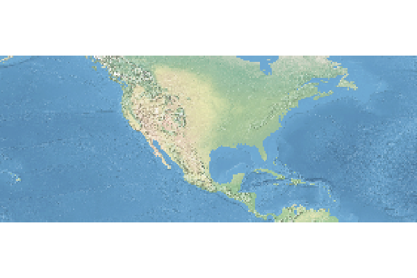
Mosaic
Mosaic two Rasters together
geo-shell> raster mosaic --name1 alki2 --name2 alki3 --output-format mosaic --output-name mosaic
Name |
Description |
Mandatory |
Specified Default |
Unspecified Default |
name1 |
The Raster name |
true |
||
name2 |
The Raster name |
true |
||
output-format |
The output Format Workspace |
true |
||
output-name |
The output Raster name |
false |
geo-shell> format open --input examples/alki2.tif --name alki2
Format alki2 opened!
geo-shell> raster open --format alki2 --raster alki2 --name alki2
Opened Format alki2 Raster alki2 as alki2
geo-shell> format open --input examples/alki3.tif --name alki3
Format alki3 opened!
geo-shell> raster open --format alki3 --raster alki3 --name alki3
Opened Format alki3 Raster alki3 as alki3
geo-shell> format open --input examples/mosaic.tif --name mosaic
Format mosaic opened!
geo-shell> raster mosaic --name1 alki2 --name2 alki3 --output-format mosaic --output-name mosaic
Mosaic alki2 and alki3 to create mosaic!
geo-shell> map open --name map
Map map opened!
geo-shell> map add raster --name map --raster mosaic
Added mosaic layer to map map
geo-shell> map draw --name map --file examples/raster_mosaic.png
Done drawing /home/runner/work/geo-shell/geo-shell/examples/raster_mosaic.png!
geo-shell> map close --name map
Map map closed!
Reclassify
Reclassify a Raster.
geo-shell> raster reclassify --name pc --output-format pcReclass --output-name pcReclass --ranges "0-0=1,0-50=2,50-200=3,200-1000=4,1000-1500=5,1500-4000=6"
Name |
Description |
Mandatory |
Specified Default |
Unspecified Default |
name |
The Raster name |
true |
||
output-format |
The output Format Workspace |
true |
||
output-name |
The output Raster name |
false |
||
ranges |
The comma delimited reclassification ranges (from-to=value) |
true |
||
band |
The Raster band to contour |
false |
0 |
0 |
nodata |
The NODATA value |
false |
0 |
0 |
geo-shell> format open --name pc --input src/test/resources/pc.tif
Format pc opened!
geo-shell> raster open --format pc --raster pc --name pc
Opened Format pc Raster pc as pc
geo-shell> format open --name pcReclass --input examples/pcReclass.tif
Format pcReclass opened!
geo-shell> raster reclassify --name pc --output-format pcReclass --output-name pcReclass --ranges "0-0=1,0-50=2,50-200=3,200-1000=4,1000-1500=5,1500-4000=6"
Raster pc reclassified to pcReclass!
geo-shell> style raster colormap --raster pcReclass --values "1=#9fd182,2=#3e7f3c,3=#133912,4=#08306b,5=#FFF8DC,6=#ffffff" --file examples/pcReclass.sld
Colormap Raster Style for pcReclass written to /home/runner/work/geo-shell/geo-shell/examples/pcReclass.sld!
geo-shell> raster style set --name pcReclass --style examples/pcReclass.sld
Style /home/runner/work/geo-shell/geo-shell/examples/pcReclass.sld set on pcReclass
geo-shell> map open --name map
Map map opened!
geo-shell> map add raster --name map --raster pcReclass
Added pcReclass layer to map map
geo-shell> map draw --name map --file examples/raster_reclassify.png
Done drawing /home/runner/work/geo-shell/geo-shell/examples/raster_reclassify.png!
geo-shell> map close --name map
Map map closed!
Reproject
Project a Raster.
geo-shell> raster reproject --name earthCropped --output-format earth3857 --output-name earth3857 --projection "EPSG:3857"
Name |
Description |
Mandatory |
Specified Default |
Unspecified Default |
name |
The Raster name |
true |
||
output-format |
The output Format Workspace |
true |
||
output-name |
The output Raster name |
false |
||
projection |
The projection |
true |
geo-shell> format open --name earth --input src/test/resources/earth.tif
Format earth opened!
geo-shell> raster open --format earth --raster earth --name earth
Opened Format earth Raster earth as earth
geo-shell> format open --name earthCropped --input examples/earthCropped.tif
Format earthCropped opened!
geo-shell> raster crop --name earth --output-format earthCropped --output-name earthCropped --geometry "-180.0,-85.06,180.0,85.06"
Raster earth cropped to earthCropped!
geo-shell> format open --name earth3857 --input examples/earth3857.tif
Format earth3857 opened!
geo-shell> raster reproject --name earthCropped --output-format earth3857 --output-name earth3857 --projection "EPSG:3857"
Raster earthCropped reprojected to earth3857 as EPSG:3857!
geo-shell> map open --name map
Map map opened!
geo-shell> map add raster --name map --raster earth3857
Added earth3857 layer to map map
geo-shell> map draw --name map --file examples/raster_reproject.png
Done drawing /home/runner/work/geo-shell/geo-shell/examples/raster_reproject.png!
geo-shell> map close --name map
Map map closed!
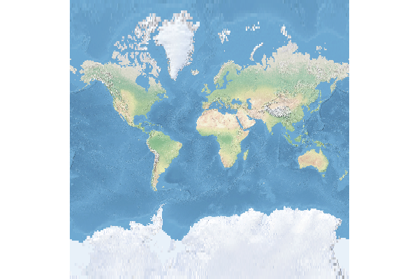
Scale
Scale a Raster.
geo-shell> raster scale --name pc --output-format pcScaled --output-name pcScaled --x 0.5 --y 0.5
Name |
Description |
Mandatory |
Specified Default |
Unspecified Default |
name |
The Raster name |
true |
||
output-format |
The output Format Workspace |
true |
||
output-name |
The output Raster name |
false |
||
x |
The scale factor along the x axis |
true |
||
y |
The scale factor along the y axis |
true |
||
x-trans |
The x translation |
false |
0 |
0 |
y-trans |
The y translation |
false |
0 |
0 |
interpolation |
The interpolation method (bicubic, bicubic2, bilinear, nearest) |
false |
nearest |
nearest |
geo-shell> format open --name pc --input src/test/resources/pc.tif
Format pc opened!
geo-shell> raster open --format pc --raster pc --name pc
Opened Format pc Raster pc as pc
geo-shell> format open --name pcScaled --input examples/pcScaled.tif
Format pcScaled opened!
geo-shell> raster scale --name pc --output-format pcScaled --output-name pcScaled --x 0.5 --y 0.5
Raster pc scaled to pcScaled!
geo-shell> style raster colormap --raster pc --values "25=#9fd182,470=#3e7f3c,920=#133912,1370=#08306b,1820=#fffff5" --file examples/pcScaled.sld
Colormap Raster Style for pc written to /home/runner/work/geo-shell/geo-shell/examples/pcScaled.sld!
geo-shell> raster style set --name pcScaled --style examples/pcScaled.sld
Style /home/runner/work/geo-shell/geo-shell/examples/pcScaled.sld set on pcScaled
geo-shell> map open --name map
Map map opened!
geo-shell> map add raster --name map --raster pcScaled
Added pcScaled layer to map map
geo-shell> map draw --name map --file examples/raster_scale.png
Done drawing /home/runner/work/geo-shell/geo-shell/examples/raster_scale.png!
geo-shell> map close --name map
Map map closed!
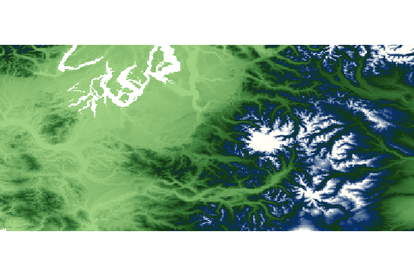
Shaded Relief
Create a shaded relief raster
geo-shell> raster shadedrelief --name pc --output-format pcShaded --output-name pcShaded --scale 1.0 --altitude 25 --azimuth 260
Name |
Description |
Mandatory |
Specified Default |
Unspecified Default |
name |
The Raster name |
true |
||
output-format |
The output Format Workspace |
true |
||
output-name |
The output Raster name |
false |
||
scale |
The scale |
true |
||
altitude |
The altitude |
true |
||
azimuth |
The azimuth |
true |
||
resx |
The x resolution |
false |
0.5 |
0.5 |
resy |
The y resolution |
false |
0.5 |
0.5 |
zetafactory |
The zeta factory |
false |
1.0 |
1.0 |
algorithm |
The x resolution |
false |
DEFAULT |
DEFAULT |
geo-shell> format open --name pc --input src/test/resources/pc.tif
Format pc opened!
geo-shell> raster open --format pc --raster pc --name pc
Opened Format pc Raster pc as pc
geo-shell> format open --name pcShaded --input examples/pcShaded.tif
Format pcShaded opened!
geo-shell> raster shadedrelief --name pc --output-format pcShaded --output-name pcShaded --scale 1.0 --altitude 25 --azimuth 260
Create shaded relief pcShaded from pc!
geo-shell> map open --name map
Map map opened!
geo-shell> map add raster --name map --raster pcShaded
Added pcShaded layer to map map
geo-shell> map draw --name map --file examples/raster_shadedrelief.png
Done drawing /home/runner/work/geo-shell/geo-shell/examples/raster_shadedrelief.png!
geo-shell> map close --name map
Map map closed!
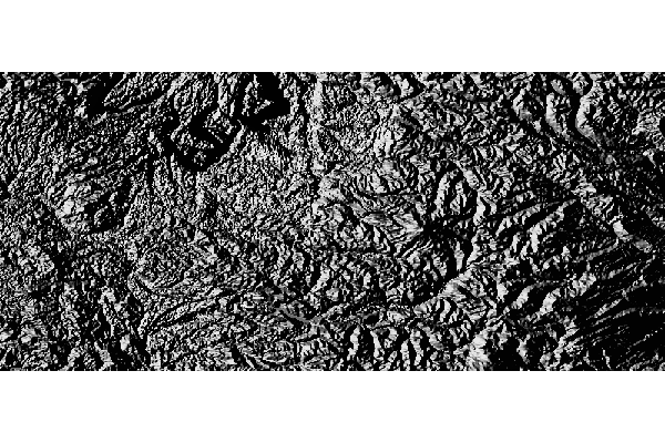
Stylize
Create a new Raster by baking the style into an existing Raster
geo-shell> raster stylize --name pc --output-format pcStyled --output-name pcStyled
Name |
Description |
Mandatory |
Specified Default |
Unspecified Default |
name |
The Raster name |
true |
||
output-format |
The output Format Workspace |
true |
||
output-name |
The output Raster name |
false |
geo-shell> format open --name pc --input src/test/resources/pc.tif
Format pc opened!
geo-shell> raster open --format pc --raster pc --name pc
Opened Format pc Raster pc as pc
geo-shell> style raster colormap --raster pc --values "25=#9fd182,470=#3e7f3c,920=#133912,1370=#08306b,1820=#fffff5" --file examples/pc.sld
Colormap Raster Style for pc written to /home/runner/work/geo-shell/geo-shell/examples/pc.sld!
geo-shell> raster style set --name pc --style examples/pc.sld
Style /home/runner/work/geo-shell/geo-shell/examples/pc.sld set on pc
geo-shell> format open --name pcStyled --input examples/pcStyled.tif
Format pcStyled opened!
geo-shell> raster stylize --name pc --output-format pcStyled --output-name pcStyled
Stylized pc to create pcStyled!
geo-shell> map open --name map
Map map opened!
geo-shell> map add raster --name map --raster pcStyled
Added pcStyled layer to map map
geo-shell> map draw --name map --file examples/raster_stylize.png
Done drawing /home/runner/work/geo-shell/geo-shell/examples/raster_stylize.png!
geo-shell> map close --name map
Map map closed!
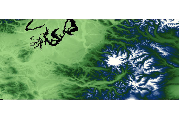
Polygon
Convert a raster in a polygon
geo-shell> raster polygon --name high --output-workspace layers --output-name grid
Name |
Description |
Mandatory |
Specified Default |
Unspecified Default |
name |
The Raster name |
true |
||
output-workspace |
The output Layer Workspace |
true |
||
output-name |
The output Layer name |
true |
||
band |
The band |
false |
0 |
0 |
inside-edges |
Whether to include inside edges |
false |
true |
true |
roi |
The region of interest |
false |
||
nodata |
The NODATA value |
false |
0 |
0 |
ranges |
The comma delimited reclassification ranges (min,minIncluded,max,maxIncluded) |
false |
geo-shell> format open --name high --input src/test/resources/high.tif
Format high opened!
geo-shell> raster open --format high --raster high --name high
Opened Format high Raster high as high
geo-shell> workspace open --name layers --params memory
Workspace layers opened!
geo-shell> raster polygon --name high --output-workspace layers --output-name grid
Done converting Raster high to a Polygon Layer grid!
geo-shell> style raster palette colormap --min 1 --max 50 --palette MutedTerrain --number 20 --file examples/high.sld
Colormap Palette Raster Style written to /home/runner/work/geo-shell/geo-shell/examples/high.sld!
geo-shell> raster style set --name high --style examples/high.sld
Style /home/runner/work/geo-shell/geo-shell/examples/high.sld set on high
geo-shell> style create --params "stroke=black stroke-width=2 label=value label-size=12" --file examples/grid.sld
Style stroke=black stroke-width=2 label=value label-size=12 written to /home/runner/work/geo-shell/geo-shell/examples/grid.sld!
geo-shell> layer style set --name grid --style examples/grid.sld
Style /home/runner/work/geo-shell/geo-shell/examples/grid.sld set on grid
geo-shell> map open --name map
Map map opened!
geo-shell> map add raster --name map --raster high
Added high layer to map map
geo-shell> map add layer --name map --layer grid
Added grid layer to map map
geo-shell> map draw --name map --file examples/raster_polygon.png --bounds "-180,-90,180,90,EPSG:4326"
Done drawing /home/runner/work/geo-shell/geo-shell/examples/raster_polygon.png!
geo-shell> map close --name map
Map map closed!

Tile
Open
Open a Tile Layer.
geo-shell> tile open --name countries --params src/test/resources/countries.mbtiles
Name |
Description |
Mandatory |
Specified Default |
Unspecified Default |
name |
The tile name |
true |
||
params |
The connection parameters |
true |
geo-shell> tile open --name countries --params src/test/resources/countries.mbtiles
Tile Layer countries opened!
geo-shell> tile close --name countries
Tile Layer countries closed!
Close
Close a Tile Layer.
geo-shell> tile close --name countries
Name |
Description |
Mandatory |
Specified Default |
Unspecified Default |
name |
The tile name |
true |
geo-shell> tile open --name countries --params src/test/resources/countries.mbtiles
Tile Layer countries opened!
geo-shell> tile close --name countries
Tile Layer countries closed!
List
List open Tile Layers.
geo-shell> tile list
| No parameters |
geo-shell> tile open --name countries --params src/test/resources/countries.mbtiles
Tile Layer countries opened!
geo-shell> tile list
countries = MBTiles
geo-shell> tile close --name countries
Tile Layer countries closed!
Info
Get information about a Tile Layer.
geo-shell> tile info --name countries
Name |
Description |
Mandatory |
Specified Default |
Unspecified Default |
name |
The tile name |
true |
geo-shell> tile open --name countries --params src/test/resources/countries.mbtiles
Tile Layer countries opened!
geo-shell> tile info --name countries
countries
EPSG:3857
-2.003639514788131E7,-2.0037471205137067E7,2.003639514788131E7,2.003747120513706E7,EPSG:3857
BOTTOM_LEFT
256,256
0,1,1,156412.0,156412.0
1,2,2,78206.0,78206.0
2,4,4,39103.0,39103.0
3,8,8,19551.5,19551.5
4,16,16,9775.75,9775.75
5,32,32,4887.875,4887.875
6,64,64,2443.9375,2443.9375
7,128,128,1221.96875,1221.96875
8,256,256,610.984375,610.984375
9,512,512,305.4921875,305.4921875
10,1024,1024,152.74609375,152.74609375
11,2048,2048,76.373046875,76.373046875
12,4096,4096,38.1865234375,38.1865234375
13,8192,8192,19.09326171875,19.09326171875
14,16384,16384,9.546630859375,9.546630859375
15,32768,32768,4.7733154296875,4.7733154296875
16,65536,65536,2.38665771484375,2.38665771484375
17,131072,131072,1.193328857421875,1.193328857421875
18,262144,262144,0.5966644287109375,0.5966644287109375
19,524288,524288,0.29833221435546875,0.29833221435546875
geo-shell> tile close --name countries
Tile Layer countries closed!
Delete
Delete tiles from a Tile Layer.
geo-shell> tile delete --name tiles --z 3
Name |
Description |
Mandatory |
Specified Default |
Unspecified Default |
name |
The tile name |
true |
||
tile |
The tile z/x/y |
false |
||
bounds |
The bounds |
false |
||
width |
The width |
false |
400 |
400 |
height |
The height |
false |
400 |
400 |
z |
The zoom level |
false |
0 |
-1 |
minx |
The min x or column |
false |
-1 |
|
miny |
The min y or row |
false |
-1 |
|
maxx |
The max x or column |
false |
-1 |
|
maxy |
The max y or row |
false |
-1 |
geo-shell> tile open --name tiles --params target/tiles.mbtiles
Tile Layer tiles opened!
geo-shell> workspace open --name naturalearth --params examples/naturalearth.gpkg
Workspace naturalearth opened!
geo-shell> layer open --workspace naturalearth --layer countries --name countries
Opened Workspace naturalearth Layer countries as countries
geo-shell> layer style set --name countries --style examples/countries.sld
Style /home/runner/work/geo-shell/geo-shell/examples/countries.sld set on countries
geo-shell> layer open --workspace naturalearth --layer ocean --name ocean
Opened Workspace naturalearth Layer ocean as ocean
geo-shell> layer style set --name ocean --style examples/ocean.sld
Style /home/runner/work/geo-shell/geo-shell/examples/ocean.sld set on ocean
geo-shell> map open --name world
Map world opened!
geo-shell> map add layer --name world --layer ocean
Added ocean layer to map world
geo-shell> map add layer --name world --layer countries
Added countries layer to map world
geo-shell> tile generate --name tiles --map world --start 0 --end 3
Tiles generated!
geo-shell> tile delete --name tiles --z 3
Deleting tiles at z level 3
geo-shell> map close --name world
Map world closed!
Generate
Generate tiles for a Tile Layer.
geo-shell> tile generate --name tiles --map world --start 0 --end 3
Name |
Description |
Mandatory |
Specified Default |
Unspecified Default |
name |
The tile name |
true |
||
map |
The map name |
true |
||
start |
The map name |
true |
||
end |
The map name |
true |
||
bounds |
The map name |
false |
||
metatile |
The metatile width,height |
false |
||
missingOnly |
The map name |
false |
false |
false |
verbose |
The map name |
false |
false |
false |
geo-shell> tile open --name tiles --params target/tiles.mbtiles
Tile Layer tiles opened!
geo-shell> workspace open --name naturalearth --params examples/naturalearth.gpkg
Workspace naturalearth opened!
geo-shell> layer open --workspace naturalearth --layer countries --name countries
Opened Workspace naturalearth Layer countries as countries
geo-shell> layer style set --name countries --style examples/countries.sld
Style /home/runner/work/geo-shell/geo-shell/examples/countries.sld set on countries
geo-shell> layer open --workspace naturalearth --layer ocean --name ocean
Opened Workspace naturalearth Layer ocean as ocean
geo-shell> layer style set --name ocean --style examples/ocean.sld
Style /home/runner/work/geo-shell/geo-shell/examples/ocean.sld set on ocean
geo-shell> map open --name world
Map world opened!
geo-shell> map add layer --name world --layer ocean
Added ocean layer to map world
geo-shell> map add layer --name world --layer countries
Added countries layer to map world
geo-shell> tile generate --name tiles --map world --start 0 --end 3
Tiles generated!
geo-shell> format open --name world_level2 --input examples/tile_generate.png
Format world_level2 opened!
geo-shell> tile stitch raster --name tiles --format world_level2 --raster world_level2 --z 2
Done stitching Raster world_level2 from tiles!
geo-shell> map close --name world
Map world closed!
Stitch Raster
Create a Raster from a Tile Layer.
geo-shell> tile stitch raster --name countries --format states --raster states --bounds -18217695.5734,1222992.4526,-4207094.0368,7924991.0926
Name |
Description |
Mandatory |
Specified Default |
Unspecified Default |
name |
The tile name |
true |
||
format |
The raster format name |
true |
||
raster |
The raster name |
true |
||
bounds |
The bounds |
false |
||
width |
The raster width |
false |
400 |
400 |
height |
The raster height |
false |
400 |
400 |
z |
The zoom level |
false |
0 |
-1 |
minx |
The min x or column |
false |
-1 |
|
miny |
The min y or row |
false |
-1 |
|
maxx |
The max x or column |
false |
-1 |
|
maxy |
The max y or row |
false |
-1 |
Create a Raster from a Tile Layer with a geographic bounds.
geo-shell> tile open --name countries --params src/test/resources/countries.mbtiles
Tile Layer countries opened!
geo-shell> format open --name states --input examples/tile_stitch_bounds.png
Format states opened!
geo-shell> tile stitch raster --name countries --format states --raster states --bounds -18217695.5734,1222992.4526,-4207094.0368,7924991.0926
Done stitching Raster states from countries!
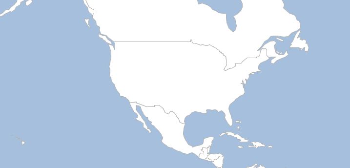
Tiles
List tiles within a given bounds.
geo-shell> tile tiles --name countries --z 8 --bounds -13787405.4140,5872198.2610,-13349574.1159,6081635.7185
Name |
Description |
Mandatory |
Specified Default |
Unspecified Default |
name |
The tile name |
true |
||
bounds |
The bounds |
true |
||
z |
The zoom level |
true |
geo-shell> tile open --name countries --params src/test/resources/countries.mbtiles
Tile Layer countries opened!
geo-shell> tile tiles --name countries --z 8 --bounds -13787405.4140,5872198.2610,-13349574.1159,6081635.7185
8/39/165
8/40/165
8/41/165
8/42/165
8/39/166
8/40/166
8/41/166
8/42/166
geo-shell> tile close --name countries
Tile Layer countries closed!
Vector Grid
Create a Vector Grid Layer from the pyramid of a Tile Layer.
geo-shell> tile vector grid --name countries --workspace layers --layer level3 --z 3
Name |
Description |
Mandatory |
Specified Default |
Unspecified Default |
name |
The tile name |
true |
||
workspace |
The workspace name |
true |
||
layer |
The layer name |
true |
||
bounds |
The bounds |
false |
||
width |
The raster width |
false |
400 |
400 |
height |
The raster height |
false |
400 |
400 |
z |
The zoom level |
false |
0 |
-1 |
minx |
The min x or column |
false |
-1 |
|
miny |
The min y or row |
false |
-1 |
|
maxx |
The max x or column |
false |
-1 |
|
maxy |
The max y or row |
false |
-1 |
geo-shell> tile open --name countries --params src/test/resources/countries.mbtiles
Tile Layer countries opened!
geo-shell> workspace open --name layers --params memory
Workspace layers opened!
geo-shell> tile vector grid --name countries --workspace layers --layer level3 --z 3
Done generating the vector grid level3 from countries!
geo-shell> style vector default --layer level3 --color #ffffff --opacity 0.25 --file examples/level3.sld
Default Vector Style for level3 written to /home/runner/work/geo-shell/geo-shell/examples/level3.sld!
geo-shell> layer style set --name level3 --style examples/level3.sld
Style /home/runner/work/geo-shell/geo-shell/examples/level3.sld set on level3
geo-shell> workspace open --name naturalearth --params examples/naturalearth.gpkg
Workspace naturalearth opened!
geo-shell> layer open --workspace naturalearth --layer countries --name countries
Opened Workspace naturalearth Layer countries as countries
geo-shell> layer style set --name countries --style examples/countries.sld
Style /home/runner/work/geo-shell/geo-shell/examples/countries.sld set on countries
geo-shell> layer open --workspace naturalearth --layer ocean --name ocean
Opened Workspace naturalearth Layer ocean as ocean
geo-shell> layer style set --name ocean --style examples/ocean.sld
Style /home/runner/work/geo-shell/geo-shell/examples/ocean.sld set on ocean
geo-shell> map open --name vectorGridMap
Map vectorGridMap opened!
geo-shell> map add layer --name vectorGridMap --layer ocean
Added ocean layer to map vectorGridMap
geo-shell> map add layer --name vectorGridMap --layer countries
Added countries layer to map vectorGridMap
geo-shell> map add layer --name vectorGridMap --layer level3
Added level3 layer to map vectorGridMap
geo-shell> map draw --name vectorGridMap --file examples/tile_vector_grid.png --projection EPSG:3857 --width 400 --height 400 --bounds -20026376.39,-20048966.10,20026376.39,20048966.10
Done drawing /home/runner/work/geo-shell/geo-shell/examples/tile_vector_grid.png!
geo-shell> map close --name vectorGridMap
Map vectorGridMap closed!
Style
Create
Create a simple style.
geo-shell> style create --params "stroke=black stroke-width=0.25 fill=wheat" --file examples/style_create.sld
Name |
Description |
Mandatory |
Specified Default |
Unspecified Default |
params |
The style parameters |
true |
||
file |
The output file |
true |
geo-shell> style create --params "stroke=black stroke-width=0.25 fill=wheat" --file examples/style_create.sld
Style stroke=black stroke-width=0.25 fill=wheat written to /home/runner/work/geo-shell/geo-shell/examples/style_create.sld!
geo-shell> workspace open --name naturalearth --params src/test/resources/naturalearth.gpkg
Workspace naturalearth opened!
geo-shell> layer open --workspace naturalearth --layer countries --name countries
Opened Workspace naturalearth Layer countries as countries
geo-shell> layer style set --name countries --style examples/style_create.sld
Style /home/runner/work/geo-shell/geo-shell/examples/style_create.sld set on countries
geo-shell> layer open --workspace naturalearth --layer ocean --name ocean
Opened Workspace naturalearth Layer ocean as ocean
geo-shell> layer style set --name ocean --style examples/ocean.sld
Style /home/runner/work/geo-shell/geo-shell/examples/ocean.sld set on ocean
geo-shell> map open --name map
Map map opened!
geo-shell> map add layer --name map --layer ocean
Added ocean layer to map map
geo-shell> map add layer --name map --layer countries
Added countries layer to map map
geo-shell> map draw --name map --file examples/style_create.png
Done drawing /home/runner/work/geo-shell/geo-shell/examples/style_create.png!
geo-shell> map close --name map
Map map closed!
<?xml version="1.0" encoding="UTF-8"?><sld:StyledLayerDescriptor xmlns:sld="http://www.opengis.net/sld" xmlns="http://www.opengis.net/sld" xmlns:gml="http://www.opengis.net/gml" xmlns:ogc="http://www.opengis.net/ogc" version="1.0.0">
  <sld:UserLayer>
    <sld:LayerFeatureConstraints>
      <sld:FeatureTypeConstraint/>
    </sld:LayerFeatureConstraints>
    <sld:UserStyle>
      <sld:Name>Default Styler</sld:Name>
      <sld:FeatureTypeStyle>
        <sld:Name>name</sld:Name>
        <sld:Rule>
          <sld:PolygonSymbolizer>
            <sld:Fill>
              <sld:CssParameter name="fill">#f5deb3</sld:CssParameter>
              <sld:CssParameter name="fill-opacity">0.6</sld:CssParameter>
            </sld:Fill>
          </sld:PolygonSymbolizer>
          <sld:LineSymbolizer>
            <sld:Stroke>
              <sld:CssParameter name="stroke-width">0.25</sld:CssParameter>
            </sld:Stroke>
          </sld:LineSymbolizer>
        </sld:Rule>
      </sld:FeatureTypeStyle>
    </sld:UserStyle>
  </sld:UserLayer>
</sld:StyledLayerDescriptor>
Vector Default
Create a default vector style.
geo-shell> style vector default --layer countries --color #F5F5DC --file examples/countries_default.sld
Name |
Description |
Mandatory |
Specified Default |
Unspecified Default |
layer |
The Layer |
true |
||
color |
The color |
false |
#f2f2f2 |
#f2f2f2 |
opacity |
The opacity |
false |
1.0 |
1.0 |
file |
The output file |
true |
geo-shell> workspace open --name naturalearth --params src/test/resources/naturalearth.gpkg
Workspace naturalearth opened!
geo-shell> layer open --workspace naturalearth --layer countries --name countries
Opened Workspace naturalearth Layer countries as countries
geo-shell> style vector default --layer countries --color #F5F5DC --file examples/countries_default.sld
Default Vector Style for countries written to /home/runner/work/geo-shell/geo-shell/examples/countries_default.sld!
geo-shell> layer style set --name countries --style examples/countries_default.sld
Style /home/runner/work/geo-shell/geo-shell/examples/countries_default.sld set on countries
geo-shell> layer open --workspace naturalearth --layer ocean --name ocean
Opened Workspace naturalearth Layer ocean as ocean
geo-shell> style vector default --layer ocean --color DeepSkyBlue --file examples/ocean_default.sld
Default Vector Style for ocean written to /home/runner/work/geo-shell/geo-shell/examples/ocean_default.sld!
geo-shell> layer style set --name ocean --style examples/ocean_default.sld
Style /home/runner/work/geo-shell/geo-shell/examples/ocean_default.sld set on ocean
geo-shell> map open --name map
Map map opened!
geo-shell> map add layer --name map --layer ocean
Added ocean layer to map map
geo-shell> map add layer --name map --layer countries
Added countries layer to map map
geo-shell> map draw --name map --file examples/style_vector_default.png
Done drawing /home/runner/work/geo-shell/geo-shell/examples/style_vector_default.png!
geo-shell> map close --name map
Map map closed!
Country Style
<?xml version="1.0" encoding="UTF-8"?><sld:StyledLayerDescriptor xmlns:sld="http://www.opengis.net/sld" xmlns="http://www.opengis.net/sld" xmlns:gml="http://www.opengis.net/gml" xmlns:ogc="http://www.opengis.net/ogc" version="1.0.0">
  <sld:UserLayer>
    <sld:LayerFeatureConstraints>
      <sld:FeatureTypeConstraint/>
    </sld:LayerFeatureConstraints>
    <sld:UserStyle>
      <sld:Name>Default Styler</sld:Name>
      <sld:FeatureTypeStyle>
        <sld:Name>name</sld:Name>
        <sld:Rule>
          <sld:PolygonSymbolizer>
            <sld:Fill>
              <sld:CssParameter name="fill">#f5f5dc</sld:CssParameter>
            </sld:Fill>
          </sld:PolygonSymbolizer>
          <sld:LineSymbolizer>
            <sld:Stroke>
              <sld:CssParameter name="stroke">#abab9a</sld:CssParameter>
              <sld:CssParameter name="stroke-width">0.5</sld:CssParameter>
            </sld:Stroke>
          </sld:LineSymbolizer>
        </sld:Rule>
      </sld:FeatureTypeStyle>
    </sld:UserStyle>
  </sld:UserLayer>
</sld:StyledLayerDescriptor>
Ocean Style
<?xml version="1.0" encoding="UTF-8"?><sld:StyledLayerDescriptor xmlns:sld="http://www.opengis.net/sld" xmlns="http://www.opengis.net/sld" xmlns:gml="http://www.opengis.net/gml" xmlns:ogc="http://www.opengis.net/ogc" version="1.0.0">
  <sld:UserLayer>
    <sld:LayerFeatureConstraints>
      <sld:FeatureTypeConstraint/>
    </sld:LayerFeatureConstraints>
    <sld:UserStyle>
      <sld:Name>Default Styler</sld:Name>
      <sld:FeatureTypeStyle>
        <sld:Name>name</sld:Name>
        <sld:Rule>
          <sld:PolygonSymbolizer>
            <sld:Fill>
              <sld:CssParameter name="fill">#00bfff</sld:CssParameter>
            </sld:Fill>
          </sld:PolygonSymbolizer>
          <sld:LineSymbolizer>
            <sld:Stroke>
              <sld:CssParameter name="stroke">#0085b2</sld:CssParameter>
              <sld:CssParameter name="stroke-width">0.5</sld:CssParameter>
            </sld:Stroke>
          </sld:LineSymbolizer>
        </sld:Rule>
      </sld:FeatureTypeStyle>
    </sld:UserStyle>
  </sld:UserLayer>
</sld:StyledLayerDescriptor>
Vector Gradient
Create a gradient vector style.
geo-shell> style vector gradient --layer countries --field PEOPLE --colors greens --number 8 --method quantile --file examples/style_vector_gradient.sld
Name |
Description |
Mandatory |
Specified Default |
Unspecified Default |
layer |
The Layer |
true |
||
field |
The field |
true |
||
number |
The number of categories |
true |
||
colors |
The colors |
true |
||
method |
The classification method (Quantile or EqualInterval) |
false |
Quantile |
Quantile |
elsemode |
The else mode (ignore, min, max) |
false |
ignore |
ignore |
file |
The output file |
true |
geo-shell> workspace open --name naturalearth --params src/test/resources/naturalearth.gpkg
Workspace naturalearth opened!
geo-shell> layer open --workspace naturalearth --layer countries --name countries
Opened Workspace naturalearth Layer countries as countries
geo-shell> style vector gradient --layer countries --field PEOPLE --colors greens --number 8 --method quantile --file examples/style_vector_gradient.sld
Gradient Vector Style for countries’s PEOPLE Field written to /home/runner/work/geo-shell/geo-shell/examples/style_vector_gradient.sld!
geo-shell> layer style set --name countries --style examples/style_vector_gradient.sld
Style /home/runner/work/geo-shell/geo-shell/examples/style_vector_gradient.sld set on countries
geo-shell> layer open --workspace naturalearth --layer ocean --name ocean
Opened Workspace naturalearth Layer ocean as ocean
geo-shell> layer style set --name ocean --style examples/ocean.sld
Style /home/runner/work/geo-shell/geo-shell/examples/ocean.sld set on ocean
geo-shell> map open --name map
Map map opened!
geo-shell> map add layer --name map --layer ocean
Added ocean layer to map map
geo-shell> map add layer --name map --layer countries
Added countries layer to map map
geo-shell> map draw --name map --file examples/style_vector_gradient.png
Done drawing /home/runner/work/geo-shell/geo-shell/examples/style_vector_gradient.png!
geo-shell> map close --name map
Map map closed!
<?xml version="1.0" encoding="UTF-8"?><sld:StyledLayerDescriptor xmlns:sld="http://www.opengis.net/sld" xmlns="http://www.opengis.net/sld" xmlns:gml="http://www.opengis.net/gml" xmlns:ogc="http://www.opengis.net/ogc" version="1.0.0">
  <sld:UserLayer>
    <sld:LayerFeatureConstraints>
      <sld:FeatureTypeConstraint/>
    </sld:LayerFeatureConstraints>
    <sld:UserStyle>
      <sld:Name>Default Styler</sld:Name>
      <sld:FeatureTypeStyle>
        <sld:Name>name</sld:Name>
        <sld:Rule>
          <ogc:Filter>
            <ogc:And>
              <ogc:PropertyIsGreaterThanOrEqualTo>
                <ogc:PropertyName>PEOPLE</ogc:PropertyName>
                <ogc:Literal>0</ogc:Literal>
              </ogc:PropertyIsGreaterThanOrEqualTo>
              <ogc:PropertyIsLessThan>
                <ogc:PropertyName>PEOPLE</ogc:PropertyName>
                <ogc:Literal>833285</ogc:Literal>
              </ogc:PropertyIsLessThan>
            </ogc:And>
          </ogc:Filter>
          <sld:PolygonSymbolizer>
            <sld:Fill>
              <sld:CssParameter name="fill">#F7FCF5</sld:CssParameter>
            </sld:Fill>
          </sld:PolygonSymbolizer>
          <sld:LineSymbolizer>
            <sld:Stroke/>
          </sld:LineSymbolizer>
        </sld:Rule>
        <sld:Rule>
          <ogc:Filter>
            <ogc:And>
              <ogc:PropertyIsGreaterThanOrEqualTo>
                <ogc:PropertyName>PEOPLE</ogc:PropertyName>
                <ogc:Literal>833285</ogc:Literal>
              </ogc:PropertyIsGreaterThanOrEqualTo>
              <ogc:PropertyIsLessThan>
                <ogc:PropertyName>PEOPLE</ogc:PropertyName>
                <ogc:Literal>3360474</ogc:Literal>
              </ogc:PropertyIsLessThan>
            </ogc:And>
          </ogc:Filter>
          <sld:PolygonSymbolizer>
            <sld:Fill>
              <sld:CssParameter name="fill">#E5F5E0</sld:CssParameter>
            </sld:Fill>
          </sld:PolygonSymbolizer>
          <sld:LineSymbolizer>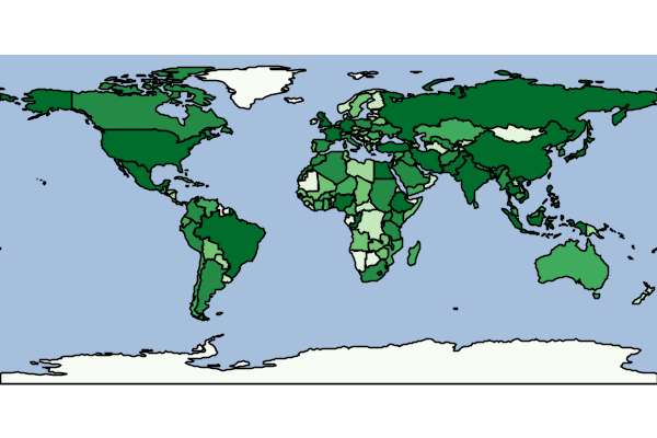
Vector Unique Values
Create a unique values vector style.
geo-shell> style vector uniquevalues --layer countries --field NAME --colors random --file examples/style_vector_uniquevalues.sld
Name |
Description |
Mandatory |
Specified Default |
Unspecified Default |
layer |
The Layer |
true |
||
field |
The field |
true |
||
colors |
The colors |
true |
||
file |
The output file |
true |
geo-shell> workspace open --name naturalearth --params src/test/resources/naturalearth.gpkg
Workspace naturalearth opened!
geo-shell> layer open --workspace naturalearth --layer countries --name countries
Opened Workspace naturalearth Layer countries as countries
geo-shell> style vector uniquevalues --layer countries --field NAME --colors random --file examples/style_vector_uniquevalues.sld
Unique Values Vector Style for countries’s NAME Field written to /home/runner/work/geo-shell/geo-shell/examples/style_vector_uniquevalues.sld!
geo-shell> layer style set --name countries --style examples/style_vector_uniquevalues.sld
Style /home/runner/work/geo-shell/geo-shell/examples/style_vector_uniquevalues.sld set on countries
geo-shell> layer open --workspace naturalearth --layer ocean --name ocean
Opened Workspace naturalearth Layer ocean as ocean
geo-shell> layer style set --name ocean --style examples/ocean.sld
Style /home/runner/work/geo-shell/geo-shell/examples/ocean.sld set on ocean
geo-shell> map open --name map
Map map opened!
geo-shell> map add layer --name map --layer ocean
Added ocean layer to map map
geo-shell> map add layer --name map --layer countries
Added countries layer to map map
geo-shell> map draw --name map --file examples/style_vector_uniquevalues.png
Done drawing /home/runner/work/geo-shell/geo-shell/examples/style_vector_uniquevalues.png!
geo-shell> map close --name map
Map map closed!
<?xml version="1.0" encoding="UTF-8"?><sld:StyledLayerDescriptor xmlns:sld="http://www.opengis.net/sld" xmlns="http://www.opengis.net/sld" xmlns:gml="http://www.opengis.net/gml" xmlns:ogc="http://www.opengis.net/ogc" version="1.0.0">
  <sld:UserLayer>
    <sld:LayerFeatureConstraints>
      <sld:FeatureTypeConstraint/>
    </sld:LayerFeatureConstraints>
    <sld:UserStyle>
      <sld:Name>Default Styler</sld:Name>
      <sld:FeatureTypeStyle>
        <sld:Name>name</sld:Name>
        <sld:Rule>
          <sld:Name>Afghanistan</sld:Name>
          <ogc:Filter>
            <ogc:PropertyIsEqualTo>
              <ogc:PropertyName>NAME</ogc:PropertyName>
              <ogc:Literal>Afghanistan</ogc:Literal>
            </ogc:PropertyIsEqualTo>
          </ogc:Filter>
          <sld:PolygonSymbolizer>
            <sld:Fill>
              <sld:CssParameter name="fill">#414d7f</sld:CssParameter>
            </sld:Fill>
          </sld:PolygonSymbolizer>
          <sld:LineSymbolizer>
            <sld:Stroke>
              <sld:CssParameter name="stroke">#2d3558</sld:CssParameter>
              <sld:CssParameter name="stroke-width">0.5</sld:CssParameter>
            </sld:Stroke>
          </sld:LineSymbolizer>
        </sld:Rule>
        <sld:Rule>
          <sld:Name>Albania</sld:Name>
          <ogc:Filter>
            <ogc:PropertyIsEqualTo>
              <ogc:PropertyName>NAME</ogc:PropertyName>
              <ogc:Literal>Albania</ogc:Literal>
            </ogc:PropertyIsEqualTo>
          </ogc:Filter>
          <sld:PolygonSymbolizer>
            <sld:Fill>
              <sld:CssParameter name="fill">#4b5b3c</sld:CssParameter>
            </sld:Fill>
          </sld:PolygonSymbolizer>
          <sld:LineSymbolizer>
            <sld:Stroke>
              <sld:CssParameter name="stroke">#343f2a</sld:CssParameter>
              <sld:CssParameter name="stroke-width">0.5</sld:CssParameter>
            </sld:Stroke>
          </sld:LineSymbolizer>
        </sld:Rule>
        <sld:Rule>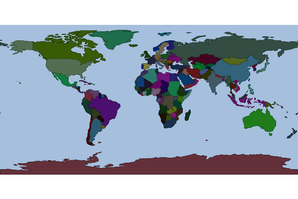
Vector Unique Values From Text File
Create a unique values vector style from a text file
geo-shell> style vector uniquevaluesfromtext --field UnitSymbol --textFile src/test/resources/mars/I1802ABC_geo_units_RGBlut.txt --geometryType polygon --styleFile examples/style_vector_uniquevaluesfromtext.sld
Name |
Description |
Mandatory |
Specified Default |
Unspecified Default |
field |
The field name |
true |
||
geometryType |
The geometry type |
true |
||
textFile |
The input text file |
true |
||
styleFile |
The output sld or ysld file |
true |
geo-shell> workspace open --name mars --params src/test/resources/mars
Workspace mars opened!
geo-shell> layer open --workspace mars --layer geo_units_oc_dd --name mars
Opened Workspace mars Layer geo_units_oc_dd as mars
geo-shell> style vector uniquevaluesfromtext --field UnitSymbol --textFile src/test/resources/mars/I1802ABC_geo_units_RGBlut.txt --geometryType polygon --styleFile examples/style_vector_uniquevaluesfromtext.sld
Create a unique values style from /home/runner/work/geo-shell/geo-shell/src/test/resources/mars/I1802ABC_geo_units_RGBlut.txt for UnitSymbol and polygon to /home/runner/work/geo-shell/geo-shell/examples/style_vector_uniquevaluesfromtext.sld
geo-shell> layer style set --name mars --style examples/style_vector_uniquevaluesfromtext.sld
Style /home/runner/work/geo-shell/geo-shell/examples/style_vector_uniquevaluesfromtext.sld set on mars
geo-shell> map open --name map
Map map opened!
geo-shell> map add layer --name map --layer mars
Added mars layer to map map
geo-shell> map draw --name map --file examples/style_vector_uniquevaluesfromtext.png
Done drawing /home/runner/work/geo-shell/geo-shell/examples/style_vector_uniquevaluesfromtext.png!
geo-shell> map close --name map
Map map closed!
<?xml version="1.0" encoding="UTF-8"?><sld:StyledLayerDescriptor xmlns:sld="http://www.opengis.net/sld" xmlns="http://www.opengis.net/sld" xmlns:gml="http://www.opengis.net/gml" xmlns:ogc="http://www.opengis.net/ogc" version="1.0.0">
  <sld:UserLayer>
    <sld:LayerFeatureConstraints>
      <sld:FeatureTypeConstraint/>
    </sld:LayerFeatureConstraints>
    <sld:UserStyle>
      <sld:Name>Default Styler</sld:Name>
      <sld:FeatureTypeStyle>
        <sld:Name>name</sld:Name>
        <sld:Rule>
          <ogc:Filter>
            <ogc:PropertyIsEqualTo>
              <ogc:PropertyName>UnitSymbol</ogc:PropertyName>
              <ogc:Literal>AHa</ogc:Literal>
            </ogc:PropertyIsEqualTo>
          </ogc:Filter>
          <sld:PolygonSymbolizer>
            <sld:Fill>
              <sld:CssParameter name="fill">#af006f</sld:CssParameter>
            </sld:Fill>
          </sld:PolygonSymbolizer>
          <sld:LineSymbolizer>
            <sld:Stroke>
              <sld:CssParameter name="stroke">#7a004d</sld:CssParameter>
              <sld:CssParameter name="stroke-width">0.5</sld:CssParameter>
            </sld:Stroke>
          </sld:LineSymbolizer>
        </sld:Rule>
        <sld:Rule>
          <ogc:Filter>
            <ogc:PropertyIsEqualTo>
              <ogc:PropertyName>UnitSymbol</ogc:PropertyName>
              <ogc:Literal>AHat</ogc:Literal>
            </ogc:PropertyIsEqualTo>
          </ogc:Filter>
          <sld:PolygonSymbolizer>
            <sld:Fill>
              <sld:CssParameter name="fill">#c03616</sld:CssParameter>
            </sld:Fill>
          </sld:PolygonSymbolizer>
          <sld:LineSymbolizer>
            <sld:Stroke>
              <sld:CssParameter name="stroke">#86250f</sld:CssParameter>
              <sld:CssParameter name="stroke-width">0.5</sld:CssParameter>
            </sld:Stroke>
          </sld:LineSymbolizer>
        </sld:Rule>
        <sld:Rule>
          <ogc:Filter>
            <ogc:PropertyIsEqualTo>
Raster Default
Create a default raster style.
geo-shell> style raster default --raster pc --opacity 0.75 --file examples/style_raster_default.sld
Name |
Description |
Mandatory |
Specified Default |
Unspecified Default |
raster |
The Raster |
true |
||
opacity |
The opacity |
false |
1.0 |
1.0 |
file |
The output file |
true |
geo-shell> format open --name pierce_county --input src/test/resources/pc.tif
Format pierce_county opened!
geo-shell> raster open --format pierce_county --raster pc --name pc
Opened Format pierce_county Raster pc as pc
geo-shell> style raster default --raster pc --opacity 0.75 --file examples/style_raster_default.sld
Default Raster Style for pc written to /home/runner/work/geo-shell/geo-shell/examples/style_raster_default.sld!
geo-shell> raster style set --name pc --style examples/style_raster_default.sld
Style /home/runner/work/geo-shell/geo-shell/examples/style_raster_default.sld set on pc
geo-shell> map open --name map
Map map opened!
geo-shell> map add raster --name map --raster pc
Added pc layer to map map
geo-shell> map draw --name map --file examples/style_raster_default.png
Done drawing /home/runner/work/geo-shell/geo-shell/examples/style_raster_default.png!
geo-shell> map close --name map
Map map closed!
<?xml version="1.0" encoding="UTF-8"?><sld:StyledLayerDescriptor xmlns:sld="http://www.opengis.net/sld" xmlns="http://www.opengis.net/sld" xmlns:gml="http://www.opengis.net/gml" xmlns:ogc="http://www.opengis.net/ogc" version="1.0.0">
  <sld:UserLayer>
    <sld:LayerFeatureConstraints>
      <sld:FeatureTypeConstraint/>
    </sld:LayerFeatureConstraints>
    <sld:UserStyle>
      <sld:Name>Default Styler</sld:Name>
      <sld:FeatureTypeStyle>
        <sld:Name>name</sld:Name>
        <sld:Rule>
          <sld:RasterSymbolizer>
            <sld:Geometry>
              <ogc:Literal>grid</ogc:Literal>
            </sld:Geometry>
            <sld:Opacity>0.75</sld:Opacity>
            <sld:ContrastEnhancement/>
          </sld:RasterSymbolizer>
        </sld:Rule>
      </sld:FeatureTypeStyle>
    </sld:UserStyle>
  </sld:UserLayer>
</sld:StyledLayerDescriptor>
Raster Color Map
Create a color map raster style.
geo-shell> style raster colormap --raster pc --values "25=#9fd182,470=#3e7f3c,920=#133912,1370=#08306b,1820=#fffff5" --file examples/style_raster_colormap.sld
Name |
Description |
Mandatory |
Specified Default |
Unspecified Default |
raster |
The Raster |
true |
||
opacity |
The opacity |
false |
1.0 |
1.0 |
values |
The comma delimited list of values (key=value) |
true |
||
type |
The type (intervals, values, ramp) |
false |
ramp |
ramp |
extended |
Whether to use extended colors or not |
false |
false |
false |
file |
The output file |
true |
geo-shell> format open --name pierce_county --input src/test/resources/pc.tif
Format pierce_county opened!
geo-shell> raster open --format pierce_county --raster pc --name pc
Opened Format pierce_county Raster pc as pc
geo-shell> style raster colormap --raster pc --values "25=#9fd182,470=#3e7f3c,920=#133912,1370=#08306b,1820=#fffff5" --file examples/style_raster_colormap.sld
Colormap Raster Style for pc written to /home/runner/work/geo-shell/geo-shell/examples/style_raster_colormap.sld!
geo-shell> raster style set --name pc --style examples/style_raster_colormap.sld
Style /home/runner/work/geo-shell/geo-shell/examples/style_raster_colormap.sld set on pc
geo-shell> map open --name map
Map map opened!
geo-shell> map add raster --name map --raster pc
Added pc layer to map map
geo-shell> map draw --name map --file examples/style_raster_colormap.png
Done drawing /home/runner/work/geo-shell/geo-shell/examples/style_raster_colormap.png!
geo-shell> map close --name map
Map map closed!
<?xml version="1.0" encoding="UTF-8"?><sld:StyledLayerDescriptor xmlns:sld="http://www.opengis.net/sld" xmlns="http://www.opengis.net/sld" xmlns:gml="http://www.opengis.net/gml" xmlns:ogc="http://www.opengis.net/ogc" version="1.0.0">
  <sld:UserLayer>
    <sld:LayerFeatureConstraints>
      <sld:FeatureTypeConstraint/>
    </sld:LayerFeatureConstraints>
    <sld:UserStyle>
      <sld:Name>Default Styler</sld:Name>
      <sld:FeatureTypeStyle>
        <sld:Name>name</sld:Name>
        <sld:Rule>
          <sld:RasterSymbolizer>
            <sld:Geometry>
              <ogc:Literal>grid</ogc:Literal>
            </sld:Geometry>
            <sld:ColorMap>
              <sld:ColorMapEntry color="#9fd182" opacity="1.0" quantity="25"/>
              <sld:ColorMapEntry color="#3e7f3c" opacity="1.0" quantity="470"/>
              <sld:ColorMapEntry color="#133912" opacity="1.0" quantity="920"/>
              <sld:ColorMapEntry color="#08306b" opacity="1.0" quantity="1370"/>
              <sld:ColorMapEntry color="#fffff5" opacity="1.0" quantity="1820"/>
            </sld:ColorMap>
            <sld:ContrastEnhancement/>
          </sld:RasterSymbolizer>
        </sld:Rule>
      </sld:FeatureTypeStyle>
    </sld:UserStyle>
  </sld:UserLayer>
</sld:StyledLayerDescriptor>
Raster Palette Color Map
Create a color map raster style from a color palette.
geo-shell> style raster palette colormap --min 1 --max 50 --palette MutedTerrain --number 20 --file examples/style_raster_palette_colormap.sld
Name |
Description |
Mandatory |
Specified Default |
Unspecified Default |
min |
The min value |
true |
||
max |
The max value |
true |
||
palette |
The color palette name (from Color Brewer) |
true |
||
number |
The number of categories |
true |
||
type |
The type of interpolation |
false |
ramp |
ramp |
extended |
Whether to use extended colors |
false |
false |
false |
opacity |
The opacity |
false |
1.0 |
1.0 |
file |
The output file |
true |
geo-shell> format open --name high --input src/test/resources/high.tif
Format high opened!
geo-shell> raster open --format high --raster high --name high
Opened Format high Raster high as high
geo-shell> style raster palette colormap --min 1 --max 50 --palette MutedTerrain --number 20 --file examples/style_raster_palette_colormap.sld
Colormap Palette Raster Style written to /home/runner/work/geo-shell/geo-shell/examples/style_raster_palette_colormap.sld!
geo-shell> raster style set --name high --style examples/style_raster_palette_colormap.sld
Style /home/runner/work/geo-shell/geo-shell/examples/style_raster_palette_colormap.sld set on high
geo-shell> map open --name map
Map map opened!
geo-shell> map add raster --name map --raster high
Added high layer to map map
<?xml version="1.0" encoding="UTF-8"?><sld:StyledLayerDescriptor xmlns:sld="http://www.opengis.net/sld" xmlns="http://www.opengis.net/sld" xmlns:gml="http://www.opengis.net/gml" xmlns:ogc="http://www.opengis.net/ogc" version="1.0.0">
  <sld:UserLayer>
    <sld:LayerFeatureConstraints>
      <sld:FeatureTypeConstraint/>
    </sld:LayerFeatureConstraints>
    <sld:UserStyle>
      <sld:Name>Default Styler</sld:Name>
      <sld:FeatureTypeStyle>
        <sld:Name>name</sld:Name>
        <sld:Rule>
          <sld:RasterSymbolizer>
            <sld:Geometry>
              <ogc:Literal>grid</ogc:Literal>
            </sld:Geometry>
            <sld:ColorMap>
              <sld:ColorMapEntry color="#CEE1E8" opacity="1.0" quantity="1.0"/>
              <sld:ColorMapEntry color="#7CBCB5" opacity="1.0" quantity="8.0"/>
              <sld:ColorMapEntry color="#82B36D" opacity="1.0" quantity="15.0"/>
              <sld:ColorMapEntry color="#94C279" opacity="1.0" quantity="22.0"/>
              <sld:ColorMapEntry color="#D1DE8D" opacity="1.0" quantity="29.0"/>
              <sld:ColorMapEntry color="#EDECC3" opacity="1.0" quantity="36.0"/>
              <sld:ColorMapEntry color="#CCAFB4" opacity="1.0" quantity="43.0"/>
              <sld:ColorMapEntry color="#C99884" opacity="1.0" quantity="50.0"/>
            </sld:ColorMap>
            <sld:ContrastEnhancement/>
          </sld:RasterSymbolizer>
        </sld:Rule>
      </sld:FeatureTypeStyle>
    </sld:UserStyle>
  </sld:UserLayer>
</sld:StyledLayerDescriptor>
Style Repository Save
Save a style to a style repository
geo-shell> style repository save --type sqlite --options file=target/styles.db --layerName fields --styleName fields --styleFile examples/fields.sld
Name |
Description |
Mandatory |
Specified Default |
Unspecified Default |
type |
The type of style repository (directory, nested-directory, h2, sqlite, postgres) |
true |
||
options |
The style repository options |
true |
||
layerName |
The layer name |
true |
||
styleName |
The style name |
true |
||
styleFile |
The style file (sld or css) |
true |
geo-shell> style create --params "stroke=black stroke-width=0.25 fill=wheat" --file examples/fields.sld
Style stroke=black stroke-width=0.25 fill=wheat written to /home/runner/work/geo-shell/geo-shell/examples/fields.sld!
geo-shell> style repository save --type sqlite --options file=target/styles.db --layerName fields --styleName fields --styleFile examples/fields.sld
Style fields for Layer fields saved to sqlite
Style Repository List
List styles in a style repository
geo-shell> style repository list --type h2 --options file=target/styles_county.db
Name |
Description |
Mandatory |
Specified Default |
Unspecified Default |
type |
The type of style repository (directory, nested-directory, h2, sqlite, postgres) |
true |
||
options |
The style repository options |
true |
||
layerName |
The layer name |
false |
geo-shell> style create --params "stroke=black stroke-width=1.0" --file examples/roads.sld
Style stroke=black stroke-width=1.0 written to /home/runner/work/geo-shell/geo-shell/examples/roads.sld!
geo-shell> style create --params "stroke=red stroke-width=0.50" --file examples/parcels.sld
Style stroke=red stroke-width=0.50 written to /home/runner/work/geo-shell/geo-shell/examples/parcels.sld!
geo-shell> style repository save --type h2 --options file=target/styles_county.db --layerName roads --styleName roads --styleFile examples/roads.sld
Style roads for Layer roads saved to h2
geo-shell> style repository save --type h2 --options file=target/styles_county.db --layerName parcels --styleName parcels --styleFile examples/parcels.sld
Style parcels for Layer parcels saved to h2
geo-shell> style repository list --type h2 --options file=target/styles_county.db
roads roads
parcels parcels
geo-shell> style repository list --type h2 --options file=target/styles_county.db --layerName roads
roads roads
Style Repository Delete
Delete a style from a style repository
geo-shell> style repository delete --type directory --options file=examples/styles --layerName parcels --styleName parcels
Name |
Description |
Mandatory |
Specified Default |
Unspecified Default |
type |
The type of style repository (directory, nested-directory, h2, sqlite, postgres) |
true |
||
options |
The style repository options |
true |
||
layerName |
The layer name |
true |
||
styleName |
The style name |
true |
geo-shell> style create --params "stroke=black stroke-width=1.0" --file examples/roads.sld
Style stroke=black stroke-width=1.0 written to /home/runner/work/geo-shell/geo-shell/examples/roads.sld!
geo-shell> style create --params "stroke=red stroke-width=0.50" --file examples/parcels.sld
Style stroke=red stroke-width=0.50 written to /home/runner/work/geo-shell/geo-shell/examples/parcels.sld!
geo-shell> style repository save --type directory --options file=examples/styles --layerName roads --styleName roads --styleFile examples/roads.sld
Style roads for Layer roads saved to directory
geo-shell> style repository save --type directory --options file=examples/styles --layerName parcels --styleName parcels --styleFile examples/parcels.sld
Style parcels for Layer parcels saved to directory
geo-shell> style repository list --type directory --options file=examples/styles
parcels parcels
roads roads
geo-shell> style repository delete --type directory --options file=examples/styles --layerName parcels --styleName parcels
Style parcels for Layer parcels deleted from directory
geo-shell> style repository list --type directory --options file=examples/styles
roads roads
Style Repository Get
Get a style from a style repository
geo-shell> style repository get --type nested-directory --options file=examples/county_styles --layerName roads --styleName roads
Name |
Description |
Mandatory |
Specified Default |
Unspecified Default |
type |
The type of style repository (directory, nested-directory, h2, sqlite, postgres) |
true |
||
options |
The style repository options |
true |
||
layerName |
The layer name |
true |
||
styleName |
The style name |
true |
||
styleFile |
The style file (sld or css) |
false |
geo-shell> style create --params "stroke=black stroke-width=1.0" --file examples/roads.sld
Style stroke=black stroke-width=1.0 written to /home/runner/work/geo-shell/geo-shell/examples/roads.sld!
geo-shell> style create --params "stroke=red stroke-width=0.50" --file examples/parcels.sld
Style stroke=red stroke-width=0.50 written to /home/runner/work/geo-shell/geo-shell/examples/parcels.sld!
geo-shell> style repository save --type nested-directory --options file=examples/county_styles --layerName roads --styleName roads --styleFile examples/roads.sld
Style roads for Layer roads saved to nested-directory
geo-shell> style repository save --type nested-directory --options file=examples/county_styles --layerName parcels --styleName parcels --styleFile examples/parcels.sld
Style parcels for Layer parcels saved to nested-directory
geo-shell> style repository get --type nested-directory --options file=examples/county_styles --layerName roads --styleName roads
<?xml version="1.0" encoding="UTF-8"?><sld:StyledLayerDescriptor xmlns:sld="http://www.opengis.net/sld" xmlns="http://www.opengis.net/sld" xmlns:gml="http://www.opengis.net/gml" xmlns:ogc="http://www.opengis.net/ogc" version="1.0.0">
<sld:UserLayer>
<sld:LayerFeatureConstraints>
<sld:FeatureTypeConstraint/>
</sld:LayerFeatureConstraints>
<sld:UserStyle>
<sld:Name>Default Styler</sld:Name>
<sld:FeatureTypeStyle>
<sld:Name>name</sld:Name>
<sld:Rule>
<sld:LineSymbolizer>
<sld:Stroke/>
</sld:LineSymbolizer>
</sld:Rule>
</sld:FeatureTypeStyle>
</sld:UserStyle>
</sld:UserLayer>
</sld:StyledLayerDescriptor>
geo-shell> style repository get --type nested-directory --options file=examples/county_styles --layerName parcels --styleName parcels --styleFile examples/roads_simple.sld
Style parcels for Layer parcels saved to roads_simple.sld
Style Repository Copy
Copy styles from one repository to another
geo-shell> style repository copy --inputType sqlite --inputOptions file=target/my-styles.db --outputType h2 --outputOptions file=target/h2-styles.db
Name |
Description |
Mandatory |
Specified Default |
Unspecified Default |
inputType |
The type of style repository (directory, nested-directory, h2, sqlite, postgres) |
true |
||
inputOptions |
The style repository options |
true |
||
outputType |
The type of style repository (directory, nested-directory, h2, sqlite, postgres) |
true |
||
outputOptions |
The style repository options |
true |
geo-shell> style create --params "stroke=black stroke-width=1.0" --file examples/roads.sld
Style stroke=black stroke-width=1.0 written to /home/runner/work/geo-shell/geo-shell/examples/roads.sld!
geo-shell> style create --params "stroke=red stroke-width=0.50" --file examples/parcels.sld
Style stroke=red stroke-width=0.50 written to /home/runner/work/geo-shell/geo-shell/examples/parcels.sld!
geo-shell> style repository save --type sqlite --options file=target/my-styles.db --layerName roads --styleName roads --styleFile examples/roads.sld
Style roads for Layer roads saved to sqlite
geo-shell> style repository save --type sqlite --options file=target/my-styles.db --layerName parcels --styleName parcels --styleFile examples/parcels.sld
Style parcels for Layer parcels saved to sqlite
geo-shell> style repository list --type sqlite --options file=target/my-styles.db
roads roads
parcels parcels
geo-shell> style repository copy --inputType sqlite --inputOptions file=target/my-styles.db --outputType h2 --outputOptions file=target/h2-styles.db
Copy styles from sqlite to h2
geo-shell> style repository list --type h2 --options file=target/h2-styles.db
roads roads
parcels parcels
Map
Open
Open a new Map.
geo-shell> map open --name earth
Name |
Description |
Mandatory |
Specified Default |
Unspecified Default |
name |
The map name |
true |
geo-shell> map open --name earth
Map earth opened!
geo-shell> map close --name earth
Map earth closed!
Close
Close a Map.
geo-shell> map close --name earth
Name |
Description |
Mandatory |
Specified Default |
Unspecified Default |
name |
The map name |
true |
geo-shell> map open --name earth
Map earth opened!
geo-shell> map close --name earth
Map earth closed!
List
List open Maps.
geo-shell> map list
| No parameters |
geo-shell> map open --name earth
Map earth opened!
geo-shell> map open --name us
Map us opened!
geo-shell> map list
earth
us
geo-shell> map close --name earth
Map earth closed!
geo-shell> map close --name us
Map us closed!
Add Layer
Add a Vector Layer.
geo-shell> map add layer --name world --layer countries
Name |
Description |
Mandatory |
Specified Default |
Unspecified Default |
name |
The map name |
true |
||
layer |
The layer |
true |
||
mapLayerName |
The map layer name |
false |
geo-shell> map open --name world
Map world opened!
geo-shell> workspace open --name naturalearth --params examples/naturalearth.gpkg
Workspace naturalearth opened!
geo-shell> layer open --workspace naturalearth --layer countries --name countries
Opened Workspace naturalearth Layer countries as countries
geo-shell> layer style set --name countries --style examples/countries.sld
Style /home/runner/work/geo-shell/geo-shell/examples/countries.sld set on countries
geo-shell> layer open --workspace naturalearth --layer ocean --name ocean
Opened Workspace naturalearth Layer ocean as ocean
geo-shell> layer style set --name ocean --style examples/ocean.sld
Style /home/runner/work/geo-shell/geo-shell/examples/ocean.sld set on ocean
geo-shell> map add layer --name world --layer ocean
Added ocean layer to map world
geo-shell> map add layer --name world --layer countries
Added countries layer to map world
geo-shell> map draw --name world --file examples/map_add_layer.png
Done drawing /home/runner/work/geo-shell/geo-shell/examples/map_add_layer.png!
geo-shell> map close --name world
Map world closed!

Add Raster
Add a Raster Layer.
geo-shell> map add raster --name world --raster earth
Name |
Description |
Mandatory |
Specified Default |
Unspecified Default |
name |
The map name |
true |
||
raster |
The raster |
true |
||
mapLayerName |
The map layer name |
false |
geo-shell> map open --name world
Map world opened!
geo-shell> format open --name earth --input src/test/resources/earth.tif
Format earth opened!
geo-shell> raster open --format earth --raster earth --name earth
Opened Format earth Raster earth as earth
geo-shell> map add raster --name world --raster earth
Added earth layer to map world
geo-shell> workspace open --name naturalearth --params examples/naturalearth.gpkg
Workspace naturalearth opened!
geo-shell> layer open --workspace naturalearth --layer countries --name countries
Opened Workspace naturalearth Layer countries as countries
geo-shell> style create --params "stroke=black stroke-width=0.1" --file examples/outline.sld
Style stroke=black stroke-width=0.1 written to /home/runner/work/geo-shell/geo-shell/examples/outline.sld!
geo-shell> layer style set --name countries --style examples/outline.sld
Style /home/runner/work/geo-shell/geo-shell/examples/outline.sld set on countries
geo-shell> map add layer --name world --layer countries
Added countries layer to map world
geo-shell> map draw --name world --file examples/map_add_raster.png
Done drawing /home/runner/work/geo-shell/geo-shell/examples/map_add_raster.png!
geo-shell> map close --name world
Map world closed!

Add Tile Layer
Add a Tile Layer.
geo-shell> map add tile --name world --tile tiles
Name |
Description |
Mandatory |
Specified Default |
Unspecified Default |
name |
The map name |
true |
||
tile |
The tile |
true |
||
mapLayerName |
The map layer name |
false |
geo-shell> map open --name world
Map world opened!
geo-shell> tile open --name tiles --params src/test/resources/countries.mbtiles
Tile Layer tiles opened!
geo-shell> map add tile --name world --tile tiles
Added tiles layer to map world
geo-shell> workspace open --name naturalearth --params examples/naturalearth.gpkg
Workspace naturalearth opened!
geo-shell> layer open --workspace naturalearth --layer places --name places
Opened Workspace naturalearth Layer places as places
geo-shell> style vector default --layer places --color #1E90FF --file examples/places.sld
Default Vector Style for places written to /home/runner/work/geo-shell/geo-shell/examples/places.sld!
geo-shell> layer style set --name places --style examples/places.sld
Style /home/runner/work/geo-shell/geo-shell/examples/places.sld set on places
geo-shell> map add layer --name world --layer places
Added places layer to map world
geo-shell> map draw --name world --width 400 --height 400 --file examples/map_add_tile.png
Done drawing /home/runner/work/geo-shell/geo-shell/examples/map_add_tile.png!
geo-shell> map close --name world
Map world closed!
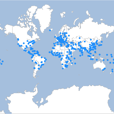
Remove Layer
Remove a Layer.
geo-shell> map remove layer --name world --layer countries
Name |
Description |
Mandatory |
Specified Default |
Unspecified Default |
name |
The map name |
true |
||
layer |
The layer name |
true |
geo-shell> map open --name world
Map world opened!
geo-shell> format open --name earth --input src/test/resources/earth.tif
Format earth opened!
geo-shell> raster open --format earth --raster earth --name earth
Opened Format earth Raster earth as earth
geo-shell> map add raster --name world --raster earth
Added earth layer to map world
geo-shell> workspace open --name naturalearth --params examples/naturalearth.gpkg
Workspace naturalearth opened!
geo-shell> layer open --workspace naturalearth --layer countries --name countries
Opened Workspace naturalearth Layer countries as countries
geo-shell> style create --params "stroke=black stroke-width=0.1" --file examples/outline.sld
Style stroke=black stroke-width=0.1 written to /home/runner/work/geo-shell/geo-shell/examples/outline.sld!
geo-shell> layer style set --name countries --style examples/outline.sld
Style /home/runner/work/geo-shell/geo-shell/examples/outline.sld set on countries
geo-shell> map add layer --name world --layer countries
Added countries layer to map world
geo-shell> map layers --name world
earth
countries
geo-shell> map remove layer --name world --layer countries
Removed countries layer from map world
geo-shell> map layers --name world
earth
geo-shell> map close --name world
Map world closed!
Reorder
Reorder a Layer in the Map.
Name |
Description |
Mandatory |
Specified Default |
Unspecified Default |
name |
The map name |
true |
||
layer |
The layer name |
true |
||
order |
The order parameters |
true |
geo-shell> map open --name world
Map world opened!
geo-shell> workspace open --name naturalearth --params examples/naturalearth.gpkg
Workspace naturalearth opened!
geo-shell> layer open --workspace naturalearth --layer countries --name countries
Opened Workspace naturalearth Layer countries as countries
geo-shell> style create --params "stroke=black stroke-width=0.1" --file examples/outline.sld
Style stroke=black stroke-width=0.1 written to /home/runner/work/geo-shell/geo-shell/examples/outline.sld!
geo-shell> layer style set --name countries --style examples/outline.sld
Style /home/runner/work/geo-shell/geo-shell/examples/outline.sld set on countries
geo-shell> map add layer --name world --layer countries
Added countries layer to map world
geo-shell> format open --name earth --input src/test/resources/earth.tif
Format earth opened!
geo-shell> raster open --format earth --raster earth --name earth
Opened Format earth Raster earth as earth
geo-shell> map add raster --name world --raster earth
Added earth layer to map world
geo-shell> map layers --name world
countries
earth
geo-shell> map reorder --name world --layer countries --order 1
Moved countries from 0 to 1
geo-shell> map layers --name world
earth
countries
geo-shell> map draw --name world --file examples/map_reorder.png
Done drawing /home/runner/work/geo-shell/geo-shell/examples/map_reorder.png!
geo-shell> map close --name world
Map world closed!
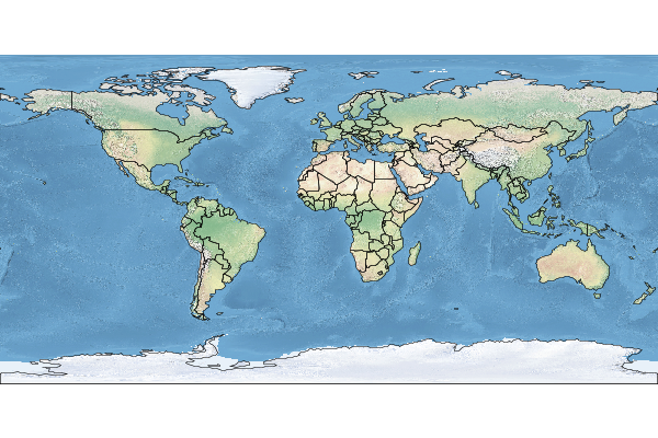
Layers
List the Map’s Layers.
geo-shell> map layers --name world
Name |
Description |
Mandatory |
Specified Default |
Unspecified Default |
name |
The map name |
true |
geo-shell> map open --name world
Map world opened!
geo-shell> format open --name earth --input src/test/resources/earth.tif
Format earth opened!
geo-shell> raster open --format earth --raster earth --name earth
Opened Format earth Raster earth as earth
geo-shell> map add raster --name world --raster earth
Added earth layer to map world
geo-shell> workspace open --name naturalearth --params examples/naturalearth.gpkg
Workspace naturalearth opened!
geo-shell> layer open --workspace naturalearth --layer countries --name countries
Opened Workspace naturalearth Layer countries as countries
geo-shell> style create --params "stroke=black stroke-width=0.1" --file examples/outline.sld
Style stroke=black stroke-width=0.1 written to /home/runner/work/geo-shell/geo-shell/examples/outline.sld!
geo-shell> layer style set --name countries --style examples/outline.sld
Style /home/runner/work/geo-shell/geo-shell/examples/outline.sld set on countries
geo-shell> map add layer --name world --layer countries
Added countries layer to map world
geo-shell> map layers --name world
earth
countries
geo-shell> map close --name world
Map world closed!
Draw
Draw a map.
geo-shell> map draw --name world --file examples/map_draw.png
Name |
Description |
Mandatory |
Specified Default |
Unspecified Default |
name |
The map name |
true |
||
bounds |
The Bounds |
false |
||
projection |
The Projection |
false |
||
width |
The width |
false |
600 |
600 |
height |
The height |
false |
400 |
400 |
type |
The type |
false |
png |
png |
file |
The file |
false |
||
background-color |
The background color |
false |
geo-shell> map open --name world
Map world opened!
geo-shell> workspace open --name naturalearth --params examples/naturalearth.gpkg
Workspace naturalearth opened!
geo-shell> layer open --workspace naturalearth --layer countries --name countries
Opened Workspace naturalearth Layer countries as countries
geo-shell> layer style set --name countries --style examples/countries.sld
Style /home/runner/work/geo-shell/geo-shell/examples/countries.sld set on countries
geo-shell> layer open --workspace naturalearth --layer ocean --name ocean
Opened Workspace naturalearth Layer ocean as ocean
geo-shell> layer style set --name ocean --style examples/ocean.sld
Style /home/runner/work/geo-shell/geo-shell/examples/ocean.sld set on ocean
geo-shell> map add layer --name world --layer ocean
Added ocean layer to map world
geo-shell> map add layer --name world --layer countries
Added countries layer to map world
geo-shell> map draw --name world --file examples/map_draw.png
Done drawing /home/runner/work/geo-shell/geo-shell/examples/map_draw.png!
geo-shell> map close --name world
Map world closed!
Display
Display a map in a GUI.
geo-shell> map display --name world
Name |
Description |
Mandatory |
Specified Default |
Unspecified Default |
name |
The map name |
true |
||
bounds |
The Bounds |
false |
||
projection |
The Projection |
false |
||
width |
The width |
false |
600 |
600 |
height |
The height |
false |
400 |
400 |
background-color |
The background color |
false |
geo-shell> map open --name world
Map world opened!
geo-shell> workspace open --name naturalearth --params examples/naturalearth.gpkg
Workspace naturalearth opened!
geo-shell> layer open --workspace naturalearth --layer countries --name countries
Opened Workspace naturalearth Layer countries as countries
geo-shell> layer style set --name countries --style examples/countries.sld
Style /Users/jericks/Projects/geo-shell/examples/countries.sld set on countries
geo-shell> layer open --workspace naturalearth --layer ocean --name ocean
Opened Workspace naturalearth Layer ocean as ocean
geo-shell> layer style set --name ocean --style examples/ocean.sld
Style /Users/jericks/Projects/geo-shell/examples/ocean.sld set on ocean
geo-shell> map add layer --name world --layer ocean
Added ocean layer to map world
geo-shell> map add layer --name world --layer countries
Added countries layer to map world
geo-shell> map display --name world
Dislaying…
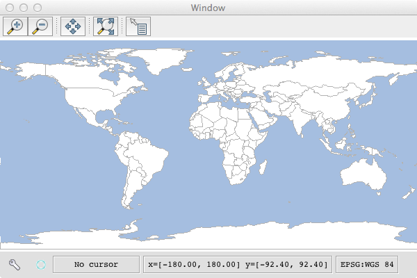
Map Cube
Draw a map cube.
geo-shell> map cube --name world --file examples/map_cube.png --title World --source NaturalEarth --draw-tabs true --draw-outline true
Name |
Description |
Mandatory |
Specified Default |
Unspecified Default |
name |
The map name |
true |
||
draw-outline |
Whether to draw outline or now |
false |
false |
false |
draw-tabs |
Whether to draw tabs or not |
false |
false |
false |
tab-size |
The size of the tabs |
false |
30 |
30 |
title |
The map title |
false |
||
source |
The map source |
false |
||
type |
The type |
false |
png |
png |
file |
The file |
false |
geo-shell> map open --name world
Map world opened!
geo-shell> workspace open --name naturalearth --params examples/naturalearth.gpkg
Workspace naturalearth opened!
geo-shell> layer open --workspace naturalearth --layer countries --name countries
Opened Workspace naturalearth Layer countries as countries
geo-shell> layer style set --name countries --style examples/countries.sld
Style /home/runner/work/geo-shell/geo-shell/examples/countries.sld set on countries
geo-shell> layer open --workspace naturalearth --layer ocean --name ocean
Opened Workspace naturalearth Layer ocean as ocean
geo-shell> layer style set --name ocean --style examples/ocean.sld
Style /home/runner/work/geo-shell/geo-shell/examples/ocean.sld set on ocean
geo-shell> map add layer --name world --layer ocean
Added ocean layer to map world
geo-shell> map add layer --name world --layer countries
Added countries layer to map world
geo-shell> map cube --name world --file examples/map_cube.png --title World --source NaturalEarth --draw-tabs true --draw-outline true
Done drawing /home/runner/work/geo-shell/geo-shell/examples/map_cube.png!
geo-shell> map close --name world
Map world closed!
Built in
Help
List all commands usage
Name |
Description |
Mandatory |
Specified Default |
Unspecified Default |
Command name to provide help for |
false |
View all commands
geo-shell> help
* ! - Allows execution of operating system (OS) commands
* // - Inline comment markers (start of line only)
* ; - Inline comment markers (start of line only)
* clear - Clears the console
* cls - Clears the console
* date - Displays the local date and time
* download - Download a URL to a file.
* exit - Exits the shell
* format close - Close a Raster Format.
* format list - List open Raster Formats.
Get help for a command
geo-shell> help layer open
Keyword: layer open
Description: Open a Layer.
Keyword: workspace
Help: The Workspace name
Mandatory: true
Default if specified: 'NULL'
Default if unspecified: 'NULL'
Keyword: layer
Help: The Layer name
Mandatory: true
Default if specified: 'NULL'
Default if unspecified: 'NULL'
Keyword: name
Help: The name
Mandatory: false
Default if specified: 'NULL'
Default if unspecified: 'NULL'
* layer open - Open a Layer.
Run OS Command
Allows execution of operating system (OS) commands
geo-shell> ! ls src/test/resources/mars
Name |
Description |
Mandatory |
Specified Default |
Unspecified Default |
The command to execute |
false |
geo-shell> ! ls src/test/resources/mars
I1802ABC_geo_units_RGBlut.txt
geo_units_oc_dd.dbf
geo_units_oc_dd.prj
geo_units_oc_dd.qix
geo_units_oc_dd.sbn
geo_units_oc_dd.sbx
geo_units_oc_dd.shp
geo_units_oc_dd.shp.xml
geo_units_oc_dd.shx
Date
Displays the local date and time
geo-shell> date
| No parameters |
geo-shell> date
Sunday, November 5, 2023 at 10:07:28 PM Coordinated Universal Time
Script
Parses the specified resource file and executes its commands
geo-shell> script src/test/resources/layer_count.txt
Name |
Description |
Mandatory |
Specified Default |
Unspecified Default |
The file to locate and execute |
true |
|||
lineNumbers |
Display line numbers when executing the script |
false |
true |
false |
workspace open --name naturalearth --params src/test/resources/naturalearth.gpkg

layer open --workspace naturalearth --layer countries --name countries

layer count --name countries

workspace close --name naturalearth
geo-shell> script src/test/resources/layer_count.txt
Workspace naturalearth opened!
Opened Workspace naturalearth Layer countries as countries
177
Workspace naturalearth closed!
System Properties
Shows the shell’s properties
geo-shell> system properties
| No parameters |
geo-shell> system properties
awt.toolkit = sun.awt.X11.XToolkit
basedir = /home/runner/work/geo-shell/geo-shell
file.encoding = UTF-8
file.separator = /
java.awt.graphicsenv = sun.awt.X11GraphicsEnvironment
Download
Download a URL to a file.
geo-shell> download --url https://astropedia.astrogeology.usgs.gov/download/Mars/Geology/Mars15MGeologicGISRenovation.zip --file mars.zip --overwrite false
Name |
Description |
Mandatory |
Specified Default |
Unspecified Default |
url |
The url |
true |
||
file |
The file |
true |
||
overwrite |
Whether to overwrite the file or not |
false |
true |
true |
geo-shell> download --url https://astropedia.astrogeology.usgs.gov/download/Mars/Geology/Mars15MGeologicGISRenovation.zip --file mars.zip --overwrite false
Downloading https://astropedia.astrogeology.usgs.gov/download/Mars/Geology/Mars15MGeologicGISRenovation.zip to /Users/jericks/Projects/geo-shell/mars.zip…
geo-shell> unzip --file mars.zip --directory mars
Unzipping /Users/jericks/Projects/geo-shell/mars.zip to /Users/jericks/Projects/geo-shell/mars
geo-shell> style vector uniquevaluesfromtext --field UnitSymbol --geometryType Polygon --styleFile mars/units.sld --textFile mars/I1802ABC_Mars_global_geology/I1802ABC_geo_units_RGBlut.txt
Create a unique values style from /Users/jericks/Projects/geo-shell/mars/I1802ABC_Mars_global_geology/I1802ABC_geo_units_RGBlut.txt for UnitSymbol and Polygon to /Users/jericks/Projects/geo-shell/mars/units.sld
geo-shell> workspace open --name mars --params mars/I1802ABC_Mars_global_geology/Shapefiles/I1802ABC_Mars2000_Sphere/geo_units_oc_dd.shp
Workspace mars opened!
geo-shell> layer open --workspace mars --layer geo_units_oc_dd
Opened Workspace mars Layer geo_units_oc_dd as mars:geo_units_oc_dd
geo-shell> layer style set --name mars:geo_units_oc_dd --style mars/units.sld
Style /Users/jericks/Projects/geo-shell/mars/units.sld set on mars:geo_units_oc_dd
geo-shell> map open --name mars
Map mars opened!
geo-shell> map add layer --name mars --layer mars:geo_units_oc_dd
Added mars:geo_units_oc_dd layer to map mars
geo-shell> map draw --name mars
Done drawing /Users/jericks/Projects/geo-shell/image.png!
geo-shell> map close --name mars
Map mars closed!
geo-shell> open --file image.png
Opening /Users/jericks/Projects/geo-shell/image.png…

Unzip
Unzip a file
geo-shell> unzip --file mars.zip --directory mars
Name |
Description |
Mandatory |
Specified Default |
Unspecified Default |
file |
The zip file |
true |
||
directory |
The directory |
true |
geo-shell> unzip --file mars.zip --directory mars
Unzipping /Users/jericks/Projects/geo-shell/mars.zip to /Users/jericks/Projects/geo-shell/mars