geoc is a geospatial command line application that follows the unix philosophy. Each command does one thing well (buffer a layer, crop a raster) by reading a vector layer as a CSV text stream or a raster layer as an ASCII grid, processing the layer or raster, and then writing out the vector layer as a CSV or a raster layer as an ASCII grid. Individual commands can be chained together with unix pipes.
Core Commands
List
List all command names.
| Short Name | Long Name | Description |
|---|---|---|
-d |
--description |
Include the description |
--help |
Print the help message |
|
--web-help |
Open help in a browser |
geoc listcarto map
filter cql2xml
geometry convert
geometry dd2pt
geometry geohash bounds
geometry geohash decode
geometry geohash encode
geometry geohash neighbors
geometry greatcirclearc
geometry offset
...List all commands names with a short description.
geoc list -dcarto map = Create a cartographic map
filter cql2xml = Convert a CQL statement to an OCG XML Filter
geometry convert = Convert a geometry from one format to another
geometry dd2pt = Convert a decimal degrees formatted string into a Point
geometry geohash bounds = Calculate the geohashes for the given bounds
geometry geohash decode = Decode a GeoHash to a Geometry.
geometry geohash encode = Encode a Geometry as a GeoHash
geometry geohash neighbors = Get a geohash's neighbors
geometry greatcirclearc = Create a great circle arc.
geometry offset = Create a Geometry offset from the input Geometry
...Version
Get the current version.
| Short Name | Long Name | Description |
|---|---|---|
--help |
Print the help message |
|
--web-help |
Open help in a browser |
geoc version0.22.0-SNAPSHOTHelp
You can get help from any subcommand.
geoc vector buffer --helpgeoc vector buffer: Buffer the features of the input Layer and save them to the output Layer
--help : Print the help message (default: true)
--web-help : Open help in a browser (default: false)
-c (--capstyle) VAL : The cap style (default: round)
-d (--distance) VAL : The buffer distance
-i (--input-workspace) VAL : The input workspace
-l (--input-layer) VAL : The input layer
-o (--output-workspace) VAL : The output workspace
-q (--quadrantsegments) N : The number of quadrant segments (default: 8)
-r (--output-layer) VAL : The output layer
-s (--singlesided) : Whether buffer should be single sided or not
(default: false)Pipe
Combine multiple commands together with a pipe.
| Short Name | Long Name | Description |
|---|---|---|
-c |
--commands |
Commands separate by pipe |
--help |
Print the help message |
|
--web-help |
Open help in a browser |
geoc pipe -c vector randompoints -n 10 -g -180,-90,180,90 | vector buffer -d 10"id:Integer","the_geom:Polygon:EPSG:4326"
"0","POLYGON ((-42.436061639517646 -29.097687392121713, -42.62820883548534 -31.048590612282997, -43.19726631440478 -32.92452171577261, -44.12136551649219 -34.65338972231773, -45.36499382765217 -36.16875520398719, -46.880359309321626 -37.41238351514717, -48.60922731586675 -38.33648271723458, -50.48515841935637 -38.90554019615402, -52.436061639517646 -39.09768739212171, -54.386964859678926 -38.90554019615402, -56.262895963168546 -38.33648271723458, -57.991763969713666 -37.41238351514717, -59.50712945138312 -36.16875520398719, -60.7507577625431 -34.65338972231773, -61.674856964630514 -32.92452171577261, -62.243914443549954 -31.048590612283, -62.436061639517646 -29.097687392121713, -62.243914443549954 -27.14678417196043, -61.674856964630514 -25.270853068470817, -60.7507577625431 -23.541985061925693, -59.50712945138312 -22.026619580256238, -57.991763969713666 -20.78299126909626, -56.262895963168546 -19.85889206700885, -54.38696485967893 -19.289834588089413, -52.436061639517646 -19.097687392121713, -50.48515841935637 -19.28983458808941, -48.60922731586675 -19.858892067008846, -46.880359309321626 -20.782991269096257, -45.36499382765217 -22.026619580256238, -44.12136551649219 -23.541985061925693, -43.197266314404786 -25.27085306847081, -42.628208835485346 -27.146784171960427, -42.436061639517646 -29.097687392121713))"
...
Shell
Run commands in an interactive shell.
| Short Name | Long Name | Description |
|---|---|---|
--help |
Print the help message |
|
--web-help |
Open help in a browser |
geoc shell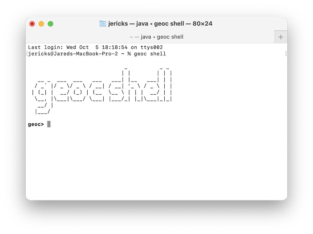
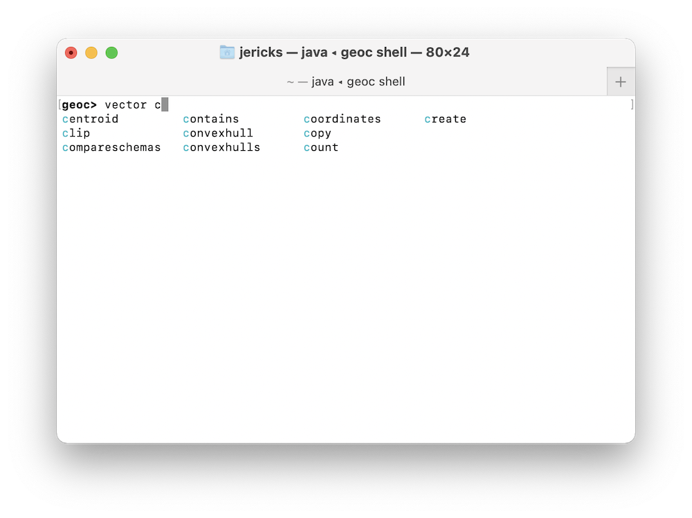
You can now type commands in the interactive shell.
If you hit the tab key you can get command line completion.
You can use the tab key again to cycle through the suggested values and hit the return key to select one.
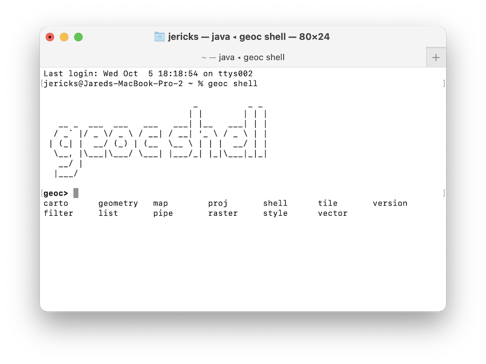
In this example, we are looking for the vector contains command, so after typing vector c and hitting tab, we get a list of all vector commands that begin with the letter c.
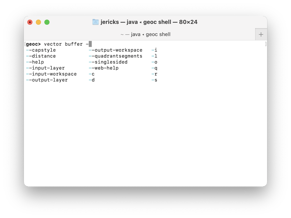
Once we have found our command, the shell will also provide completion for options.
Carto Commands
Map
Create a cartographic map from a JSON or XML definition file.
| Short Name | Long Name | Description |
|---|---|---|
-t |
--type |
The type of the carto file (json, xml) |
-c |
--carto-file |
The input carto definition file |
-o |
--output-file |
The output file |
--help |
Print the help message |
|
--web-help |
Open help in a browser |
JSON
Create a cartographic map from a JSON definition file.
geoc carto map -t json -c src/test/resources/carto/simple.json -o target/carto_simple_json.png{
"type": "png",
"width": 792,
"height": 612,
"items": [
{
"x": 0,
"y": 0,
"width": 792,
"height": 612,
"type": "rectangle",
"fillColor": "white",
"strokeColor": "black"
},
{
"x": 30,
"y": 50,
"width": 742,
"height": 20,
"type": "text",
"text": "Map Title",
"color": "Black",
"horizontalAlign": "center",
"verticalAlign": "middle",
"font": {
"name": "Arial",
"style": "Bold",
"size": 36
}
},
{
"x": 30,
"y": 120,
"width": 742,
"height": 470,
"type": "map",
"name": "mainMap",
"layers": [
{"layertype": "layer", "file": "src/test/resources/data.gpkg", "layername": "ocean", "style": "src/test/resources/ocean.sld"},
{"layertype": "layer", "file": "src/test/resources/data.gpkg", "layername": "countries", "style": "src/test/resources/countries.sld"}
]
}
]
}
XML
Create a cartographic map from an XML definition file.
geoc carto map -t xml -c src/test/resources/carto/simple.xml -o target/carto_simple_xml.png<carto>
<type>png</type>
<width>792</width>
<height>612</height>
<items>
<item>
<x>0</x>
<y>0</y>
<width>792</width>
<height>612</height>
<type>rectangle</type>
<fillColor>white</fillColor>
<strokeColor>black</strokeColor>
</item>
<item>
<x>30</x>
<y>50</y>
<width>742</width>
<height>20</height>
<type>text</type>
<text>Map Title</text>
<color>black</color>
<horizontalAlign>center</horizontalAlign>
<verticalAlign>middle</verticalAlign>
<font>
<name>Arial</name>
<style>bold</style>
<size>36</size>
</font>
</item>
<item>
<x>30</x>
<y>120</y>
<width>742</width>
<height>470</height>
<type>map</type>
<name>mainMap</name>
<layers>
<layer>
<layertype>layer</layertype>
<file>src/test/resources/data.gpkg</file>
<layername>ocean</layername>
<style>src/test/resources/ocean.sld</style>
</layer>
<layer>
<layertype>layer</layertype>
<file>src/test/resources/data.gpkg</file>
<layername>countries</layername>
<style>src/test/resources/countries.sld</style>
</layer>
</layers>
</item>
</items>
</carto>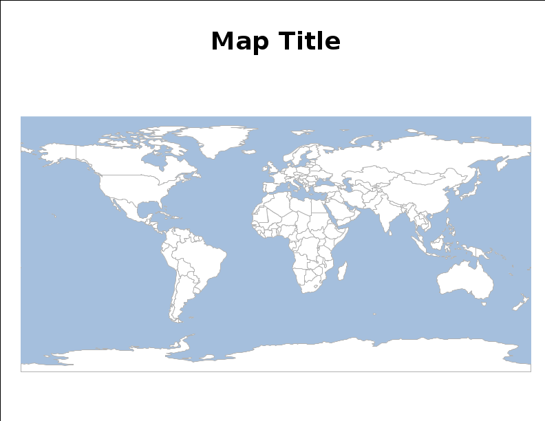
Elements
The geoc carto map command takes either a JSON or XML document made up of one or more elements.
Map
Draw a map.
JSON
{
  "x": 10,
  "y": 10,
  "width": 380,
  "height": 280,
  "type": "map",
  "name": "mainMap",
  "imageType": "png",
  "backgroundColor": "white",
  "fixAspectRatio": true,
  "proj": "EPSG:4326",
  "bounds": {
    "minX": -180,
    "minY": -90,
    "maxX": 180,
    "maxY": 90
  },
  "layers": [
    {"layertype": "layer", "file": "src/test/resources/data.gpkg", "layername": "ocean", "style": "src/test/resources/ocean.sld"},
    {"layertype": "layer", "file": "src/test/resources/data.gpkg", "layername": "countries", "style": "src/test/resources/countries.sld"}
  ]
}
XML
<item>
    <x>10</x>
    <y>10</y>
    <width>380</width>
    <height>280</height>
    <type>map</type>
    <name>mainMap</name>
    <imageType>png</imageType>
    <backgroundColor>white</backgroundColor>
    <fixAspectRatio>true</fixAspectRatio>
    <proj>EPSG:4326</proj>
    <bounds>
        <minX>-180</minX>
        <minY>-90</minY>
        <maxX>180</maxX>
        <maxY>90</maxY>
        <proj>EPSG:4326</proj>
    </bounds>
    <layers>
        <layer>
            <layertype>layer</layertype>
            <file>src/test/resources/data.gpkg</file>
            <layername>ocean</layername>
            <style>src/test/resources/ocean.sld</style>
        </layer>
        <layer>
            <layertype>layer</layertype>
            <file>src/test/resources/data.gpkg</file>
            <layername>countries</layername>
            <style>src/test/resources/countries.sld</style>
        </layer>
    </layers>
</item>
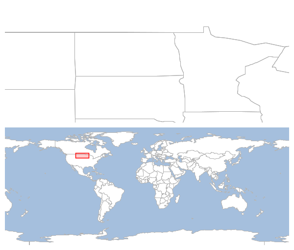
Overview Map
Draw a overview map.
JSON
{
  "x": 10,
  "y": 10,
  "width": 580,
  "height": 240,
  "type": "map",
  "name": "mainMap",
  "fixAspectRatio": false,
  "bounds": {
    "minX": -108.917446,
    "minY": 43.519820,
    "maxX": -89.229946,
    "maxY": 50.137433
  },
  "layers": [
    {"layertype": "layer", "file": "src/test/resources/data.gpkg", "layername": "ocean", "style": "src/test/resources/ocean.sld"},
    {"layertype": "layer", "file": "src/test/resources/data.gpkg", "layername": "countries", "style": "src/test/resources/countries.sld"},
    {"layertype": "layer", "file": "src/test/resources/data.gpkg", "layername": "states", "style": "src/test/resources/states.sld"}
  ]
},
{
  "x": 10,
  "y": 260,
  "width": 580,
  "height": 240,
  "type": "overViewMap",
  "zoomIntoBounds": false,
  "scaleFactor": 2.0,
  "linkedMap": "mainMap",
  "layers": [
    {"layertype": "layer", "file": "src/test/resources/data.gpkg", "layername": "ocean", "style": "src/test/resources/ocean.sld"},
    {"layertype": "layer", "file": "src/test/resources/data.gpkg", "layername": "countries", "style": "src/test/resources/countries.sld"}
  ]
}
XML
<item>
    <x>10</x>
    <y>10</y>
    <width>580</width>
    <height>240</height>
    <type>map</type>
    <name>mainMap</name>
    <imageType>png</imageType>
    <backgroundColor>white</backgroundColor>
    <fixAspectRatio>true</fixAspectRatio>
    <proj>EPSG:4326</proj>
    <bounds>
        <minX>-108.917446</minX>
        <minY>43.519820</minY>
        <maxX>-89.229946</maxX>
        <maxY>50.137433</maxY>
        <proj>EPSG:4326</proj>
    </bounds>
    <layers>
        <layer>
            <layertype>layer</layertype>
            <file>src/test/resources/data.gpkg</file>
            <layername>ocean</layername>
            <style>src/test/resources/ocean.sld</style>
        </layer>
        <layer>
            <layertype>layer</layertype>
            <file>src/test/resources/data.gpkg</file>
            <layername>countries</layername>
            <style>src/test/resources/countries.sld</style>
        </layer>
         <layer>
            <layertype>layer</layertype>
            <file>src/test/resources/data.gpkg</file>
            <layername>states</layername>
            <style>src/test/resources/states.sld</style>
        </layer>
    </layers>
</item>
<item>
    <x>10</x>
    <y>260</y>
    <width>580</width>
    <height>240</height>
    <type>overviewMap</type>
    <zoomIntoBounds>false</zoomIntoBounds>
    <scaleFactor>2.0</scaleFactor>
    <linkedMap>mainMap</linkedMap>
    <layers>
        <layer>
            <layertype>layer</layertype>
            <file>src/test/resources/data.gpkg</file>
            <layername>ocean</layername>
            <style>src/test/resources/ocean.sld</style>
        </layer>
        <layer>
            <layertype>layer</layertype>
            <file>src/test/resources/data.gpkg</file>
            <layername>countries</layername>
            <style>src/test/resources/countries.sld</style>
        </layer>
    </layers>
</item>
Text
Draw text.
JSON
{
  "x": 10,
  "y": 10,
  "width": 140,
  "height": 30,
  "type": "text",
  "text": "Map Text",
  "horizontalAlign": "center",
  "verticalAlign": "middle",
  "color": "black",
  "font": {
    "name": "Arial",
    "style": "plain",
    "size": 14
  }
}
XML
<item>
    <x>10</x>
    <y>10</y>
    <width>140</width>
    <height>30</height>
    <type>text</type>
    <text>Map Text</text>
    <horizontalAlign>center</horizontalAlign>
    <verticalAlign>middle</verticalAlign>
    <color>black</color>
    <font>
        <name>Arial</name>
        <style>plain</style>
        <size>14</size>
    </font>
</item>
Rectangle
Draw a rectangle.
JSON
{
  "x": 10,
  "y": 10,
  "width": 30,
  "height": 30,
  "type": "rectangle",
  "fillColor": "white",
  "strokeColor": "black"
}
XML
<item>
    <x>10</x>
    <y>10</y>
    <width>30</width>
    <height>30</height>
    <type>rectangle</type>
    <fillColor>white</fillColor>
    <strokeColor>black</strokeColor>
</item>
North Arrow
Draw a north arrow.
JSON
{
  "x": 10,
  "y": 10,
  "width": 130,
  "height": 130,
  "type": "northarrow",
  "style": "North",
  "fillColor1": "black",
  "fillColor2": "white",
  "strokeColor1": "black",
  "strokeColor2": "black",
  "strokeWidth": 1,
  "drawText": true,
  "textColor": "black",
  "font": {
    "name": "Arial",
    "style": "plain",
    "size": 24
  }
}
XML
<item>
    <x>10</x>
    <y>10</y>
    <width>130</width>
    <height>130</height>
    <type>northarrow</type>
    <style>NorthEastSouthWest</style>
    <fillColor1>black</fillColor1>
    <fillColor2>white</fillColor2>
    <strokeColor1>black</strokeColor1>
    <strokeColor2>black</strokeColor2>
    <strokeWidth>1</strokeWidth>
    <drawText>true</drawText>
    <textColor>black</textColor>
    <font>
        <name>Arial</name>
        <style>plain</style>
        <size>24</size>
    </font>
</item>
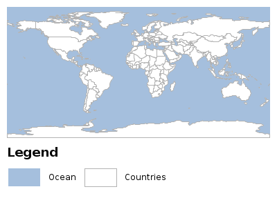
Legend
Draw a legend.
JSON
{
  "x": 10,
  "y": 10,
  "width": 380,
  "height": 190,
  "type": "map",
  "name": "mainMap",
  "layers": [
    {"layertype": "layer", "file": "src/test/resources/data.gpkg", "layername": "ocean", "style": "src/test/resources/ocean.sld"},
    {"layertype": "layer", "file": "src/test/resources/data.gpkg", "layername": "countries", "style": "src/test/resources/countries.sld"}
  ]
}, {
  "x": 10,
  "y": 210,
  "width": 380,
  "height": 70,
  "type": "legend",
  "map": "mainMap",
  "backgroundColor": "white",
  "title": "Legend",
  "titleFont":{
    "name": "Arial",
    "style": "bold",
    "size": 18
  },
  "titleColor": "black",
  "textColor": "black",
  "textFont": {
    "name": "Arial",
    "style": "plain",
    "size": 12
  },
  "numberFormat": "#.##",
  "legendEntryWidth": "50",
  "legendEntryHeight": "30",
  "gapBetweenEntries": "10"
}
XML
<item>
    <x>10</x>
    <y>10</y>
    <width>380</width>
    <height>190</height>
    <type>map</type>
    <name>mainMap</name>
    <layers>
        <layer>
            <layertype>layer</layertype>
            <file>src/test/resources/data.gpkg</file>
            <layername>ocean</layername>
            <style>src/test/resources/ocean.sld</style>
        </layer>
        <layer>
            <layertype>layer</layertype>
            <file>src/test/resources/data.gpkg</file>
            <layername>countries</layername>
            <style>src/test/resources/countries.sld</style>
        </layer>
         <layer>
            <layertype>layer</layertype>
            <file>src/test/resources/data.gpkg</file>
            <layername>states</layername>
            <style>src/test/resources/states.sld</style>
        </layer>
    </layers>
</item>
<item>
    <x>10</x>
    <y>210</y>
    <width>380</width>
    <height>70</height>
    <type>legend</type>
    <map>mainMap</map>
    <backgroundColor>white</backgroundColor>
    <title>Legend</title>
    <titleFont>
        <name>Arial</name>
        <style>bold</style>
        <size>14</size>
    </titleFont>
    <titleColor>black</titleColor>
    <textColor>black</textColor>
    <textFont>
        <name>Arial</name>
        <style>plain</style>
        <size>12</size>
    </textFont>
    <numberFormat>#.##</numberFormat>
    <legendEntryWidth>50</legendEntryWidth>
    <legendEntryHeight>30</legendEntryHeight>
    <gapBetweenEntries>10</gapBetweenEntries>
</item>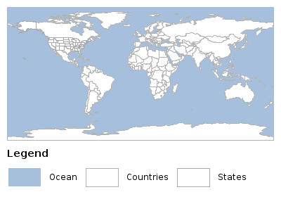
Date
Draw a date.
JSON
{
  "x": 10,
  "y": 10,
  "width": 140,
  "height": 30,
  "type": "datetext",
  "date": "1/22/2022",
  "format": "MM/dd/yyyy",
  "horizontalAlign": "center",
  "verticalAlign": "middle",
  "color": "black",
  "font": {
    "name": "Arial",
    "style": "plain",
    "size": 14
  }
}
XML
<item>
    <x>10</x>
    <y>10</y>
    <width>140</width>
    <height>30</height>
    <type>dateText</type>
    <date>1/22/2022</date>
    <format>MM/dd/yyyy</format>
    <horizontalAlign>center</horizontalAlign>
    <verticalAlign>middle</verticalAlign>
    <color>black</color>
    <font>
        <name>Arial</name>
        <style>plain</style>
        <size>14</size>
    </font>
</item>
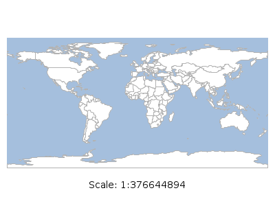
Scale Text
Draw scale text.
JSON
{
  "x": 10,
  "y": 10,
  "width": 380,
  "height": 280,
  "type": "map",
  "name": "mainMap",
  "layers": [
    {"layertype": "layer", "file": "src/test/resources/data.gpkg", "layername": "ocean", "style": "src/test/resources/ocean.sld"},
    {"layertype": "layer", "file": "src/test/resources/data.gpkg", "layername": "countries", "style": "src/test/resources/countries.sld"}
  ]
}, {
  "x": 10,
  "y": 250,
  "width": 380,
  "height": 40,
  "type": "scaletext",
  "map": "mainMap",
  "format": "#",
  "prefixText": "Scale: ",
  "horizontalAlign": "center",
  "verticalAlign": "middle",
  "color": "black",
  "font": {
    "name": "Arial",
    "style": "plain",
    "size": 14
  }
}
XML
<item>
    <x>10</x>
    <y>10</y>
    <width>580</width>
    <height>240</height>
    <type>map</type>
    <name>mainMap</name>
    <layers>
        <layer>
            <layertype>layer</layertype>
            <file>src/test/resources/data.gpkg</file>
            <layername>ocean</layername>
            <style>src/test/resources/ocean.sld</style>
        </layer>
        <layer>
            <layertype>layer</layertype>
            <file>src/test/resources/data.gpkg</file>
            <layername>countries</layername>
            <style>src/test/resources/countries.sld</style>
        </layer>
         <layer>
            <layertype>layer</layertype>
            <file>src/test/resources/data.gpkg</file>
            <layername>states</layername>
            <style>src/test/resources/states.sld</style>
        </layer>
    </layers>
</item>
<item>
    <x>10</x>
    <y>250</y>
    <width>380</width>
    <height>40</height>
    <type>scaletext</type>
    <map>mainMap</map>
    <format>#</format>
    <prefixText>Scale :</prefixText>
    <horizontalAlign>center</horizontalAlign>
    <verticalAlign>middle</verticalAlign>
    <color>black</color>
    <font>
        <name>Arial</name>
        <style>plain</style>
        <size>14</size>
    </font>
</item>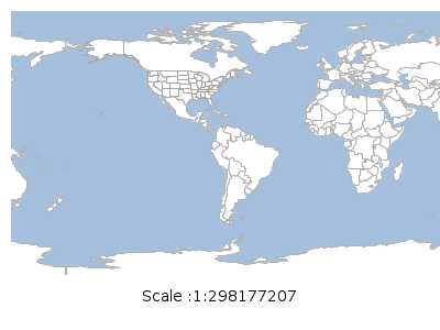
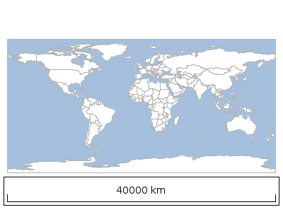
Scale Bar
Draw scale bar.
JSON
{
  "x": 10,
  "y": 10,
  "width": 380,
  "height": 280,
  "type": "map",
  "name": "mainMap",
  "layers": [
    {"layertype": "layer", "file": "src/test/resources/data.gpkg", "layername": "ocean", "style": "src/test/resources/ocean.sld"},
    {"layertype": "layer", "file": "src/test/resources/data.gpkg", "layername": "countries", "style": "src/test/resources/countries.sld"}
  ]
}, {
  "x": 10,
  "y": 250,
  "width": 380,
  "height": 40,
  "type": "scalebar",
  "map": "mainMap",
  "strokeColor": "black",
  "strokeWidth": 1,
  "border": 5,
  "units": "METRIC",
  "fillColor": "white",
  "font": {
    "name": "Arial",
    "style": "plain",
    "size": 14
  }
}
XML
<item>
    <x>10</x>
    <y>10</y>
    <width>580</width>
    <height>240</height>
    <type>map</type>
    <name>mainMap</name>
    <layers>
        <layer>
            <layertype>layer</layertype>
            <file>src/test/resources/data.gpkg</file>
            <layername>ocean</layername>
            <style>src/test/resources/ocean.sld</style>
        </layer>
        <layer>
            <layertype>layer</layertype>
            <file>src/test/resources/data.gpkg</file>
            <layername>countries</layername>
            <style>src/test/resources/countries.sld</style>
        </layer>
         <layer>
            <layertype>layer</layertype>
            <file>src/test/resources/data.gpkg</file>
            <layername>states</layername>
            <style>src/test/resources/states.sld</style>
        </layer>
    </layers>
</item>
<item>
    <x>10</x>
    <y>250</y>
    <width>380</width>
    <height>40</height>
    <type>scalebar</type>
    <map>mainMap</map>
    <strokeColor>black</strokeColor>
    <strokeWidth>1</strokeWidth>
    <border>5</border>
    <units>US</units>
    <fillColor>white</fillColor>
    <font>
        <name>Arial</name>
        <style>plain</style>
        <size>14</size>
    </font>
</item>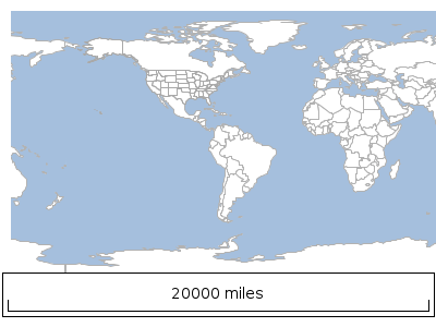
Line
Draw a line.
JSON
{
  "x": 10,
  "y": 10,
  "width": 180,
  "height": 0,
  "type": "line",
  "strokeColor": "black",
  "strokeWidth": 2
}
XML
<item>
    <x>10</x>
    <y>10</y>
    <width>180</width>
    <height>0</height>
    <type>line</type>
    <strokeColor>black</strokeColor>
    <strokeWidth>2</strokeWidth>
</item>
Grid
Draw a grid to make it easier to place other items.
JSON
{
  "x": 0,
  "y": 0,
  "width": 100,
  "height": 100,
  "type": "grid",
  "size": 10,
  "strokeColor": "black",
  "strokeWidth": 0.5
}
XML
<item>
    <x>0</x>
    <y>0</y>
    <width>100</width>
    <height>100</height>
    <type>grid</type>
    <size>10</size>
    <strokeColor>black</strokeColor>
    <strokeWidth>0.5</strokeWidth>
</item>
Paragraph
Draw paragraph.
JSON
{
  "x": 10,
  "y": 10,
  "width": 240,
  "height": 140,
  "type": "paragraph",
  "text": "The Carto package contains classes for creating cartographic documents. All items are added to the document with x and y coordinates whose origin is the upper left and width and a height.",
  "color": "black",
  "font": {
    "name": "Arial",
    "style": "plain",
    "size": 14
  }
}
XML
<item>
    <x>10</x>
    <y>10</y>
    <width>240</width>
    <height>140</height>
    <type>paragraph</type>
    <text>The Carto package contains classes for creating cartographic documents. All items are added to the document with x and y coordinates whose origin is the upper left and width and a height.t</text>
    <color>black</color>
    <font>
        <name>Arial</name>
        <style>plain</style>
        <size>14</size>
    </font>
</item>
Image
Draw an image.
JSON
{
  "x": 10,
  "y": 10,
  "width": 512,
  "height": 431,
  "type": "image",
  "path": "src/main/docs/static/images/geoc.png"
}
XML
<item>
    <x>10</x>
    <y>10</y>
    <width>512</width>
    <height>431</height>
    <type>image</type>
    <path>src/main/docs/static/images/geoc.png</path>
</item>
Table
Draw a table of data.
JSON
{
  "x": 10,
  "y": 10,
  "width": 280,
  "height": 80,
  "type": "table",
  "columns": ["ID", "Name", "Abbreviation"],
  "rows": [
    {"ID": 1, "Name": "Washington", "Abbreviation": "WA"},
    {"ID": 2, "Name": "Oregon", "Abbreviation": "OR"},
    {"ID": 3, "Name": "California", "Abbreviation": "CA"}
  ]
}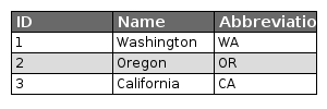
XML
<item>
    <x>10</x>
    <y>10</y>
    <width>280</width>
    <height>80</height>
    <type>table</type>
    <columns>
        <column>ID</column>
        <column>Name</column>
        <column>Abbreviation</column>
    </columns>
    <rows>
        <row>
            <ID>1</ID>
            <Name>Washington</Name>
            <Abbreviation>WA</Abbreviation>
        </row>
        <row>
            <ID>2</ID>
            <Name>Oregon</Name>
            <Abbreviation>OR</Abbreviation>
        </row>
        <row>
            <ID>3</ID>
            <Name>California</Name>
            <Abbreviation>CA</Abbreviation>
        </row>
    </rows>
</item>
Filter Commands
CQL to XML
Convert a CQL statement to an OCG XML Filter.
| Short Name | Long Name | Description |
|---|---|---|
-c |
--cql |
The CQL statement |
--help |
Print the help message |
|
--web-help |
Open help in a browser |
geoc filter cql2xml -c name=wa<ogc:Filter xmlns:xs="http://www.w3.org/2001/XMLSchema" xmlns:gml="http://www.opengis.net/gml" xmlns:ogc="http://www.opengis.net/ogc">
<ogc:PropertyIsEqualTo>
<ogc:PropertyName>name</ogc:PropertyName>
<ogc:PropertyName>wa</ogc:PropertyName>
</ogc:PropertyIsEqualTo>
</ogc:Filter>Geometry Commands
Convert
Convert a geometry from one format to another.
| Short Name | Long Name | Description |
|---|---|---|
-i |
--input |
The input geometry |
-f |
--format |
The output format (wkt, geojson, gml2, gml3, kml, georss, gpx, csv, wkb) |
-p |
--format-options |
The output format options |
-t |
--type |
The output type (geometry, feature, layer) |
--help |
Print the help message |
|
--web-help |
Open help in a browser |
geoc geometry convert -i "POINT(-122.386371 47.581154)" -f geojson -t feature{"type":"Feature","geometry":{"type":"Point","coordinates":[-122.3864,47.5812]},"properties":{},"id":"1"}Decimal Degrees to Point
Convert a decimal degrees formatted string into a Point.
| Short Name | Long Name | Description |
|---|---|---|
-d |
--decimaldegrees |
The decimal degrees |
-t |
--type |
The output type (xy, wkt, json) |
--help |
Print the help message |
|
--web-help |
Open help in a browser |
geoc geometry dd2pt -d "122d 31m 32.23s W, 47d 12m 43.28s N" -t wktPOINT (-122.52561944444444 47.212022222222224)GeoHash Bounds
Calculate the geohashes for the given bounds.
| Short Name | Long Name | Description |
|---|---|---|
-b |
--bounds |
The input geometry |
-t |
--type |
The encoding type (string or long). The default is string. |
-n |
--number-of-chars |
The number of characters. The default is 9. |
-d |
--bit-depth |
The bit depth. The default is 52. |
--help |
Print the help message |
|
--web-help |
Open help in a browser |
geoc geometry geohash bounds -b "120, 30, 120.0001, 30.0001" -t long -d 4528147497671064
28147497671068
28147497671112
28147497671066
28147497671070
28147497671114
28147497671088
28147497671092
28147497671136GeoHash Decode
Decode a GeoHash to a Geometry.
| Short Name | Long Name | Description |
|---|---|---|
-i |
--input |
The input geohash |
-t |
--type |
Whether the geohash is a point or bounds |
--help |
Print the help message |
|
--web-help |
Open help in a browser |
geoc geometry geohash decode -i uf8vk6wjr -t pointPOINT (35.00001668930054 60.00000715255737)GeoHash Encode
Encode a Geometry as a GeoHash.
| Short Name | Long Name | Description |
|---|---|---|
-i |
--input |
The input geometry |
-t |
--type |
The encoding type (string or long). The default is string. |
-n |
--number-of-chars |
The number of characters. The default is 9. |
-d |
--bit-depth |
The bit depth. The default is 52. |
--help |
Print the help message |
|
--web-help |
Open help in a browser |
geoc geometry geohash encode -i "POINT(-122.386371 47.581154)"c22yxjbuqGeoHash Neighbors
Get a geohash’s neighbors.
| Short Name | Long Name | Description |
|---|---|---|
-i |
--input |
The input geometry |
-n |
--number-of-chars |
The number of characters. The default is 9. |
-d |
--bit-depth |
The bit depth. The default is 52. |
--help |
Print the help message |
|
--web-help |
Open help in a browser |
geoc geometry geohash neighbors -i uf8vk6wjrNORTH,uf8vk6wjx
NORTHEAST,uf8vk6wm8
EAST,uf8vk6wm2
SOUTHEAST,uf8vk6wm0
SOUTH,uf8vk6wjp
SOUTHWEST,uf8vk6wjn
WEST,uf8vk6wjq
NORTHWEST,uf8vk6wjwGreat Circle Arc
Create a great circle arc.
| Short Name | Long Name | Description |
|---|---|---|
-e |
--ellipsoid |
The ellipsoid |
-p |
--start-point |
The start point |
-t |
--end-point |
The end point |
-n |
--num-points |
The number of points |
--help |
Print the help message |
|
--web-help |
Open help in a browser |
geoc geometry greatcirclearc -p POINT (-122 48) -t POINT (-0.102938 51.498749) -e wgs84 -n 20LINESTRING (-119.07040273132067 50.67129040608734, -115.79405787410982 53.25898813815459, -112.10566632488812 55.74416257443563, -107.93031121546862 58.102903619395605, -103.18586832746001 60.30516464523606, -97.78964326539094 62.313702219535685, -91.67188919322786 64.08357246715578, -84.79846274611634 65.56300075396796, -77.20148714844558 66.69673003845362, -69.00888413693454 67.4327000137296, -60.454039139748815 67.73150516117609, -51.847144661724116 67.57568999780139, -43.51024818547282 66.97446827309976, -35.70614774738105 65.96118559566465, -28.596592724101157 64.58499988892942, -22.24128289210202 62.90104269692094, -16.623473379491926 60.96269894447343, -11.681762264482387 58.81725900451406, -7.335682843452773 56.50439016948547, -3.501944007479139 54.05631263013969)
Offset
Create a Geometry offset from the input Geometry.
| Short Name | Long Name | Description |
|---|---|---|
-i |
--input |
The input geometry |
-d |
--offset |
The offset distance |
-s |
--quadrant-segements |
The number of quadrant segments (defaults to 8) |
--help |
Print the help message |
|
--web-help |
Open help in a browser |
geoc geometry offset -i LINESTRING (-120.41362631285119 47.87883318858252, -3.9909723099333974 39.24424611524387) -d 5 -s 8LINESTRING (-120.0438126769743 52.86513822084032, -3.621158674056503 44.23055114750167)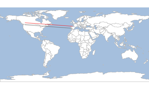
Orthodromic Distance
Calculate the orthodromic distance between two points..
| Short Name | Long Name | Description |
|---|---|---|
-e |
--ellipsoid |
The ellipsoid |
-p |
--start-point |
The start point |
-t |
--end-point |
The end point |
--help |
Print the help message |
|
--web-help |
Open help in a browser |
geoc geometry orthodromicdistance -p POINT (-122 48) -t POINT (-0.102938 51.498749) -e wgs847674355.352400642Plot
Draw a geometry to a plot.
| Short Name | Long Name | Description |
|---|---|---|
-i |
--input |
The input geometry |
-f |
--file |
The output file |
-w |
--width |
The image width |
-h |
--height |
The image height |
-l |
--legend |
Whether to show the legend |
-r |
--fill-coords |
Whether to fill coordinates |
-p |
--fill-polys |
Whether to fill polygons |
-d |
--draw-coords |
Whether to draw coordinates |
--help |
Print the help message |
|
--web-help |
Open help in a browser |
geoc geometry plot -i "POLYGON ((-113.98365269610397 52.04260423559353, -117.55190821991903 41.99216856357597, -102.82940482544078 37.1267755781612, -82.26457660787091 47.05513909003821, -102.75935045963138 44.33220905070587, -101.89775634863287 52.5472919646931, -113.98365269610397 52.04260423559353))" -f target/geometry_plot.png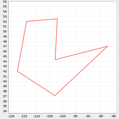
Point to Decimal Degrees
Format a Point in Decimal Degrees.
| Short Name | Long Name | Description |
|---|---|---|
-p |
--point |
The Point |
-t |
--type |
The output type (dms, dms_char, ddm, ddm_char) |
--help |
Print the help message |
|
--web-help |
Open help in a browser |
geoc geometry pt2dd -p "POINT (-122 48)" -t dms-122° 0' 0.0000" W, 48° 0' 0.0000" NMap Commands
Map Layers
Map layer is a simple string format that allows you to pass in information about a map layer.
It can contain the following properties:
-
layertype = The type of layer (layer, raster, tile)
-
For layer layertype, you can use the same key value pairs used to specify a Workspace.
-
For raster layertype, you specify a source=file key value pair.
-
For tile layertype, you use the same key value pairs used to specify a Tile layer.
-
-
layername = The name of the Layer/Raster/Tile
-
layerprojection = The Projection
-
style = The SLD, CSS, or other style
Examples:
-
Vector Layer
-
layertype=layer dbtype=geopkg database=/Users/user/Desktop/countries.gpkg layername=countries style=/Users/user/Desktop/countries.sld
-
layertype=layer file=/Users/user/Desktop/geoc/polygons.csv layername=polygons style=/Users/user/Desktop/geoc/polygons.sld
-
layertype=layer file=/Users/user/Desktop/geoc/points.properties style=/Users/user/Desktop/geoc/points.sld
-
layertype=layer file=/Users/user/Projects/geoc/src/test/resources/polygons.shp
-
layertype=layer directory=/Users/user/Projects/geoc/src/test/resources/points.properties layername=points
-
-
Raster
-
layertype=raster source=rasters/earth.tif
-
-
Tile
-
layertype=tile file=world.mbtiles
-
layertype=tile type=geopackage file=states.gpkg
-
Draw
Draw a map.
| Short Name | Long Name | Description |
|---|---|---|
-l |
--layer |
The map layer |
-f |
--file |
The output image file |
-t |
--type |
The type of document |
-w |
--width |
The width |
-h |
--height |
The height |
-b |
--bounds |
The bounds |
-g |
--background-color |
The background color |
-p |
--projection |
The projection |
--help |
Print the help message |
|
--web-help |
Open help in a browser |
geoc map draw -l "layertype=layer file=src/test/resources/data.gpkg layername=ocean style=src/test/resources/ocean.sld" -l "layertype=layer file=src/test/resources/data.gpkg layername=countries style=src/test/resources/countries.sld" -f target/map.png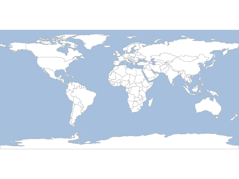
Map Cube
Draw a map cube.
| Short Name | Long Name | Description |
|---|---|---|
-l |
--layer |
The map layer |
-f |
--file |
The output image file |
-o |
--draw-outline |
The flag to whether to draw outlines or not |
-t |
--draw-tabs |
The flag to whether to draw tabs or not |
-s |
--tab-size |
The tab size |
-i |
--title |
The title |
-c |
--source |
The data source or credits |
--help |
Print the help message |
|
--web-help |
Open help in a browser |
geoc map cube -l "layertype=layer file=src/test/resources/data.gpkg layername=ocean style=src/test/resources/ocean.sld" -l "layertype=layer file=src/test/resources/data.gpkg layername=countries style=src/test/resources/countries.sld" -o -f target/cube.png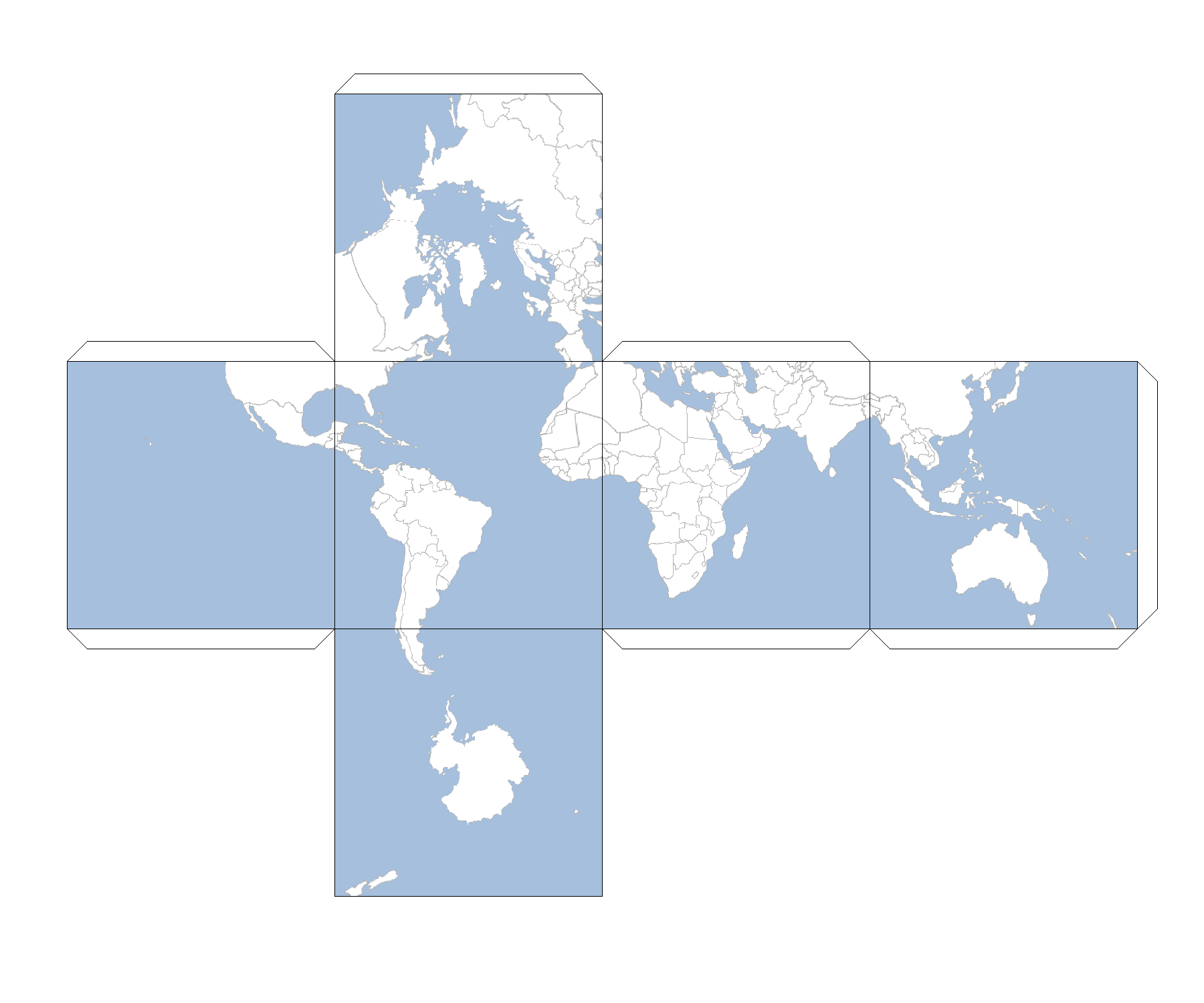
Draw a blank map cube.
geoc map cube -o -f target/cube_blank.png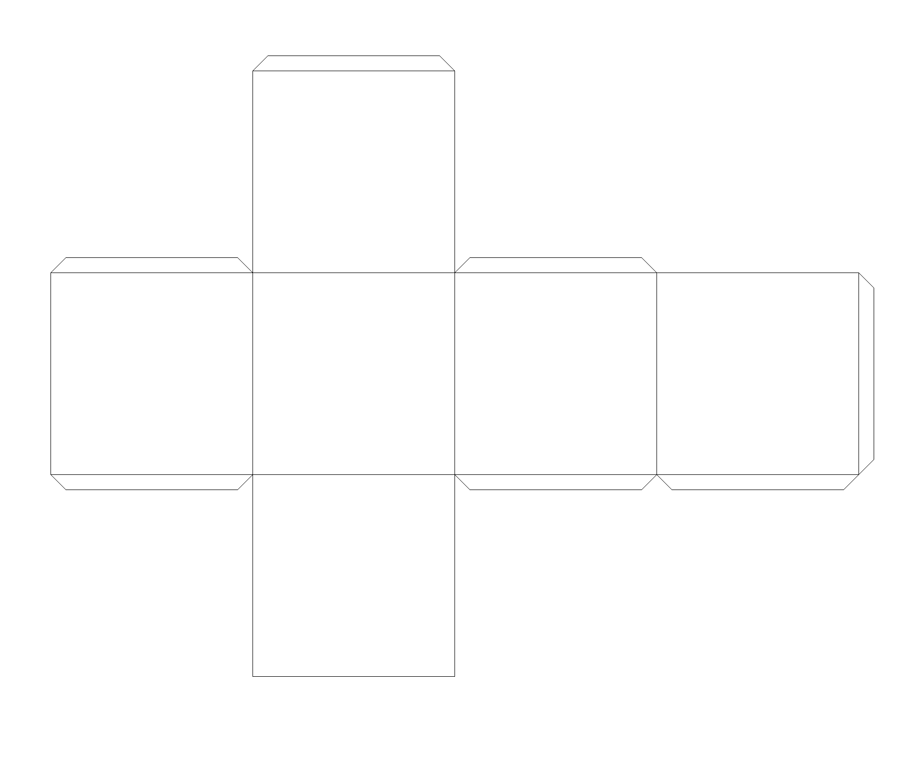
Projection Commands
Envelope
Get a Projection’s envelope.
| Short Name | Long Name | Description |
|---|---|---|
-e |
--epsg |
The EPSG Projection code |
-g |
--geo-bounds |
The flag for whether to use geo bounds or not |
-o |
--output-workspace |
The output workspace |
-r |
--output-layer |
The output layer |
--help |
Print the help message |
|
--web-help |
Open help in a browser |
geoc proj envelope -e EPSG:2927 -g -o target/envelope.shp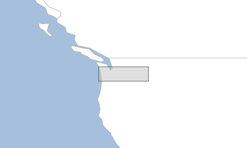
WKT
Get the WKT of a Projection
| Short Name | Long Name | Description |
|---|---|---|
-e |
--epsg |
The EPSG Projection code |
-f |
--file |
The output File |
-c |
--citation |
The citations (epsg or esri) |
-i |
--indentation |
The number of spaces to indent |
--help |
Print the help message |
|
--web-help |
Open help in a browser |
geoc proj wkt -e EPSG:2927PROJCS["NAD83(HARN) / Washington South (ftUS)",
GEOGCS["NAD83(HARN)",
DATUM["NAD83 (High Accuracy Reference Network)",
SPHEROID["GRS 1980", 6378137.0, 298.257222101, AUTHORITY["EPSG","7019"]],
TOWGS84[0.0, 0.0, 0.0, 0.0, 0.0, 0.0, 0.0],
AUTHORITY["EPSG","6152"]],
PRIMEM["Greenwich", 0.0, AUTHORITY["EPSG","8901"]],
UNIT["degree", 0.017453292519943295],
AXIS["Geodetic longitude", EAST],
AXIS["Geodetic latitude", NORTH],
AUTHORITY["EPSG","4152"]],
PROJECTION["Lambert Conic Conformal (2SP)", AUTHORITY["EPSG","9802"]],
PARAMETER["Longitude of natural origin", -120.5],
PARAMETER["Latitude of false origin", 45.333333333333336],
PARAMETER["Latitude of 1st standard parallel", 47.333333333333336],
PARAMETER["False easting", 1640416.667],
PARAMETER["False northing", 0.0],
PARAMETER["Scale factor at natural origin", 1.0],
PARAMETER["Latitude of 2nd standard parallel", 45.833333333333336],
UNIT["ft_survey_us", 0.3048006096012192],
AXIS["Easting", EAST],
AXIS["Northing", NORTH],
AUTHORITY["EPSG","2927"]]Raster Commands
Absolute
Calculate the absolute value of the values of a Raster.
| Short Name | Long Name | Description |
|---|---|---|
-o |
--output-raster |
The output raster |
-f |
--output-raster-format |
The output raster format |
-i |
--input-raster |
The input raster |
-l |
--input-raster-name |
The input raster name |
-p |
--input-projection |
The input projection |
--help |
Print the help message |
|
--web-help |
Open help in a browser |
geoc raster abs -i src/test/resources/absolute.tif -o target/absolute_abs.tif
Add Constant
Add a constant value to a Raster.
| Short Name | Long Name | Description |
|---|---|---|
-v |
--value |
The value |
-o |
--output-raster |
The output raster |
-f |
--output-raster-format |
The output raster format |
-i |
--input-raster |
The input raster |
-l |
--input-raster-name |
The input raster name |
-p |
--input-projection |
The input projection |
--help |
Print the help message |
|
--web-help |
Open help in a browser |
Get original value
geoc raster get value -i src/test/resources/pc.tif -x -121.799927 -y 46.8677033069.0
Add 100 to all cells
geoc raster add constant -i src/test/resources/pc.tif -v 100 -o target/pc_add.tifGet new value
geoc raster get value -i target/pc_add.tif -x -121.799927 -y 46.8677033169.0
Add
Add two Raster together.
| Short Name | Long Name | Description |
|---|---|---|
-k |
--other-raster |
The other raster |
-y |
--other-raster-name |
The other raster name |
-j |
--other-projection |
The other projection |
-o |
--output-raster |
The output raster |
-f |
--output-raster-format |
The output raster format |
-i |
--input-raster |
The input raster |
-l |
--input-raster-name |
The input raster name |
-p |
--input-projection |
The input projection |
--help |
Print the help message |
|
--web-help |
Open help in a browser |
geoc raster add -i src/test/resources/low.tif -k src/test/resources/high.tif -o target/lowPlusHigh.tifLow

High

Low + High
Animated GIF
Create an animated GIF from a list of GIFs.
| Short Name | Long Name | Description |
|---|---|---|
-f |
--file |
The GIF file |
-o |
--output-file |
The output animated GIF file |
-d |
--delay |
The delay between images |
-r |
--repeat |
Whether to repeat the animation or not |
--help |
Print the help message |
|
--web-help |
Open help in a browser |
First, lets create individual maps of 3 states.
Washington
geoc map draw -l "layertype=layer file=src/test/resources/data.gpkg layername=ocean style=src/test/resources/ocean.sld" -l "layertype=layer file=src/test/resources/data.gpkg layername=countries style=src/test/resources/countries.sld" -l "layertype=layer file=src/test/resources/data.gpkg layername=states style=src/test/resources/states.sld" -b -124.68721008300781,45.59199778907822,-116.90652787968992,49.000885321643864 -f target/state_washington.png
Oregon
geoc map draw -l "layertype=layer file=src/test/resources/data.gpkg layername=ocean style=src/test/resources/ocean.sld" -l "layertype=layer file=src/test/resources/data.gpkg layername=countries style=src/test/resources/countries.sld" -l "layertype=layer file=src/test/resources/data.gpkg layername=states style=src/test/resources/states.sld" -b -124.53283999999996,41.99260508886846,-116.45779557988342,46.2830694871044 -f target/state_oregon.png
California
geoc map draw -l "layertype=layer file=src/test/resources/data.gpkg layername=ocean style=src/test/resources/ocean.sld" -l "layertype=layer file=src/test/resources/data.gpkg layername=countries style=src/test/resources/countries.sld" -l "layertype=layer file=src/test/resources/data.gpkg layername=states style=src/test/resources/states.sld" -b -124.39795772362243,32.535327053348965,-114.16597164595498,41.99947805436335 -f target/state_california.png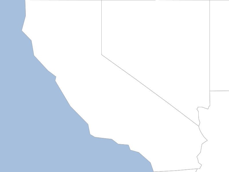
Now lets stitch them together into an animated GIF.
geoc raster animatedgif -f target/state_washington.png -f target/state_oregon.png -f target/state_california.png -o target/states.gif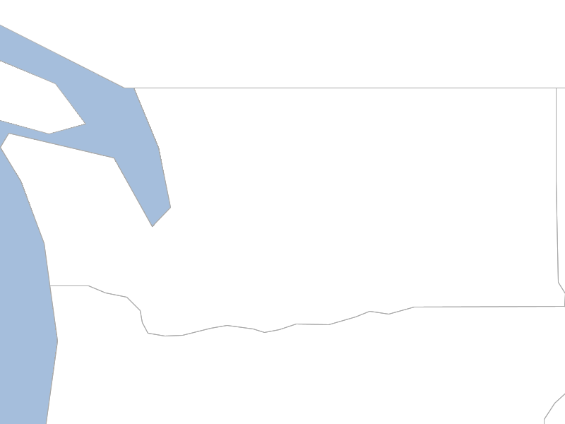
Convolve
Convolve the values of a Raster.
| Short Name | Long Name | Description |
|---|---|---|
-w |
--width |
The kernel width |
-h |
--height |
The kernel height |
-o |
--output-raster |
The output raster |
-f |
--output-raster-format |
The output raster format |
-i |
--input-raster |
The input raster |
-l |
--input-raster-name |
The input raster name |
-p |
--input-projection |
The input projection |
--help |
Print the help message |
|
--web-help |
Open help in a browser |
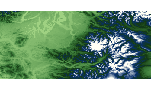
geoc raster convolve -i src/test/resources/pc.tif -o target/pc_convolve.tif -w 2 -h 2
Original
geoc raster info -i src/test/resources/pc.tifFormat: GeoTIFF
Size: 800, 400
Projection ID: EPSG:4326
Projection WKT: GEOGCS["WGS 84",
DATUM["World Geodetic System 1984",
SPHEROID["WGS 84", 6378137.0, 298.257223563, AUTHORITY["EPSG","7030"]],
AUTHORITY["EPSG","6326"]],
PRIMEM["Greenwich", 0.0, AUTHORITY["EPSG","8901"]],
UNIT["degree", 0.017453292519943295],
AXIS["Geodetic longitude", EAST],
AXIS["Geodetic latitude", NORTH],
AUTHORITY["EPSG","4326"]]
Extent: -123.55291606131708, 46.25375026634816, -120.73958272798374, 47.522916933014834
Pixel Size: 0.0035166666666666658, 0.0031729166666666763
Block Size: 800, 5
Bands:
GRAY_INDEX
Min Value: -23.0 Max Value: 4370.0Convolved
geoc raster info -i target/pc_convolve.tifFormat: GeoTIFF
Size: 800, 400
Projection ID: EPSG:4326
Projection WKT: GEOGCS["WGS 84",
DATUM["World Geodetic System 1984",
SPHEROID["WGS 84", 6378137.0, 298.257223563, AUTHORITY["EPSG","7030"]],
AUTHORITY["EPSG","6326"]],
PRIMEM["Greenwich", 0.0, AUTHORITY["EPSG","8901"]],
UNIT["degree", 0.017453292519943295],
AXIS["Geodetic longitude", EAST],
AXIS["Geodetic latitude", NORTH],
AUTHORITY["EPSG","4326"]]
Extent: -123.55291606131708, 46.25375026634816, -120.73958272798374, 47.522916933014834
Pixel Size: 0.0035166666666666658, 0.0031729166666666763
Block Size: 800, 10
Bands:
GRAY_INDEX
Min Value: -32767.0 Max Value: 17278.0Contour
Create contours from a Raster.
| Short Name | Long Name | Description |
|---|---|---|
-b |
--band |
The band |
-v |
--level |
A level or interval |
-s |
--simplify |
Whether to simplify |
-m |
--smooth |
Whether to smooth |
-n |
--bounds |
The bounds |
-o |
--output-workspace |
The output workspace |
-r |
--output-layer |
The output layer |
-i |
--input-raster |
The input raster |
-l |
--input-raster-name |
The input raster name |
-p |
--input-projection |
The input projection |
--help |
Print the help message |
|
--web-help |
Open help in a browser |
geoc raster contour -i src/test/resources/pc.tif -b 0 -v 300 -s -m -o target/contours.shp
Crop with Bounds
Crop a Raster with Bounds.
| Short Name | Long Name | Description |
|---|---|---|
-b |
--bound |
The Bounds |
-x |
--pixel |
Whether the Bounds is pixel or geographic |
-o |
--output-raster |
The output raster |
-f |
--output-raster-format |
The output raster format |
-i |
--input-raster |
The input raster |
-l |
--input-raster-name |
The input raster name |
-p |
--input-projection |
The input projection |
--help |
Print the help message |
|
--web-help |
Open help in a browser |
geoc raster crop -i src/test/resources/earth.tif -b -160.927734,6.751896,-34.716797,57.279043 -o target/earth_cropped.tif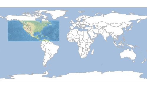
Crop with Geometry
Crop a Raster with Geometry.
| Short Name | Long Name | Description |
|---|---|---|
-g |
--geometry |
The Geometry |
-o |
--output-raster |
The output raster |
-f |
--output-raster-format |
The output raster format |
-i |
--input-raster |
The input raster |
-l |
--input-raster-name |
The input raster name |
-p |
--input-projection |
The input projection |
--help |
Print the help message |
|
--web-help |
Open help in a browser |
geoc raster crop with geometry -i src/test/resources/earth.tif -g "POLYGON ((-120.06886118446164 54.657570186377484, -131.4744345802818 40.88641840854305, -120.66873293244274 27.841500134049014, -91.23852896646747 22.376168381822453, -75.66538001484537 23.99772020337508, -54.66444615739175 45.994788780815526, -91.94198075352523 53.20175611636799, -120.06886118446164 54.657570186377484))" -o target/earth_cropped.tif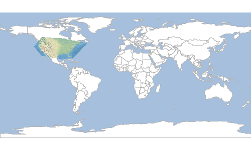
Crop with Layer
Crop a Raster with a Layer.
| Short Name | Long Name | Description |
|---|---|---|
-w |
--input-workspace |
The input workspace |
-y |
--input-layer |
The input layer |
-o |
--output-raster |
The output raster |
-f |
--output-raster-format |
The output raster format |
-i |
--input-raster |
The input raster |
-l |
--input-raster-name |
The input raster name |
-p |
--input-projection |
The input projection |
--help |
Print the help message |
|
--web-help |
Open help in a browser |
geoc vector randompoints -n 10 -g -180,-90,180,90 -o target/locations.shpgeoc vector buffer -d 10 -i target/locations.shp -o target/buffers.shpgeoc raster crop with layer -i src/test/resources/earth.tif -o target/earth_cropped.tif -w target/buffers.shp
Display
Display a Raster in a simple GUI Window.
| Short Name | Long Name | Description |
|---|---|---|
-w |
--width |
The width |
-h |
--height |
The height |
-s |
--sld-file |
The sld file |
-b |
--bounds |
The bounds |
-m |
--layer |
The map layer |
-g |
--background-color |
The background color |
-i |
--input-raster |
The input raster |
-l |
--input-raster-name |
The input raster name |
-p |
--input-projection |
The input projection |
--help |
Print the help message |
|
--web-help |
Open help in a browser |
geoc raster display -i src/test/resources/pc.tif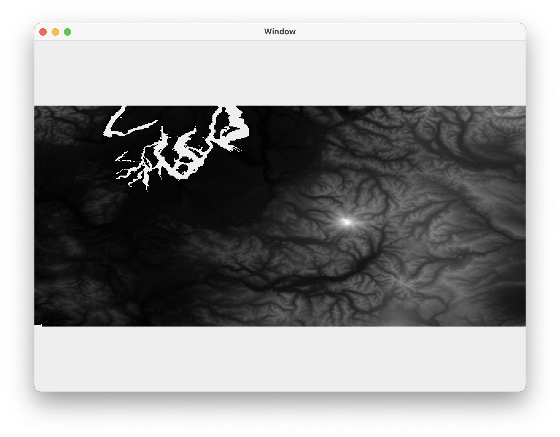
Divide
Divide one Raster by another Raster.
| Short Name | Long Name | Description |
|---|---|---|
-k |
--other-raster |
The other raster |
-y |
--other-raster-name |
The other raster name |
-j |
--other-projection |
The other projection |
-o |
--output-raster |
The output raster |
-f |
--output-raster-format |
The output raster format |
-i |
--input-raster |
The input raster |
-l |
--input-raster-name |
The input raster name |
-p |
--input-projection |
The input projection |
--help |
Print the help message |
|
--web-help |
Open help in a browser |
geoc raster divide -i src/test/resources/high.tif -k src/test/resources/low.tif -o target/divided.tifLow
High
High / Low
Divide Constant
Divide a Raster by a constant value.
| Short Name | Long Name | Description |
|---|---|---|
-v |
--value |
The value |
-o |
--output-raster |
The output raster |
-f |
--output-raster-format |
The output raster format |
-i |
--input-raster |
The input raster |
-l |
--input-raster-name |
The input raster name |
-p |
--input-projection |
The input projection |
--help |
Print the help message |
|
--web-help |
Open help in a browser |
geoc raster divide constant -i src/test/resources/high.tif -v 2.1 -o target/divided.tifRaster

Raster / 2.1
Draw
Draw a Raster to an image.
| Short Name | Long Name | Description |
|---|---|---|
-f |
--file |
The output file |
-t |
--type |
The type of document |
-w |
--width |
The width |
-h |
--height |
The height |
-s |
--sld-file |
The sld file |
-b |
--bounds |
The bounds |
-m |
--layer |
The map layer |
-i |
--input-raster |
The input raster |
-l |
--input-raster-name |
The input raster name |
-p |
--input-projection |
The input projection |
--help |
Print the help message |
|
--web-help |
Open help in a browser |
geoc raster draw -i src/test/resources/earth.tif -f target/image.png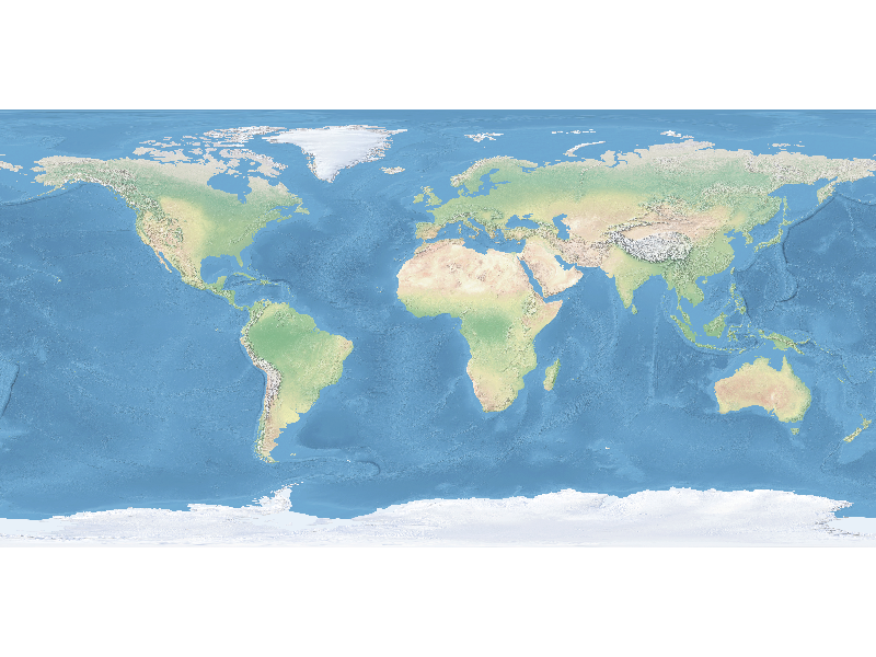
Envelope
Get the Envelope of a Raster as a Vector Layer.
| Short Name | Long Name | Description |
|---|---|---|
-o |
--output-workspace |
The output workspace |
-r |
--output-layer |
The output layer |
-i |
--input-raster |
The input raster |
-l |
--input-raster-name |
The input raster name |
-p |
--input-projection |
The input projection |
--help |
Print the help message |
|
--web-help |
Open help in a browser |
geoc raster envelope -i src/test/resources/earth.tif -o target/earth_envelope.shp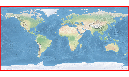
Exponent
Calculate the exponent for each cell..
| Short Name | Long Name | Description |
|---|---|---|
-o |
--output-raster |
The output raster |
-f |
--output-raster-format |
The output raster format |
-i |
--input-raster |
The input raster |
-l |
--input-raster-name |
The input raster name |
-p |
--input-projection |
The input projection |
--help |
Print the help message |
|
--web-help |
Open help in a browser |
geoc raster exp -i src/test/resources/pc.tif -o target/pc_exp.tif
Extract Footprint
Extract the footprint of the Raster as a Vector Layer.
| Short Name | Long Name | Description |
|---|---|---|
-e |
--exclusion-range |
A comma delimited range of values to exclude from the search. |
-t |
--threshold-area |
A number used to exclude small Polygons. The default is 5. |
-f |
--compute-simplified-footprint |
Whether to compute a simplified footprint or not. The default is false. |
-s |
--simplifier-factor |
A number used to simplify the geometry. The default is 2. |
-c |
--remove-collinear |
Whether to remove collinear coordinates. The default is true. |
-v |
--force-valid |
Whether to force creation of valid polygons. The default is true. |
-y |
--loading-type |
The image loading type (Deferred or Immediate). Immediate is the default. |
-o |
--output-workspace |
The output workspace |
-r |
--output-layer |
The output layer |
-i |
--input-raster |
The input raster |
-l |
--input-raster-name |
The input raster name |
-p |
--input-projection |
The input projection |
--help |
Print the help message |
|
--web-help |
Open help in a browser |
geoc raster extractfootprint -i src/test/resources/earth.tif -o target/earth_footprint.shp
Info
Get information about a Raster.
| Short Name | Long Name | Description |
|---|---|---|
-i |
--input-raster |
The input raster |
-l |
--input-raster-name |
The input raster name |
-p |
--input-projection |
The input projection |
--help |
Print the help message |
|
--web-help |
Open help in a browser |
geoc raster info -i src/test/resources/earth.tifFormat: GeoTIFF
Size: 800, 400
Projection ID: EPSG:4326
Projection WKT: GEOGCS["WGS 84",
DATUM["World Geodetic System 1984",
SPHEROID["WGS 84", 6378137.0, 298.257223563, AUTHORITY["EPSG","7030"]],
AUTHORITY["EPSG","6326"]],
PRIMEM["Greenwich", 0.0, AUTHORITY["EPSG","8901"]],
UNIT["degree", 0.017453292519943295],
AXIS["Geodetic longitude", EAST],
AXIS["Geodetic latitude", NORTH],
AUTHORITY["EPSG","4326"]]
Extent: -179.99999999999997, -89.99999999998205, 179.99999999996405, 90.0
Pixel Size: 0.44999999999995505, 0.4499999999999551
Block Size: 800, 8
Bands:
RED_BAND
Min Value: 56.0 Max Value: 255.0
GREEN_BAND
Min Value: 84.0 Max Value: 255.0
BLUE_BAND
Min Value: 91.0 Max Value: 255.0
Invert
Invert the values of a Raster.
| Short Name | Long Name | Description |
|---|---|---|
-o |
--output-raster |
The output raster |
-f |
--output-raster-format |
The output raster format |
-i |
--input-raster |
The input raster |
-l |
--input-raster-name |
The input raster name |
-p |
--input-projection |
The input projection |
--help |
Print the help message |
|
--web-help |
Open help in a browser |
geoc raster invert -i src/test/resources/raster.tif -o target/inverted.tif
Get Projection
Get the Raster Projection.
| Short Name | Long Name | Description |
|---|---|---|
-t |
--type |
The output type (epsg, id, srs, wkt) |
-i |
--input-raster |
The input raster |
-l |
--input-raster-name |
The input raster name |
-p |
--input-projection |
The input projection |
--help |
Print the help message |
|
--web-help |
Open help in a browser |
geoc raster projection -i src/test/resources/earth.tifEPSG:4326
Get Size
Get the Raster size (width,height).
| Short Name | Long Name | Description |
|---|---|---|
-i |
--input-raster |
The input raster |
-l |
--input-raster-name |
The input raster name |
-p |
--input-projection |
The input projection |
--help |
Print the help message |
|
--web-help |
Open help in a browser |
geoc raster size -i src/test/resources/earth.tif800,400
Get Value
Get a value from a Raster
| Short Name | Long Name | Description |
|---|---|---|
-x |
--x-coordinate |
The x coordinate |
-y |
--y-coordinate |
The y coordinate |
-t |
--type |
The type can be point or pixel |
-b |
--band |
The band to get a value from |
-i |
--input-raster |
The input raster |
-l |
--input-raster-name |
The input raster name |
-p |
--input-projection |
The input projection |
--help |
Print the help message |
|
--web-help |
Open help in a browser |
geoc raster get value -i src/test/resources/pc.tif -x -121.799927 -y 46.8677033069.0
Reclassify
Reclassify a Raster.
| Short Name | Long Name | Description |
|---|---|---|
-b |
--band |
The band |
-n |
--nodata |
The NODATA value |
-r |
--range |
A range: from-to=value or 1-10=5 |
-o |
--output-raster |
The output raster |
-f |
--output-raster-format |
The output raster format |
-i |
--input-raster |
The input raster |
-l |
--input-raster-name |
The input raster name |
-p |
--input-projection |
The input projection |
--help |
Print the help message |
|
--web-help |
Open help in a browser |
geoc raster reclassify -i src/test/resources/pc.tif -o target/pc_reclass.tif -r 0-0=1 -r 0-50=2 -r 50-200=3 -r 200-1000=5 -r 1000-1500=4 -r 1500-4000=6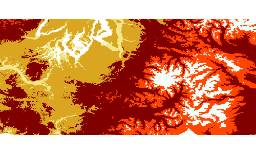
Style Default
Create a default Style for a Raster.
| Short Name | Long Name | Description |
|---|---|---|
-o |
--opacity |
The opacity |
--help |
Print the help message |
|
--web-help |
Open help in a browser |
geoc raster style default<?xml version="1.0" encoding="UTF-8"?><sld:StyledLayerDescriptor xmlns:sld="http://www.opengis.net/sld" xmlns="http://www.opengis.net/sld" xmlns:gml="http://www.opengis.net/gml" xmlns:ogc="http://www.opengis.net/ogc" version="1.0.0">
<sld:UserLayer>
<sld:LayerFeatureConstraints>
<sld:FeatureTypeConstraint/>
</sld:LayerFeatureConstraints>
<sld:UserStyle>
<sld:Name>Default Styler</sld:Name>
<sld:FeatureTypeStyle>
<sld:Name>name</sld:Name>
<sld:Rule>
<sld:RasterSymbolizer>
<sld:Geometry>
<ogc:Literal>grid</ogc:Literal>
</sld:Geometry>
<sld:ContrastEnhancement/>
</sld:RasterSymbolizer>
</sld:Rule>
</sld:FeatureTypeStyle>
</sld:UserStyle>
</sld:UserLayer>
</sld:StyledLayerDescriptor>Subtract Constant
Subtract a constant value from a Raster.
| Short Name | Long Name | Description |
|---|---|---|
-v |
--value |
The value |
-m |
--from |
Whether to subtract the Raster from the constant or vice verse |
-o |
--output-raster |
The output raster |
-f |
--output-raster-format |
The output raster format |
-i |
--input-raster |
The input raster |
-l |
--input-raster-name |
The input raster name |
-p |
--input-projection |
The input projection |
--help |
Print the help message |
|
--web-help |
Open help in a browser |
Get original value
geoc raster get value -i src/test/resources/pc.tif -x -121.799927 -y 46.8677033069.0
Subtract 100 from all cells
geoc raster subtract constant -i src/test/resources/pc.tif -v 100 -o target/pc_subtract.tifGet new value
geoc raster get value -i target/pc_subtract.tif -x -121.799927 -y 46.8677032969.0
Subtract
Subtract one Raster from another.
| Short Name | Long Name | Description |
|---|---|---|
-k |
--other-raster |
The other raster |
-y |
--other-raster-name |
The other raster name |
-j |
--other-projection |
The other projection |
-o |
--output-raster |
The output raster |
-f |
--output-raster-format |
The output raster format |
-i |
--input-raster |
The input raster |
-l |
--input-raster-name |
The input raster name |
-p |
--input-projection |
The input projection |
--help |
Print the help message |
|
--web-help |
Open help in a browser |
geoc raster subtract -i src/test/resources/high.tif -k src/test/resources/low.tif -o target/highMinusLow.tifHigh
Low
High - Low
To
Convert a Raster from one format to another.
| Short Name | Long Name | Description |
|---|---|---|
-o |
--output-raster |
The output raster |
-f |
--output-raster-format |
The output raster format |
-i |
--input-raster |
The input raster |
-l |
--input-raster-name |
The input raster name |
-p |
--input-projection |
The input projection |
--help |
Print the help message |
|
--web-help |
Open help in a browser |
geoc raster to -i src/test/resources/raster.tif -o target/raster.png -f worldimage
World File
Create a Raster world file
| Short Name | Long Name | Description |
|---|---|---|
-b |
--bounds |
The bounds |
-s |
--size |
The size |
-f |
--file |
The world file |
--help |
Print the help message |
|
--web-help |
Open help in a browser |
geoc raster worldfile -b 10,11,20,21 -s 800,7510.0125 0.0 0.0 -0.013315579227696404 10.00625 20.993342210386153
Style Commands
Create
Create a simple style.
| Short Name | Long Name | Description |
|---|---|---|
-s |
--style-options |
A style options |
-t |
--type |
The output type (sld or ysld) |
-w |
--writer-options |
The StyleWriter options |
-o |
--output |
The output file |
--help |
Print the help message |
|
--web-help |
Open help in a browser |
Style Options:
-
Fill properties
-
fill (color)
-
fill-opacity (0-1)
-
-
Stroke properties
-
stroke (color)
-
stroke-width (double)
-
stroke-opacity (0-1)
-
-
Shape properties
-
shape (color)
-
shape-size (double)
-
shape-type (circle, square, triangle, star, cross, or x)
-
-
Label properties
-
label The field name (ID, NAME)
-
label-size (12)
-
label-style (normal, italic, oblique)
-
label-weight (normal, bold)
-
label-family (serif, Arial, Verdana)
-
geoc style create -s stroke=navy -s stroke-width=0.5 -t sld -o target/boundaries.sld<?xml version="1.0" encoding="UTF-8"?><sld:StyledLayerDescriptor xmlns:sld="http://www.opengis.net/sld" xmlns="http://www.opengis.net/sld" xmlns:gml="http://www.opengis.net/gml" xmlns:ogc="http://www.opengis.net/ogc" version="1.0.0">
<sld:UserLayer>
<sld:LayerFeatureConstraints>
<sld:FeatureTypeConstraint/>
</sld:LayerFeatureConstraints>
<sld:UserStyle>
<sld:Name>Default Styler</sld:Name>
<sld:FeatureTypeStyle>
<sld:Name>name</sld:Name>
<sld:Rule>
<sld:LineSymbolizer>
<sld:Stroke>
<sld:CssParameter name="stroke">#000080</sld:CssParameter>
<sld:CssParameter name="stroke-width">0.5</sld:CssParameter>
</sld:Stroke>
</sld:LineSymbolizer>
</sld:Rule>
</sld:FeatureTypeStyle>
</sld:UserStyle>
</sld:UserLayer>
</sld:StyledLayerDescriptor>geoc style create -s fill=white -s stroke=black -s stroke-width=1.5 -t ysld -o target/boundaries.ysldname: Default Styler
feature-styles:
- name: name
rules:
- scale: [min, max]
symbolizers:
- polygon:
fill-color: '#FFFFFF'
fill-opacity: 0.6
- line:
stroke-color: '#000000'
stroke-width: 1.5CSS to SLD
Convert CSS to SLD.
| Short Name | Long Name | Description |
|---|---|---|
-i |
--input |
The input file or url |
-o |
--output |
The output file |
-w |
--writer-options |
The StyleWriter options |
--help |
Print the help message |
|
--web-help |
Open help in a browser |
geoc style css2sld -i target/points.css -o target/points.sldpoints.css
* {
   mark: symbol(circle);
   mark-size: 6px;
 }

 :mark {
   fill: red;
 }
points.sld
<?xml version="1.0" encoding="UTF-8"?><sld:StyledLayerDescriptor xmlns:sld="http://www.opengis.net/sld" xmlns="http://www.opengis.net/sld" xmlns:gml="http://www.opengis.net/gml" xmlns:ogc="http://www.opengis.net/ogc" version="1.0.0">
  <sld:UserLayer>
    <sld:LayerFeatureConstraints>
      <sld:FeatureTypeConstraint/>
    </sld:LayerFeatureConstraints>
    <sld:UserStyle>
      <sld:Name>Default Styler</sld:Name>
      <sld:FeatureTypeStyle>
        <sld:Rule>
          <sld:PointSymbolizer>
            <sld:Graphic>
              <sld:Mark>
                <sld:WellKnownName>circle</sld:WellKnownName>
                <sld:Fill>
                  <sld:CssParameter name="fill">#ff0000</sld:CssParameter>
                </sld:Fill>
              </sld:Mark>
              <sld:Size>6</sld:Size>
            </sld:Graphic>
          </sld:PointSymbolizer>
        </sld:Rule>
        <sld:VendorOption name="ruleEvaluation">first</sld:VendorOption>
      </sld:FeatureTypeStyle>
    </sld:UserStyle>
  </sld:UserLayer>
</sld:StyledLayerDescriptor>
SLD to Ysld
Convert SLD to Ysld
| Short Name | Long Name | Description |
|---|---|---|
-i |
--input |
The input file or url |
-o |
--output |
The output file |
--help |
Print the help message |
|
--web-help |
Open help in a browser |
geoc style sld2ysld -i target/points.sld -o target/points.ysldpoints.sld
<?xml version="1.0" encoding="UTF-8"?><sld:StyledLayerDescriptor xmlns="http://www.opengis.net/sld" xmlns:sld="http://www.opengis.net/sld" xmlns:gml="http://www.opengis.net/gml" xmlns:ogc="http://www.opengis.net/ogc" version="1.0.0">
  <sld:UserLayer>
    <sld:LayerFeatureConstraints>
      <sld:FeatureTypeConstraint/>
    </sld:LayerFeatureConstraints>
    <sld:UserStyle>
      <sld:Name>Default Styler</sld:Name>
      <sld:FeatureTypeStyle>
        <sld:Rule>
          <sld:PointSymbolizer>
            <sld:Graphic>
              <sld:Mark>
                <sld:WellKnownName>circle</sld:WellKnownName>
                <sld:Fill>
                  <sld:CssParameter name="fill">#ff0000</sld:CssParameter>
                </sld:Fill>
              </sld:Mark>
              <sld:Size>6</sld:Size>
            </sld:Graphic>
          </sld:PointSymbolizer>
        </sld:Rule>
        <sld:VendorOption name="ruleEvaluation">first</sld:VendorOption>
      </sld:FeatureTypeStyle>
    </sld:UserStyle>
  </sld:UserLayer>
</sld:StyledLayerDescriptor>
points.ysld
name: Default Styler
feature-styles:
- name: name
  rules:
  - scale: [min, max]
    symbolizers:
    - point:
        size: 6
        symbols:
        - mark:
            shape: circle
            fill-color: '#FF0000'
  x-ruleEvaluation: first
Ysld to SLD
Convert Ysld to SLD.
| Short Name | Long Name | Description |
|---|---|---|
-i |
--input |
The input file or url |
-o |
--output |
The output file |
-w |
--writer-options |
The StyleWriter options |
--help |
Print the help message |
|
--web-help |
Open help in a browser |
geoc style ysld2sld -i target/points.ysld -o target/points.sldpoints.ysld
name: Default Styler
feature-styles:
- name: name
  rules:
  - scale: [min, max]
    symbolizers:
    - point:
        size: 6
        symbols:
        - mark:
            shape: circle
            fill-color: '#FF0000'
  x-ruleEvaluation: first
points.sld
<?xml version="1.0" encoding="UTF-8"?><sld:StyledLayerDescriptor xmlns:sld="http://www.opengis.net/sld" xmlns="http://www.opengis.net/sld" xmlns:gml="http://www.opengis.net/gml" xmlns:ogc="http://www.opengis.net/ogc" version="1.0.0">
  <sld:UserLayer>
    <sld:LayerFeatureConstraints>
      <sld:FeatureTypeConstraint/>
    </sld:LayerFeatureConstraints>
    <sld:UserStyle>
      <sld:Name>Default Styler</sld:Name>
      <sld:FeatureTypeStyle>
        <sld:Name>name</sld:Name>
        <sld:Rule>
          <sld:PointSymbolizer>
            <sld:Graphic>
              <sld:Mark>
                <sld:WellKnownName>circle</sld:WellKnownName>
                <sld:Fill>
                  <sld:CssParameter name="fill">#FF0000</sld:CssParameter>
                </sld:Fill>
              </sld:Mark>
              <sld:Size>6</sld:Size>
            </sld:Graphic>
          </sld:PointSymbolizer>
        </sld:Rule>
        <sld:VendorOption name="ruleEvaluation">first</sld:VendorOption>
      </sld:FeatureTypeStyle>
    </sld:UserStyle>
  </sld:UserLayer>
</sld:StyledLayerDescriptor>
Unique Values from Text
Create a Style from reading values in the unique values format.
| Short Name | Long Name | Description |
|---|---|---|
-f |
--field |
The field |
-g |
--geometry-type |
The geometry type (point, linestring, polygon) |
-i |
--input |
The input file or url |
-t |
--type |
The output type (sld or ysld) |
-o |
--output |
The output file |
-w |
--writer-options |
The StyleWriter options |
--help |
Print the help message |
|
--web-help |
Open help in a browser |
geoc style uniquevaluesfromtext -i target/units.txt -f UNIT -g polygon -t sld -o target/units.sldunits.txt
AHa=#aa0c74
AHat=#b83b1f
AHcf=#964642
AHh=#78092e
AHpe=#78092e
AHt=#5f025a
AHt3=#e76161
Aa1=#fcedcd
Aa2=#94474b
units.sld
<?xml version="1.0" encoding="UTF-8"?><sld:StyledLayerDescriptor xmlns:sld="http://www.opengis.net/sld" xmlns="http://www.opengis.net/sld" xmlns:gml="http://www.opengis.net/gml" xmlns:ogc="http://www.opengis.net/ogc" version="1.0.0">
  <sld:UserLayer>
    <sld:LayerFeatureConstraints>
      <sld:FeatureTypeConstraint/>
    </sld:LayerFeatureConstraints>
    <sld:UserStyle>
      <sld:Name>Default Styler</sld:Name>
      <sld:FeatureTypeStyle>
        <sld:Name>name</sld:Name>
        <sld:Rule>
          <ogc:Filter>
            <ogc:PropertyIsEqualTo>
              <ogc:PropertyName>UNIT</ogc:PropertyName>
              <ogc:Literal>AHa</ogc:Literal>
            </ogc:PropertyIsEqualTo>
          </ogc:Filter>
          <sld:PolygonSymbolizer>
            <sld:Fill>
              <sld:CssParameter name="fill">#aa0c74</sld:CssParameter>
            </sld:Fill>
          </sld:PolygonSymbolizer>
          <sld:LineSymbolizer>
            <sld:Stroke>
              <sld:CssParameter name="stroke">#760851</sld:CssParameter>
              <sld:CssParameter name="stroke-width">0.5</sld:CssParameter>
            </sld:Stroke>
          </sld:LineSymbolizer>
        </sld:Rule>
        <sld:Rule>
          <ogc:Filter>
            <ogc:PropertyIsEqualTo>
              <ogc:PropertyName>UNIT</ogc:PropertyName>
              <ogc:Literal>AHat</ogc:Literal>
            </ogc:PropertyIsEqualTo>
          </ogc:Filter>
          <sld:PolygonSymbolizer>
            <sld:Fill>
              <sld:CssParameter name="fill">#b83b1f</sld:CssParameter>
            </sld:Fill>
          </sld:PolygonSymbolizer>
          <sld:LineSymbolizer>
            <sld:Stroke>
              <sld:CssParameter name="stroke">#802915</sld:CssParameter>
              <sld:CssParameter name="stroke-width">0.5</sld:CssParameter>
            </sld:Stroke>
          </sld:LineSymbolizer>
        </sld:Rule>
        <sld:Rule>
          <ogc:Filter>
            <ogc:PropertyIsEqualTo>
              <ogc:PropertyName>UNIT</ogc:PropertyName>
              <ogc:Literal>AHcf</ogc:Literal>
            </ogc:PropertyIsEqualTo>
          </ogc:Filter>
          <sld:PolygonSymbolizer>
            <sld:Fill>
              <sld:CssParameter name="fill">#964642</sld:CssParameter>
            </sld:Fill>
          </sld:PolygonSymbolizer>
          <sld:LineSymbolizer>
            <sld:Stroke>
              <sld:CssParameter name="stroke">#69312e</sld:CssParameter>
              <sld:CssParameter name="stroke-width">0.5</sld:CssParameter>
            </sld:Stroke>
          </sld:LineSymbolizer>
        </sld:Rule>
        <sld:Rule>
          <ogc:Filter>
            <ogc:PropertyIsEqualTo>
              <ogc:PropertyName>UNIT</ogc:PropertyName>
              <ogc:Literal>AHh</ogc:Literal>
            </ogc:PropertyIsEqualTo>
          </ogc:Filter>
          <sld:PolygonSymbolizer>
            <sld:Fill>
              <sld:CssParameter name="fill">#78092e</sld:CssParameter>
            </sld:Fill>
          </sld:PolygonSymbolizer>
          <sld:LineSymbolizer>
            <sld:Stroke>
              <sld:CssParameter name="stroke">#540620</sld:CssParameter>
              <sld:CssParameter name="stroke-width">0.5</sld:CssParameter>
            </sld:Stroke>
          </sld:LineSymbolizer>
        </sld:Rule>
        <sld:Rule>
          <ogc:Filter>
            <ogc:PropertyIsEqualTo>
              <ogc:PropertyName>UNIT</ogc:PropertyName>
              <ogc:Literal>AHpe</ogc:Literal>
            </ogc:PropertyIsEqualTo>
          </ogc:Filter>
          <sld:PolygonSymbolizer>
            <sld:Fill>
              <sld:CssParameter name="fill">#78092e</sld:CssParameter>
            </sld:Fill>
          </sld:PolygonSymbolizer>
          <sld:LineSymbolizer>
            <sld:Stroke>
              <sld:CssParameter name="stroke">#540620</sld:CssParameter>
              <sld:CssParameter name="stroke-width">0.5</sld:CssParameter>
            </sld:Stroke>
          </sld:LineSymbolizer>
        </sld:Rule>
        <sld:Rule>
          <ogc:Filter>
            <ogc:PropertyIsEqualTo>
              <ogc:PropertyName>UNIT</ogc:PropertyName>
              <ogc:Literal>AHt</ogc:Literal>
            </ogc:PropertyIsEqualTo>
          </ogc:Filter>
          <sld:PolygonSymbolizer>
            <sld:Fill>
              <sld:CssParameter name="fill">#5f025a</sld:CssParameter>
            </sld:Fill>
          </sld:PolygonSymbolizer>
          <sld:LineSymbolizer>
            <sld:Stroke>
              <sld:CssParameter name="stroke">#42013e</sld:CssParameter>
              <sld:CssParameter name="stroke-width">0.5</sld:CssParameter>
            </sld:Stroke>
          </sld:LineSymbolizer>
        </sld:Rule>
        <sld:Rule>
          <ogc:Filter>
            <ogc:PropertyIsEqualTo>
              <ogc:PropertyName>UNIT</ogc:PropertyName>
              <ogc:Literal>AHt3</ogc:Literal>
            </ogc:PropertyIsEqualTo>
          </ogc:Filter>
          <sld:PolygonSymbolizer>
            <sld:Fill>
              <sld:CssParameter name="fill">#e76161</sld:CssParameter>
            </sld:Fill>
          </sld:PolygonSymbolizer>
          <sld:LineSymbolizer>
            <sld:Stroke>
              <sld:CssParameter name="stroke">#a14343</sld:CssParameter>
              <sld:CssParameter name="stroke-width">0.5</sld:CssParameter>
            </sld:Stroke>
          </sld:LineSymbolizer>
        </sld:Rule>
        <sld:Rule>
          <ogc:Filter>
            <ogc:PropertyIsEqualTo>
              <ogc:PropertyName>UNIT</ogc:PropertyName>
              <ogc:Literal>Aa1</ogc:Literal>
            </ogc:PropertyIsEqualTo>
          </ogc:Filter>
          <sld:PolygonSymbolizer>
            <sld:Fill>
              <sld:CssParameter name="fill">#fcedcd</sld:CssParameter>
            </sld:Fill>
          </sld:PolygonSymbolizer>
          <sld:LineSymbolizer>
            <sld:Stroke>
              <sld:CssParameter name="stroke">#b0a58f</sld:CssParameter>
              <sld:CssParameter name="stroke-width">0.5</sld:CssParameter>
            </sld:Stroke>
          </sld:LineSymbolizer>
        </sld:Rule>
        <sld:Rule>
          <ogc:Filter>
            <ogc:PropertyIsEqualTo>
              <ogc:PropertyName>UNIT</ogc:PropertyName>
              <ogc:Literal>Aa2</ogc:Literal>
            </ogc:PropertyIsEqualTo>
          </ogc:Filter>
          <sld:PolygonSymbolizer>
            <sld:Fill>
              <sld:CssParameter name="fill">#94474b</sld:CssParameter>
            </sld:Fill>
          </sld:PolygonSymbolizer>
          <sld:LineSymbolizer>
            <sld:Stroke>
              <sld:CssParameter name="stroke">#673134</sld:CssParameter>
              <sld:CssParameter name="stroke-width">0.5</sld:CssParameter>
            </sld:Stroke>
          </sld:LineSymbolizer>
        </sld:Rule>
      </sld:FeatureTypeStyle>
    </sld:UserStyle>
  </sld:UserLayer>
</sld:StyledLayerDescriptor>
Style Repository Commands
Style Repositories are useful for storing styles for layers in a directories or databases.
Style Repository Types
| Name | Type | Arguments |
|---|---|---|
Flat Directory |
-t directory |
-p file=path/styles |
Nested Directory |
-t nested-directory |
-p file=path/styles |
SQLite Database (GeoPackage) |
-t sqlite |
-p file=path/data.gpkg |
H2 Database |
-t h2 |
-p file=path/data.db |
PostGIS Database |
-t postgres |
|
Save a Style
Save a Style to a Style Repository.
| Short Name | Long Name | Description |
|---|---|---|
-t |
--type |
The type of style repository (directory, nested-directory, h2, sqlite, postgres) |
-o |
--options |
The style repository options |
-l |
--layer-name |
The layer name |
-s |
--style-name |
The style name |
-f |
--style-file |
The style file (sld or css) |
--help |
Print the help message |
|
--web-help |
Open help in a browser |
geoc style repository save -t sqlite -o file=target/layers.gpkg -l locations -s circles -f target/location_circles.sldDelete a Style
Delete a Style from a Style Repository.
| Short Name | Long Name | Description |
|---|---|---|
-t |
--type |
The type of style repository (directory, nested-directory, h2, sqlite, postgres) |
-o |
--options |
The style repository options |
-l |
--layer-name |
The layer name |
-s |
--style-name |
The style name |
--help |
Print the help message |
|
--web-help |
Open help in a browser |
geoc style repository delete -t sqlite -o file=target/layers.gpkg -l locations -s circlesGet a Style
Get a Style in a Style Repository.
| Short Name | Long Name | Description |
|---|---|---|
-t |
--type |
The type of style repository (directory, nested-directory, h2, sqlite, postgres) |
-o |
--options |
The style repository options |
-l |
--layer-name |
The layer name |
-s |
--style-name |
The style name |
-f |
--output-file |
The output file |
--help |
Print the help message |
|
--web-help |
Open help in a browser |
geoc style repository get -t sqlite -o file=target/layers.gpkg -l locations -s circles<?xml version="1.0" encoding="UTF-8"?><sld:StyledLayerDescriptor xmlns:sld="http://www.opengis.net/sld" xmlns="http://www.opengis.net/sld" xmlns:gml="http://www.opengis.net/gml" xmlns:ogc="http://www.opengis.net/ogc" version="1.0.0">
<sld:UserLayer>
<sld:LayerFeatureConstraints>
<sld:FeatureTypeConstraint/>
</sld:LayerFeatureConstraints>
<sld:UserStyle>
<sld:Name>Default Styler</sld:Name>
<sld:FeatureTypeStyle>
<sld:Name>name</sld:Name>
<sld:Rule>
<sld:PointSymbolizer>
<sld:Graphic>
<sld:Mark>
<sld:WellKnownName>circle</sld:WellKnownName>
<sld:Fill>
<sld:CssParameter name="fill">#6495ed</sld:CssParameter>
</sld:Fill>
<sld:Stroke>
<sld:CssParameter name="stroke">#4668a5</sld:CssParameter>
<sld:CssParameter name="stroke-width">0.1</sld:CssParameter>
</sld:Stroke>
</sld:Mark>
<sld:Size>6</sld:Size>
</sld:Graphic>
</sld:PointSymbolizer>
</sld:Rule>
</sld:FeatureTypeStyle>
</sld:UserStyle>
</sld:UserLayer>
</sld:StyledLayerDescriptor>List Styles
List all Styles in a Style Repository.
| Short Name | Long Name | Description |
|---|---|---|
-t |
--type |
The type of style repository (directory, nested-directory, h2, sqlite, postgres) |
-o |
--options |
The style repository options |
-l |
--layer-name |
The layer name |
--help |
Print the help message |
|
--web-help |
Open help in a browser |
geoc style repository list -t sqlite -o file=target/layers.gpkg -l locationslocations blue
locations redCopy a Style
Copy styles from one repository to another/
| Short Name | Long Name | Description |
|---|---|---|
-t |
--input-type |
The type of style repository (directory, nested-directory, h2, sqlite, postgres) |
-p |
--input-options |
The style repository options |
-o |
--output-type |
The type of style repository (directory, nested-directory, h2, sqlite, postgres) |
-r |
--output-options |
The style repository options |
--help |
Print the help message |
|
--web-help |
Open help in a browser |
geoc style repository copy -t sqlite -p file=target/layers.gpkg -o directory -r file=target/layer_stylesblue.sld
red.sldTile Commands
Tile Layers
All of the tile commands work with a tile layer.
Supported Tile Layers include:
-
MBTiles
-
GeoPackage
-
TMS
-
OSM
-
UTFGrid
-
Vector Tiles
Tile layer configuration strings are similar to layer and map layer configuration strings.
-
pyramid = Several tile layers can take a pyramid attribute. You can use one of several well known pyramid names:
-
globalmercator
-
mercator
-
globalmercatorbottomleft
-
globalgeodetic
-
geodetic
-
file that contains pyramid metadata in csv, xml, or json format.
-
-
type = The type of image layer.
-
mbtiles
-
geopackage
-
tms
-
osm
-
mbtiles
-
type=mbtiles file=states.mbtiles
-
type=mbtiles file=states.mbtiles name=states description='The united states'
-
states.mbtiles
geopackage
-
type=geopackage file=states.gpkg name=states pyramid=globalmercator
-
states.gpkg
tms
-
type=tms file=/Users/you/tms format=jpeg
-
type=tms file=/Users/you/tms format=png name=tms pyramid=geodetic
osm
-
type=osm url=http://a.tile.openstreetmap.org
-
type=osm urls=http://a.tile.openstreetmap.org,http://b.tile.openstreetmap.org
utfgrid
-
type=utfgrid file=/Users/me/tiles/states
vectortiles
-
type=vectortiles name=states file=/Users/me/tiles/states format=mvt pyramid=GlobalMercator
-
type=vectortiles name=states url=http://vectortiles.org format=pbf pyramid=GlobalGeodeti
Delete
Delete tiles from a tile layer
| Short Name | Long Name | Description |
|---|---|---|
-l |
--tile-layer |
The tile layer |
-i |
--tile |
The Tile Z/X/Y coordinates |
-b |
--bounds |
The bounds |
-z |
--zoom-level |
The tile zoom level |
-x |
--minx |
The min x or col |
-y |
--miny |
The min y or row |
-c |
--maxx |
The max x or col |
-u |
--maxy |
The max y or row |
-w |
--width |
The raster width |
-h |
--height |
The raster height |
--help |
Print the help message |
|
--web-help |
Open help in a browser |
geoc tile delete -l "type=mbtiles file=target/world.mbtiles" -z 2Generate
Generate tiles.
| Short Name | Long Name | Description |
|---|---|---|
-l |
--tile-layer |
The tile layer |
-f |
--field |
A field |
-d |
--layer-fields |
A List of sub fields for a layer |
-m |
--layer |
The map layer |
-s |
--start-zoom |
The start zoom level |
-e |
--end-zoom |
The end zoom level |
-b |
--bounds |
The bounds |
-t |
--metatile |
The metatile width,height |
-i |
--missing |
Whether to generate only missing tiles |
-v |
--verbose |
The verbose flag |
--help |
Print the help message |
|
--web-help |
Open help in a browser |
MBTiles
geoc tile generate -l "type=mbtiles file=target/world.mbtiles" -m "layertype=layer file=src/test/resources/data.gpkg layername=ocean style=src/test/resources/ocean.sld" -m "layertype=layer file=src/test/resources/data.gpkg layername=countries style=src/test/resources/countries.sld" -s 0 -e 2 --verboseZoom Level 0
0). Tile(x:0, y:0, z:0)
Bounds(-2.003639514788131E7,-2.0037471205137067E7,2.003639514788131E7,2.003747120513706E7,EPSG:3857)
Generating 1 tile took 0.088379932 seconds
Zoom Level 1
0). Tile(x:0, y:0, z:1)
Bounds(-2.003639514788131E7,-2.0037471205137067E7,0.0,-3.725290298461914E-9,EPSG:3857)
1). Tile(x:1, y:0, z:1)
Bounds(0.0,-2.0037471205137067E7,2.003639514788131E7,-3.725290298461914E-9,EPSG:3857)
2). Tile(x:0, y:1, z:1)
Bounds(-2.003639514788131E7,-3.725290298461914E-9,0.0,2.003747120513706E7,EPSG:3857)
3). Tile(x:1, y:1, z:1)
Bounds(0.0,-3.725290298461914E-9,2.003639514788131E7,2.003747120513706E7,EPSG:3857)
Generating 4 tiles took 0.243557204 seconds
Zoom Level 2
0). Tile(x:0, y:0, z:2)
Bounds(-2.003639514788131E7,-2.0037471205137067E7,-1.0018197573940655E7,-1.0018735602568535E7,EPSG:3857)
1). Tile(x:1, y:0, z:2)
Bounds(-1.0018197573940655E7,-2.0037471205137067E7,0.0,-1.0018735602568535E7,EPSG:3857)
2). Tile(x:2, y:0, z:2)
Bounds(0.0,-2.0037471205137067E7,1.0018197573940655E7,-1.0018735602568535E7,EPSG:3857)
3). Tile(x:3, y:0, z:2)
Bounds(1.0018197573940653E7,-2.0037471205137067E7,2.0036395147881307E7,-1.0018735602568535E7,EPSG:3857)
4). Tile(x:0, y:1, z:2)
Bounds(-2.003639514788131E7,-1.0018735602568535E7,-1.0018197573940655E7,-3.725290298461914E-9,EPSG:3857)
5). Tile(x:1, y:1, z:2)
Bounds(-1.0018197573940655E7,-1.0018735602568535E7,0.0,-3.725290298461914E-9,EPSG:3857)
6). Tile(x:2, y:1, z:2)
Bounds(0.0,-1.0018735602568535E7,1.0018197573940655E7,-3.725290298461914E-9,EPSG:3857)
7). Tile(x:3, y:1, z:2)
Bounds(1.0018197573940653E7,-1.0018735602568535E7,2.0036395147881307E7,-3.725290298461914E-9,EPSG:3857)
8). Tile(x:0, y:2, z:2)
Bounds(-2.003639514788131E7,-3.725290298461914E-9,-1.0018197573940655E7,1.0018735602568528E7,EPSG:3857)
9). Tile(x:1, y:2, z:2)
Bounds(-1.0018197573940655E7,-3.725290298461914E-9,0.0,1.0018735602568528E7,EPSG:3857)
10). Tile(x:2, y:2, z:2)
Bounds(0.0,-3.725290298461914E-9,1.0018197573940655E7,1.0018735602568528E7,EPSG:3857)
11). Tile(x:3, y:2, z:2)
Bounds(1.0018197573940653E7,-3.725290298461914E-9,2.0036395147881307E7,1.0018735602568528E7,EPSG:3857)
12). Tile(x:0, y:3, z:2)
Bounds(-2.003639514788131E7,1.001873560256853E7,-1.0018197573940655E7,2.003747120513706E7,EPSG:3857)
13). Tile(x:1, y:3, z:2)
Bounds(-1.0018197573940655E7,1.001873560256853E7,0.0,2.003747120513706E7,EPSG:3857)
14). Tile(x:2, y:3, z:2)
Bounds(0.0,1.001873560256853E7,1.0018197573940655E7,2.003747120513706E7,EPSG:3857)
15). Tile(x:3, y:3, z:2)
Bounds(1.0018197573940653E7,1.001873560256853E7,2.0036395147881307E7,2.003747120513706E7,EPSG:3857)
Generating 16 tiles took 1.06558958 seconds
GeoPackage
geoc tile generate -l "type=geopackage file=target/world.gpkg name=world pyramid=geodetic" -m "layertype=layer file=src/test/resources/data.gpkg layername=ocean style=src/test/resources/ocean.sld" -m "layertype=layer file=src/test/resources/data.gpkg layername=countries style=src/test/resources/countries.sld" -s 0 -e 2 --verboseZoom Level 0
0). Tile(x:0, y:0, z:0)
Bounds(-179.99,-89.99,0.0,89.99,EPSG:4326)
1). Tile(x:1, y:0, z:0)
Bounds(0.0,-89.99,179.99,89.99,EPSG:4326)
Generating 2 tiles took 0.071144078 seconds
Zoom Level 1
0). Tile(x:0, y:0, z:1)
Bounds(-179.99,0.0,-89.995,89.99,EPSG:4326)
1). Tile(x:1, y:0, z:1)
Bounds(-89.995,0.0,0.0,89.99,EPSG:4326)
2). Tile(x:2, y:0, z:1)
Bounds(0.0,0.0,89.995,89.99,EPSG:4326)
3). Tile(x:3, y:0, z:1)
Bounds(89.995,0.0,179.99,89.99,EPSG:4326)
4). Tile(x:0, y:1, z:1)
Bounds(-179.99,-89.99,-89.995,0.0,EPSG:4326)
5). Tile(x:1, y:1, z:1)
Bounds(-89.995,-89.99,0.0,0.0,EPSG:4326)
6). Tile(x:2, y:1, z:1)
Bounds(0.0,-89.99,89.995,0.0,EPSG:4326)
7). Tile(x:3, y:1, z:1)
Bounds(89.995,-89.99,179.99,0.0,EPSG:4326)
Generating 8 tiles took 0.191146543 seconds
Zoom Level 2
0). Tile(x:0, y:0, z:2)
Bounds(-179.99,44.995,-134.9925,89.99,EPSG:4326)
1). Tile(x:1, y:0, z:2)
Bounds(-134.9925,44.995,-89.995,89.99,EPSG:4326)
2). Tile(x:2, y:0, z:2)
Bounds(-89.995,44.995,-44.9975,89.99,EPSG:4326)
3). Tile(x:3, y:0, z:2)
Bounds(-44.9975,44.995,0.0,89.99,EPSG:4326)
4). Tile(x:4, y:0, z:2)
Bounds(0.0,44.995,44.9975,89.99,EPSG:4326)
5). Tile(x:5, y:0, z:2)
Bounds(44.9975,44.995,89.995,89.99,EPSG:4326)
6). Tile(x:6, y:0, z:2)
Bounds(89.995,44.995,134.9925,89.99,EPSG:4326)
7). Tile(x:7, y:0, z:2)
Bounds(134.9925,44.995,179.99,89.99,EPSG:4326)
8). Tile(x:0, y:1, z:2)
Bounds(-179.99,-7.105427357601002E-15,-134.9925,44.99499999999999,EPSG:4326)
9). Tile(x:1, y:1, z:2)
Bounds(-134.9925,-7.105427357601002E-15,-89.995,44.99499999999999,EPSG:4326)
10). Tile(x:2, y:1, z:2)
Bounds(-89.995,-7.105427357601002E-15,-44.9975,44.99499999999999,EPSG:4326)
11). Tile(x:3, y:1, z:2)
Bounds(-44.9975,-7.105427357601002E-15,0.0,44.99499999999999,EPSG:4326)
12). Tile(x:4, y:1, z:2)
Bounds(0.0,-7.105427357601002E-15,44.9975,44.99499999999999,EPSG:4326)
13). Tile(x:5, y:1, z:2)
Bounds(44.9975,-7.105427357601002E-15,89.995,44.99499999999999,EPSG:4326)
14). Tile(x:6, y:1, z:2)
Bounds(89.995,-7.105427357601002E-15,134.9925,44.99499999999999,EPSG:4326)
15). Tile(x:7, y:1, z:2)
Bounds(134.9925,-7.105427357601002E-15,179.99,44.99499999999999,EPSG:4326)
16). Tile(x:0, y:2, z:2)
Bounds(-179.99,-44.995,-134.9925,0.0,EPSG:4326)
17). Tile(x:1, y:2, z:2)
Bounds(-134.9925,-44.995,-89.995,0.0,EPSG:4326)
18). Tile(x:2, y:2, z:2)
Bounds(-89.995,-44.995,-44.9975,0.0,EPSG:4326)
19). Tile(x:3, y:2, z:2)
Bounds(-44.9975,-44.995,0.0,0.0,EPSG:4326)
20). Tile(x:4, y:2, z:2)
Bounds(0.0,-44.995,44.9975,0.0,EPSG:4326)
21). Tile(x:5, y:2, z:2)
Bounds(44.9975,-44.995,89.995,0.0,EPSG:4326)
22). Tile(x:6, y:2, z:2)
Bounds(89.995,-44.995,134.9925,0.0,EPSG:4326)
23). Tile(x:7, y:2, z:2)
Bounds(134.9925,-44.995,179.99,0.0,EPSG:4326)
24). Tile(x:0, y:3, z:2)
Bounds(-179.99,-89.99,-134.9925,-44.995,EPSG:4326)
25). Tile(x:1, y:3, z:2)
Bounds(-134.9925,-89.99,-89.995,-44.995,EPSG:4326)
26). Tile(x:2, y:3, z:2)
Bounds(-89.995,-89.99,-44.9975,-44.995,EPSG:4326)
27). Tile(x:3, y:3, z:2)
Bounds(-44.9975,-89.99,0.0,-44.995,EPSG:4326)
28). Tile(x:4, y:3, z:2)
Bounds(0.0,-89.99,44.9975,-44.995,EPSG:4326)
29). Tile(x:5, y:3, z:2)
Bounds(44.9975,-89.99,89.995,-44.995,EPSG:4326)
30). Tile(x:6, y:3, z:2)
Bounds(89.995,-89.99,134.9925,-44.995,EPSG:4326)
31). Tile(x:7, y:3, z:2)
Bounds(134.9925,-89.99,179.99,-44.995,EPSG:4326)
Generating 32 tiles took 0.667971349 seconds
TMS
geoc tile generate -l "type=tms file=target/tiles" -m "layertype=layer file=src/test/resources/data.gpkg layername=ocean style=src/test/resources/ocean.sld" -m "layertype=layer file=src/test/resources/data.gpkg layername=countries style=src/test/resources/countries.sld" -s 0 -e 2 --verboseZoom Level 0
0). Tile(x:0, y:0, z:0)
Bounds(-2.003639514788131E7,-2.0037471205137067E7,2.003639514788131E7,2.003747120513706E7,EPSG:3857)
Generating 1 tile took 0.063299508 seconds
Zoom Level 1
0). Tile(x:0, y:0, z:1)
Bounds(-2.003639514788131E7,-2.0037471205137067E7,0.0,-3.725290298461914E-9,EPSG:3857)
1). Tile(x:1, y:0, z:1)
Bounds(0.0,-2.0037471205137067E7,2.003639514788131E7,-3.725290298461914E-9,EPSG:3857)
2). Tile(x:0, y:1, z:1)
Bounds(-2.003639514788131E7,-3.725290298461914E-9,0.0,2.003747120513706E7,EPSG:3857)
3). Tile(x:1, y:1, z:1)
Bounds(0.0,-3.725290298461914E-9,2.003639514788131E7,2.003747120513706E7,EPSG:3857)
Generating 4 tiles took 0.223274997 seconds
Zoom Level 2
0). Tile(x:0, y:0, z:2)
Bounds(-2.003639514788131E7,-2.0037471205137067E7,-1.0018197573940655E7,-1.0018735602568535E7,EPSG:3857)
1). Tile(x:1, y:0, z:2)
Bounds(-1.0018197573940655E7,-2.0037471205137067E7,0.0,-1.0018735602568535E7,EPSG:3857)
2). Tile(x:2, y:0, z:2)
Bounds(0.0,-2.0037471205137067E7,1.0018197573940655E7,-1.0018735602568535E7,EPSG:3857)
3). Tile(x:3, y:0, z:2)
Bounds(1.0018197573940653E7,-2.0037471205137067E7,2.0036395147881307E7,-1.0018735602568535E7,EPSG:3857)
4). Tile(x:0, y:1, z:2)
Bounds(-2.003639514788131E7,-1.0018735602568535E7,-1.0018197573940655E7,-3.725290298461914E-9,EPSG:3857)
5). Tile(x:1, y:1, z:2)
Bounds(-1.0018197573940655E7,-1.0018735602568535E7,0.0,-3.725290298461914E-9,EPSG:3857)
6). Tile(x:2, y:1, z:2)
Bounds(0.0,-1.0018735602568535E7,1.0018197573940655E7,-3.725290298461914E-9,EPSG:3857)
7). Tile(x:3, y:1, z:2)
Bounds(1.0018197573940653E7,-1.0018735602568535E7,2.0036395147881307E7,-3.725290298461914E-9,EPSG:3857)
8). Tile(x:0, y:2, z:2)
Bounds(-2.003639514788131E7,-3.725290298461914E-9,-1.0018197573940655E7,1.0018735602568528E7,EPSG:3857)
9). Tile(x:1, y:2, z:2)
Bounds(-1.0018197573940655E7,-3.725290298461914E-9,0.0,1.0018735602568528E7,EPSG:3857)
10). Tile(x:2, y:2, z:2)
Bounds(0.0,-3.725290298461914E-9,1.0018197573940655E7,1.0018735602568528E7,EPSG:3857)
11). Tile(x:3, y:2, z:2)
Bounds(1.0018197573940653E7,-3.725290298461914E-9,2.0036395147881307E7,1.0018735602568528E7,EPSG:3857)
12). Tile(x:0, y:3, z:2)
Bounds(-2.003639514788131E7,1.001873560256853E7,-1.0018197573940655E7,2.003747120513706E7,EPSG:3857)
13). Tile(x:1, y:3, z:2)
Bounds(-1.0018197573940655E7,1.001873560256853E7,0.0,2.003747120513706E7,EPSG:3857)
14). Tile(x:2, y:3, z:2)
Bounds(0.0,1.001873560256853E7,1.0018197573940655E7,2.003747120513706E7,EPSG:3857)
15). Tile(x:3, y:3, z:2)
Bounds(1.0018197573940653E7,1.001873560256853E7,2.0036395147881307E7,2.003747120513706E7,EPSG:3857)
Generating 16 tiles took 0.79404923 seconds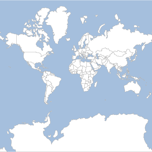
Vector Tiles (PBF)
geoc tile generate -l "type=vectortiles format=pbf file=target/vectortiles" -m "layertype=layer file=src/test/resources/data.gpkg layername=countries" -d countries=NAME,TYPE,LEVEL -s 0 -e 2 --verboseZoom Level 0
0). Tile(x:0, y:0, z:0)
Bounds(-2.003639514788131E7,-2.0037471205137067E7,2.003639514788131E7,2.003747120513706E7,EPSG:3857)
Generating 1 tile took 1.172432924 seconds
Zoom Level 1
0). Tile(x:0, y:0, z:1)
Bounds(-2.003639514788131E7,-2.0037471205137067E7,0.0,-3.725290298461914E-9,EPSG:3857)
1). Tile(x:1, y:0, z:1)
Bounds(0.0,-2.0037471205137067E7,2.003639514788131E7,-3.725290298461914E-9,EPSG:3857)
2). Tile(x:0, y:1, z:1)
Bounds(-2.003639514788131E7,-3.725290298461914E-9,0.0,2.003747120513706E7,EPSG:3857)
3). Tile(x:1, y:1, z:1)
Bounds(0.0,-3.725290298461914E-9,2.003639514788131E7,2.003747120513706E7,EPSG:3857)
Generating 4 tiles took 1.153544333 seconds
Zoom Level 2
0). Tile(x:0, y:0, z:2)
Bounds(-2.003639514788131E7,-2.0037471205137067E7,-1.0018197573940655E7,-1.0018735602568535E7,EPSG:3857)
1). Tile(x:1, y:0, z:2)
Bounds(-1.0018197573940655E7,-2.0037471205137067E7,0.0,-1.0018735602568535E7,EPSG:3857)
2). Tile(x:2, y:0, z:2)
Bounds(0.0,-2.0037471205137067E7,1.0018197573940655E7,-1.0018735602568535E7,EPSG:3857)
3). Tile(x:3, y:0, z:2)
Bounds(1.0018197573940653E7,-2.0037471205137067E7,2.0036395147881307E7,-1.0018735602568535E7,EPSG:3857)
4). Tile(x:0, y:1, z:2)
Bounds(-2.003639514788131E7,-1.0018735602568535E7,-1.0018197573940655E7,-3.725290298461914E-9,EPSG:3857)
5). Tile(x:1, y:1, z:2)
Bounds(-1.0018197573940655E7,-1.0018735602568535E7,0.0,-3.725290298461914E-9,EPSG:3857)
6). Tile(x:2, y:1, z:2)
Bounds(0.0,-1.0018735602568535E7,1.0018197573940655E7,-3.725290298461914E-9,EPSG:3857)
7). Tile(x:3, y:1, z:2)
Bounds(1.0018197573940653E7,-1.0018735602568535E7,2.0036395147881307E7,-3.725290298461914E-9,EPSG:3857)
8). Tile(x:0, y:2, z:2)
Bounds(-2.003639514788131E7,-3.725290298461914E-9,-1.0018197573940655E7,1.0018735602568528E7,EPSG:3857)
9). Tile(x:1, y:2, z:2)
Bounds(-1.0018197573940655E7,-3.725290298461914E-9,0.0,1.0018735602568528E7,EPSG:3857)
10). Tile(x:2, y:2, z:2)
Bounds(0.0,-3.725290298461914E-9,1.0018197573940655E7,1.0018735602568528E7,EPSG:3857)
11). Tile(x:3, y:2, z:2)
Bounds(1.0018197573940653E7,-3.725290298461914E-9,2.0036395147881307E7,1.0018735602568528E7,EPSG:3857)
12). Tile(x:0, y:3, z:2)
Bounds(-2.003639514788131E7,1.001873560256853E7,-1.0018197573940655E7,2.003747120513706E7,EPSG:3857)
13). Tile(x:1, y:3, z:2)
Bounds(-1.0018197573940655E7,1.001873560256853E7,0.0,2.003747120513706E7,EPSG:3857)
14). Tile(x:2, y:3, z:2)
Bounds(0.0,1.001873560256853E7,1.0018197573940655E7,2.003747120513706E7,EPSG:3857)
15). Tile(x:3, y:3, z:2)
Bounds(1.0018197573940653E7,1.001873560256853E7,2.0036395147881307E7,2.003747120513706E7,EPSG:3857)
Generating 16 tiles took 0.844536872 secondsTile Bounds
Get the Bounds of a tile.
| Short Name | Long Name | Description |
|---|---|---|
-p |
--pyramid |
The tile pyramid |
-z |
--zoom-level |
The tile zoom level |
-x |
--column |
The tile x or column |
-y |
--row |
The tile y or row |
--help |
Print the help message |
|
--web-help |
Open help in a browser |
geoc tile get bounds -p mercator -z 3 -x 2 -y 1POLYGON ((-10018197.573940655 -15028103.403852802, -10018197.573940655 -10018735.602568537, -5009098.786970328 -10018735.602568537, -5009098.786970328 -15028103.403852802, -10018197.573940655 -15028103.403852802))List Tiles
Get a list of tiles for a given geometry
| Short Name | Long Name | Description |
|---|---|---|
-p |
--pyramid |
The tile pyramid |
-b |
--bounds |
The bounds |
-z |
--zoom-level |
The tile zoom level |
--help |
Print the help message |
|
--web-help |
Open help in a browser |
geoc tile list tiles -p mercator -z 10 -b 2315277.538707974,4356146.199006655,2534193.2172859586,4470343.22712192810/571/623
10/572/623
10/573/623
10/574/623
10/575/623
10/576/623
10/571/624
10/572/624
10/573/624
10/574/624
10/575/624
10/576/624
10/571/625
10/572/625
10/573/625
10/574/625
10/575/625
10/576/625
10/571/626
10/572/626
10/573/626
10/574/626
10/575/626
10/576/626Pyramid
Get a Pyramid from a TileLayer.
| Short Name | Long Name | Description |
|---|---|---|
-l |
--tile-layer |
The tile layer |
-o |
--output-type |
The output type (text, xml, json) |
--help |
Print the help message |
|
--web-help |
Open help in a browser |
Text
geoc tile pyramid -l "type=geopackage file=src/test/resources/data.gpkg name=world" -o textEPSG:4326 -179.99,-89.99,179.99,89.99,EPSG:4326 TOP_LEFT 256,256 0,2,1,0.703125,0.703125 1,4,2,0.3515625,0.3515625 2,8,4,0.17578125,0.17578125 3,16,8,0.087890625,0.087890625 4,32,16,0.0439453125,0.0439453125 5,64,32,0.02197265625,0.02197265625 6,128,64,0.010986328125,0.010986328125 7,256,128,0.0054931640625,0.0054931640625 8,512,256,0.00274658203125,0.00274658203125 9,1024,512,0.001373291015625,0.001373291015625 10,2048,1024,6.866455078125E-4,6.866455078125E-4 11,4096,2048,3.4332275390625E-4,3.4332275390625E-4 12,8192,4096,1.71661376953125E-4,1.71661376953125E-4 13,16384,8192,8.58306884765625E-5,8.58306884765625E-5 14,32768,16384,4.291534423828125E-5,4.291534423828125E-5 15,65536,32768,2.1457672119140625E-5,2.1457672119140625E-5 16,131072,65536,1.0728836059570312E-5,1.0728836059570312E-5 17,262144,131072,5.364418029785156E-6,5.364418029785156E-6 18,524288,262144,2.682209014892578E-6,2.682209014892578E-6 19,1048576,524288,1.341104507446289E-6,1.341104507446289E-6
JSON
geoc tile pyramid -l "type=geopackage file=src/test/resources/data.gpkg name=world" -o json{
"proj": "EPSG:4326",
"bounds": {
"minX": -179.99,
"minY": -89.99,
"maxX": 179.99,
"maxY": 89.99
},
"origin": "TOP_LEFT",
"tileSize": {
"width": 256,
"height": 256
},
"grids": [
{
"z": 0,
"width": 2,
"height": 1,
"xres": 0.703125,
"yres": 0.703125
},
{
"z": 1,
"width": 4,
"height": 2,
"xres": 0.3515625,
"yres": 0.3515625
},
{
"z": 2,
"width": 8,
"height": 4,
"xres": 0.17578125,
"yres": 0.17578125
},
{
"z": 3,
"width": 16,
"height": 8,
"xres": 0.087890625,
"yres": 0.087890625
},
{
"z": 4,
"width": 32,
"height": 16,
"xres": 0.0439453125,
"yres": 0.0439453125
},
{
"z": 5,
"width": 64,
"height": 32,
"xres": 0.02197265625,
"yres": 0.02197265625
},
{
"z": 6,
"width": 128,
"height": 64,
"xres": 0.010986328125,
"yres": 0.010986328125
},
{
"z": 7,
"width": 256,
"height": 128,
"xres": 0.0054931640625,
"yres": 0.0054931640625
},
{
"z": 8,
"width": 512,
"height": 256,
"xres": 0.00274658203125,
"yres": 0.00274658203125
},
{
"z": 9,
"width": 1024,
"height": 512,
"xres": 0.001373291015625,
"yres": 0.001373291015625
},
{
"z": 10,
"width": 2048,
"height": 1024,
"xres": 6.866455078125E-4,
"yres": 6.866455078125E-4
},
{
"z": 11,
"width": 4096,
"height": 2048,
"xres": 3.4332275390625E-4,
"yres": 3.4332275390625E-4
},
{
"z": 12,
"width": 8192,
"height": 4096,
"xres": 1.71661376953125E-4,
"yres": 1.71661376953125E-4
},
{
"z": 13,
"width": 16384,
"height": 8192,
"xres": 8.58306884765625E-5,
"yres": 8.58306884765625E-5
},
{
"z": 14,
"width": 32768,
"height": 16384,
"xres": 4.291534423828125E-5,
"yres": 4.291534423828125E-5
},
{
"z": 15,
"width": 65536,
"height": 32768,
"xres": 2.1457672119140625E-5,
"yres": 2.1457672119140625E-5
},
{
"z": 16,
"width": 131072,
"height": 65536,
"xres": 1.0728836059570312E-5,
"yres": 1.0728836059570312E-5
},
{
"z": 17,
"width": 262144,
"height": 131072,
"xres": 5.364418029785156E-6,
"yres": 5.364418029785156E-6
},
{
"z": 18,
"width": 524288,
"height": 262144,
"xres": 2.682209014892578E-6,
"yres": 2.682209014892578E-6
},
{
"z": 19,
"width": 1048576,
"height": 524288,
"xres": 1.341104507446289E-6,
"yres": 1.341104507446289E-6
}
]
}XML
geoc tile pyramid -l "type=geopackage file=src/test/resources/data.gpkg name=world" -o xml<pyramid>
<proj>EPSG:4326</proj>
<bounds>
<minX>-179.99</minX>
<minY>-89.99</minY>
<maxX>179.99</maxX>
<maxY>89.99</maxY>
</bounds>
<origin>TOP_LEFT</origin>
<tileSize>
<width>256</width>
<height>256</height>
</tileSize>
<grids>
<grid>
<z>0</z>
<width>2</width>
<height>1</height>
<xres>0.703125</xres>
<yres>0.703125</yres>
</grid>
<grid>
<z>1</z>
<width>4</width>
<height>2</height>
<xres>0.3515625</xres>
<yres>0.3515625</yres>
</grid>
<grid>
<z>2</z>
<width>8</width>
<height>4</height>
<xres>0.17578125</xres>
<yres>0.17578125</yres>
</grid>
<grid>
<z>3</z>
<width>16</width>
<height>8</height>
<xres>0.087890625</xres>
<yres>0.087890625</yres>
</grid>
<grid>
<z>4</z>
<width>32</width>
<height>16</height>
<xres>0.0439453125</xres>
<yres>0.0439453125</yres>
</grid>
<grid>
<z>5</z>
<width>64</width>
<height>32</height>
<xres>0.02197265625</xres>
<yres>0.02197265625</yres>
</grid>
<grid>
<z>6</z>
<width>128</width>
<height>64</height>
<xres>0.010986328125</xres>
<yres>0.010986328125</yres>
</grid>
<grid>
<z>7</z>
<width>256</width>
<height>128</height>
<xres>0.0054931640625</xres>
<yres>0.0054931640625</yres>
</grid>
<grid>
<z>8</z>
<width>512</width>
<height>256</height>
<xres>0.00274658203125</xres>
<yres>0.00274658203125</yres>
</grid>
<grid>
<z>9</z>
<width>1024</width>
<height>512</height>
<xres>0.001373291015625</xres>
<yres>0.001373291015625</yres>
</grid>
<grid>
<z>10</z>
<width>2048</width>
<height>1024</height>
<xres>6.866455078125E-4</xres>
<yres>6.866455078125E-4</yres>
</grid>
<grid>
<z>11</z>
<width>4096</width>
<height>2048</height>
<xres>3.4332275390625E-4</xres>
<yres>3.4332275390625E-4</yres>
</grid>
<grid>
<z>12</z>
<width>8192</width>
<height>4096</height>
<xres>1.71661376953125E-4</xres>
<yres>1.71661376953125E-4</yres>
</grid>
<grid>
<z>13</z>
<width>16384</width>
<height>8192</height>
<xres>8.58306884765625E-5</xres>
<yres>8.58306884765625E-5</yres>
</grid>
<grid>
<z>14</z>
<width>32768</width>
<height>16384</height>
<xres>4.291534423828125E-5</xres>
<yres>4.291534423828125E-5</yres>
</grid>
<grid>
<z>15</z>
<width>65536</width>
<height>32768</height>
<xres>2.1457672119140625E-5</xres>
<yres>2.1457672119140625E-5</yres>
</grid>
<grid>
<z>16</z>
<width>131072</width>
<height>65536</height>
<xres>1.0728836059570312E-5</xres>
<yres>1.0728836059570312E-5</yres>
</grid>
<grid>
<z>17</z>
<width>262144</width>
<height>131072</height>
<xres>5.364418029785156E-6</xres>
<yres>5.364418029785156E-6</yres>
</grid>
<grid>
<z>18</z>
<width>524288</width>
<height>262144</height>
<xres>2.682209014892578E-6</xres>
<yres>2.682209014892578E-6</yres>
</grid>
<grid>
<z>19</z>
<width>1048576</width>
<height>524288</height>
<xres>1.341104507446289E-6</xres>
<yres>1.341104507446289E-6</yres>
</grid>
</grids>
</pyramid>Stitch Raster
Stitch image tiles together to create a Raster.
| Short Name | Long Name | Description |
|---|---|---|
-l |
--tile-layer |
The tile layer |
-b |
--bounds |
The bounds |
-w |
--width |
The raster width |
-h |
--height |
The raster height |
-z |
--zoom-level |
The tile zoom level |
-x |
--minx |
The min x or col |
-y |
--miny |
The min y or row |
-c |
--maxx |
The max x or col |
-u |
--maxy |
The max y or row |
-o |
--output-raster |
The output raster |
-f |
--output-raster-format |
The output raster format |
--help |
Print the help message |
|
--web-help |
Open help in a browser |
Zoom Level
geoc tile stitch raster -l "type=geopackage file=src/test/resources/data.gpkg name=world" -o target/world_1.png -z 1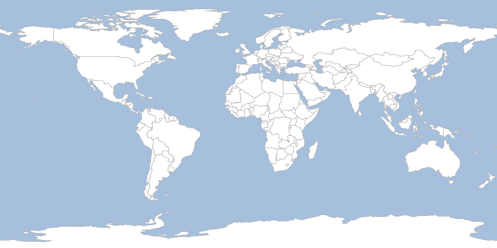
Stitch Vector
Stitch vector tiles together to create a one or more Layers.
| Short Name | Long Name | Description |
|---|---|---|
-l |
--tile-layer |
The tile layer |
-b |
--bounds |
The bounds |
-w |
--width |
The raster width |
-h |
--height |
The raster height |
-z |
--zoom-level |
The tile zoom level |
-x |
--minx |
The min x or col |
-y |
--miny |
The min y or row |
-c |
--maxx |
The max x or col |
-u |
--maxy |
The max y or row |
-o |
--output-workspace |
The output workspace |
--help |
Print the help message |
|
--web-help |
Open help in a browser |
Zoom Level
geoc tile stitch vector -l "type=vectortiles format=pbf file=target/vectortiles" -o "type=geopackage file=target/world.gpkg name=world" -z 1Layers
countries
Schema
| Name | Type |
|---|---|
geometry |
Polygon |
TYPE |
String |
LEVEL |
Long |
NAME |
String |
Vector Grid
Create a vector grid of a tile layers cells.
| Short Name | Long Name | Description |
|---|---|---|
-l |
--tile-layer |
The tile layer |
-b |
--bounds |
The bounds |
-z |
--zoom-level |
The tile zoom level |
-x |
--minx |
The min x or col |
-y |
--miny |
The min y or row |
-c |
--maxx |
The max x or col |
-u |
--maxy |
The max y or row |
-w |
--width |
The raster width |
-h |
--height |
The raster height |
-o |
--output-workspace |
The output workspace |
-r |
--output-layer |
The output layer |
--help |
Print the help message |
|
--web-help |
Open help in a browser |
geoc tile vector grid -l "type=geopackage file=src/test/resources/data.gpkg name=world" -o target/world_grid_1.shp -z 2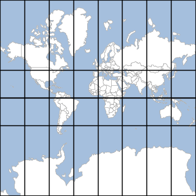
Vector Commands
Add
Add a Feature to a Layer.
| Short Name | Long Name | Description |
|---|---|---|
-v |
--value |
A value 'field=value' |
-i |
--input-workspace |
The input workspace |
-l |
--input-layer |
The input layer |
--help |
Print the help message |
|
--web-help |
Open help in a browser |
geoc vector add -i target/locations.shp -v id=1 -v name=Seattle -v "the_geom=POINT (-122.334758 47.578364)"| the_geom | name | id |
|---|---|---|
POINT (-122.334758 47.578364) |
Seattle |
1 |
Add Fields
Add one or more Fields to a Layer
| Short Name | Long Name | Description |
|---|---|---|
-f |
--field |
A Field in the format 'name=type' |
-o |
--output-workspace |
The output workspace |
-r |
--output-layer |
The output layer |
-i |
--input-workspace |
The input workspace |
-l |
--input-layer |
The input layer |
--help |
Print the help message |
|
--web-help |
Open help in a browser |
geoc vector addfields -i target/locations.shp -o target/locations_idname.shp -f id=int -f name=stringSchema
| Name | Type |
|---|---|
the_geom |
Point |
name |
String |
id |
Integer |
Add Area Field
Add an area Field.
| Short Name | Long Name | Description |
|---|---|---|
-f |
--area-fieldname |
The name for the area Field |
-o |
--output-workspace |
The output workspace |
-r |
--output-layer |
The output layer |
-i |
--input-workspace |
The input workspace |
-l |
--input-layer |
The input layer |
--help |
Print the help message |
|
--web-help |
Open help in a browser |
geoc vector addareafield -i src/test/resources/states.shp -o target/states_area.shpSchema
| Name | Type |
|---|---|
the_geom |
MultiPolygon |
STATE_NAME |
String |
SUB_REGION |
String |
STATE_ABBR |
String |
AREA |
Double |
Values
| STATE_NAME | SUB_REGION | STATE_ABBR | AREA |
|---|---|---|---|
Illinois |
E N Cen |
IL |
15.396467068063995 |
District of Columbia |
S Atl |
DC |
0.017769720828999 |
Delaware |
S Atl |
DE |
0.553317799081003 |
West Virginia |
S Atl |
WV |
6.493194953114009 |
Maryland |
S Atl |
MD |
2.625116892757991 |
Add Length Field
Add an Length Field.
| Short Name | Long Name | Description |
|---|---|---|
-f |
--length-fieldname |
The name for the length Field |
-o |
--output-workspace |
The output workspace |
-r |
--output-layer |
The output layer |
-i |
--input-workspace |
The input workspace |
-l |
--input-layer |
The input layer |
--help |
Print the help message |
|
--web-help |
Open help in a browser |
geoc vector addlengthfield -i src/test/resources/data.gpkg -l rivers -o target/rivers_length.shp -f lengthSchema
| Name | Type |
|---|---|
the_geom |
MultiLineString |
name |
String |
label |
String |
length |
Double |
Values
| name | label | length |
|---|---|---|
Brahmaputra |
Brahmaputra |
25.21241966609205 |
Mekong |
Mekong |
34.97738061177052 |
Ob |
Ob |
48.39570358268261 |
Peace |
Peace |
44.84258394589285 |
Donau |
Donau |
26.67902946932429 |
Add ID Field
Add an ID Field.
| Short Name | Long Name | Description |
|---|---|---|
-f |
--id-fieldname |
The name for the ID Field |
-s |
--start |
The number of start at |
-o |
--output-workspace |
The output workspace |
-r |
--output-layer |
The output layer |
-i |
--input-workspace |
The input workspace |
-l |
--input-layer |
The input layer |
--help |
Print the help message |
|
--web-help |
Open help in a browser |
geoc vector addidfield -i src/test/resources/data.gpkg -l places -o target/places_id.shpSchema
| Name | Type |
|---|---|
the_geom |
Point |
NAME |
String |
ID |
Integer |
Values
| NAME | ID |
|---|---|
Vatican City |
1 |
San Marino |
2 |
Vaduz |
3 |
Lobamba |
4 |
Luxembourg |
5 |
Add XY Fields
Add XY Fields.
| Short Name | Long Name | Description |
|---|---|---|
-x |
--x-fieldname |
The name for the X Field |
-y |
--y-fieldname |
The name for the Y Field |
-a |
--algorithm |
The XY generation algorithm (centroid or interiorpoint) |
-o |
--output-workspace |
The output workspace |
-r |
--output-layer |
The output layer |
-i |
--input-workspace |
The input workspace |
-l |
--input-layer |
The input layer |
--help |
Print the help message |
|
--web-help |
Open help in a browser |
geoc vector addxyfields -i src/test/resources/data.gpkg -l places -o target/places_xy.shp -x x_coord -y y_coord -a centroidSchema
| Name | Type |
|---|---|
the_geom |
Point |
NAME |
String |
x_coord |
Double |
y_coord |
Double |
Values
| NAME | x_coord | y_coord |
|---|---|---|
Vatican City |
12.4533865 |
41.9032822 |
San Marino |
12.4417702 |
43.9360958 |
Vaduz |
9.5166695 |
47.1337238 |
Lobamba |
31.1999971 |
-26.4666675 |
Luxembourg |
6.1300028 |
49.6116604 |
Append
Add a Features from one layer to another Layer.
| Short Name | Long Name | Description |
|---|---|---|
-k |
--other-workspace |
The other workspace |
-y |
--other-layer |
The other layer |
-i |
--input-workspace |
The input workspace |
-l |
--input-layer |
The input layer |
--help |
Print the help message |
|
--web-help |
Open help in a browser |
geoc vector append -i target/points1.shp -k target/points2.shp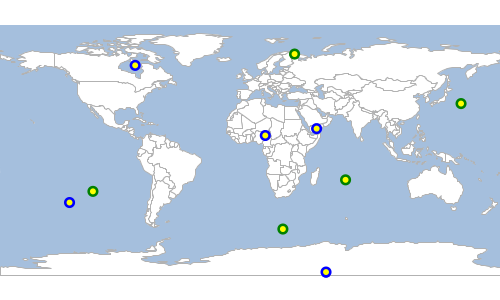
Buffer
Buffer all of the features in a Layer.
| Short Name | Long Name | Description |
|---|---|---|
-d |
--distance |
The buffer distance |
-q |
--quadrantsegments |
The number of quadrant segments |
-s |
--singlesided |
Whether buffer should be single sided or not |
-c |
--capstyle |
The cap style |
-o |
--output-workspace |
The output workspace |
-r |
--output-layer |
The output layer |
-i |
--input-workspace |
The input workspace |
-l |
--input-layer |
The input layer |
--help |
Print the help message |
|
--web-help |
Open help in a browser |
geoc vector buffer -i src/test/resources/data.gpkg -l places -o target/places_buffer.shp -d 10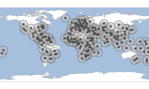
Centroid
Calculate the centroid of all the features in a Layer.
| Short Name | Long Name | Description |
|---|---|---|
-o |
--output-workspace |
The output workspace |
-r |
--output-layer |
The output layer |
-i |
--input-workspace |
The input workspace |
-l |
--input-layer |
The input layer |
--help |
Print the help message |
|
--web-help |
Open help in a browser |
geoc vector centroid -i src/test/resources/data.gpkg -l countries -o target/countries_centroids.shp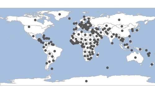
Convexhull
Calculate the convexhull of all the features in a Layer.
| Short Name | Long Name | Description |
|---|---|---|
-o |
--output-workspace |
The output workspace |
-r |
--output-layer |
The output layer |
-i |
--input-workspace |
The input workspace |
-l |
--input-layer |
The input layer |
--help |
Print the help message |
|
--web-help |
Open help in a browser |
geoc vector convexhull -i src/test/resources/data.gpkg -l places -o target/convexhull.shp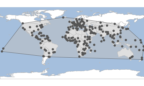
Convexhulls
Calculate the convexhulls for each feature in a Layer.
| Short Name | Long Name | Description |
|---|---|---|
-o |
--output-workspace |
The output workspace |
-r |
--output-layer |
The output layer |
-i |
--input-workspace |
The input workspace |
-l |
--input-layer |
The input layer |
--help |
Print the help message |
|
--web-help |
Open help in a browser |
geoc vector convexhulls -i src/test/resources/data.gpkg -l countries -o target/convexhulls.shp
Coordinates
Extract coordinates from the input Layer and save them to the output Layer.
| Short Name | Long Name | Description |
|---|---|---|
-o |
--output-workspace |
The output workspace |
-r |
--output-layer |
The output layer |
-i |
--input-workspace |
The input workspace |
-l |
--input-layer |
The input layer |
--help |
Print the help message |
|
--web-help |
Open help in a browser |
geoc vector coordinates -i src/test/resources/data.gpkg -l states -o target/coordinates.shp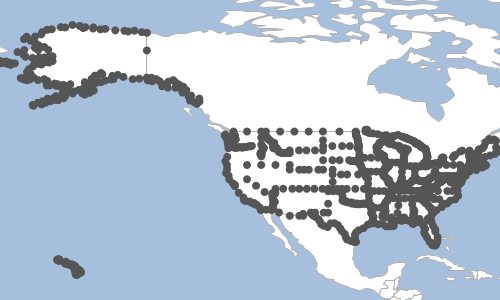
Count
Count the Features in a Layer.
| Short Name | Long Name | Description |
|---|---|---|
-t |
--type |
Count features, geometries, or points |
-i |
--input-workspace |
The input workspace |
-l |
--input-layer |
The input layer |
--help |
Print the help message |
|
--web-help |
Open help in a browser |
geoc vector count -i src/test/resources/data.gpkg -l places243Create
Create a new Layer.
| Short Name | Long Name | Description |
|---|---|---|
-f |
--field |
A Field in the format 'name=type' |
-o |
--output-workspace |
The output workspace |
-r |
--output-layer |
The output layer |
--help |
Print the help message |
|
--web-help |
Open help in a browser |
geoc vector create -o target/locations.shp -f "the_geom=POINT EPSG:4326" -f id=integer -f name=string| Name | Type |
|---|---|
the_geom |
Point |
name |
String |
id |
Integer |
Default Style
Get the default style for a Layer.
| Short Name | Long Name | Description |
|---|---|---|
-g |
--geometry-type |
The geometry type |
-c |
--color |
The base color |
-o |
--opacity |
The opacity (defaults to 1.0) |
-i |
--input-workspace |
The input workspace |
-l |
--input-layer |
The input layer |
--help |
Print the help message |
|
--web-help |
Open help in a browser |
geoc vector defaultstyle -i src/test/resources/data.gpkg -l places -c cornflowerblue<?xml version="1.0" encoding="UTF-8"?><sld:StyledLayerDescriptor xmlns:sld="http://www.opengis.net/sld" xmlns="http://www.opengis.net/sld" xmlns:gml="http://www.opengis.net/gml" xmlns:ogc="http://www.opengis.net/ogc" version="1.0.0">
<sld:UserLayer>
<sld:LayerFeatureConstraints>
<sld:FeatureTypeConstraint/>
</sld:LayerFeatureConstraints>
<sld:UserStyle>
<sld:Name>Default Styler</sld:Name>
<sld:FeatureTypeStyle>
<sld:Name>name</sld:Name>
<sld:Rule>
<sld:PointSymbolizer>
<sld:Graphic>
<sld:Mark>
<sld:WellKnownName>circle</sld:WellKnownName>
<sld:Fill>
<sld:CssParameter name="fill">#6495ed</sld:CssParameter>
</sld:Fill>
<sld:Stroke>
<sld:CssParameter name="stroke">#4668a5</sld:CssParameter>
<sld:CssParameter name="stroke-width">0.1</sld:CssParameter>
</sld:Stroke>
</sld:Mark>
<sld:Size>6</sld:Size>
</sld:Graphic>
</sld:PointSymbolizer>
</sld:Rule>
</sld:FeatureTypeStyle>
</sld:UserStyle>
</sld:UserLayer>
</sld:StyledLayerDescriptor>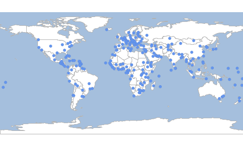
Delaunay
Calculate a delaunay diagram of all the features in a Layer.
| Short Name | Long Name | Description |
|---|---|---|
-o |
--output-workspace |
The output workspace |
-r |
--output-layer |
The output layer |
-i |
--input-workspace |
The input workspace |
-l |
--input-layer |
The input layer |
--help |
Print the help message |
|
--web-help |
Open help in a browser |
geoc vector delaunay -i src/test/resources/data.gpkg -l places -o target/delaunay.shp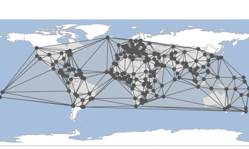
Geometry Reader
Convert a text stream of WKT geometries to a Layer.
| Short Name | Long Name | Description |
|---|---|---|
-t |
--text |
The text |
-o |
--output-workspace |
The output workspace |
-r |
--output-layer |
The output layer |
--help |
Print the help message |
|
--web-help |
Open help in a browser |
places.txt
POINT (95.93096088300103 -21.052562876111054)
POINT (108.68699242651462 31.906673138178704)
POINT (67.21295358024213 37.71179581778536)
POINT (134.80355671499728 -81.23567389016853)
POINT (140.6972351264812 63.79594874701479)
cat places.txt | geoc vector geomr -o target/places.shp
Geometry Writer
Convert the input layer to a text stream of WKT geometries that can be read by the geom commands.
| Short Name | Long Name | Description |
|---|---|---|
-i |
--input-workspace |
The input workspace |
-l |
--input-layer |
The input layer |
--help |
Print the help message |
|
--web-help |
Open help in a browser |
geoc vector geomw -i target/locations.shpPOINT (88.80873287305673 56.54291366855236)
POINT (-122.98209287381891 -32.122918313667476)
POINT (126.16800661729837 30.551909917150027)
POINT (71.33219143624825 -18.320680358619484)
POINT (-124.91165077171125 -51.665741582374686)
Envelope
Calculate the envelope of all the features in a Layer.
| Short Name | Long Name | Description |
|---|---|---|
-o |
--output-workspace |
The output workspace |
-r |
--output-layer |
The output layer |
-i |
--input-workspace |
The input workspace |
-l |
--input-layer |
The input layer |
--help |
Print the help message |
|
--web-help |
Open help in a browser |
geoc vector envelope -i src/test/resources/data.gpkg -l places -o target/envelope.shp
Envelopes
Calculate the envelopes for each feature in a Layer.
| Short Name | Long Name | Description |
|---|---|---|
-o |
--output-workspace |
The output workspace |
-r |
--output-layer |
The output layer |
-i |
--input-workspace |
The input workspace |
-l |
--input-layer |
The input layer |
--help |
Print the help message |
|
--web-help |
Open help in a browser |
geoc vector envelopes -i src/test/resources/data.gpkg -l countries -o target/envelopes.shp
From
Create a Layer from a string of KML, CSV, GML, GEORSS, GEOBUF, GPX or GeoJSON.
| Short Name | Long Name | Description |
|---|---|---|
-t |
--text |
The text |
-f |
--format |
The string format (CSV, GeoJSON, KML, GML) |
-g |
--geometry-type |
The geometry type |
-p |
--format-options |
A format options 'key=value' |
-o |
--output-workspace |
The output workspace |
-r |
--output-layer |
The output layer |
--help |
Print the help message |
|
--web-help |
Open help in a browser |
GeoJSON
points.json
{"type":"FeatureCollection","features":[{"type":"Feature","geometry":{"type":"Point","coordinates":[-69.3327,7.8517]},"properties":{"id":0},"id":"randompoints.1"},{"type":"Feature","geometry":{"type":"Point","coordinates":[-56.9915,12.2363]},"properties":{"id":1},"id":"randompoints.2"},{"type":"Feature","geometry":{"type":"Point","coordinates":[-39.622,-37.3316]},"properties":{"id":2},"id":"randompoints.3"},{"type":"Feature","geometry":{"type":"Point","coordinates":[-72.491,62.336]},"properties":{"id":3},"id":"randompoints.4"},{"type":"Feature","geometry":{"type":"Point","coordinates":[20.5597,-17.3221]},"properties":{"id":4},"id":"randompoints.5"}]}cat points.json | geoc vector from -f csv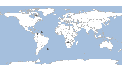
CSV
points.csv
"the_geom:Point:EPSG:4326","id:Integer"
"POINT (-84.09447269918599 -30.583623358889803)","0"
"POINT (-7.283506840146174 -16.268460568373243)","1"
"POINT (-77.65679694566269 82.25446269979147)","2"
"POINT (116.65532864790612 -71.71821946981899)","3"
"POINT (-92.13761370125539 -72.28635599964923)","4"
cat points.csv | geoc vector from -f csv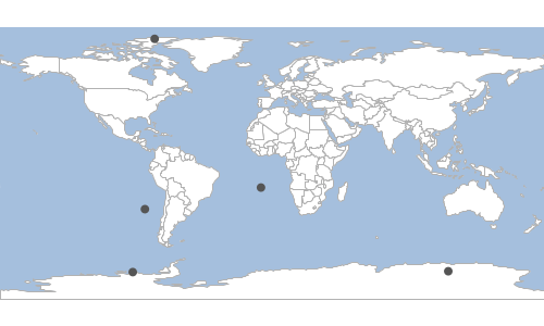
Graticule
Hexagon
Create hexagon graticules.
| Short Name | Long Name | Description |
|---|---|---|
-g |
--geometry |
The geometry |
-l |
--length |
The length |
-s |
--spacing |
The spacing (defaults to -1) |
-t |
--orientation |
The orientation (flat or angled). |
-o |
--output-workspace |
The output workspace |
-r |
--output-layer |
The output layer |
--help |
Print the help message |
|
--web-help |
Open help in a browser |
geoc vector graticule hexagon -g -180,-90,180,90 -l 10 -o target/hexagons.shp
Line
Create line graticules.
| Short Name | Long Name | Description |
|---|---|---|
-g |
--geometry |
The geometry |
-s |
--spacing |
The spacing (defaults to -1) |
-l |
--line-definition |
Each line definition has comma delimited orientation (vertical or horizontal), level, and spacing) |
-o |
--output-workspace |
The output workspace |
-r |
--output-layer |
The output layer |
--help |
Print the help message |
|
--web-help |
Open help in a browser |
geoc vector graticule line -g -180,-90,180,90 -l vertical,2,10 -l horizontal,1,2 -o target/lines.shp
Oval
Create oval graticules.
| Short Name | Long Name | Description |
|---|---|---|
-g |
--geometry |
The geometry |
-l |
--length |
The length |
-o |
--output-workspace |
The output workspace |
-r |
--output-layer |
The output layer |
--help |
Print the help message |
|
--web-help |
Open help in a browser |
geoc vector graticule oval -g -180,-90,180,90 -l 20 -o target/ovals.shp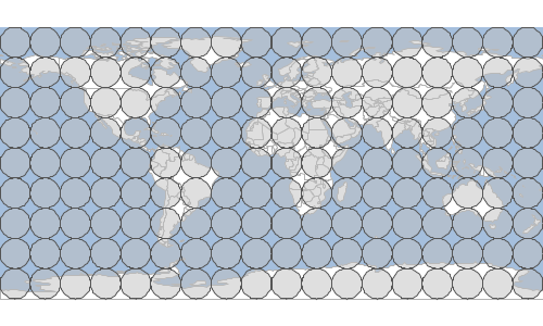
Rectangle
Create rectangle graticules.
| Short Name | Long Name | Description |
|---|---|---|
-g |
--geometry |
The geometry |
-w |
--width |
The width |
-h |
--height |
The height |
-s |
--spacing |
The spacing (defaults to -1) |
-o |
--output-workspace |
The output workspace |
-r |
--output-layer |
The output layer |
--help |
Print the help message |
|
--web-help |
Open help in a browser |
geoc vector graticule rectangle -g -180,-90,180,90 -w 10 -h 20 -o target/rectangles.shp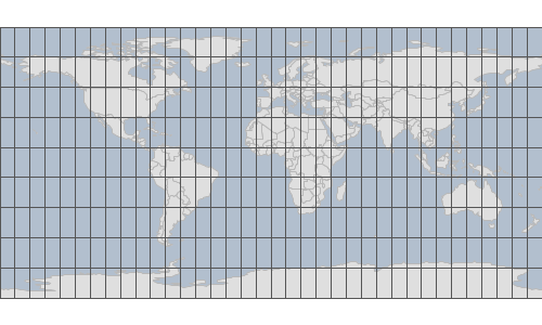
Square
Create square graticules.
| Short Name | Long Name | Description |
|---|---|---|
-g |
--geometry |
The geometry |
-l |
--length |
The length |
-s |
--spacing |
The spacing (defaults to -1) |
-o |
--output-workspace |
The output workspace |
-r |
--output-layer |
The output layer |
--help |
Print the help message |
|
--web-help |
Open help in a browser |
geoc vector graticule square -g -180,-90,180,90 -l 20 -o target/squares.shp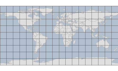
Info
Get information about a Layer.
| Short Name | Long Name | Description |
|---|---|---|
-i |
--input-workspace |
The input workspace |
-l |
--input-layer |
The input layer |
--help |
Print the help message |
|
--web-help |
Open help in a browser |
geoc vector info -i src/test/resources/data.gpkg -l countriesName: countries
Geometry: MultiPolygon
Extent: -180.0, -90.0, 180.00000000000006, 83.64513000000001
Projection ID: EPSG:4326
Projection WKT: GEOGCS["WGS 84",
DATUM["World Geodetic System 1984",
SPHEROID["WGS 84", 6378137.0, 298.257223563, AUTHORITY["EPSG","7030"]],
AUTHORITY["EPSG","6326"]],
PRIMEM["Greenwich", 0.0, AUTHORITY["EPSG","8901"]],
UNIT["degree", 0.017453292519943295],
AXIS["Geodetic longitude", EAST],
AXIS["Geodetic latitude", NORTH],
AUTHORITY["EPSG","4326"]]
Feature Count: 177
Fields:
the_geom: MultiPolygon
featurecla: String
scalerank: Integer
LABELRANK: Integer
SOVEREIGNT: String
SOV_A3: String
ADM0_DIF: Integer
...Interior Point
Calculate the interior point of all the features in a Layer.
| Short Name | Long Name | Description |
|---|---|---|
-o |
--output-workspace |
The output workspace |
-r |
--output-layer |
The output layer |
-i |
--input-workspace |
The input workspace |
-l |
--input-layer |
The input layer |
--help |
Print the help message |
|
--web-help |
Open help in a browser |
geoc vector interiorPoint -i src/test/resources/data.gpkg -l countries -o target/countries_interiorpoints.shp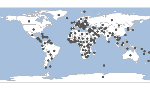
Layer List
List the Layers in a Workspace.
| Short Name | Long Name | Description |
|---|---|---|
-i |
--input-workspace |
The input workspace |
--help |
Print the help message |
|
--web-help |
Open help in a browser |
geoc vector list layers -i src/test/resources/data.gpkgcountries
graticules
ocean
places
rivers
statesMinimum Bounding Circle
Calculate the minimum bounding circle of all the features in a Layer.
| Short Name | Long Name | Description |
|---|---|---|
-o |
--output-workspace |
The output workspace |
-r |
--output-layer |
The output layer |
-i |
--input-workspace |
The input workspace |
-l |
--input-layer |
The input layer |
--help |
Print the help message |
|
--web-help |
Open help in a browser |
geoc vector mincircle -i src/test/resources/data.gpkg -l places -o target/mincircle.shp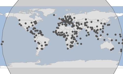
Minimum Bounding Circles
Calculate the minimum bounding circle for each feature in a Layer.
| Short Name | Long Name | Description |
|---|---|---|
-o |
--output-workspace |
The output workspace |
-r |
--output-layer |
The output layer |
-i |
--input-workspace |
The input workspace |
-l |
--input-layer |
The input layer |
--help |
Print the help message |
|
--web-help |
Open help in a browser |
geoc vector mincircles -i src/test/resources/data.gpkg -l countries -o target/mincircles.shp
Minimum Bounding Rectangle
Calculate the minimum bounding rectangle of all the features in a Layer.
| Short Name | Long Name | Description |
|---|---|---|
-o |
--output-workspace |
The output workspace |
-r |
--output-layer |
The output layer |
-i |
--input-workspace |
The input workspace |
-l |
--input-layer |
The input layer |
--help |
Print the help message |
|
--web-help |
Open help in a browser |
geoc vector minrect -i src/test/resources/data.gpkg -l places -o target/minrect.shp
Minimum Bounding rects
Calculate the minimum bounding rectangle for each feature in a Layer.
| Short Name | Long Name | Description |
|---|---|---|
-o |
--output-workspace |
The output workspace |
-r |
--output-layer |
The output layer |
-i |
--input-workspace |
The input workspace |
-l |
--input-layer |
The input layer |
--help |
Print the help message |
|
--web-help |
Open help in a browser |
geoc vector minrects -i src/test/resources/data.gpkg -l countries -o target/minrects.shp
Octangonal Envelope
Calculate the octagonal envelope of the input Layer and save it to the output Layer.
| Short Name | Long Name | Description |
|---|---|---|
-o |
--output-workspace |
The output workspace |
-r |
--output-layer |
The output layer |
-i |
--input-workspace |
The input workspace |
-l |
--input-layer |
The input layer |
--help |
Print the help message |
|
--web-help |
Open help in a browser |
geoc vector octagonalenvelope -i src/test/resources/data.gpkg -l places -o target/octagonalenvelope.shp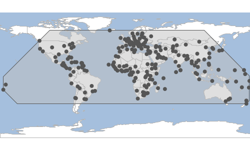
Octangonal Envelopes
Calculate the octagonal envelope for each Feature of the input Layer and save it to the output Layer.
| Short Name | Long Name | Description |
|---|---|---|
-o |
--output-workspace |
The output workspace |
-r |
--output-layer |
The output layer |
-i |
--input-workspace |
The input workspace |
-l |
--input-layer |
The input layer |
--help |
Print the help message |
|
--web-help |
Open help in a browser |
geoc vector octagonalenvelopes -i src/test/resources/data.gpkg -l countries -o target/octagonalenvelopes.shp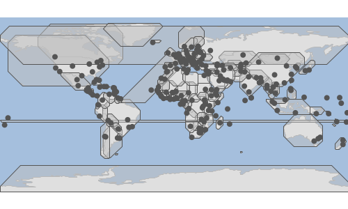
Page
Page through Feature in the input Layer.
| Short Name | Long Name | Description |
|---|---|---|
-m |
--max |
The maximum number of Features to include |
-t |
--start |
The 0 based index of the Feature to start at |
-o |
--output-workspace |
The output workspace |
-r |
--output-layer |
The output layer |
-i |
--input-workspace |
The input workspace |
-l |
--input-layer |
The input layer |
--help |
Print the help message |
|
--web-help |
Open help in a browser |
geoc vector page -i target/locations.shp -o target/locations_1_5.shp -t 0 -m 5geoc vector page -i target/locations.shp -o target/locations_6_10.shp -t 5 -m 5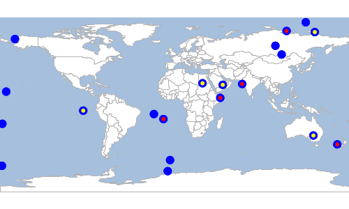
Project
Project the input Layer to another Projection and save it as the output Layer.
| Short Name | Long Name | Description |
|---|---|---|
-s |
--source-projection |
The source projection |
-t |
--target-projection |
The target projection |
-o |
--output-workspace |
The output workspace |
-r |
--output-layer |
The output layer |
-i |
--input-workspace |
The input workspace |
-l |
--input-layer |
The input layer |
--help |
Print the help message |
|
--web-help |
Open help in a browser |
geoc vector project -i src/test/resources/data.gpkg -l places -o target/mercator.gpkg -r places -s EPSG:4326 -t EPSG:3857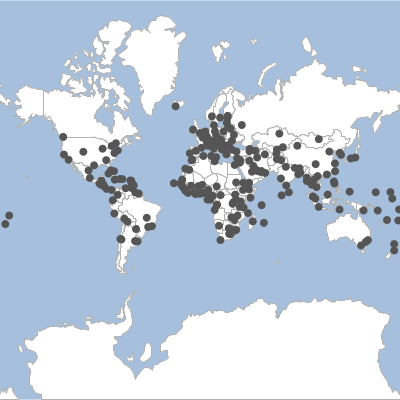
Random Points
Generate random points.
| Short Name | Long Name | Description |
|---|---|---|
-n |
--number |
The number of points |
-p |
--projection |
The projection |
-g |
--geometry |
The geometry |
-d |
--grid |
Whether to create random points in grid |
-c |
--constrained-to-circle |
Whether the points should be constrained to a circle or not |
-f |
--gutter-fraction |
The size of the gutter between cells |
-e |
--geom-fieldname |
The geometry field name |
-u |
--id-fieldname |
The id field name |
-o |
--output-workspace |
The output workspace |
-r |
--output-layer |
The output layer |
--help |
Print the help message |
|
--web-help |
Open help in a browser |
geoc vector randompoints -n 100 -g -180,-90,180,90 -o target/randompoints.shp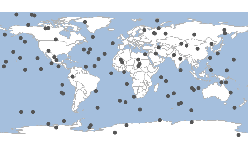
Shapes
Arc
Create a arc shape around each feature of the input Layer.
| Short Name | Long Name | Description |
|---|---|---|
-s |
--start-angle |
The start angle |
-e |
--end-angle |
The end angle |
-g |
--geometry |
The geometry expression |
-w |
--width |
The width of the bounds |
-h |
--height |
The height of the bounds |
-p |
--num-points |
The number of points |
-a |
--rotation |
The angle of rotation |
-u |
--unit |
The unit can either be degrees(d) or radians(r). The default is degrees. |
-o |
--output-workspace |
The output workspace |
-r |
--output-layer |
The output layer |
-i |
--input-workspace |
The input workspace |
-l |
--input-layer |
The input layer |
--help |
Print the help message |
|
--web-help |
Open help in a browser |
geoc vector arc -i src/test/resources/data.gpkg -l countries -o target/country_arcs.shp -s 45 -e 90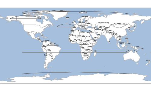
Arc Polygon
Create a arc polygon shape around each feature of the input Layer.
| Short Name | Long Name | Description |
|---|---|---|
-s |
--start-angle |
The start angle |
-e |
--end-angle |
The end angle |
-g |
--geometry |
The geometry expression |
-w |
--width |
The width of the bounds |
-h |
--height |
The height of the bounds |
-p |
--num-points |
The number of points |
-a |
--rotation |
The angle of rotation |
-u |
--unit |
The unit can either be degrees(d) or radians(r). The default is degrees. |
-o |
--output-workspace |
The output workspace |
-r |
--output-layer |
The output layer |
-i |
--input-workspace |
The input workspace |
-l |
--input-layer |
The input layer |
--help |
Print the help message |
|
--web-help |
Open help in a browser |
geoc vector arcpolygon -i src/test/resources/data.gpkg -l countries -o target/country_arcs.shp -s 45 -e 90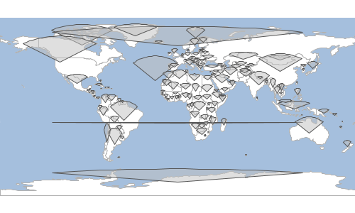
Ellipse
Calculate the ellipse around each feature in a Layer.
| Short Name | Long Name | Description |
|---|---|---|
-g |
--geometry |
The geometry expression |
-w |
--width |
The width of the bounds |
-h |
--height |
The height of the bounds |
-p |
--num-points |
The number of points |
-a |
--rotation |
The angle of rotation |
-u |
--unit |
The unit can either be degrees(d) or radians(r). The default is degrees. |
-o |
--output-workspace |
The output workspace |
-r |
--output-layer |
The output layer |
-i |
--input-workspace |
The input workspace |
-l |
--input-layer |
The input layer |
--help |
Print the help message |
|
--web-help |
Open help in a browser |
geoc vector ellipse -i src/test/resources/data.gpkg -l countries -o target/ellipse.shp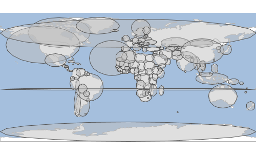
Rectangle
Create a rectangle shape around each feature of the input Layer.
| Short Name | Long Name | Description |
|---|---|---|
-g |
--geometry |
The geometry expression |
-w |
--width |
The width of the bounds |
-h |
--height |
The height of the bounds |
-p |
--num-points |
The number of points |
-a |
--rotation |
The angle of rotation |
-u |
--unit |
The unit can either be degrees(d) or radians(r). The default is degrees. |
-o |
--output-workspace |
The output workspace |
-r |
--output-layer |
The output layer |
-i |
--input-workspace |
The input workspace |
-l |
--input-layer |
The input layer |
--help |
Print the help message |
|
--web-help |
Open help in a browser |
geoc vector rectangle -i src/test/resources/data.gpkg -l countries -o target/rectangle.shp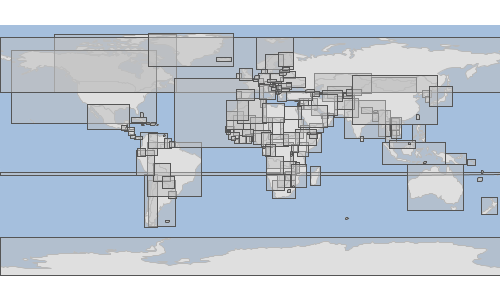
Sine Star
Create a sinestar shape around each feature of the input Layer.
| Short Name | Long Name | Description |
|---|---|---|
-n |
--number-of-arms |
The number of arms |
-e |
--arm-length-ratio |
The arm length ratio |
-g |
--geometry |
The geometry expression |
-w |
--width |
The width of the bounds |
-h |
--height |
The height of the bounds |
-p |
--num-points |
The number of points |
-a |
--rotation |
The angle of rotation |
-u |
--unit |
The unit can either be degrees(d) or radians(r). The default is degrees. |
-o |
--output-workspace |
The output workspace |
-r |
--output-layer |
The output layer |
-i |
--input-workspace |
The input workspace |
-l |
--input-layer |
The input layer |
--help |
Print the help message |
|
--web-help |
Open help in a browser |
geoc vector sinestar -i src/test/resources/data.gpkg -l countries -o target/country_stars.shp -n 10 -e 2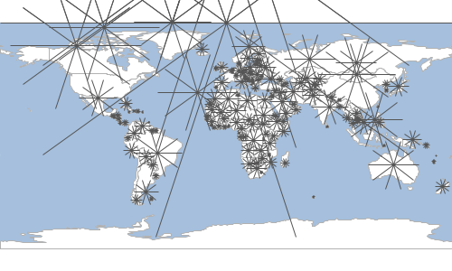
Squircle
Create a squircle shape around each feature of the input Layer.
| Short Name | Long Name | Description |
|---|---|---|
-g |
--geometry |
The geometry expression |
-w |
--width |
The width of the bounds |
-h |
--height |
The height of the bounds |
-p |
--num-points |
The number of points |
-a |
--rotation |
The angle of rotation |
-u |
--unit |
The unit can either be degrees(d) or radians(r). The default is degrees. |
-o |
--output-workspace |
The output workspace |
-r |
--output-layer |
The output layer |
-i |
--input-workspace |
The input workspace |
-l |
--input-layer |
The input layer |
--help |
Print the help message |
|
--web-help |
Open help in a browser |
geoc vector squircle -i src/test/resources/data.gpkg -l countries -o target/country_squircles.shp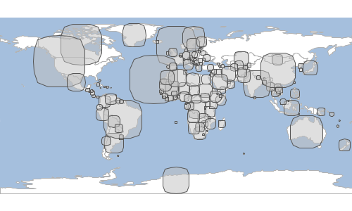
Super Circle
Create a super circle shape around each feature of the input Layer.
| Short Name | Long Name | Description |
|---|---|---|
-e |
--power |
The power |
-g |
--geometry |
The geometry expression |
-w |
--width |
The width of the bounds |
-h |
--height |
The height of the bounds |
-p |
--num-points |
The number of points |
-a |
--rotation |
The angle of rotation |
-u |
--unit |
The unit can either be degrees(d) or radians(r). The default is degrees. |
-o |
--output-workspace |
The output workspace |
-r |
--output-layer |
The output layer |
-i |
--input-workspace |
The input workspace |
-l |
--input-layer |
The input layer |
--help |
Print the help message |
|
--web-help |
Open help in a browser |
geoc vector supercircle -i src/test/resources/data.gpkg -l countries -o target/country_circles.shp -e 0.5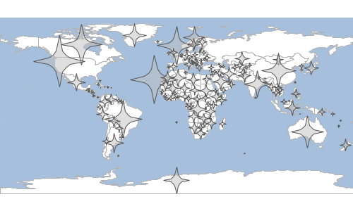
To
Write a Layer to a String format (CSV, GeoJSON, KML, GML, GEORSS, GPX).
| Short Name | Long Name | Description |
|---|---|---|
-f |
--format |
The string format (CSV, GeoJSON, KML, GML, GEORSS, GPX) |
-p |
--format-options |
A format options 'key=value' |
-i |
--input-workspace |
The input workspace |
-l |
--input-layer |
The input layer |
--help |
Print the help message |
|
--web-help |
Open help in a browser |
GeoJSON
geoc vector to -i target/randompoints.shp -f geojson{"type":"FeatureCollection","features":[{"type":"Feature","geometry":{"type":"Point","coordinates":[-178.5693,-3.5731]},"properties":{"id":0},"id":"randompoints.1"},{"type":"Feature","geometry":{"type":"Point","coordinates":[117.2997,68.0367]},"properties":{"id":1},"id":"randompoints.2"},{"type":"Feature","geometry":{"type":"Point","coordinates":[59.8407,-41.6504]},"properties":{"id":2},"id":"randompoints.3"},{"type":"Feature","geometry":{"type":"Point","coordinates":[-27.9635,-30.4333]},"properties":{"id":3},"id":"randompoints.4"},{"type":"Feature","geometry":{"type":"Point","coordinates":[178.6504,62.8016]},"properties":{"id":4},"id":"randompoints.5"}]}CSV
geoc vector to -i target/randompoints.shp -f csv"the_geom:Point:EPSG:4326","id:Integer"
"POINT (-157.09746270532656 -10.145074243161275)","0"
"POINT (169.281118518389 -3.6389979408728124)","1"
"POINT (-129.93375642776647 7.401094194550069)","2"
"POINT (-133.39111968877594 48.36407663584882)","3"
"POINT (123.78887483036084 -87.36481198845937)","4"Schema
Get a Layer’s Schema.
| Short Name | Long Name | Description |
|---|---|---|
-p |
--pretty-print |
Whether to pretty print the output |
-i |
--input-workspace |
The input workspace |
-l |
--input-layer |
The input layer |
--help |
Print the help message |
|
--web-help |
Open help in a browser |
geoc vector schema -i src/test/resources/data.gpkg -l countries -p-----------------------------
| name | type |
-----------------------------
| the_geom | MultiPolygon |
| featurecla | String |
| scalerank | Integer |
| LABELRANK | Integer |
| SOVEREIGNT | String |
| SOV_A3 | String |
| ADM0_DIF | Integer |
| LEVEL | Integer |
| TYPE | String |
| ADMIN | String |
| ADM0_A3 | String |
| GEOU_DIF | Integer |
| GEOUNIT | String |
| GU_A3 | String |
| SU_DIF | Integer |
| SUBUNIT | String |
| SU_A3 | String |
| BRK_DIFF | Integer |
| NAME | String |
| NAME_LONG | String |
| BRK_A3 | String |
| BRK_NAME | String |
| ABBREV | String |
| POSTAL | String |
| FORMAL_EN | String |
| FORMAL_FR | String |
| NAME_CIAWF | String |
| NOTE_ADM0 | String |
| NOTE_BRK | String |
| NAME_SORT | String |
| NAME_ALT | String |
| MAPCOLOR7 | Integer |
| MAPCOLOR8 | Integer |
| MAPCOLOR9 | Integer |
| MAPCOLOR13 | Integer |
| POP_EST | Double |
| POP_RANK | Integer |
| POP_YEAR | Integer |
| GDP_MD | Integer |
| GDP_YEAR | Integer |
| ECONOMY | String |
| INCOME_GRP | String |
| FIPS_10 | String |
| ISO_A2 | String |
| ISO_A2_EH | String |
| ISO_A3 | String |
| ISO_A3_EH | String |
| ISO_N3 | String |
| ISO_N3_EH | String |
| UN_A3 | String |
| WB_A2 | String |
| WB_A3 | String |
| WOE_ID | Integer |
| WOE_ID_EH | Integer |
| WOE_NOTE | String |
| ADM0_A3_IS | String |
| ADM0_A3_US | String |
| ADM0_A3_FR | String |
| ADM0_A3_RU | String |
| ADM0_A3_ES | String |
| ADM0_A3_CN | String |
| ADM0_A3_TW | String |
| ADM0_A3_IN | String |
| ADM0_A3_NP | String |
| ADM0_A3_PK | String |
| ADM0_A3_DE | String |
| ADM0_A3_GB | String |
| ADM0_A3_BR | String |
| ADM0_A3_IL | String |
| ADM0_A3_PS | String |
| ADM0_A3_SA | String |
| ADM0_A3_EG | String |
| ADM0_A3_MA | String |
| ADM0_A3_PT | String |
| ADM0_A3_AR | String |
| ADM0_A3_JP | String |
| ADM0_A3_KO | String |
| ADM0_A3_VN | String |
| ADM0_A3_TR | String |
| ADM0_A3_ID | String |
| ADM0_A3_PL | String |
| ADM0_A3_GR | String |
| ADM0_A3_IT | String |
| ADM0_A3_NL | String |
| ADM0_A3_SE | String |
| ADM0_A3_BD | String |
| ADM0_A3_UA | String |
| ADM0_A3_UN | Integer |
| ADM0_A3_WB | Integer |
| CONTINENT | String |
| REGION_UN | String |
| SUBREGION | String |
| REGION_WB | String |
| NAME_LEN | Integer |
| LONG_LEN | Integer |
| ABBREV_LEN | Integer |
| TINY | Integer |
| HOMEPART | Integer |
| MIN_ZOOM | Double |
| MIN_LABEL | Double |
| MAX_LABEL | Double |
| NE_ID | Long |
| WIKIDATAID | String |
| NAME_AR | String |
| NAME_BN | String |
| NAME_DE | String |
| NAME_EN | String |
| NAME_ES | String |
| NAME_FA | String |
| NAME_FR | String |
| NAME_EL | String |
| NAME_HE | String |
| NAME_HI | String |
| NAME_HU | String |
| NAME_ID | String |
| NAME_IT | String |
| NAME_JA | String |
| NAME_KO | String |
| NAME_NL | String |
| NAME_PL | String |
| NAME_PT | String |
| NAME_RU | String |
| NAME_SV | String |
| NAME_TR | String |
| NAME_UK | String |
| NAME_UR | String |
| NAME_VI | String |
| NAME_ZH | String |
| NAME_ZHT | String |
| FCLASS_ISO | String |
| FCLASS_US | String |
| FCLASS_FR | String |
| FCLASS_RU | String |
| FCLASS_ES | String |
| FCLASS_CN | String |
| FCLASS_TW | String |
| FCLASS_IN | String |
| FCLASS_NP | String |
| FCLASS_PK | String |
| FCLASS_DE | String |
| FCLASS_GB | String |
| FCLASS_BR | String |
| FCLASS_IL | String |
| FCLASS_PS | String |
| FCLASS_SA | String |
| FCLASS_EG | String |
| FCLASS_MA | String |
| FCLASS_PT | String |
| FCLASS_AR | String |
| FCLASS_JP | String |
| FCLASS_KO | String |
| FCLASS_VN | String |
| FCLASS_TR | String |
| FCLASS_ID | String |
| FCLASS_PL | String |
| FCLASS_GR | String |
| FCLASS_IT | String |
| FCLASS_NL | String |
| FCLASS_SE | String |
| FCLASS_BD | String |
| FCLASS_UA | String |
-----------------------------Unique Values
List the unique values in a Layer’s Field.
| Short Name | Long Name | Description |
|---|---|---|
-f |
--field |
The field name |
-i |
--input-workspace |
The input workspace |
-l |
--input-layer |
The input layer |
--help |
Print the help message |
|
--web-help |
Open help in a browser |
geoc vector uniquevalues -i src/test/resources/data.gpkg -l countries -f ECONOMY1. Developed region: G7
2. Developed region: nonG7
3. Emerging region: BRIC
4. Emerging region: MIKT
5. Emerging region: G20
6. Developing region
7. Least developed regionUnique Values Style
Create an SLD document where each unique value in the Layer is a rule.
| Short Name | Long Name | Description |
|---|---|---|
-f |
--field |
The field name |
-c |
--colors |
The color brewer palette name or a list of colors (space delimited) |
-i |
--input-workspace |
The input workspace |
-l |
--input-layer |
The input layer |
--help |
Print the help message |
|
--web-help |
Open help in a browser |
geoc vector uniquevaluesstyle -i src/test/resources/data.gpkg -l countries -f ECONOMY -c GREENS<?xml version="1.0" encoding="UTF-8"?><sld:StyledLayerDescriptor xmlns:sld="http://www.opengis.net/sld" xmlns="http://www.opengis.net/sld" xmlns:gml="http://www.opengis.net/gml" xmlns:ogc="http://www.opengis.net/ogc" version="1.0.0">
<sld:UserLayer>
<sld:LayerFeatureConstraints>
<sld:FeatureTypeConstraint/>
</sld:LayerFeatureConstraints>
<sld:UserStyle>
<sld:Name>Default Styler</sld:Name>
<sld:FeatureTypeStyle>
<sld:Name>name</sld:Name>
<sld:Rule>
<sld:Name>1. Developed region: G7</sld:Name>
<ogc:Filter>
<ogc:PropertyIsEqualTo>
<ogc:PropertyName>ECONOMY</ogc:PropertyName>
<ogc:Literal>1. Developed region: G7</ogc:Literal>
</ogc:PropertyIsEqualTo>
</ogc:Filter>
<sld:PolygonSymbolizer>
<sld:Fill>
<sld:CssParameter name="fill">#f7fcf5</sld:CssParameter>
</sld:Fill>
</sld:PolygonSymbolizer>
<sld:LineSymbolizer>
<sld:Stroke>
<sld:CssParameter name="stroke">#acb0ab</sld:CssParameter>
<sld:CssParameter name="stroke-width">0.5</sld:CssParameter>
</sld:Stroke>
</sld:LineSymbolizer>
</sld:Rule>
<sld:Rule>
<sld:Name>2. Developed region: nonG7</sld:Name>
<ogc:Filter>
<ogc:PropertyIsEqualTo>
<ogc:PropertyName>ECONOMY</ogc:PropertyName>
<ogc:Literal>2. Developed region: nonG7</ogc:Literal>
</ogc:PropertyIsEqualTo>
</ogc:Filter>
<sld:PolygonSymbolizer>
<sld:Fill>
<sld:CssParameter name="fill">#e5f5e0</sld:CssParameter>
</sld:Fill>
</sld:PolygonSymbolizer>
<sld:LineSymbolizer>
<sld:Stroke>
<sld:CssParameter name="stroke">#a0ab9c</sld:CssParameter>
<sld:CssParameter name="stroke-width">0.5</sld:CssParameter>
</sld:Stroke>
</sld:LineSymbolizer>
</sld:Rule>
<sld:Rule>
<sld:Name>3. Emerging region: BRIC</sld:Name>
<ogc:Filter>
<ogc:PropertyIsEqualTo>
<ogc:PropertyName>ECONOMY</ogc:PropertyName>
<ogc:Literal>3. Emerging region: BRIC</ogc:Literal>
</ogc:PropertyIsEqualTo>
</ogc:Filter>
<sld:PolygonSymbolizer>
<sld:Fill>
<sld:CssParameter name="fill">#c7e9c0</sld:CssParameter>
</sld:Fill>
</sld:PolygonSymbolizer>
<sld:LineSymbolizer>
<sld:Stroke>
<sld:CssParameter name="stroke">#8ba386</sld:CssParameter>
<sld:CssParameter name="stroke-width">0.5</sld:CssParameter>
</sld:Stroke>
</sld:LineSymbolizer>
</sld:Rule>
<sld:Rule>
<sld:Name>4. Emerging region: MIKT</sld:Name>
<ogc:Filter>
<ogc:PropertyIsEqualTo>
<ogc:PropertyName>ECONOMY</ogc:PropertyName>
<ogc:Literal>4. Emerging region: MIKT</ogc:Literal>
</ogc:PropertyIsEqualTo>
</ogc:Filter>
<sld:PolygonSymbolizer>
<sld:Fill>
<sld:CssParameter name="fill">#a1d99b</sld:CssParameter>
</sld:Fill>
</sld:PolygonSymbolizer>
<sld:LineSymbolizer>
<sld:Stroke>
<sld:CssParameter name="stroke">#70976c</sld:CssParameter>
<sld:CssParameter name="stroke-width">0.5</sld:CssParameter>
</sld:Stroke>
</sld:LineSymbolizer>
</sld:Rule>
<sld:Rule>
<sld:Name>5. Emerging region: G20</sld:Name>
<ogc:Filter>
<ogc:PropertyIsEqualTo>
<ogc:PropertyName>ECONOMY</ogc:PropertyName>
<ogc:Literal>5. Emerging region: G20</ogc:Literal>
</ogc:PropertyIsEqualTo>
</ogc:Filter>
<sld:PolygonSymbolizer>
<sld:Fill>
<sld:CssParameter name="fill">#74c476</sld:CssParameter>
</sld:Fill>
</sld:PolygonSymbolizer>
<sld:LineSymbolizer>
<sld:Stroke>
<sld:CssParameter name="stroke">#518952</sld:CssParameter>
<sld:CssParameter name="stroke-width">0.5</sld:CssParameter>
</sld:Stroke>
</sld:LineSymbolizer>
</sld:Rule>
<sld:Rule>
<sld:Name>6. Developing region</sld:Name>
<ogc:Filter>
<ogc:PropertyIsEqualTo>
<ogc:PropertyName>ECONOMY</ogc:PropertyName>
<ogc:Literal>6. Developing region</ogc:Literal>
</ogc:PropertyIsEqualTo>
</ogc:Filter>
<sld:PolygonSymbolizer>
<sld:Fill>
<sld:CssParameter name="fill">#41ab5d</sld:CssParameter>
</sld:Fill>
</sld:PolygonSymbolizer>
<sld:LineSymbolizer>
<sld:Stroke>
<sld:CssParameter name="stroke">#2d7741</sld:CssParameter>
<sld:CssParameter name="stroke-width">0.5</sld:CssParameter>
</sld:Stroke>
</sld:LineSymbolizer>
</sld:Rule>
<sld:Rule>
<sld:Name>7. Least developed region</sld:Name>
<ogc:Filter>
<ogc:PropertyIsEqualTo>
<ogc:PropertyName>ECONOMY</ogc:PropertyName>
<ogc:Literal>7. Least developed region</ogc:Literal>
</ogc:PropertyIsEqualTo>
</ogc:Filter>
<sld:PolygonSymbolizer>
<sld:Fill>
<sld:CssParameter name="fill">#238b45</sld:CssParameter>
</sld:Fill>
</sld:PolygonSymbolizer>
<sld:LineSymbolizer>
<sld:Stroke>
<sld:CssParameter name="stroke">#186130</sld:CssParameter>
<sld:CssParameter name="stroke-width">0.5</sld:CssParameter>
</sld:Stroke>
</sld:LineSymbolizer>
</sld:Rule>
</sld:FeatureTypeStyle>
</sld:UserStyle>
</sld:UserLayer>
</sld:StyledLayerDescriptor>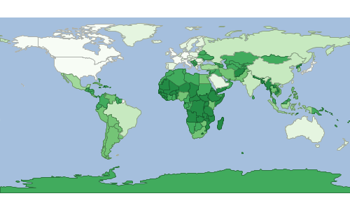
Voronoi
Calculate a voronoi diagram of all the features in a Layer.
| Short Name | Long Name | Description |
|---|---|---|
-o |
--output-workspace |
The output workspace |
-r |
--output-layer |
The output layer |
-i |
--input-workspace |
The input workspace |
-l |
--input-layer |
The input layer |
--help |
Print the help message |
|
--web-help |
Open help in a browser |
geoc vector voronoi -i src/test/resources/data.gpkg -l places -o target/voronoi.shp